Njombe Region
Njombe Region is one of the 31 administrative regions of Tanzania. It was established in March 2012, from the Iringa Region as an independent region.[2] The region's capital is Njombe town. The newly established Njombe region is an upcoming tourism attractive area, ideal for domestic and international visits in the southern highlands of Tanzania.
Njombe Region
Mkoa wa Njombe (Swahili) | |
|---|---|
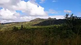
 Livingstone Forest Reserve in Kitulo National Park | |
 Location in Tanzania | |
| Country | Tanzania |
| Zone | Southern Highlands |
| Established | 2012 |
| Capital | Njombe |
| Government | |
| • Regional Commissioner | Aseri Msangi |
| Area | |
| • Total | 21,347 km2 (8,242 sq mi) |
| Population (2012) | |
| • Total | 702,097 |
| • Density | 33/km2 (85/sq mi) |
| Time zone | UTC+3 (EAT) |
| Postcode | 59xxx |
| Area code(s) | 026 |
| HDI (2018) | 0.554[1] medium · 7th of 25 |
| Website | www |

Etymology

The name Njombe originated from a name of a tree species called ‘Mdzombe’ for singular and Mazdombe for plural which then dominant in one of its localities known as Mdandu. And it was in Mdandu where the Germans chose to build an administrative and defence block; the Boma.
Tourism
Among the top tourism sites in Njombe region are the Nyumba Nitu natural forest, currently under conservation and management of local communities.
Nyumba Nitu, meaning a Black house, consists of natural caves and a natural forest located at Mlevela village in Mdandu ward, approximately 15 kilometers away from Njombe Township.
The forest has its root from Nyumba Nitu caves, since the caves are very dark for one to see and they are associated by the myth of black cows which lived in the cave.
Inside the caves, local Wabena people hid or took refugee during tribal wars between rival Wahehe fighters during Chief Mkwawa conquests in Iringa region, back in last quarter of 19th century. The caves also provided safe hideout from German forces during the Maji Maji uprising.
A miracle rock or a big slab stone is another attraction in Njombe region. Known as “Lwivala Stone”, or Glittering stone, the slab-rock has a feature similar to a map of Africa. It is located in Lwivala natural forest which local communities perform rituals and traditional ceremonies.
This 7.5-acre rock is grown with short grass with glittering outgrows during rainy season. There are some unreadable inscriptions which, according to local legend, appeared naturally. It is located in Igodiva village, about three kilometres from Nyumba Nitu forest.
Cattle and tea estates are the other attractions in Njombe region. Excursions and walking through tea and cattle estates provide a views of the southern highlands of Tanzania.
Luhuji waterfall in Njombe town is a tourist attraction, used for filming and picnics. Located in Luhuji River, the waterfall, rocks and scenery are visited by international film or movie makers.
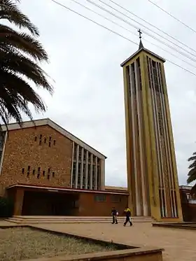
Old buildings including a Catholic Cathedral and a Lutheran church are other attractions available in Njombe town. A memorial monument to honour Africans who fought the Second World War is found in Njombe,
This bears inscriptions of the veterans who fought under the command of King’s African Rifles (KAR) of the British Army.
An early German built Primary Magistrate’s Court and a German administrative block are historical sites found in Njombe Township.
A grave of the local Wabena warriors killed during the Maji Maji war in 1906 is found in Utengule village. The grave bears hundreds of bodies of the fallen locals who were killed by German forces.
New in administration, Njombe region has several attractions which are still under development and exploration. Lake Nyasa beaches in Manda, scenery of the Eastern Arm of the Rift Valley escarpment and village settlements are tourist sites in the region.
Mpanga Kipengele ranges and Kitulo National Park are natural attractions available in Njombe region.

Transport
Road
Paved Trunk road T1 from Dar es Salaam to the Zambia border passes through the northern part of the region. In the town of Makambako paved trunk road T6 branches off. This roads passes through Njombe and ends in Songea town, Ruvuma Region.[3] Since 2014, a paved trunk road has been extended from Songea Town to Mbinga district.
Railway
The TAZARA Railway - from Dar es Salaam to New Kapiri Mposhi - passes through the northern part of the region as well; a train station is located in the town of Makambako.[4]
Districts
The region is administratively divided into six districts:[5]
| Districts of Njombe Region | ||||
|---|---|---|---|---|
| District | Population (2012 Census) | |||
| Ludewa District | 133,218 | |||
| Makambako Town | 93,827 | |||
| Makete District | 97,266 | |||
| Njombe District | 85,747 | |||
| Njombe Town | 130,223 | |||
| Wanging'ombe District | 161,816 | |||
| Total | 702,097 | |||
References
- "Sub-national HDI - Area Database - Global Data Lab". hdi.globaldatalab.org. Retrieved 2020-02-26.
- Staff (9 March 2012). "Tanzania: State Gazettes New Regions, Districts". Daily News. Dar es Salaam, Tanzania. Archived from the original on August 23, 2012.
- "Njombe Roads Network" (PDF). Tanroads. Archived from the original (PDF) on 10 May 2017. Retrieved 14 February 2016.
- "Express Train Timetable" (PDF). TAZARA Railway Authority. Archived from the original (PDF) on 28 May 2016. Retrieved 14 February 2016.
- "Census 2012". National Bureau of Statistics. Archived from the original on March 5, 2016. Retrieved 14 February 2016.