Nhà Bè District
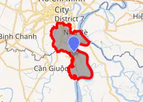
Nhà Bè is a suburban district of Ho Chi Minh City, the largest city in Vietnam. As of 2010, this district had an area of 100 km² and population of 103,793.[1]
Nhà Bè District
Huyện Nhà Bè | |
|---|---|
 Seal | |

Position in HCMC's metropolitan area | |
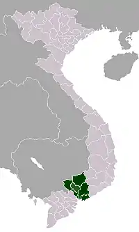
 Nhà Bè District Location in Vietnam | |
| Coordinates: 10°39′6″N 106°43′35″E | |
| Country | |
| Centrally governed city | Ho Chi Minh City |
| Seat | Nhà Bè Town |
| Divisions | 1 township, 6 communes |
| Area | |
| • Total | 100 km2 (40 sq mi) |
| Population (2018) | |
| • Total | 175,360 |
| • Density | 1,800/km2 (4,500/sq mi) |
| Demographics | |
| • Main ethnic groups | predominantly Kinh |
| Time zone | UTC+07 (ICT) |
| Website | nhabe.hochiminhcity.gov.vn |
Geographical location
Nhà Bè borders District 7 to the north, Long An Province to the south, Đồng Nai Province to the northeast, Cần Giờ District to the southeast, and Bình Chánh District to the west.
Administration
Nhà Bè district includes the town of Nhà Bè and six communes:
|
|
References
- "HCMC's Population and population density in 2010 by district". HCMC Office of Statistics. Archived from the original on July 5, 2017. Retrieved Feb 4, 2014.
This article is issued from Wikipedia. The text is licensed under Creative Commons - Attribution - Sharealike. Additional terms may apply for the media files.

