National Sea Rescue Institute
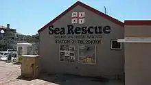
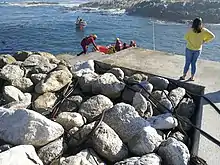
The National Sea Rescue Institute (NSRI) is a voluntary non-profit organization in South Africa tasked with saving lives through drowning prevention. It operates 41 bases (as of 2020) comprising coastal stations and inland stations on dams. There are crews on standby at all hours. There are over 1000 volunteers equipped with sponsored rescue craft, rescue vehicles, quad bikes and tractors, supported by an operations department at the head office.
 | |
| Abbreviation | NSRI |
|---|---|
| Formation | 1967[1] |
| Type | Non-profit organization |
| Purpose | Search and rescue |
| Headquarters | 1 Glengariff road, Three Anchor Bay, Cape Town |
| Location | |
Region served | Southern Africa |
Budget | Donations, bequests and sponsorships cover the annual running costs. Use of volunteers avoids a salary bill around R0.5m per annum. |
| Website | https://www.nsri.org.za/ |
The NSRI works closely with other Search and Rescue organisations in South Africa.
History
Following an incident at Stilbaai near Mossel Bay on the south coast of South Africa in 1966, in which 17 fishermen drowned after three fishing boats sank in a storm, Miss Pattie Price of Simon’s Town whose own life had been saved by a RNLI lifeboat in the English Channel, wrote a series of letters to the newspapers to advocate for the formation of a sea rescue organisation in South Africa.
Captain Bob Deacon and Ray Lant were the first volunteers to respond to this call and in 1967 the South African Inshore Rescue Service (SAISRS) was started, with a 4.7m inflatable boat donated by the Society of Master Mariners. The SAISRS was later renamed to National Sea Rescue Institute (NSRI) and continues the tradition of operation by volunteers.[2]
List of NSRI stations


.jpg.webp)
- Agulhas - Station 30, -34.798567, 20.059433[3]
- Bakoven - Station 2, -33.960583, 18.373033 (Cape Town)[3]
- Ballito - Station 41, -29.437578, 31.222571[3]
- Durban - Station 5, -29.873933, 31.050767[3]
- East London - Station 7, -33.02305, 27.8913[3]
- Gauteng - Station 27, -26.270759, 28.112268 (inland)[3]
- Gordon's Bay - Station 9, -34.16435, 18.859733 (Cape Town)[3]
- Hartebeespoort Dam - Station 25, -25.730167, 27.86045 (inland)[3]
- Hermanus - Station 17, -34.433417, 19.22515[3]
- Hout Bay - Station 8, -34.05025, 18.345333 (Cape Town)[3]
- Jeffrey's Bay - Station 37, -34.048333, 24.923333[3]
- Kleinmond - Station 42, -34.335399, 19.012628[3]
- Knysna - Station 12, -34.076083, 23.060383[3]
- Kommetjie - Station 26, -34.140833, 18.328833 (Cape Town)[3]
- Lambert's Bay - Starion 34, -32.090726, 18.300401[3]
- Melkbosstrand - Station 18, -33.729, 18.4385 (Cape Town)[3]
- Mossel Bay - Station 15, -34.180583, 22.1488[3]
- Mykonos - Station 4, -33.047367, 18.0398[3]
- Oyster Bay - Station 36, -34.169673, 24.653434[3]
- Plettenberg Bay - Station 40, -34.058333, 23.378[3]
- Port Alfred - Station 11, -33.594933, 26.89095[3]
- Port Edward - Station 32, -31.048217, 30.231167[3]
- Port Elizabeth - Station 6, -33.967617, 25.633567[3]
- Port Nolloth - Station 43, -29.238409, 16.928872[3]
- Port St Johns - Station 28, -31.530022, 29.4643592[3]
- Richards Bay - Station 19, -28.791633, 32.08365[3]
- Rocky Bay - Station 39, -30.334283, 30.733833[3]
- Shelly Beach - Station 20, -30.808517, 30.412217[3]
- Simon's Town - Station 10, -34.192283, 18.434367 (Cape Town)[3]
- St Francis Bay - Station 21, -34.184333, 24.8523[3]
- St Lucia - Station 40, -28.372602, 32.414163[3]
- Still Bay - Station 21, -34.385733, 21.423917[3]
- Strandfontein - Station 16, -34.077876, 18.573032 (Cape Town)[3]
- Table Bay - Station 3, -33.909167, 18.423617 (Cape Town)[3]
- Theewaterskloof - Station 38, -34.176, 19.262533 (inland)[3]
- Vaal Dam - Station 22, -26.895867, 28.113433 (inland)[3]
- Wilderness - Station 23, -33.9952, 22.580567[3]
- Witbank Dam - Station 35, -25.9093, 29.308733 (inland)[3]
- Witsand - Station 33, -34.391333, 20.837833[3]
- Yzerfontein - Station 34, -33.346, 18.149833[3]
Rescue craft
The NSRI has used a wide range of rescue vessels and types of rescue vessel over the years.
Offshore Rescue Craft class
The first vessel of the offshore rescue craft (ORC) class vessel was procured from a French boatyard in 2019 and stationed at Durban. The vessel has a 14.8m long composite hull with a 4m beam, and is suitable for search and rescue operations up to 50 nautical miles offshore.[4]
Specifications:
- Survivor capacity: 23 persons.
- Expexted lifespan: 40 years.
- Self righting
- Original vessel manufacture: France
- Series manufacturer: Two Oceans Marine (Cape Town)
- Cost per vessel: R20 million
- Series cost: R180 million
See also
Similar organizations around the world
- Royal Netherlands Sea Rescue Institution
- Royal National Lifeboat Institution (Ireland and the United Kingdom)
- Société Nationale de Sauvetage en Mer (France)
- German Maritime Search and Rescue Service (Germany)
- Norsk Selskab til Skibbrudnes Redning (Norway, also called Redningsselskapet)
References
- "Our History". NSRI. Retrieved 2009-01-18.
- "History". www.nsri.org.za. Retrieved 11 January 2021.
- "Rescue base finder". www.nsri.org.za. Retrieved 3 December 2020.
- "NSRI's ORC project is taking shape". Sea Rescue. Cape Town, South Africa: National Sea Rescue Institute. Summer 2020. pp. 28 to 29.
External links
- NSRI homepage
- The ASR, one of the 3 helicopter units of the NSRI
- NSRI Station 2 at Bakoven
- NSRI Station 8 at Hout Bay
- NSRI Station 10 Simon's Town
- NSRI Station 12 at Knysna
- NSRI Station 14 at Plettenberg Bay
- NSRI Station 15 at Mossel Bay
- NSRI Station 19 at Richards Bay
- NSRI Station 18 at Melkbosstrand
- South African Search and Rescue Organisation