National Register of Historic Places listings in Yamhill County, Oregon
This list presents the full set of buildings, structures, objects, sites, or districts designated on the National Register of Historic Places in Yamhill County, Oregon, and offers brief descriptive information about each of them. The National Register recognizes places of national, state, or local historic significance across the United States.[1] Out of over 90,000 National Register sites nationwide,[2] Oregon is home to over 2,000,[3] and 85 of those are found in Yamhill County.
- This National Park Service list is complete through NPS recent listings posted January 29, 2021.[4]

Location of Yamhill County in Oregon
Current listings
| [5] | Name on the Register | Image | Date listed[6] | Location | City or town | Description |
|---|---|---|---|---|---|---|
| 1 | 99W Drive-in Theatre | 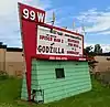 99W Drive-in Theatre |
July 11, 2014 (#14000401) |
3110 Portland Road 45°18′17″N 122°56′53″W |
Newberg | |
| 2 | Avery House | 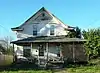 Avery House |
March 16, 1987 (#87000329) |
403 Church St. 45°13′17″N 123°04′45″W |
Dayton | |
| 3 | Baxter House | 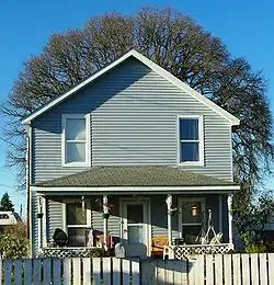 Baxter House |
March 16, 1987 (#87000331) |
407 Church St. 45°13′17″N 123°04′46″W |
Dayton | |
| 4 | Berry–Sigler Investment Property |  Berry–Sigler Investment Property |
August 3, 1987 (#87000368) |
700 Church St. 45°13′07″N 123°05′00″W |
Dayton | |
| 5 | Henry Bertram, Sr. House | .jpg.webp) Henry Bertram, Sr. House |
February 29, 1988 (#88000080) |
6160 SE Webfoot Rd. 45°12′51″N 123°05′10″W |
Dayton | |
| 6 | Briedwell School |  Briedwell School |
July 28, 1988 (#88001156) |
11935 SW Bellevue Hwy. 45°06′48″N 123°14′16″W |
Amity | Built in 1895, this is the most intact and architecturally sophisticated of the few remaining one-room schoolhouses in Yamhill County. It served students in kindergarten through 8th grade until it closed in 1957, and has since been converted into a house. It is the sole remnant of the former railroad town of Briedwell.[7] |
| 7 | Brookside Cemetery | 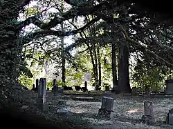 Brookside Cemetery |
March 16, 1987 (#87000332) |
South end of 3rd St. 45°13′06″N 123°04′24″W |
Dayton | |
| 8 | Buchanan Cellers Mill | 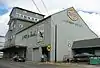 Buchanan Cellers Mill |
January 27, 2012 (#11001065) |
855 NE 5th St. 45°12′42″N 123°11′23″W |
McMinnville | |
| 9 | John Marion Bunn House | 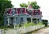 John Marion Bunn House |
October 16, 1979 (#79002152) |
285 W 3rd St. 45°20′21″N 123°11′25″W |
Yamhill | |
| 10 | Cain House | 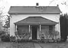 Cain House |
March 16, 1987 (#87000333) |
208 Alder St. 45°13′13″N 123°04′26″W |
Dayton | Has been demolished.[8] |
| 11 | Cameo Theatre | 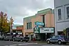 Cameo Theatre |
October 22, 2018 (#100003055) |
304 E. 1st St. 45°18′00″N 122°58′36″W |
Newberg | |
| 12 | Carlton State and Savings Bank |  Carlton State and Savings Bank |
February 11, 1988 (#88000082) |
109 W. Main St. 45°17′40″N 123°10′38″W |
Carlton | |
| 13 | Carter–Goodrich House |  Carter–Goodrich House |
March 16, 1987 (#87000334) |
521 Church St. 45°13′16″N 123°04′48″W |
Dayton | |
| 14 | Asa F. Cate Farm Ensemble |  Asa F. Cate Farm Ensemble |
February 23, 1990 (#90000285) |
16900 NW Baker Creek Rd. 45°13′52″N 123°17′19″W |
McMinnville | |
| 15 | Joseph and Virginia Chambers Farmstead |  Joseph and Virginia Chambers Farmstead |
March 5, 1992 (#92000136) |
30295 Highway 99W 45°18′48″N 122°55′39″W |
Newberg | |
| 16 | Commercial Club – S. C. Stuckey Building |  Commercial Club – S. C. Stuckey Building |
March 16, 1987 (#87000335) |
304 Ferry St. 45°13′14″N 123°04′33″W |
Dayton | |
| 17 | Amos Cook House |  Amos Cook House |
December 31, 1974 (#74001726) |
NW of Dayton on OR 233 45°14′13″N 123°06′55″W |
Dayton | |
| 18 | Courthouse Square | _(yamDA0084).jpg.webp) Courthouse Square |
March 16, 1987 (#87000336) |
Bounded by 3rd, 4th, Ferry, and Main Sts. 45°13′15″N 123°04′36″W |
Dayton | |
| 19 | Dayton Common School |  Dayton Common School |
March 16, 1987 (#87000338) |
504 4th St. 45°13′11″N 123°04′35″W |
Dayton | |
| 20 | Dayton High School | _(yamDA0070).jpg.webp) Dayton High School |
March 16, 1987 (#87000339) |
801 Ferry St. 45°12′59″N 123°05′04″W |
Dayton | |
| 21 | Dayton Methodist Episcopal Church | 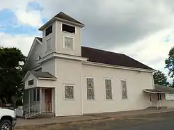 Dayton Methodist Episcopal Church |
March 16, 1987 (#87000340) |
302 4th St. 45°13′17″N 123°04′42″W |
Dayton | |
| 22 | Diehl–Seitters House | 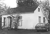 Diehl–Seitters House |
March 16, 1987 (#87000344) |
527 Church St. 45°13′14″N 123°04′50″W |
Dayton | Has been demolished.[8] |
| 23 | Dundee Woman's Club Hall | 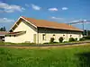 Dundee Woman's Club Hall |
June 5, 1986 (#86001241) |
OR 99W 45°16′31″N 123°00′49″W |
Dundee | |
| 24 | Jesse Edwards House | 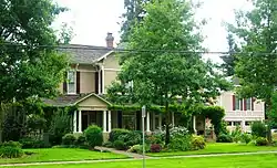 Jesse Edwards House |
August 25, 1980 (#80003393) |
402 S. College St. 45°17′51″N 122°58′21″W |
Newberg | |
| 25 | Evangelical Church of Lafayette | 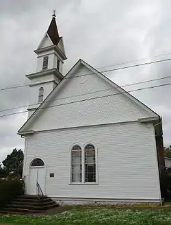 Evangelical Church of Lafayette |
October 31, 2002 (#02001278) |
605 Market St. 45°14′45″N 123°06′45″W |
Lafayette | |
| 26 | Evangelical United Brethren Church | 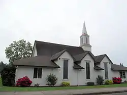 Evangelical United Brethren Church |
August 3, 1987 (#87000346) |
302 5th St. 45°13′15″N 123°04′46″W |
Dayton | |
| 27 | Frank W. Fenton House |  Frank W. Fenton House |
September 1, 1983 (#83002180) |
434 NE Evans St. 45°12′40″N 123°11′39″W |
McMinnville | |
| 28 | Fernwood Pioneer Cemetery | 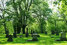 Fernwood Pioneer Cemetery |
August 5, 1994 (#94000809) |
Everest Rd., 0.5 miles (0.80 km) south of the junction with OR 219 45°17′41″N 122°57′37″W |
Newberg | |
| 29 | First Baptist Church | _(yamDA0025b).jpg.webp) First Baptist Church |
October 16, 1979 (#79002151) |
3rd and Main Sts. 45°13′18″N 123°04′36″W |
Dayton | |
| 30 | Carl Fischer Meats | 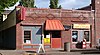 Carl Fischer Meats |
March 16, 1987 (#87000348) |
400 Ferry St. 45°13′12″N 123°04′36″W |
Dayton | |
| 31 | Alfred P. Fletcher Farmhouse | 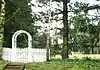 Alfred P. Fletcher Farmhouse |
August 25, 1980 (#80003392) |
1007 3rd St. 45°14′32″N 123°06′27″W |
Lafayette | |
| 32 | Francis Fletcher House | 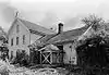 Francis Fletcher House |
October 29, 1975 (#75001601) |
W of Dayton off OR 18 45°13′26″N 123°06′29″W |
Dayton vicinity | |
| 33 | Fletcher–Stretch House | .jpg.webp) Fletcher–Stretch House |
March 16, 1987 (#87000349) |
401 Oak St. 45°13′21″N 123°04′46″W |
Dayton | |
| 34 | Foster Oil Company | .jpg.webp) Foster Oil Company |
March 16, 1987 (#87000356) |
216 Ferry St. 45°13′15″N 123°04′31″W |
Dayton | |
| 35 | Free Methodist Church |  Free Methodist Church |
March 16, 1987 (#87000357) |
411 Oak St. 45°13′19″N 123°04′49″W |
Dayton | |
| 36 | Gabriel–Filer House |  Gabriel–Filer House |
March 16, 1987 (#87000358) |
525 Church St. 45°13′15″N 123°04′49″W |
Dayton | |
| 37 | Gabriel–Will House | 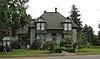 Gabriel–Will House |
March 16, 1987 (#87000359) |
401 3rd St. 45°13′17″N 123°04′33″W |
Dayton | |
| 38 | Levi Hagey House |  Levi Hagey House |
December 19, 1974 (#74001727) |
Off OR 99W 45°17′02″N 123°00′14″W |
Dundee | |
| 39 | Harrington House | .jpg.webp) Harrington House |
March 16, 1987 (#87000360) |
212 Mill St. 45°13′10″N 123°04′25″W |
Dayton | |
| 40 | Harris Building |  Harris Building |
March 16, 1987 (#87000363) |
302 Ferry St. 45°13′14″N 123°04′32″W |
Dayton | |
| 41 | William Hibbert House |  William Hibbert House |
November 30, 1978 (#78002329) |
426 5th St. 45°13′11″N 123°04′42″W |
Dayton | |
| 42 | Hole House |  Hole House |
March 16, 1987 (#87000367) |
623 Ferry St. 45°13′04″N 123°04′54″W |
Dayton | |
| 43 | J. C. Penney Building |  J. C. Penney Building |
June 13, 2007 (#07000555) |
516 E. 1st St. 45°18′00″N 122°58′27″W |
Newberg | |
| 44 | Jessen–Goodrich House |  Jessen–Goodrich House |
March 16, 1987 (#87000370) |
324 6th St. 45°13′10″N 123°04′53″W |
Dayton | |
| 45 | James M. and Paul R. Kelty House |  James M. and Paul R. Kelty House |
September 23, 1982 (#82003756) |
675 3rd St. 45°14′35″N 123°06′41″W |
Lafayette | |
| 46 | Dr. Andrew Kershaw House |  Dr. Andrew Kershaw House |
March 2, 1989 (#89000122) |
472 E. Main St. 45°04′49″N 123°28′54″W |
Willamina | |
| 47 | Krietz House |  Krietz House |
March 16, 1987 (#87000372) |
627 Church St. 45°13′10″N 123°04′58″W |
Dayton | |
| 48 | Lamson Ranch | Lamson Ranch |
July 9, 2013 (#13000483) |
37845 SW Dent Road 45°04′49″N 123°30′18″W |
Willamina vicinity | |
| 49 | Lee Laughlin House |  Lee Laughlin House |
March 26, 1979 (#79002153) |
100 S. Laurel St. 45°20′29″N 123°11′12″W |
Yamhill | |
| 50 | Lewis–Shippy House |  Lewis–Shippy House |
March 16, 1987 (#87000373) |
421 6th St. 45°13′08″N 123°04′49″W |
Dayton | |
| 51 | Gottlieb Londershausen House | .jpg.webp) Gottlieb Londershausen House |
March 16, 1987 (#87000383) |
402 Main St. 45°13′14″N 123°04′40″W |
Dayton | |
| 52 | Paul Londershausen House |  Paul Londershausen House |
March 16, 1987 (#87000384) |
309 Main St. 45°13′16″N 123°04′39″W |
Dayton | |
| 53 | Mabee–Mayberry House |  Mabee–Mayberry House |
August 3, 1987 (#87000385) |
309 7th St. 45°13′07″N 123°04′58″W |
Dayton | |
| 54 | Joseph Mattey House |  Joseph Mattey House |
February 15, 1977 (#77001118) |
W of Lafayette at jct. of Mattey Lane and Rutherford Rd. 45°14′44″N 123°07′58″W |
Lafayette | |
| 55 | McMinnville Downtown Historic District |  McMinnville Downtown Historic District |
September 14, 1987 (#87001366) |
Bounded by 5th St., Southern Pacific RR tracks, 2nd, and N. Adams Sts. 45°12′36″N 123°11′41″W |
McMinnville | |
| 56 | McNamar Building |  McNamar Building |
March 16, 1987 (#87000386) |
310–312 Ferry St. 45°13′13″N 123°04′34″W |
Dayton | |
| 57 | McNish House |  McNish House |
March 16, 1987 (#87000388) |
1005 Ferry St. 45°12′52″N 123°05′21″W |
Dayton | Building no longer exists. |
| 58 | Mellinger House |  Mellinger House |
March 16, 1987 (#87000389) |
414 5th St. 45°13′12″N 123°04′43″W |
Dayton | |
| 59 | Mellinger–Ponnay House |  Mellinger–Ponnay House |
August 3, 1987 (#87000390) |
102 Tribbett Court 45°13′02″N 123°04′11″W |
Dayton | |
| 60 | Methodist Episcopal Parsonage | .jpg.webp) Methodist Episcopal Parsonage |
August 3, 1987 (#87000393) |
202 4th St. 45°13′19″N 123°04′44″W |
Dayton | |
| 61 | Minthorn Hall |  Minthorn Hall |
June 13, 1997 (#97000581) |
North St. on the George Fox University Campus 45°18′14″N 122°58′05″W |
Newberg | |
| 62 | Dr. Henry J. Minthorn House (Herbert Hoover House) |  Dr. Henry J. Minthorn House (Herbert Hoover House) |
December 19, 2003 (#75001602) |
115 S. River St. 45°17′59″N 122°58′08″W |
Newberg | |
| 63 | Monahan House | .jpg.webp) Monahan House |
March 16, 1987 (#87000395) |
120 5th St. 45°13′19″N 123°04′51″W |
Dayton | |
| 64 | Morse House |  Morse House |
March 16, 1987 (#87000398) |
409 Oak St. 45°13′20″N 123°04′48″W |
Dayton | |
| 65 | Morse House |  Morse House |
March 16, 1987 (#87000396) |
101 5th St. 45°13′21″N 123°04′51″W |
Dayton | |
| 66 | Nichols House |  Nichols House |
March 16, 1987 (#87000400) |
303 Main St. 45°13′18″N 123°04′37″W |
Dayton | Building no longer exists. |
| 67 | Oregon Mutual Merchant Fire Insurance Association Office |  Oregon Mutual Merchant Fire Insurance Association Office |
March 16, 1987 (#87000402) |
308 Ferry St. 45°13′13″N 123°04′34″W |
Dayton | |
| 68 | Palmer House | _(yamDA0073).jpg.webp) Palmer House |
March 16, 1987 (#87000403) |
600 Ferry St. 45°13′05″N 123°04′47″W |
Dayton | |
| 69 | William Albert and Anna May Bristow Parrish Farmstead |  William Albert and Anna May Bristow Parrish Farmstead |
July 17, 2000 (#00000803) |
30280 NE Wilsonville Rd. 45°17′18″N 122°55′36″W |
Newberg | |
| 70 | Paulson–Gregory House |  Paulson–Gregory House |
March 18, 1999 (#99000355) |
509 S. College St. 45°17′47″N 122°58′23″W |
Newberg | |
| 71 | Pioneer Hall, Linfield College | _(yamDA0112).jpg.webp) Pioneer Hall, Linfield College |
February 23, 1978 (#78002330) |
Linfield College campus 45°12′05″N 123°11′57″W |
McMinnville | |
| 72 | Curtis W. Powell House |  Curtis W. Powell House |
March 16, 1987 (#87000404) |
524 Ash St. 45°13′19″N 123°04′54″W |
Dayton | |
| 73 | Rippey House |  Rippey House |
March 16, 1987 (#87000405) |
523 Ash St. 45°13′20″N 123°04′55″W |
Dayton | |
| 74 | Sigler House |  Sigler House |
March 16, 1987 (#87000406) |
521 Ferry St. 45°13′09″N 123°04′44″W |
Dayton | |
| 75 | Andrew Smith House |  Andrew Smith House |
June 23, 1976 (#76001591) |
308 5th St. 45°13′13″N 123°04′45″W |
Dayton | |
| 76 | John T. Smith House |  John T. Smith House |
November 15, 1984 (#84000493) |
414 N. College St. 45°18′12″N 122°58′21″W |
Newberg | |
| 77 | Charles K. Spaulding House |  Charles K. Spaulding House |
August 26, 1994 (#94001022) |
717 E. Sheridan St. 45°18′08″N 122°58′19″W |
Newberg | Home of timber industry businessman Charles K. Spaulding |
| 78 | Jack Spence House |  Jack Spence House |
February 27, 1986 (#86000295) |
536 NE 5th St. 45°12′40″N 123°11′37″W |
McMinnville | |
| 79 | Dr. Stuart House |  Dr. Stuart House |
March 16, 1987 (#87000408) |
103 Ferry St. 45°13′19″N 123°04′24″W |
Dayton | |
| 80 | Lewis C. and Emma Thompson House |  Lewis C. and Emma Thompson House |
May 11, 2018 (#100000770) |
12789 Meadowlake Road 45°17′14″N 123°14′47″W |
Carlton vicinity | |
| 81 | Travelers Home |  Travelers Home |
July 8, 1982 (#82003757) |
147 NE Yamhill St. 45°06′02″N 123°23′39″W |
Sheridan | |
| 82 | Union Block |  Union Block |
May 5, 2000 (#00000450) |
610–620 E. 1st St. 45°18′00″N 122°58′23″W |
Newberg | |
| 83 | John B. Wennerberg Barn |  John B. Wennerberg Barn |
June 25, 2018 (#100002598) |
501 S. Park St. 45°17′28″N 123°10′42″W |
Carlton | |
| 84 | Yamhill River Lock and Dam |  Yamhill River Lock and Dam |
June 21, 1991 (#91000799) |
Across the Yamhill River at the south terminus of Locks Rd. 45°13′50″N 123°06′16″W |
Dayton | |
| 85 | Ewing Young Site |  Ewing Young Site |
November 26, 1989 (#89001977) |
Address restricted[9] |
Newberg | Ewing Young Park sits on the homestead site. |
Former listings
| [5] | Name on the Register | Image | Date listed | Date removed | Location | City or town | Summary |
|---|---|---|---|---|---|---|---|
| 1 | Dayton Auto and Transfer Company Building | March 16, 1987 (#87000337) | July 21, 1998 | 411 Ferry St. |
Dayton | ||
| 2 | Dayton Opera House | March 16, 1987 (#87000342) | July 21, 1998 | 318 Ferry St. |
Dayton |
See also
- National Register of Historic Places listings in Oregon
- Listings in neighboring counties: Clackamas, Marion, Polk, Tillamook, Washington
- Historic preservation
- History of Oregon
- Lists of Oregon-related topics
References
- Andrus, Patrick W.; Shrimpton, Rebecca H.; et al. (2002), How to Apply the National Register Criteria for Evaluation, National Register Bulletin, National Park Service, U.S. Department of the Interior, OCLC 39493977, archived from the original on April 6, 2014, retrieved June 20, 2014.
- National Park Service, National Register of Historic Places Program: Research, archived from the original on February 1, 2015, retrieved January 28, 2015.
- Oregon Parks and Recreation Department, Oregon Historic Sites Database, retrieved August 6, 2015. Note that a simple count of National Register records in this database returns a slightly higher total than actual listings, due to duplicate records. A close reading of detailed query results is necessary to arrive at the precise count.
- "National Register of Historic Places: Weekly List Actions". National Park Service, United States Department of the Interior. Retrieved on January 29, 2021.
- Numbers represent an alphabetical ordering by significant words. Various colorings, defined here, differentiate National Historic Landmarks and historic districts from other NRHP buildings, structures, sites or objects.
- The eight-digit number below each date is the number assigned to each location in the National Register Information System database, which can be viewed by clicking the number.
- Cram, Lauren (January 15, 1987). "National Register of Historic Places Registration Form: Briedwell School". Cite journal requires
|journal=(help) - Oregon Parks and Recreation Department, Oregon Historic Sites Database, retrieved September 11, 2014.
- Federal and state laws and practices restrict general public access to information regarding the specific location of this resource. In some cases, this is to protect archeological sites from vandalism, while in other cases it is restricted at the request of the owner. See: Knoerl, John; Miller, Diane; Shrimpton, Rebecca H. (1990), Guidelines for Restricting Information about Historic and Prehistoric Resources, National Register Bulletin, National Park Service, U.S. Department of the Interior, OCLC 20706997.
External links
- Oregon Parks and Recreation Department, National Register Program
- National Park Service, National Register of Historic Places site
 Media related to National Register of Historic Places in Yamhill County, Oregon at Wikimedia Commons
| Lists by county | 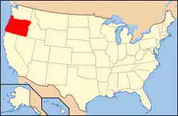 | |
|---|---|---|
| Portland lists | ||
| Other lists |
| |
| Topics | |
|---|---|
| Lists by state |
|
| Lists by insular areas | |
| Lists by associated state | |
| Other areas | |
| Related | |
| |
Municipalities and communities of Yamhill County, Oregon, United States | ||
|---|---|---|
| Cities | | |
| CDPs | ||
| Other unincorporated communities | ||
| Indian reservation | ||
| Footnotes | ‡This populated place also has portions in an adjacent county or counties | |
| ||
This article is issued from Wikipedia. The text is licensed under Creative Commons - Attribution - Sharealike. Additional terms may apply for the media files.