National Register of Historic Places listings in Miller County, Arkansas
This is a list of the National Register of Historic Places listings in Miller County, Arkansas.

Location of Miller County in Arkansas
This is intended to be a complete list of the properties and districts on the National Register of Historic Places in Miller County, Arkansas, United States. The locations of National Register properties and districts for which the latitude and longitude coordinates are included below, may be seen in a map.[1]
There are 33 properties and districts listed on the National Register in the county.
- This National Park Service list is complete through NPS recent listings posted February 5, 2021.[2]
Current listings
| [3] | Name on the Register[4] | Image | Date listed[5] | Location | City or town | Description |
|---|---|---|---|---|---|---|
| 1 | Wallace Adams Service Station | 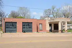 Wallace Adams Service Station |
August 1, 2008 (#08000726) |
523 E. 3rd St. 33°26′39″N 94°02′17″W |
Texarkana | |
| 2 | Patrick J. Ahern House | 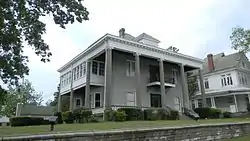 Patrick J. Ahern House |
January 20, 2005 (#04001508) |
403 Laurel St. 33°25′35″N 94°02′23″W |
Texarkana | |
| 3 | Averitt House | 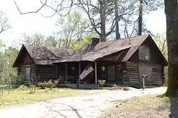 Averitt House |
July 24, 1992 (#92000958) |
Western side of U.S. Route 71, 6 miles south of Texarkana 33°20′50″N 93°57′51″W |
Mount Pleasant | |
| 4 | Beech Street Brick Street | 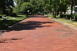 Beech Street Brick Street |
May 22, 2007 (#07000438) |
Beech St. between 14th and 24th Sts. 33°26′50″N 94°02′21″W |
Texarkana | |
| 5 | Beech Street Historic District |  Beech Street Historic District |
January 21, 2010 (#09001254) |
Roughly Beech St. between 14th and 23rd Sts. 33°26′26″N 94°02′22″W |
Texarkana | |
| 6 | Bottoms House | 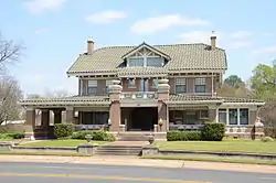 Bottoms House |
June 8, 1982 (#82002124) |
500 Hickory 33°25′44″N 94°02′05″W |
Texarkana | |
| 7 | Buhrman-Pharr Hardware Company Historic District | 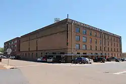 Buhrman-Pharr Hardware Company Historic District |
September 24, 2004 (#04001045) |
610 and 620 E 3rd St. 33°25′36″N 94°02′15″W |
Texarkana | |
| 8 | Canaan Baptist Church | 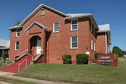 Canaan Baptist Church |
June 14, 1990 (#90000903) |
Junction of Laurel and 10th Sts. 33°25′59″N 94°02′29″W |
Texarkana | |
| 9 | John Clifton House | 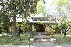 John Clifton House |
June 2, 2000 (#00000608) |
1803 Pecan St. 33°26′23″N 94°02′14″W |
Texarkana | |
| 10 | Confederate Section-Old Rondo Cemetery | 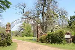 Confederate Section-Old Rondo Cemetery |
September 22, 2004 (#04001029) |
1612 Smith Rd. 33°26′47″N 93°58′03″W |
Rondo | |
| 11 | Cotton Belt Railroad Office Building | 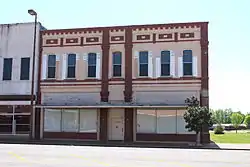 Cotton Belt Railroad Office Building |
August 1, 2008 (#08000727) |
312 E. Broad St. 33°25′21″N 94°02′26″W |
Texarkana | |
| 12 | Crenshaw Site | January 26, 1994 (#93001521) |
Address Restricted |
Hervey | ||
| 13 | Dean House | 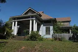 Dean House |
December 12, 1976 (#76000433) |
1520 Beech St. 33°26′19″N 94°02′19″W |
Texarkana | |
| 14 | East Broad Street Historic District |  East Broad Street Historic District |
August 1, 2008 (#08000729) |
100 block of E. Broad St. 33°25′18″N 94°02′32″W |
Texarkana | |
| 15 | Claude Foulke House | 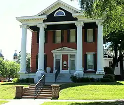 Claude Foulke House |
April 22, 1982 (#82002125) |
501 Pecan St. 33°25′41″N 94°02′09″W |
Texarkana | |
| 16 | Augustus M. Garrison House | 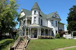 Augustus M. Garrison House |
March 25, 1982 (#82002126) |
600 Pecan St. 33°25′45″N 94°02′11″W |
Texarkana | |
| 17 | Hopkins Feed and Seed Store | 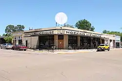 Hopkins Feed and Seed Store |
August 1, 2008 (#08000728) |
301 E. 3rd St. 33°25′24″N 94°02′29″W |
Texarkana | |
| 18 | Kiblah School | 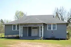 Kiblah School |
November 20, 1989 (#88003210) |
Route 1 33°03′12″N 93°52′01″W |
Doddridge | |
| 19 | Kittrell House | 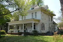 Kittrell House |
December 22, 1982 (#82000864) |
1103 Hickory St. 33°26′01″N 94°02′11″W |
Texarkana | |
| 20 | Miller County Courthouse | 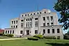 Miller County Courthouse |
May 29, 1998 (#98000578) |
400 Laurel St. 33°25′35″N 94°01′38″W |
Texarkana | |
| 21 | Mullins Court | 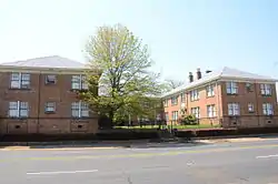 Mullins Court |
January 29, 2007 (#06001313) |
605 Hickory St. 33°25′53″N 94°02′08″W |
Texarkana | |
| 22 | Charles J. Neif House | 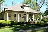 Charles J. Neif House |
August 5, 1994 (#94000822) |
1410 Pecan St. 33°26′12″N 94°02′13″W |
Texarkana | |
| 23 | Old Arkansas 2-Mayton Segment | 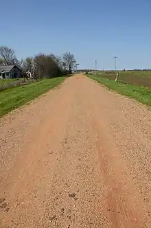 Old Arkansas 2-Mayton Segment |
May 16, 2008 (#08000440) |
County Roads 122 and 123 33°23′43″N 93°44′40″W |
Garland | Part of Arkansas Highway 2 |
| 24 | Old US 67, Mandeville | 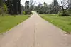 Old US 67, Mandeville |
January 21, 2004 (#03001458) |
Highway 296, County Road 138, and southeast of the current U.S. Route 67 33°29′16″N 93°57′35″W |
Mandeville | |
| 25 | Orr School | 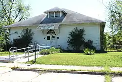 Orr School |
July 30, 1976 (#76000434) |
831 Laurel St. 33°25′48″N 94°02′31″W |
Texarkana | |
| 26 | Ritchie Grocery Building | 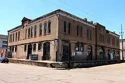 Ritchie Grocery Building |
June 14, 1990 (#90000900) |
Junction of Front and Olive Sts. 33°25′15″N 94°02′29″W |
Texarkana | |
| 27 | Swift Building | 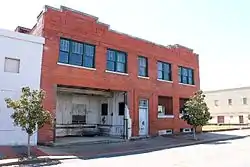 Swift Building |
August 1, 2008 (#08000725) |
410 E. Broad St. 33°25′23″N 94°02′22″W |
Texarkana | |
| 28 | Texarkana Union Station | 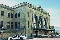 Texarkana Union Station |
November 19, 1978 (#78000611) |
State Line and Front St. 33°25′12″N 94°02′33″W |
Texarkana | Extends into Bowie County, Texas |
| 29 | Texarkana US Post Office and Courthouse |  Texarkana US Post Office and Courthouse |
March 24, 2000 (#00000245) |
5th St. and State Line Ave. 33°25′30″N 94°02′34″W |
Texarkana | Extends into Bowie County, Texas |
| 30 | Texarkana, Arkansas, Municipal Building | 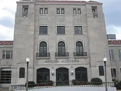 Texarkana, Arkansas, Municipal Building |
January 21, 2004 (#03001456) |
Walnut and 3rd Sts. 33°25′25″N 94°02′22″W |
Texarkana | |
| 31 | J.K. Wadley House |  J.K. Wadley House |
February 12, 1999 (#99000155) |
618 Pecan St. 33°25′47″N 94°02′11″W |
Texarkana | |
| 32 | Alvah Horace Whitmarsh House |  Alvah Horace Whitmarsh House |
August 29, 1980 (#80000778) |
711 Pecan St. 33°25′57″N 94°02′26″W |
Texarkana | |
| 33 | Wynn-Price House |  Wynn-Price House |
January 23, 1992 (#90001950) |
Price St. 33°21′48″N 93°43′24″W |
Garland |
Former listings
| [3] | Name on the Register | Image | Date listed | Date removed | Location | City or town | Summary |
|---|---|---|---|---|---|---|---|
| 1 | First Methodist Church | December 22, 1982 (#82000863) | January 14, 2002 | 400 E. 6th |
Texarkana | ||
| 2 | Dr. J. A. Lightfoot House | June 30, 1995 (#95000792) | January 14, 2002 | 422 Pecan Street |
Texarkana | ||
| 3 | Red River Bridge | Red River Bridge |
April 4, 1990 (#90000517) | August 11, 1999 | over the Red River |
Garland | Replaced in 1990. Historic Bridges of Arkansas MPS |
See also
| Wikimedia Commons has media related to National Register of Historic Places in Miller County, Arkansas. |
References
- The latitude and longitude information provided in this table was derived originally from the National Register Information System, which has been found to be fairly accurate for about 99% of listings. Some locations in this table may have been corrected to current GPS standards.
- "National Register of Historic Places: Weekly List Actions". National Park Service, United States Department of the Interior. Retrieved on February 5, 2021.
- Numbers represent an alphabetical ordering by significant words. Various colorings, defined here, differentiate National Historic Landmarks and historic districts from other NRHP buildings, structures, sites or objects.
- "National Register Information System". National Register of Historic Places. National Park Service. March 13, 2009.
- The eight-digit number below each date is the number assigned to each location in the National Register Information System database, which can be viewed by clicking the number.
| Topics | |
|---|---|
| Lists by state |
|
| Lists by insular areas | |
| Lists by associated state | |
| Other areas | |
| Related | |
| |
Municipalities and communities of Miller County, Arkansas, United States | ||
|---|---|---|
| Cities | Map of Arkansas highlighting Miller County | |
| Town | ||
| Unincorporated communities | ||
| ||
This article is issued from Wikipedia. The text is licensed under Creative Commons - Attribution - Sharealike. Additional terms may apply for the media files.