National Register of Historic Places listings in Merrimack County, New Hampshire
This is a list of the National Register of Historic Places listings in Merrimack County, New Hampshire.

Location of Merrimack County in New Hampshire
This is intended to be a complete list of the properties and districts on the National Register of Historic Places in Merrimack County, New Hampshire, United States. Latitude and longitude coordinates are provided for many National Register properties and districts; these locations may be seen together in a map.[1]
There are 88 properties and districts listed on the National Register in the county, including 2 National Historic Landmarks.
| Belknap - Carroll - Cheshire - Coos - Grafton - Hillsborough - Merrimack - Rockingham - Strafford - Sullivan |
- This National Park Service list is complete through NPS recent listings posted January 29, 2021.[2]
Current listings
| [3] | Name on the Register[4] | Image | Date listed[5] | Location | City or town | Description |
|---|---|---|---|---|---|---|
| 1 | 2½ Beacon Street | 2½ Beacon Street |
December 17, 1984 (#84000500) |
2½ Beacon St. 43°12′42″N 71°32′33″W |
Concord | |
| 2 | Allenstown Meeting House |  Allenstown Meeting House |
December 6, 2004 (#04001327) |
Deerfield Rd. 43°09′37″N 71°22′53″W |
Allenstown | |
| 3 | Baptist New Meeting House |  Baptist New Meeting House |
December 22, 2005 (#05001446) |
461 Main St. 43°24′45″N 71°58′50″W |
New London | |
| 4 | Bear Brook State Park Civilian Conservation Corps (CCC) Camp Historic District |  Bear Brook State Park Civilian Conservation Corps (CCC) Camp Historic District |
June 11, 1992 (#92000632) |
½ mile from park entrance, 160 yd (150 m) south of Allenstown-Deerfield Rd., in Bear Brook State Park 43°09′29″N 71°22′44″W |
Allenstown | |
| 5 | Beaver Meadow Brook Archeological Site (27MR3) |  Beaver Meadow Brook Archeological Site (27MR3) |
June 2, 1989 (#89000434) |
West side of the Merrimack River near Sewall's Falls[6] |
Concord | Major Native American archeological site[6] |
| 6 | Bement Covered Bridge |  Bement Covered Bridge |
November 21, 1976 (#76000128) |
Center Rd. 43°15′51″N 71°57′13″W |
Bradford | Over the Warner River |
| 7 | Bennett Farm |  Bennett Farm |
September 14, 2002 (#02000960) |
11 Bennett Rd. 43°10′14″N 71°47′33″W |
Henniker | |
| 8 | Blossom Hill and Calvary Cemeteries |  Blossom Hill and Calvary Cemeteries |
December 15, 2010 (#10000891) |
N. State St. 43°13′19″N 71°33′13″W |
Concord | |
| 9 | Bog Bridge |  Bog Bridge |
March 16, 1989 (#89000192) |
Off NH 11 over Pleasant Brook 43°25′49″N 71°52′11″W |
Andover | |
| 10 | Boscawen Academy and Much-I-Do Hose House |  Boscawen Academy and Much-I-Do Hose House |
December 8, 1980 (#80000292) |
King St. 43°19′03″N 71°37′20″W |
Boscawen | |
| 11 | Boscawen Public Library |  Boscawen Public Library |
May 28, 1981 (#81000073) |
King St. 43°19′09″N 71°37′31″W |
Boscawen | |
| 12 | Bradford Center Meetinghouse |  Bradford Center Meetinghouse |
June 14, 2013 (#13000384) |
18 Rowe Mountain Rd. 43°14′10″N 71°58′08″W |
Bradford | |
| 13 | Bradford Town Hall |  Bradford Town Hall |
November 13, 1980 (#80000293) |
W. Main St. 43°16′09″N 71°57′42″W |
Bradford | |
| 14 | H. Styles Bridges House |  H. Styles Bridges House |
December 22, 2005 (#05001444) |
21 Mountain Rd. 43°14′23″N 71°32′20″W |
Concord | The official residence of the governor |
| 15 | Canterbury Shaker Village |  Canterbury Shaker Village |
June 17, 1975 (#75000129) |
4 mi (6.4 km) east of Canterbury on Shaker Rd. 43°21′32″N 71°29′24″W |
Canterbury | One of the best-preserved Shaker villages |
| 16 | Center Meetinghouse |  Center Meetinghouse |
December 19, 1979 (#79000201) |
NH 103 43°19′16″N 72°02′08″W |
Newbury | |
| 17 | Chamberlin House |  Chamberlin House |
August 16, 1982 (#82001688) |
44 Pleasant St. 43°12′12″N 71°32′19″W |
Concord | |
| 18 | Concord Civic District |  Concord Civic District |
December 22, 1983 (#83004203) |
107 N. Main St., 25 Capitol St., 39-45 Green St., 20-30 Park St., and 33 N. State St. 43°12′24″N 71°32′22″W |
Concord | |
| 19 | Concord Gas Light Company Gasholder House |  Concord Gas Light Company Gasholder House |
January 12, 2018 (#100001962) |
Gas St. 43°11′47″N 71°31′52″W |
Concord | |
| 20 | Concord Historic District |  Concord Historic District |
June 11, 1975 (#75000234) |
Roughly bounded by N. State St., Horse Shoe Pond, Boston and Maine railroad tracks, Sen. Styles Bridges Highway, and Church St. 43°12′57″N 71°32′30″W |
Concord | |
| 21 | Contoocook Railroad Depot |  Contoocook Railroad Depot |
March 16, 2006 (#06000131) |
896 Main St. in the village of Contoocook 43°13′21″N 71°42′47″W |
Hopkinton | |
| 22 | Henry J. Crippen House |  Henry J. Crippen House |
December 22, 1983 (#83004204) |
189-191 N. Main St. 43°12′45″N 71°32′26″W |
Concord | |
| 23 | Dalton Covered Bridge |  Dalton Covered Bridge |
November 21, 1976 (#76000221) |
Joppa Rd. 43°16′36″N 71°48′43″W |
Warner | Over the Warner River |
| 24 | Dimond Hill Farm |  Dimond Hill Farm |
March 15, 2007 (#07000155) |
314 Hopkinton Rd. 43°11′28″N 71°37′03″W |
Concord | |
| 25 | Lewis Downing, Jr., House |  Lewis Downing, Jr., House |
September 11, 1987 (#87001425) |
33 Pleasant St. 43°12′10″N 71°32′18″W |
Concord | |
| 26 | Downtown Concord Historic District |  Downtown Concord Historic District |
June 9, 2000 (#00000652) |
Roughly bounded by Center St., Loudon Rd., Storrs St., Hills Ave., and S. State, Green, School, Capitol, and Park Sts. 43°12′19″N 71°32′15″W |
Concord | |
| 27 | Gershom Durgin House |  Gershom Durgin House |
December 1, 2000 (#00001463) |
391 Franklin Highway 43°26′34″N 71°46′14″W |
Andover | |
| 28 | Eagle Hotel |  Eagle Hotel |
September 20, 1978 (#78000216) |
110 N. Main St. 43°12′25″N 71°32′12″W |
Concord | |
| 29 | East Andover Village Center Historic District |  East Andover Village Center Historic District |
March 16, 1989 (#89000191) |
Village of East Andover, junction of NH 11 and Chase Hill Rd. 43°27′34″N 71°44′51″W |
Andover | |
| 30 | Endicott Hotel |  Endicott Hotel |
May 29, 1987 (#87000818) |
1-3 S. Main St. 43°12′14″N 71°32′09″W |
Concord | |
| 31 | Farrington House |  Farrington House |
March 9, 1982 (#82001858) |
30 S. Main St. 43°12′11″N 71°32′09″W |
Concord | |
| 32 | First Congregational Church of Boscawen |  First Congregational Church of Boscawen |
April 19, 1982 (#82001689) |
King St. 43°19′19″N 71°37′45″W |
Boscawen | |
| 33 | Reuben Foster House and Perley Cleaves House | 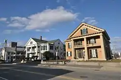 Reuben Foster House and Perley Cleaves House |
March 15, 1982 (#82001690) |
64 and 62 N. State St. 43°12′35″N 71°32′27″W |
Concord | |
| 34 | Franklin Falls Historic District |  Franklin Falls Historic District |
August 19, 1982 (#82001691) |
Roughly bounded by Bow, River, and School Sts., Ayles Ct., and the Winnipesaukee River 43°26′39″N 71°38′57″W |
Franklin | Encompasses most of downtown Franklin |
| 35 | Hall Memorial Library |  Hall Memorial Library |
October 4, 1978 (#78000217) |
Park St. 43°26′30″N 71°35′36″W |
Northfield | |
| 36 | Charles S. Hall House |  Charles S. Hall House |
June 13, 2002 (#02000640) |
1740 Dover Rd. 43°13′32″N 71°20′48″W |
Epsom | |
| 37 | Matthew Harvey House |  Matthew Harvey House |
September 4, 1992 (#92001082) |
Western side of Harvey Rd., 0.25 mi (0.40 km) north of its junction with Keyser St. 43°22′22″N 71°57′22″W |
Sutton | |
| 38 | Hay Estate |  Hay Estate |
November 2, 2000 (#00001288) |
NH 103A, 2.2 mi (3.5 km) north of its junction with NH 103 43°21′00″N 72°02′43″W |
Newbury | Former summer home of American statesman John Hay |
| 39 | Henniker Town Hall |  Henniker Town Hall |
February 24, 1981 (#81000074) |
Depot Hill Rd. 43°10′32″N 71°49′23″W |
Henniker | |
| 40 | Hersey Farms Historic District |  Hersey Farms Historic District |
June 30, 2008 (#08000512) |
1057 and 1088 Franklin Highway 43°28′16″N 71°43′51″W |
Andover | |
| 41 | Hill Center Church |  Hill Center Church |
September 12, 1985 (#85002186) |
Murray Hill Rd.[7] 43°31′26″N 71°44′26″W |
Hill | |
| 42 | Hopkinton Railroad Covered Bridge |  Hopkinton Railroad Covered Bridge |
January 11, 1980 (#80000294) |
Off NH 103 and NH 127 43°13′23″N 71°42′51″W |
Hopkinton | Over Contoocook River in village of Contoocook |
| 43 | Howe-Quimby House |  Howe-Quimby House |
June 27, 1980 (#80000295) |
Southwest of Hopkinton on Sugar Hill Rd. 43°09′29″N 71°42′03″W |
Hopkinton | |
| 44 | Keniston Bridge |  Keniston Bridge |
March 16, 1989 (#89000190) |
Bridge Rd. over the Blackwater River 43°26′06″N 71°50′12″W |
Andover | |
| 45 | Leavitt Farm |  Leavitt Farm |
March 11, 1982 (#82001692) |
103 Old Loudon Rd. 43°13′56″N 71°28′52″W |
Concord | |
| 46 | William H. Long Memorial |  William H. Long Memorial |
July 15, 1977 (#77000092) |
Main St. 43°11′27″N 71°40′19″W |
Hopkinton | Now houses the Hopkinton Historical Society |
| 47 | Loudon Town Hall |  Loudon Town Hall |
September 5, 1990 (#90001351) |
Junction of Clough Hill and Youngs Hill Rds. 43°19′57″N 71°25′51″W |
Loudon | |
| 48 | Lower Warner Meetinghouse |  Lower Warner Meetinghouse |
May 25, 1989 (#89000450) |
NH 103 43°16′28″N 71°47′57″W |
Warner | |
| 49 | Memorial Arch of Tilton |  Memorial Arch of Tilton |
May 19, 1980 (#80000296) |
Elm St. 43°26′23″N 71°35′17″W |
Northfield | |
| 50 | Merrimack County Bank |  Merrimack County Bank |
February 28, 1980 (#80000415) |
214 N. Main St. 43°12′41″N 71°32′20″W |
Concord | |
| 51 | Merrimack County Courthouse |  Merrimack County Courthouse |
November 27, 1979 (#79000202) |
163 N. Main St. 43°12′35″N 71°32′20″W |
Concord | |
| 52 | Millville School |  Millville School |
November 7, 1985 (#85002781) |
2 Fisk Rd. 43°11′50″N 71°34′28″W |
Concord | |
| 53 | Morrill-Lassonde House |  Morrill-Lassonde House |
March 15, 1984 (#84003216) |
East of King St. 43°18′38″N 71°36′52″W |
Boscawen | |
| 54 | Murray Hill Summer Home District |  Murray Hill Summer Home District |
March 17, 1988 (#88000179) |
Murray Hill Rd. roughly between Cass Mill and Lynch Rds. 43°32′24″N 71°47′46″W |
Hill | |
| 55 | New Hampshire Savings Bank Building |  New Hampshire Savings Bank Building |
June 14, 1988 (#88000658) |
97 N. Main St. 43°12′24″N 71°32′14″W |
Concord | |
| 56 | Northfield Union Church |  Northfield Union Church |
March 15, 1984 (#84003219) |
Sondogardy Pond Rd. 43°22′39″N 71°37′06″W |
Northfield | |
| 57 | Jacob Noyes Block |  Jacob Noyes Block |
February 27, 1986 (#86000278) |
48 Glass St. 43°07′50″N 71°27′06″W |
Suncook | |
| 58 | Old North Cemetery |  Old North Cemetery |
November 9, 2008 (#08001031) |
North State St. 43°12′53″N 71°32′40″W |
Concord | |
| 59 | Old Post Office |  Old Post Office |
August 13, 1973 (#73000269) |
N. State St., between Capitol and Park St. 43°12′23″N 71°32′24″W |
Concord | |
| 60 | Old Webster Meeting House |  Old Webster Meeting House |
March 7, 1985 (#85000479) |
1220 Battle Street (NH 127). 43°19′47″N 71°43′03″W |
Webster | |
| 61 | Page Belting Company Mills |  Page Belting Company Mills |
June 14, 2002 (#02000641) |
26 Commercial St. 43°13′01″N 71°32′21″W |
Concord | |
| 62 | Pembroke Mill |  Pembroke Mill |
September 12, 1985 (#85002188) |
100 Main St. 43°07′49″N 71°27′18″W |
Pembroke | |
| 63 | Franklin Pierce House |  Franklin Pierce House |
October 15, 1979 (#79000318) |
52 S. Main St. 43°12′01″N 71°32′03″W |
Concord | Site of home of President Franklin Pierce, 1856–1869, and place where he died. Burned down in 1981.[8] Not to be confused with Pierce Manse at 14 Horseshoe Pond Lane, Pierce's home during 1842–1848. |
| 64 | Pillsbury Memorial Hall |  Pillsbury Memorial Hall |
March 4, 1993 (#93000147) |
93 Main St. 43°20′02″N 71°57′13″W |
Sutton | |
| 65 | Pineground Bridge |  Pineground Bridge |
March 10, 2004 (#04000149) |
0.15 mi (0.24 km) east of NH 28 on Depot Rd. 43°15′26″N 71°22′12″W |
Chichester | Over Suncook River |
| 66 | Pittsfield Center Historic District |  Pittsfield Center Historic District |
December 12, 1980 (#80000416) |
Main Street and town center side streets 43°18′18″N 71°19′34″W |
Pittsfield | |
| 67 | Pleasant View Home |  Pleasant View Home |
September 19, 1984 (#84003222) |
227 Pleasant St. 43°11′42″N 71°33′31″W |
Concord | |
| 68 | Potter Place Railroad Station |  Potter Place Railroad Station |
March 16, 1989 (#89000189) |
Depot St. 43°26′18″N 71°51′22″W |
Andover | Houses the Andover Historical Society Museum |
| 69 | Robie's Country Store |  Robie's Country Store |
August 31, 2000 (#00001038) |
8 Riverside St. 43°05′52″N 71°27′59″W |
Hooksett | |
| 70 | Rolfe Barn |  Rolfe Barn |
March 15, 2007 (#07000154) |
16 Penacook St. 43°17′00″N 71°35′23″W |
Concord | Owned by the Penacook Historical Society |
| 71 | Gov. Frank West Rollins House |  Gov. Frank West Rollins House |
March 15, 1984 (#84003225) |
135 N. State St. 43°12′54″N 71°32′36″W |
Concord | |
| 72 | Rowell's Covered Bridge | 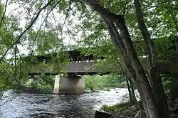 Rowell's Covered Bridge |
November 21, 1976 (#76000129) |
Clement Hill Rd. 43°11′33″N 71°44′54″W |
West Hopkinton | Over Contoocook River |
| 73 | Salisbury Academy Building |  Salisbury Academy Building |
May 30, 1975 (#75000235) |
Junction of NH 127 and U.S. Route 4 43°22′47″N 71°42′52″W |
Salisbury | Now houses the town offices |
| 74 | South Danbury Christian Church |  South Danbury Christian Church |
June 6, 1985 (#85001191) |
U.S. Route 4 43°28′58″N 71°53′12″W |
Danbury | |
| 75 | South Sutton Meeting House |  South Sutton Meeting House |
May 27, 1993 (#93000462) |
17 Meeting House Hill Rd. 43°19′14″N 71°56′07″W |
South Sutton | |
| 76 | Stanley Tavern |  Stanley Tavern |
September 7, 2005 (#05000970) |
371 Main St. 43°11′29″N 71°40′27″W |
Hopkinton | |
| 77 | Sulphite Railroad Bridge | .jpg.webp) Sulphite Railroad Bridge |
June 11, 1975 (#75000130) |
Off US 3 over the Winnipesaukee River 43°26′43″N 71°38′10″W |
Franklin | |
| 78 | Suncook Village Commercial-Civic Historic District |  Suncook Village Commercial-Civic Historic District |
March 15, 2005 (#05000174) |
1 and 9-15 Glass St., 116-161 Main St., 19 Mill Falls, and 4 Union St. in the village of Suncook 43°07′52″N 71°27′12″W |
Pembroke | |
| 79 | Tucker Mountain Schoolhouse |  Tucker Mountain Schoolhouse |
March 18, 2005 (#05000175) |
Tucker Mountain Road 43°29′01″N 71°45′42″W |
Andover | Former schoolhouse open as a local museum on weekends; operated by the Andover Historical Society |
| 80 | Donald D. Tuttle House |  Donald D. Tuttle House |
August 31, 1995 (#95001052) |
12 Gabby Lane 43°10′34″N 71°32′13″W |
Concord | Listed at 257 Pleasant St; moved to Gabby Lane in Concord in 2009 to make way for the Langley Parkway[9] |
| 81 | Upham-Walker House |  Upham-Walker House |
May 15, 1980 (#80000418) |
18 Park St. 43°12′26″N 71°32′20″W |
Concord | |
| 82 | Waterloo Covered Bridge |  Waterloo Covered Bridge |
November 21, 1976 (#76000130) |
Newmarket Rd. 43°17′16″N 71°51′27″W |
Waterloo | Over the Warner River |
| 83 | Waterloo Historic District |  Waterloo Historic District |
September 13, 2003 (#03000926) |
78-183 Waterloo St., 12 and 68 Newmarket Rd., 4 Willoughby-Colby Rd., Bean Road Cemetery 43°17′19″N 71°51′15″W |
Warner | |
| 84 | Webster Congregational Church |  Webster Congregational Church |
March 7, 1985 (#85000480) |
Off NH 127 on Long St. 43°19′48″N 71°43′00″W |
Webster | |
| 85 | Daniel Webster Family Home | 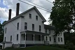 Daniel Webster Family Home |
May 30, 1974 (#74000196) |
S. Main St. 43°24′24″N 71°39′06″W |
West Franklin | Farm owned by family of Daniel Webster; it is sometimes confused with the nearby Daniel Webster Birthplace state historic site. |
| 86 | Dr. Solomon M. Whipple House |  Dr. Solomon M. Whipple House |
September 12, 1985 (#85002187) |
Main St. 43°24′48″N 71°59′05″W |
New London | |
| 87 | White Farm |  White Farm |
May 15, 1981 (#81000075) |
144 Clinton St. 43°11′19″N 71°33′37″W |
Concord | |
| 88 | White Park |  White Park |
November 9, 1982 (#82000623) |
Bounded by Washington, Centre, High, Beacon, and White Sts. 43°12′23″N 71°32′53″W |
Concord |
See also
| Wikimedia Commons has media related to National Register of Historic Places in Merrimack County, New Hampshire. |
References
- Starbuck, David (2006). The Archeology of New Hampshire. Durham, NH: University of New Hampshire Press. ISBN 9781584655626.
- The latitude and longitude information provided in this table was derived originally from the National Register Information System, which has been found to be fairly accurate for about 99% of listings. Some locations in this table may have been corrected to current GPS standards.
- "National Register of Historic Places: Weekly List Actions". National Park Service, United States Department of the Interior. Retrieved on January 29, 2021.
- Numbers represent an alphabetical ordering by significant words. Various colorings, defined here, differentiate National Historic Landmarks and historic districts from other NRHP buildings, structures, sites or objects.
- "National Register Information System". National Register of Historic Places. National Park Service. April 24, 2008.
- The eight-digit number below each date is the number assigned to each location in the National Register Information System database, which can be viewed by clicking the number.
- Starbuck, pp. 56-57
- http://www.nhsec.nh.gov/projects/2015-06/application/Volume-XVI/pages_from_2015-06_2015-10-19_nptllc_psnh_app_18_npt_project_assessment_historic_properties_oct2015_part1_pgs_501-1000.pdf
- Concord Monitor Archived 2016-03-03 at the Wayback Machine
- |CSGroupId%3Aapproved%3A2786F1B794D98D03FCF51EEDD48BBA4E&CSUserId=94&CSGroupId=1 Archived 2015-09-23 at the Wayback Machine
| Topics |  | |
|---|---|---|
| Lists by county | ||
| Other lists | ||
| ||
Municipalities and communities of Merrimack County, New Hampshire, United States | ||
|---|---|---|
| Cities | Map of New Hampshire highlighting Merrimack County | |
| Towns | ||
| CDPs | ||
| Other unincorporated communities | ||
| Footnotes | ‡This populated place also has portions in an adjacent county or counties | |
| ||
This article is issued from Wikipedia. The text is licensed under Creative Commons - Attribution - Sharealike. Additional terms may apply for the media files.