National Register of Historic Places listings in Manhattan from 14th to 59th Streets
This is intended to be a complete list of properties and districts listed on the National Register of Historic Places on Manhattan Island, the primary portion of the New York City borough of Manhattan (also designated as New York County, New York), from 14th to 59th Streets. For properties and districts in other parts of Manhattan, whether on Manhattan Island, other islands within the borough, or the neighborhood of Marble Hill on the North American mainland, see National Register of Historic Places listings in Manhattan. The locations of National Register properties and districts (at least for all showing latitude and longitude coordinates below) may be seen in an online map by clicking on "Map of all coordinates".[1]
- This National Park Service list is complete through NPS recent listings posted January 29, 2021.[2]
| Albany (Albany) – Allegany – Bronx – Broome – Cattaraugus – Cayuga – Chautauqua – Chemung – Chenango – Clinton – Columbia – Cortland – Delaware – Dutchess (Poughkeepsie, Rhinebeck) – Erie (Buffalo) – Essex – Franklin – Fulton – Genesee – Greene – Hamilton – Herkimer – Jefferson – Kings – Lewis – Livingston – Madison – Monroe (Rochester) – Montgomery – Nassau – New York (Below 14th Street, 14th to 59th Streets, 59th to 110th Streets, Above 110th Street, Islands) – Niagara – Oneida – Onondaga – Ontario – Orange – Orleans – Oswego – Otsego – Putnam – Queens – Rensselaer – Richmond – Rockland – St. Lawrence – Saratoga – Schenectady – Schoharie – Schuyler – Seneca – Steuben – Suffolk – Sullivan – Tioga – Tompkins – Ulster – Warren – Washington – Wayne – Westchester (Northern, Southern, New Rochelle, Peekskill, Yonkers) – Wyoming – Yates |
Current listings from 14th to 59th Streets
| [3] | Name on the Register | Image | Date listed[4] | Location | Neighborhood | Description |
|---|---|---|---|---|---|---|
| 1 | 14th Street-Union Square Subway Station (IRT; Dual System BMT) | 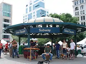 14th Street-Union Square Subway Station (IRT; Dual System BMT) |
July 6, 2005 (#05000671) |
Broadway, 4th Ave., and E. 14th St. 40°44′07″N 73°59′28″W |
Union Square | Subway station (4, 5, 6, <6>, L, N, Q, R, and W trains) |
| 2 | 240 Central Park South | 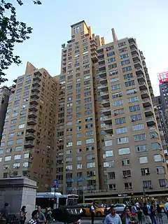 240 Central Park South |
May 12, 2009 (#09000304) |
240 Central Park South 40°46′04″N 73°58′52″W |
Columbus Circle | |
| 3 | 28th Street Subway Station (IRT) |  28th Street Subway Station (IRT) |
March 30, 2005 (#05000230) |
Under Park Avenue S, bet E 29th and 27th Sts. 40°44′36″N 73°59′04″W |
Rose Hill | Subway station (4, 6, and <6> trains) |
| 4 | 33rd Street Subway Station (IRT) | 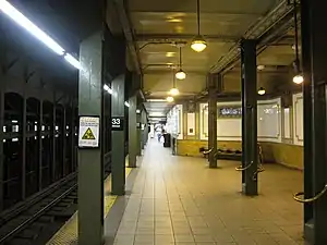 33rd Street Subway Station (IRT) |
September 17, 2004 (#04001014) |
33rd St. and Park Ave. 40°44′53″N 73°58′55″W |
Murray Hill | Subway station (4, 6, and <6> trains) |
| 5 | 59th Street-Columbus Circle Subway Station (IRT) |  59th Street-Columbus Circle Subway Station (IRT) |
September 17, 2004 (#04001015) |
Junction of Broadway and Central Park South 40°46′05″N 73°58′57″W |
Columbus Circle | Subway station (1 and 2 trains) |
| 6 | 69th Regiment Armory |  69th Regiment Armory |
January 28, 1994 (#93001538) |
68 Lexington Ave. 40°44′28″N 73°59′05″W |
Rose Hill | |
| 7 | Actors Temple | 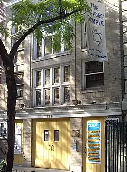 Actors Temple |
May 19, 2005 (#05000445) |
339 W. 47th St. 40°45′40″N 73°59′22″W |
Hell's Kitchen | |
| 8 | Alwyn Court Apartments |  Alwyn Court Apartments |
December 26, 1979 (#79001599) |
180 W. 58th St. 40°45′57″N 73°58′48″W |
Midtown Manhattan | |
| 9 | American Fine Arts Society |  American Fine Arts Society |
May 6, 1980 (#80002662) |
215 W. 57th St. 40°45′57″N 73°58′52″W |
Midtown Manhattan | |
| 10 | American Radiator Building | 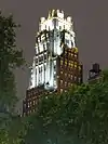 American Radiator Building |
May 7, 1980 (#80002663) |
40–52 W. 40th St. 40°45′10″N 73°59′04″W |
Midtown Manhattan | Black and gold building aka American Standard Building and recently The Bryant Park Hotel |
| 11 | Appellate Division Courthouse of New York State |  Appellate Division Courthouse of New York State |
July 26, 1982 (#82003366) |
27 Madison Ave. 40°44′32″N 73°59′13″W |
Madison Square | |
| 12 | Chester A. Arthur House |  Chester A. Arthur House |
October 15, 1966 (#66000534) |
123 Lexington Ave. 40°44′34″N 73°58′57″W |
Kips Bay | Home of former US president Chester A. Arthur |
| 13 | Association of the Bar of the City of New York |  Association of the Bar of the City of New York |
January 3, 1980 (#80002666) |
42 W. 44th St. 40°45′18″N 73°58′57″W |
Midtown Manhattan | |
| 14 | Bank of the Metropolis |  Bank of the Metropolis |
November 15, 2003 (#03001153) |
31 Union Square West 40°44′12″N 73°59′29″W |
Union Square | |
| 15 | Biltmore Theater | 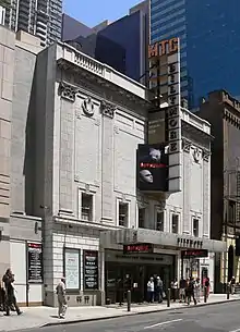 Biltmore Theater |
October 27, 2004 (#04001203) |
261–265 W. 47th St. 40°45′37″N 73°59′14″W |
Theater District | |
| 16 | Building at 304 Park Avenue South |  Building at 304 Park Avenue South |
March 15, 2005 (#05000167) |
304 Park Ave. S 40°44′24″N 73°59′14″W |
Flatiron District | |
| 17 | Building at 315–325 West 36th Street |  Building at 315–325 West 36th Street |
May 27, 2004 (#04000542) |
315–325 W. 36th St. 40°45′15″N 73°59′39″W |
Chelsea | |
| 18 | Candler Building |  Candler Building |
July 8, 1982 (#82003368) |
220 West 42nd St. and 221 West 41st St. 40°45′22″N 73°59′18″W |
Times Square | |
| 19 | Carnegie Hall |  Carnegie Hall |
October 15, 1966 (#66000535) |
7th Ave., 56th to 57th Sts. 40°45′55″N 73°58′48″W |
Theater District | Internationally-known classical music venue |
| 20 | Central IND Substation |  Central IND Substation |
February 9, 2006 (#06000019) |
136 W. 53rd St. (btwn 6th & 7th) 40°45′44″N 73°58′52″W |
Midtown Manhattan | |
| 21 | Central Synagogue |  Central Synagogue |
October 9, 1970 (#70000423) |
646–652 Lexington Ave. 40°45′34″N 73°58′16″W |
Midtown Manhattan | |
| 22 | Century Association Building |  Century Association Building |
July 15, 1982 (#82003369) |
5–7 W. 43rd St. 40°45′16″N 73°58′52″W |
Midtown Manhattan | |
| 23 | Century Building |  Century Building |
September 18, 1997 (#97001148) |
33 E. 17th St. 40°44′13″N 73°59′25″W |
Union Square | |
| 24 | Chanin Building |  Chanin Building |
April 23, 1980 (#80002676) |
122 E. 42nd St. 40°45′04″N 73°58′32″W |
Murray Hill | |
| 25 | Chelsea Historic District |  Chelsea Historic District |
December 6, 1977 (#77000954) |
Roughly bounded by 19th and 22nd Sts., 9th and 10th Aves. 40°44′43″N 74°00′15″W |
Chelsea | |
| 26 | Chrysler Building |  Chrysler Building |
December 8, 1976 (#76001237) |
405 Lexington Ave. 40°45′05″N 73°58′31″W |
Midtown East | |
| 27 | Church of St. Mary the Virgin Complex | 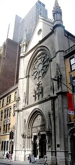 Church of St. Mary the Virgin Complex |
April 16, 1990 (#90000606) |
145 W. 46th St. 40°45′30″N 73°59′02″W |
Times Square | |
| 28 | Church of the Holy Apostles | 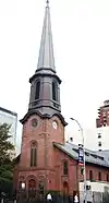 Church of the Holy Apostles |
April 26, 1972 (#72000867) |
300 9th Ave. 40°44′57″N 73°59′57″W |
Chelsea | |
| 29 | Church of the Holy Communion and Buildings |  Church of the Holy Communion and Buildings |
April 17, 1980 (#80002680) |
656–662 6th Ave. 40°44′28″N 73°59′40″W |
Flatiron District | Location of The Limelight nightclub |
| 30 | Church of the Immaculate Conception and Clergy Houses | 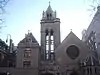 Church of the Immaculate Conception and Clergy Houses |
March 28, 1980 (#80002681) |
406–414 E. 14th St. 40°43′52″N 73°58′56″W |
East Village | |
| 31 | Church of the Incarnation and Parish House | 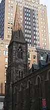 Church of the Incarnation and Parish House |
July 8, 1982 (#82003371) |
205–209 Madison Ave. 40°44′54″N 73°58′57″W |
Murray Hill | |
| 32 | Church of the Transfiguration and Rectory | Church of the Transfiguration and Rectory |
June 4, 1973 (#73001216) |
1 E. 29th St. 40°44′44″N 73°59′14″W |
NoMad | |
| 33 | Church Missions House |  Church Missions House |
June 3, 1982 (#82003370) |
281 Park Ave., S. 40°44′21″N 73°59′14″W |
Gramercy Park | |
| 34 | CIRCLE LINE X (sightseeing vessel) | 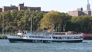 CIRCLE LINE X (sightseeing vessel) |
September 22, 2014 (#14000702) |
Pier 83 & West 42nd St. 40°45′46″N 74°00′06″W |
Hell's Kitchen | Former World War II landing craft later used for sightseeing; being converted into a museum.[5] |
| 35 | Civic Club |  Civic Club |
September 16, 1982 (#82003372) |
243 E. 34th St. 40°44′41″N 73°58′34″W |
Murray Hill | Nowadays it's the New York Estonian House. |
| 36 | Colony Arcade Building | September 10, 2014 (#14000580) |
63–67 W. 38th St. 40°45′08″N 73°59′07″W |
Garment District | Neo-Gothic 1912 building was crucial to city's developing fashion industry in the early 20th century. Now redeveloped into a hotel. | |
| 37 | Columbus Monument |  Columbus Monument |
November 20, 2018 (#100003133) |
Columbus Circle 40°46′05″N 73°58′55″W |
Midtown Manhattan | Italian sculptor Gaetano Rosso's only work in the U.S.; erected in 1892 for quadcentennial of Columbus's voyage. |
| 38 | Daily News Building |  Daily News Building |
November 14, 1982 (#82001191) |
220 E. 42nd St. 40°44′58″N 73°58′25″W |
Turtle Bay | |
| 39 | Decker Building | .jpg.webp) Decker Building |
November 21, 2003 (#03001179) |
33 Union Square W. 40°44′12″N 73°59′29″W |
Union Square | |
| 40 | DeLamar Mansion |  DeLamar Mansion |
August 25, 1983 (#83001722) |
233 Madison Ave. 40°44′59″N 73°58′54″W |
Murray Hill | |
| 41 | Adelaide L. T. Douglas House |  Adelaide L. T. Douglas House |
July 15, 1982 (#82003373) |
57 Park Ave. (btwn East 37 & 38) 40°44′57″N 73°58′48″W |
Murray Hill | now the Guatemalan Mission to the UN |
| 42 | The Emerson |  The Emerson |
August 20, 2009 (#09000634) |
554 W. 53rd St. 40°46′01″N 73°59′30″W |
Hell's Kitchen | |
| 43 | Empire State Building | 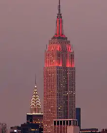 Empire State Building |
November 17, 1982 (#82001192) |
350 Fifth Ave. 40°44′53″N 73°59′10″W |
Koreatown | Seventh tallest building in Manhattan and an international symbol of New York City |
| 44 | Engineering Societies' Building and Engineers' Club | 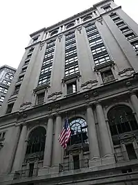 Engineering Societies' Building and Engineers' Club |
August 30, 2007 (#07000867) |
23 and 25-33 W. 39th St. and 28, 32-34, and 36 W. 40th St. 40°45′09″N 73°59′04″W |
Midtown Manhattan | |
| 45 | ENTERPRISE (space shuttle) |  ENTERPRISE (space shuttle) |
March 13, 2013 (#13000071) |
Pier 86, W. 46th St. and 12th Ave. 40°45′56″N 74°00′07″W |
Hell's Kitchen | First space shuttle built; was never taken into orbit but helped immensely in development of later vehicles that were. Now on exhibit at Intrepid museum. |
| 46 | Father Francis D. Duffy Statue and Duffy Square |  Father Francis D. Duffy Statue and Duffy Square |
March 12, 2001 (#01000243) |
Triangle bounded by Broadway, Seventh Ave., W. 47th. and W. 46th St. 40°45′32″N 73°59′07″W |
Times Square | |
| 47 | Film Center Building |  Film Center Building |
September 7, 1984 (#84002768) |
630 9th Ave. 40°45′35″N 73°59′30″W |
Hell's Kitchen | |
| 48 | Flatiron Building |  Flatiron Building |
November 20, 1979 (#79001603) |
5th Ave. and Broadway 40°44′29″N 73°59′27″W |
Flatiron District | |
| 49 | Fred F. French Building | 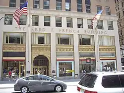 Fred F. French Building |
January 28, 2004 (#03001514) |
551 Fifth Ave. 40°45′20″N 73°58′47″W |
Midtown Manhattan | |
| 50 | FRYING PAN SHOALS LIGHTSHIP NO. 115 (lightship) |  FRYING PAN SHOALS LIGHTSHIP NO. 115 (lightship) |
January 28, 1999 (#98001615) |
Pier 66, W. 26th and West Side Highway. 40°45′00″N 74°00′37″W |
Chelsea | |
| 51 | Garment Center Historic District |  Garment Center Historic District |
November 5, 2008 (#08001034) |
Roughly bounded by Sixth Ave. on the E., Ninth Ave. on the W., W. 35th St. on the S., and W. 41st St. on the N. 40°45′14″N 73°59′25″W |
Garment District | |
| 52 | General Electric Building | 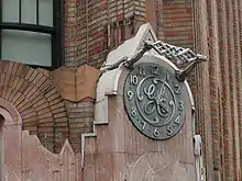 General Electric Building |
January 28, 2004 (#03001515) |
570 Lexington Ave. 40°45′26″N 73°58′38″W |
Rockefeller Center | |
| 53 | General Society of Mechanics and Tradesmen | 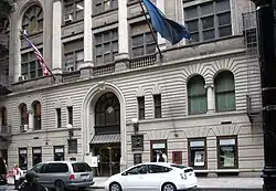 General Society of Mechanics and Tradesmen |
November 12, 2008 (#08001048) |
20 W. 44th St 40°45′19″N 73°58′53″W |
Midtown Manhattan | |
| 54 | George Washington Hotel | 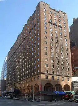 George Washington Hotel |
May 20, 2019 (#100003931) |
23 Lexington Ave. 40°44′23″N 73°59′03″W |
Rose Hill | 1930 Renaissance Revival apartment hotel, recently restored to that use, is the last major one from that era. |
| 55 | Germania Life Insurance Company Building | 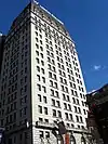 Germania Life Insurance Company Building |
May 25, 2001 (#01000556) |
50 Union Sq. E 40°44′12″N 73°59′21″W |
Union Square | |
| 56 | Gilsey Hotel | 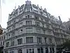 Gilsey Hotel |
December 14, 1978 (#78001872) |
1200 Broadway 40°44′45″N 73°59′19″W |
NoMad | |
| 57 | Gramercy Park Historic District | 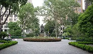 Gramercy Park Historic District |
January 23, 1980 (#80002691) |
Roughly bounded by 3rd and Park Aves., S., E. 18th and 22nd Sts. 40°44′16″N 73°59′10″W |
Gramercy Park | |
| 58 | Grand Central Terminal |  Grand Central Terminal |
January 17, 1975 (#75001206) |
71–105 E. 42nd St. 40°45′10″N 73°58′35″W |
Midtown Manhattan | 1913 Beaux Arts landmark still used by Metro-North Railroad. Construction helped trigger development of Park Avenue. |
| 59 | Grand Central Terminal Park Avenue Viaduct | 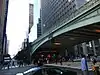 Grand Central Terminal Park Avenue Viaduct |
August 11, 1983 (#83001726) |
71–105 E. 42nd St., Park Ave. between E. 40th and E. 42nd Sts. 40°44′59″N 73°58′40″W |
Pershing Square | Elevated roadway bringing Park Avenue around Grand Central Terminal |
| 60 | Grand Hotel |  Grand Hotel |
September 15, 1983 (#83001725) |
1232–1238 Broadway 40°44′50″N 73°59′19″W |
NoMad | |
| 61 | Greenacre Park | 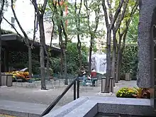 Greenacre Park |
February 2, 2018 (#100002076) |
217 E 51st St. 40°45′23″N 73°58′09″W |
Midtown East | Small park with modernist design in mid-block, built 1971 on land donated by Abby Rockefeller Mauzé, is an early pocket park |
| 62 | Greenwich Savings Bank | 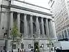 Greenwich Savings Bank |
November 16, 2005 (#05001286) |
1352–1362 Broadway 40°45′05″N 73°59′15″W |
Near Herald Square | |
| 63 | Harvard Club of New York City | 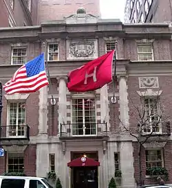 Harvard Club of New York City |
March 28, 1980 (#80002693) |
27 W. 44th St. 40°45′18″N 73°58′53″W |
Midtown Manhattan | |
| 64 | Hotel Chelsea |  Hotel Chelsea |
December 27, 1977 (#77000958) |
222 W. 23rd St. 40°44′35″N 73°59′39″W |
Chelsea | |
| 65 | Hotel Gerard | 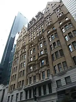 Hotel Gerard |
February 10, 1983 (#83001729) |
123 W. 44th St. 40°45′48″N 73°59′34″W |
Midtown Manhattan | |
| 66 | House at 146 East 38th Street |  House at 146 East 38th Street |
May 21, 2008 (#08000450) |
145 E. 38th St. 40°44′55″N 73°58′37″W |
Murray Hill | |
| 67 | House at 17 West 16th Street | 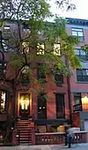 House at 17 West 16th Street |
May 26, 1983 (#83001730) |
17 W. 16th St. 40°44′16″N 73°59′38″W |
Chelsea | |
| 68 | House at 20 West 16th St |  House at 20 West 16th St |
May 30, 2007 (#07000484) |
20 W. 16th St. 40°44′15″N 73°59′40″W |
Chelsea | |
| 69 | House at 203 East 29 Street |  House at 203 East 29 Street |
July 8, 1982 (#82003377) |
203 E. 29th St. 40°44′33″N 73°58′49″W |
Rose Hill | |
| 70 | Houses at 311 and 313 East 58th Street |  Houses at 311 and 313 East 58th Street |
November 14, 1982 (#82001197) |
311–313 E. 58th St. 40°45′35″N 73°57′53″W |
Midtown East | |
| 71 | Houses at 326, 328 and 330 East 18th Street |  Houses at 326, 328 and 330 East 18th Street |
September 30, 1982 (#82003380) |
326–330 E. 18th St. 40°44′03″N 73°58′57″W |
Kips Bay | |
| 72 | Houses at 437–459 West 24th Street | 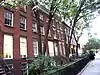 Houses at 437–459 West 24th Street |
October 29, 1982 (#82001196) |
437–459 W. 24th St. 40°44′53″N 74°00′11″W |
Chelsea | |
| 73 | Houses at 647, 651–53 Fifth Avenue and 4 East 52nd Street |  Houses at 647, 651–53 Fifth Avenue and 4 East 52nd Street |
September 8, 1983 (#83001733) |
647, 651–53 5th Ave. and 4 E. 52nd St. 40°45′34″N 73°58′36″W |
Midtown Manhattan | |
| 74 | JOHN J. HARVEY (fireboat) |  JOHN J. HARVEY (fireboat) |
June 15, 2000 (#00000576) |
Pier 63, North R. 40°45′00″N 74°00′39″W |
Chelsea | |
| 75 | Hudson Theatre |  Hudson Theatre |
November 15, 2016 (#16000780) |
139–141 W. 44th St. 40°45′25″N 73°59′05″W |
Theater District | Israels & Harder theater built in 1903 was home to many important Broadway shows |
| 76 | Knickerbocker Hotel | 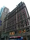 Knickerbocker Hotel |
April 11, 1980 (#80002697) |
142 W. 42nd St. 40°45′19″N 73°59′12″W |
Times Square | |
| 77 | Knox Building | 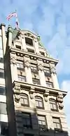 Knox Building |
June 3, 1982 (#82003381) |
452 5th Ave. 40°45′08″N 73°58′57″W |
Midtown | |
| 78 | Lamb's Club | 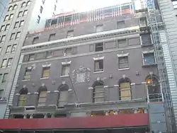 Lamb's Club |
June 3, 1982 (#82003382) |
128 W. 44th St. 40°45′23″N 73°59′07″W |
Near Rockefeller Center | Former home of the Lamb's Club, is being gut renovated into a hotel in 2009. |
| 79 | James F. D. Lanier Residence |  James F. D. Lanier Residence |
June 3, 1982 (#82003383) |
123 E. 35th 40°44′51″N 73°58′49″W |
Murray Hill | |
| 80 | Lescaze House | 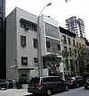 Lescaze House |
May 19, 1980 (#80002698) |
211 E. 48th St. 40°45′15″N 73°58′17″W |
Midtown East | |
| 81 | Lever House |  Lever House |
October 2, 1983 (#83004078) |
390 Park Ave. 40°45′34″N 73°58′23″W |
Midtown Manhattan | |
| 82 | Lincoln Building |  Lincoln Building |
September 8, 1983 (#83001735) |
1 Union Sq. W. 40°44′08″N 73°59′32″W |
Union Square | |
| 83 | Look Building | 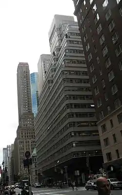 Look Building |
February 24, 2005 (#05000087) |
488 Madison Ave. 40°45′31″N 73°58′33″W |
Midtown East | |
| 84 | R. H. Macy and Company Store | 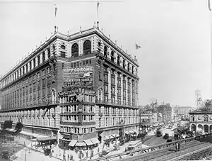 R. H. Macy and Company Store |
June 2, 1978 (#78001873) |
151 W. 34th St. 40°45′41″N 73°58′22″W |
Herald Square | Home of first major American department store. |
| 85 | Marble Collegiate Reformed Church | 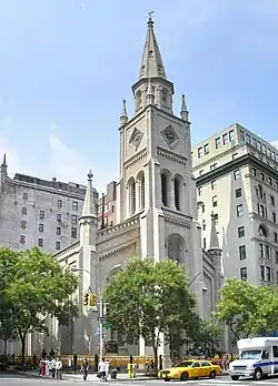 Marble Collegiate Reformed Church |
April 9, 1980 (#80002699) |
275 5th Ave. 40°44′44″N 73°59′15″W |
NoMad | |
| 86 | McGraw-Hill Building |  McGraw-Hill Building |
March 28, 1980 (#80002701) |
326 W. 42nd St. 40°45′25″N 73°59′31″W |
Hell's Kitchen | |
| 87 | Mecca Temple | 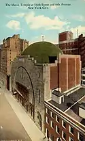 Mecca Temple |
September 7, 1984 (#84002788) |
131 N. 55th St. 40°45′50″N 73°58′48″W |
Midtown Manhattan | Known as New York City Center Theater. Moorish-revival interior and exterior details. Harry P. Knowles, architect. |
| 88 | Merchants Refrigerating Company Warehouse |  Merchants Refrigerating Company Warehouse |
May 31, 1985 (#85001171) |
501 W. 16th St. 40°44′38″N 74°00′28″W |
Chelsea | |
| 89 | Metropolitan Life Home Office Complex | 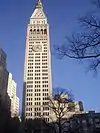 Metropolitan Life Home Office Complex |
January 19, 1996 (#95001544) |
Roughly bounded by Madison Ave., E. 23rd St., Park Ave. S. and E. 25th St. 40°44′28″N 73°59′14″W |
Flatiron District | |
| 90 | Metropolitan Life Insurance Company |  Metropolitan Life Insurance Company |
June 2, 1978 (#78001874) |
1 Madison Ave. 40°44′29″N 73°59′16″W |
Flatiron District | |
| 91 | William H. Moore House | 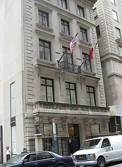 William H. Moore House |
March 16, 1972 (#72000878) |
4 E. 54th St. 40°45′38″N 73°58′31″W |
Midtown Manhattan | |
| 92 | Pierpont Morgan Library |  Pierpont Morgan Library |
November 13, 1966 (#66000544) |
33 E. 36th St. 40°44′56″N 73°58′54″W |
Murray Hill | Now known as "The Morgan Library & Museum" |
| 93 | Murray Hill Historic District |  Murray Hill Historic District |
October 5, 2003 (#03000997) |
E. 34th, 35th, 36th, 37th, 38th & 39th Sts., Lexington, Madison & Park Aves. 40°44′54″N 73°58′47″W |
Murray Hill | One of last intact 19th-century residential districts in Manhattan; many buildings by prominent architects. Boundary increase on February 27, 2013. |
| 94 | New Amsterdam Theater |  New Amsterdam Theater |
January 10, 1980 (#80002664) |
214 W. 42nd St. 40°45′21″N 73°59′18″W |
Theater District | |
| 95 | New York Bible Society | .jpg.webp) New York Bible Society |
February 5, 2014 (#13001152) |
5 E. 48th St. 40°45′26″N 73°58′39″W |
Midtown Manhattan | Since 1978 in use by the Swedish Seamen's Church[6] |
| 96 | New York Life Building |  New York Life Building |
June 2, 1978 (#78001876) |
51 Madison Ave. 40°44′34″N 73°59′09″W |
Flatiron District | |
| 97 | New York Public Library |  New York Public Library |
October 15, 1966 (#66000546) |
5th Ave. and 42nd St. 40°45′12″N 73°58′56″W |
Midtown Manhattan | Main branch of New York Public Library system; one of the world's largest public libraries. |
| 98 | New York Public Library and Bryant Park |  New York Public Library and Bryant Park |
October 15, 1966 (#66000547) |
Avenue of the Americas, 5th Ave., 40th and 42nd Sts. 40°45′12″N 73°58′56″W |
Midtown Manhattan | |
| 99 | New York Savings Bank |  New York Savings Bank |
January 7, 2000 (#99001657) |
81 Eighth Ave. 40°44′24″N 74°00′11″W |
Chelsea | |
| 100 | New York School of Applied Design |  New York School of Applied Design |
December 16, 1982 (#82001202) |
160 Lexington Ave. 40°44′38″N 73°58′56″W |
Murray Hill | |
| 101 | New York Yacht Club | 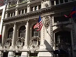 New York Yacht Club |
October 29, 1982 (#82001203) |
37 W. 44th St. 40°45′19″N 73°58′54″W |
Midtown | |
| 102 | Andrew Norwood House | 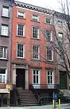 Andrew Norwood House |
July 9, 1979 (#79001606) |
241 W. 14th St. 40°44′23″N 74°00′07″W |
Chelsea | |
| 103 | Old Colony Club | 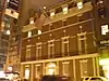 Old Colony Club |
April 23, 1980 (#80002706) |
120 Madison Ave. 40°44′43″N 73°59′06″W |
Rose Hill | |
| 104 | Old Grolier Club | 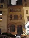 Old Grolier Club |
April 23, 1980 (#80002707) |
29 E. 32nd St. 40°44′47″N 73°59′02″W |
Rose Hill | |
| 105 | Osborne Apartments | 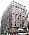 Osborne Apartments |
April 22, 1993 (#93000333) |
205 W. 57th St. 40°45′56″N 73°58′51″W |
Midtown Manhattan | |
| 106 | Pier 57 |  Pier 57 |
August 11, 2004 (#04000821) |
Eleventh Ave. at end of W. 15th St. 40°44′37″N 74°00′40″W |
Chelsea | |
| 107 | The Players |  The Players |
October 15, 1966 (#66000549) |
16 Gramercy Park 40°44′15″N 73°59′13″W |
Gramercy Park | |
| 108 | Plaza Hotel |  Plaza Hotel |
November 29, 1978 (#78001878) |
Fifth Ave. and Fifty-ninth St. 40°45′51″N 73°58′27″W |
Grand Army Plaza | Famous Upper East Side hotel being remodeled into condos. Setting for Eloise books. |
| 109 | Prince George Hotel |  Prince George Hotel |
February 12, 1999 (#99000195) |
10–20 E. 28th and 17–19 E. 27 Sts. 40°44′41″N 73°59′12″W |
NoMad | |
| 110 | Public Baths | 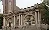 Public Baths |
April 23, 1980 (#80002709) |
Asser Levy Pl. and E. 23rd St. 40°44′09″N 73°58′35″W |
Kips Bay | |
| 111 | Public School 35 | 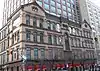 Public School 35 |
October 27, 1980 (#80002710) |
931 1st Ave. 40°45′17″N 73°57′57″W |
Turtle Bay | |
| 112 | Queensboro Bridge | 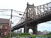 Queensboro Bridge |
December 20, 1978 (#78001879) |
59th St. 40°45′26″N 73°57′22″W |
Lenox Hill and Roosevelt Island | Also listed in the Borough of Queens |
| 113 | R & S Building | 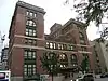 R & S Building |
September 22, 1986 (#86002683) |
492 First Ave. 40°44′26″N 73°58′31″W |
Kips Bay | |
| 114 | Racquet and Tennis Club Building | 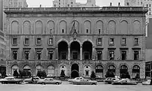 Racquet and Tennis Club Building |
July 13, 1983 (#83001741) |
370 Park Ave. 40°45′31″N 73°58′25″W |
Midtown Manhattan | Ornate private club; now a foil |
| 115 | Radio City Music Hall | 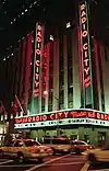 Radio City Music Hall |
May 8, 1978 (#78001880) |
1260 Avenue of the Americas (50th and 6th) 40°45′36″N 73°59′03″W |
Rockefeller Center | Major live-entertainment venue since the 1920s; home to the Rockettes |
| 116 | Residences at 5-15 West 54th Street | 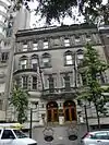 Residences at 5-15 West 54th Street |
January 4, 1990 (#89002260) |
5–15 W. 54th St. 40°45′42″N 73°58′35″W |
Midtown Manhattan | |
| 117 | Rockefeller Center | 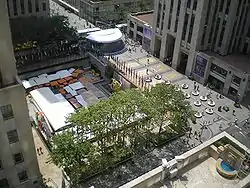 Rockefeller Center |
December 23, 1987 (#87002591) |
Bounded by Fifth Ave., W. Forty-eighth St., Seventh Ave., & W. Fifty-first St. 40°45′32″N 73°58′46″W |
Midtown Manhattan | Trend-setting urban office complex. Home to many NBC broadcasts. Setting and location for 2000s sitcom 30 Rock. |
| 118 | Bayard Rustin Residence | March 8, 2016 (#16000062) |
340 W. 28th St. (Building 7B Apartment 9J of Penn South) 40°44′56″N 73°59′52″W |
Chelsea | Bayard Rustin, a civil rights activist who later came out and fought for gay rights, lived in this apartment building for most of his later life | |
| 119 | St. Bartholomew's Church and Community House | 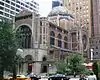 St. Bartholomew's Church and Community House |
April 16, 1980 (#80002719) |
109 E. 50th St. 40°45′26″N 73°58′25″W |
Midtown East | |
| 120 | St. George's Episcopal Church |  St. George's Episcopal Church |
December 8, 1976 (#76001249) |
E. 16th St. and Rutherford Place 40°44′04″N 73°59′06″W |
Stuyvesant Square | |
| 121 | St. Luke's Evangelical Lutheran Church | 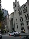 St. Luke's Evangelical Lutheran Church |
June 1, 2007 (#07000483) |
208 W. 46th St. 40°45′35″N 73°59′21″W |
Midtown | |
| 122 | St. Patrick's Cathedral Complex |  St. Patrick's Cathedral Complex |
December 8, 1976 (#76001250) |
Bounded by 5th and Madison Aves., E. 50th and E. 51st Sts. 40°45′31″N 73°58′35″W |
Midtown | |
| 123 | St. Thomas Church and Parish House | 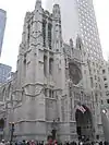 St. Thomas Church and Parish House |
April 9, 1980 (#80002722) |
1–3 W. 53rd St. 40°45′39″N 73°58′36″W |
Midtown | |
| 124 | Salmagundi Club | 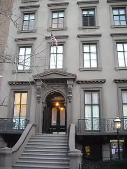 Salmagundi Club |
July 25, 1974 (#74001275) |
47 5th Ave. 40°44′03″N 73°59′00″W |
Kips Bay | |
| 125 | Margaret Sanger Clinic | 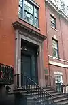 Margaret Sanger Clinic |
September 14, 1993 (#93001599) |
17 W. 16th St. 40°44′17″N 73°59′39″W |
Chelsea | Workplace of birth control pioneer Margaret Sanger. |
| 126 | Scribner Building |  Scribner Building |
May 6, 1980 (#80002715) |
153–157 5th Ave. 40°44′25″N 73°59′27″W |
Flatiron District | Known also as the Old Scribner Building. Note, Charles Scribner Building is different. |
| 127 | Seagram Building |  Seagram Building |
February 24, 2006 (#06000056) |
375 Park Ave. 40°45′30″N 73°58′22″W |
Midtown Manhattan | Milestone modernist building by Ludwig Mies van der Rohe |
| 128 | Seville Hotel | 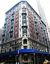 Seville Hotel |
February 24, 2005 (#05000088) |
22 East 29th St. 40°44′40″N 73°59′10″W |
NoMad | |
| 129 | Sidewalk Clock at 200 5th Avenue, Manhattan | 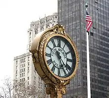 Sidewalk Clock at 200 5th Avenue, Manhattan |
April 18, 1985 (#85000927) |
200 5th Ave. 40°44′30″N 73°59′24″W |
Flatiron District | |
| 130 | Sidewalk Clock at 519 3rd Avenue, Manhattan |  Sidewalk Clock at 519 3rd Avenue, Manhattan |
April 18, 1985 (#85000928) |
519 3rd Ave. 40°44′46″N 73°58′41″W |
Kips Bay | No longer in location. |
| 131 | Sidewalk Clock at 522 5th Avenue, Manhattan | 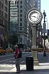 Sidewalk Clock at 522 5th Avenue, Manhattan |
April 18, 1985 (#85000929) |
522 5th Ave. 40°45′16″N 73°58′50″W |
Midtown Manhattan | |
| 132 | Sniffen Court Historic District |  Sniffen Court Historic District |
November 28, 1973 (#73001224) |
E. 36th St., between Lexington and 3rd Aves. 40°44′51″N 73°58′40″W |
Murray Hill | |
| 133 | Society for the Lying-In Hospital |  Society for the Lying-In Hospital |
September 1, 1983 (#83001746) |
305 2nd Ave. 40°44′05″N 73°59′03″W |
Gramercy Park | |
| 134 | Stuyvesant Square Historic District | .jpg.webp) Stuyvesant Square Historic District |
November 21, 1980 (#80002723) |
Roughly bounded by Nathan D. Perleman Pl., 3rd Ave., E. 18th and E. 15th Sts. 40°44′02″N 73°59′06″W |
Gramercy Park | |
| 135 | Substation 13 | 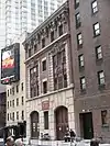 Substation 13 |
February 9, 2006 (#06000026) |
225 W 53rd St. 40°45′50″N 73°59′03″W |
Midtown Manhattan | |
| 136 | Substation 42 |  Substation 42 |
February 9, 2006 (#06000024) |
154 E. 57th St. 40°45′37″N 73°58′07″W |
Midtown Manhattan | |
| 137 | Ed Sullivan Theater | 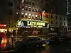 Ed Sullivan Theater |
November 17, 1997 (#97001303) |
1697–1699 Broadway 40°45′49″N 73°59′00″W |
Theater District | |
| 138 | Sutton Place Historic District |  Sutton Place Historic District |
September 12, 1985 (#85002294) |
1–21 Sutton Pl. & 4–16 Sutton Sq. 40°45′28″N 73°57′57″W |
Sutton Place | |
| 139 | Theodore Roosevelt Birthplace National Historic Site | 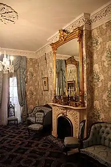 Theodore Roosevelt Birthplace National Historic Site |
October 15, 1966 (#66000054) |
28 E. 20th St. 40°44′18″N 73°59′21″W |
Flatiron District | Birthplace of Theodore Roosevelt |
| 140 | Tiffany and Company Building |  Tiffany and Company Building |
June 2, 1978 (#78001886) |
401 5th Ave., at 36th 40°45′00″N 73°58′53″W |
Midtown Manhattan | Former Tiffany's building |
| 141 | Samuel J. Tilden House | 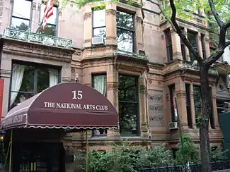 Samuel J. Tilden House |
May 11, 1976 (#76001251) |
14–15 Gramercy Park South 40°44′15″N 73°59′14″W |
Gramercy Park | Also known as "National Arts Club". Home of Tilden, winner of popular vote in disputed 1876 presidential election |
| 142 | Times Square Hotel | 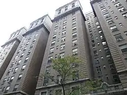 Times Square Hotel |
May 4, 1995 (#95000530) |
255 W. 43rd St. 40°45′28″N 73°59′22″W |
Times Square | |
| 143 | Times Square-42nd Street Subway Station | 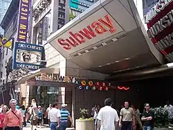 Times Square-42nd Street Subway Station |
September 17, 2004 (#04001016) |
Junction of W. 42nd St. and Broadway/7th Ave. 40°45′19″N 73°59′15″W |
Times Square | Subway station (1, 2, 3, 7, <7>, N, Q, R, W, and S trains) |
| 144 | Town Hall |  Town Hall |
April 23, 1980 (#80002724) |
113–123 W. 43rd St. 40°45′21″N 73°59′05″W |
Midtown Manhattan | Public-affairs media developed here with "America's Town Hall of the Air" radio program in 1930s. Has been host to many major artists as concert venue. |
| 145 | Trinity Chapel Complex | 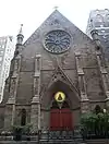 Trinity Chapel Complex |
December 16, 1982 (#82001205) |
15 W. 25th St. 40°44′37″N 73°59′25″W |
NoMad | |
| 146 | Tudor City Historic District | 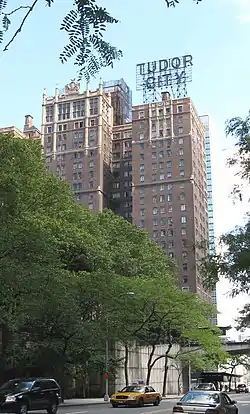 Tudor City Historic District |
September 11, 1986 (#86002516) |
Roughly bounded by Forty-third St., First Ave., Forty-first St., and Second Ave. 40°44′56″N 73°58′17″W |
Turtle Bay | |
| 147 | Turtle Bay Gardens Historic District |  Turtle Bay Gardens Historic District |
July 21, 1983 (#83001750) |
226–246 E. 49th St. and 227–245 E. 48th St. 40°45′15″N 73°58′13″W |
Turtle Bay | |
| 148 | U.S. General Post Office | 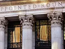 U.S. General Post Office |
January 29, 1973 (#73002257) |
8th Ave. between 31st and 33rd Sts. 40°45′37″N 73°59′03″W |
Midtown Manhattan | |
| 149 | Union Square |  Union Square |
December 9, 1997 (#97001678) |
Bounded by E 14th & E 17th Sts. and Union Square East & Union Square West 40°44′10″N 73°59′25″W |
Union Square | Site of many political demonstrations over the years |
| 150 | United Charities Building Complex |  United Charities Building Complex |
March 28, 1985 (#85000661) |
105 E. 22nd St,. 289 Park Ave. S. and 111-113 E. 22nd St. 40°44′22″N 73°59′14″W |
Gramercy Park | |
| 151 | University Club | 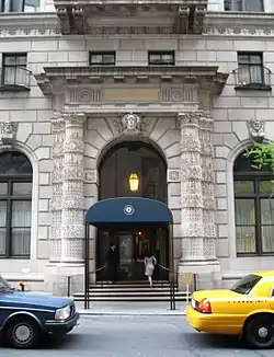 University Club |
April 16, 1980 (#80002726) |
1 W. 54th St. 40°45′40″N 73°58′34″W |
Midtown Manhattan | |
| 152 | US Post Office-Madison Square Station |  US Post Office-Madison Square Station |
May 11, 1989 (#88002364) |
149–153 E. 23rd St. 40°44′23″N 73°59′04″W |
Gramercy Park | |
| 153 | US Post Office-Old Chelsea Station | 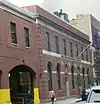 US Post Office-Old Chelsea Station |
May 11, 1989 (#88002365) |
217 W. 18th St. 40°46′07″N 73°59′56″W |
Chelsea | |
| 154 | USS INTREPID (aircraft carrier) |  USS INTREPID (aircraft carrier) |
January 14, 1986 (#86000082) |
Intrepid Sq., 45th and West Side Highway 40°45′51″N 73°59′59″W |
Hell's Kitchen | |
| 155 | Villard Houses | 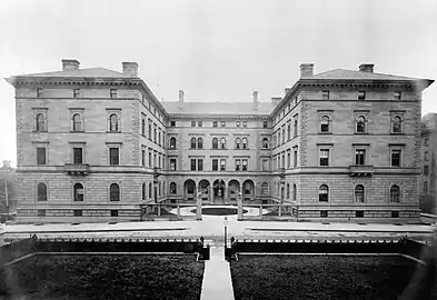 Villard Houses |
September 2, 1975 (#75001210) |
29½ 50th St., 24-26 E. 51st St., and 451, 453, 455, and 457 Madison Ave. 40°45′29″N 73°58′31″W |
Midtown Manhattan | |
| 156 | Webster Hotel | 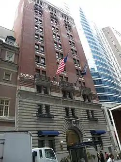 Webster Hotel |
September 7, 1984 (#84002806) |
40 W. 45th St. 40°45′22″N 73°58′56″W |
Midtown Manhattan | |
| 157 | West 28th Street Subway Station (Dual System IRT) | 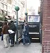 West 28th Street Subway Station (Dual System IRT) |
March 30, 2005 (#05000235) |
Seventh Ave. bet. West 26th and West 29th Sts. 40°44′48″N 73°59′39″W |
Chelsea | Subway station (1 and 2 trains) |
| 158 | The Wilbraham | 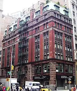 The Wilbraham |
May 4, 2018 (#100002386) |
284 5th Ave. 40°44′46″N 73°59′12″W |
NoMad | 1888 Romanesque Revival building original built as bachelor flats, complete with communal dining room |
| 159 | R. C. Williams Warehouse |  R. C. Williams Warehouse |
February 24, 2005 (#05000086) |
259–273 Tenth Ave. 40°44′57″N 74°00′14″W |
Chelsea | |
| 160 | Women's National Republican Club |  Women's National Republican Club |
February 27, 2013 (#13000040) |
3 W. 51st St. 40°45′34″N 73°58′39″W |
Midtown Manhattan | Georgian home of early women's political organization |
See also
| Wikimedia Commons has media related to National Register of Historic Places in Manhattan between 14th and 59th Streets. |
- County: National Register of Historic Places listings in New York County, New York
- State: National Register of Historic Places listings in New York
- Municipal: List of New York City Designated Landmarks in Manhattan from 14th to 59th Streets
References
- Notes
- The latitude and longitude information provided in this table was derived originally from the National Register Information System, which has been found to be fairly accurate for about 99% of listings. Some locations in this table may have been corrected to current GPS standards.
- "National Register of Historic Places: Weekly List Actions". National Park Service, United States Department of the Interior. Retrieved on January 29, 2021.
- Numbers represent an alphabetical ordering by significant words. Various colorings, defined here, differentiate National Historic Landmarks and historic districts from other NRHP buildings, structures, sites or objects.
- The eight-digit number below each date is the number assigned to each location in the National Register Information System database, which can be viewed by clicking the number.
- Circle Line X National Park Service
- "Swedish Seaman's Church - New York City". nycago.org. Retrieved 2017-07-26.
| Topics |  | |
|---|---|---|
| Lists by county |
| |
| Lists by city | ||
| Other lists | ||
| ||
This article is issued from Wikipedia. The text is licensed under Creative Commons - Attribution - Sharealike. Additional terms may apply for the media files.