National Register of Historic Places listings in Kent County, Michigan
The following is a list of Registered Historic Places in Kent County, Michigan.
- This National Park Service list is complete through NPS recent listings posted January 29, 2021.[1]
Current listings
| [2] | Name on the Register[3] | Image | Date listed[4] | Location | City or town | Description |
|---|---|---|---|---|---|---|
| 1 | Ada Covered Bridge† | 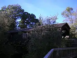 Ada Covered Bridge† |
February 16, 1970 (#70000275) |
Across the Thornapple River 42°57′08″N 85°29′10″W |
Ada | |
| 2 | Aldrich Building | 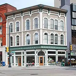 Aldrich Building |
November 12, 1982 (#82000536) |
98 Monroe Center, NW. 42°57′55″N 85°40′12″W |
Grand Rapids | |
| 3 | Aldrich Godfrey and White Block | 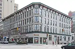 Aldrich Godfrey and White Block |
January 27, 1999 (#99000052) |
89-99 Monroe Center 42°57′53″N 85°40′13″W |
Grand Rapids | |
| 4 | Mathias J. Alten House and Studio | 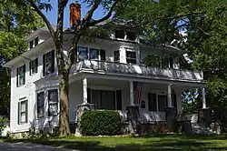 Mathias J. Alten House and Studio |
June 23, 2009 (#08001102) |
1593 East Fulton Street 42°57′47″N 85°37′50″W |
Grand Rapids | |
| 5 | American Box Board Company Headquarters and Factory |  American Box Board Company Headquarters and Factory |
November 24, 2020 (#100005823) |
470 Market Ave. SW 42°57′17″N 85°40′56″W |
Grand Rapids | |
| 6 | American Seating Company Factory Complex | 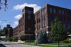 American Seating Company Factory Complex |
July 25, 2003 (#03000687) |
801 Broadway Ave., NW. 42°58′40″N 85°40′46″W |
Grand Rapids | |
| 7 | Berkey and Gay Furniture Company Factory |  Berkey and Gay Furniture Company Factory |
December 20, 2000 (#00001486) |
940 Monroe Ave., NW. 42°58′44″N 85°40′18″W |
Grand Rapids | |
| 8 | John W. Blodgett Estate† |  John W. Blodgett Estate† |
July 28, 1983 (#83000877) |
250 Plymouth Rd., SE. 42°57′26″N 85°37′25″W |
East Grand Rapids | |
| 9 | Business Route M-21 – Plaster Creek Bridge |  Business Route M-21 – Plaster Creek Bridge |
December 17, 1999 (#99001522) |
Business Loop Interstate 196/Chicago Drive over Plaster Creek 42°56′09″N 85°41′14″W |
Wyoming | |
| 10 | Central Furniture Company – H. E. Shaw Furniture Company Factory |  Central Furniture Company – H. E. Shaw Furniture Company Factory |
December 24, 2013 (#13000969) |
400 Ionia Avenue, SW 42°57′20″N 85°40′11″W |
Grand Rapids | |
| 11 | Division Avenue – Plaster Creek Bridge |  Division Avenue – Plaster Creek Bridge |
December 17, 1999 (#99001523) |
Division Ave. over Plaster Creek 42°55′05″N 85°39′58″W |
Grand Rapids | Bridge was replaced in 2007 |
| 12 | Downtown Lowell Historic District | .jpg.webp) Downtown Lowell Historic District |
December 9, 1999 (#99001539) |
Roughly along Main St. between Hudson and Washington 42°56′04″N 85°20′16″W |
Lowell | |
| 13 | Eastern Avenue School | Eastern Avenue School |
September 4, 2013 (#13000666) |
758 Eastern Avenue, NE 42°58′36″N 85°38′56″W |
Grand Rapids | |
| 14 | Fallasburg Covered Bridge | 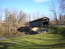 Fallasburg Covered Bridge |
March 16, 1972 (#72000627) |
Covered Bridge Rd. 42°58′51″N 85°19′38″W |
Lowell | |
| 15 | Fallasburg Historic District† | 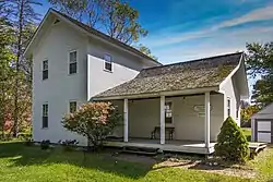 Fallasburg Historic District† |
March 31, 1999 (#98001217) |
Covered Bridge Rd. 42°58′56″N 85°19′24″W |
Vergennes Township | |
| 16 | Fine Arts Building |  Fine Arts Building |
November 12, 1982 (#82000537) |
220 Lyon St., NW. 42°58′01″N 85°40′26″W |
Grand Rapids | |
| 17 | First (Park) Congregational Church† | CongregationalChurchGrandRapidsMI.jpg.webp) First (Park) Congregational Church† |
November 12, 1982 (#82000538) |
10 E. Park Pl., NE. 42°57′51″N 85°39′56″W |
Grand Rapids | |
| 18 | President Gerald R. Ford, Jr. Boyhood Home† | 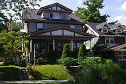 President Gerald R. Ford, Jr. Boyhood Home† |
February 27, 1995 (#95000073) |
649 Union Ave., SE. 42°57′02″N 85°39′15″W |
Grand Rapids | |
| 19 | Goodspeed Brothers Building |  Goodspeed Brothers Building |
April 17, 1980 (#80001877) |
188 Monroe St., NW. 42°58′00″N 85°40′19″W |
Grand Rapids | |
| 20 | Graham House | 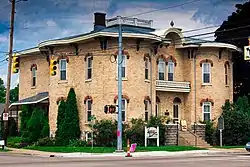 Graham House |
January 13, 1972 (#72000626) |
323-325 Main St. 42°56′02″N 85°20′30″W |
Lowell | |
| 21 | Grand Rapids Christian High School | Grand Rapids Christian High School |
July 25, 2018 (#100002712) |
415 Franklin St., SE. 42°56′55″N 85°39′31″W |
Grand Rapids | The school's old campus. |
| 22 | Grand Rapids Cycle Company Factory |  Grand Rapids Cycle Company Factory |
June 16, 2004 (#04000600) |
514 Butterworth St. SW. 42°57′35″N 85°40′53″W |
Grand Rapids | In 2007 the building was destroyed by fire. |
| 23 | Grand Rapids Savings Bank Building |  Grand Rapids Savings Bank Building |
December 28, 1990 (#90001956) |
60 Monroe Center, NW. 42°57′52″N 85°40′07″W |
Grand Rapids | |
| 24 | Grand Rapids Storage and Van Company Building |  Grand Rapids Storage and Van Company Building |
December 12, 2012 (#12001032) |
1415 Lake Dr. SE 42°57′27″N 85°38′04″W |
Grand Rapids | Built in 1926, renovated into a mixed-use apartment structure and called the Kingsley Building. |
| 25 | Heartside Historic District | 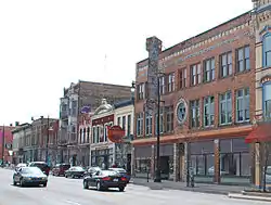 Heartside Historic District |
March 2, 1982 (#82002844) |
Division, Commerce, and Ionia Aves., Fulton, Weston, Oakes, and Cherry Sts. 42°57′42″N 85°40′09″W |
Grand Rapids | |
| 26 | Heritage Hill Historic District | 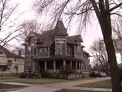 Heritage Hill Historic District |
March 11, 1971 (#71000399) |
Bounded by Michigan Ave. on the north, Pleasant St. on the south, Union Ave. on the east, and Clarendon Pl. and Jefferson Ave. on the west 42°57′35″N 85°39′25″W |
Grand Rapids | |
| 27 | Keeler Building |  Keeler Building |
November 27, 2017 (#80004806) |
56 N Division Ave. 42°57′54″N 85°40′04″W |
Grand Rapids | |
| 28 | Kent County Civil War Monument |  Kent County Civil War Monument |
July 14, 2004 (#04000690) |
Division Ave. at Monroe Ave. 42°57′49″N 85°40′04″W |
Grand Rapids | |
| 29 | Ladies' Literary Club | 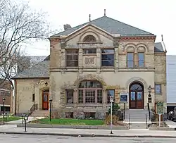 Ladies' Literary Club |
October 26, 1971 (#71000400) |
61 Sheldon St., SE. 42°57′45″N 85°40′01″W |
Grand Rapids | |
| 30 | Ledyard Block Historic District |  Ledyard Block Historic District |
September 8, 1983 (#83000878) |
123-145 Ottawa Ave., and 104-124 Monroe Center, NW. 42°57′57″N 85°40′14″W |
Grand Rapids | |
| 31 | Lexington School | Lexington School |
September 4, 2013 (#13000667) |
45 Lexington Avenue, NW 42°57′53″N 85°41′04″W |
Grand Rapids | |
| 32 | Loraine Building |  Loraine Building |
November 24, 1982 (#82000539) |
124 E. Fulton St. 42°57′47″N 85°39′56″W |
Grand Rapids | |
| 33 | Medical Arts Building |  Medical Arts Building |
May 18, 2000 (#00000506) |
26 Sheldon Blvd. SE. 42°57′44″N 85°39′58″W |
Grand Rapids | |
| 34 | Metal Office Furniture Company (Steelcase) Plants No. 2 and 3 | _Plants_No-_2_and_3_2012-09-27_15-38-11.jpg.webp) Metal Office Furniture Company (Steelcase) Plants No. 2 and 3 |
July 17, 2004 (#04000691) |
401 Hall St. SW. 42°56′34″N 85°40′41″W |
Grand Rapids | |
| 35 | Michigan Trust Company Building |  Michigan Trust Company Building |
February 24, 1983 (#83000879) |
40 Pearl St., NW. 42°57′58″N 85°40′12″W |
Grand Rapids | |
| 36 | Monroe Avenue Water Filtration Plant | 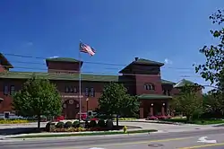 Monroe Avenue Water Filtration Plant |
July 31, 2002 (#02000815) |
1430 Monroe Ave. NW. 42°59′14″N 85°40′12″W |
Grand Rapids | |
| 37 | Mt. Mercy Academy and Convent | Mt. Mercy Academy and Convent |
August 5, 1993 (#93000769) |
1425 Bridge St., NW. 42°58′22″N 85°42′11″W |
Grand Rapids | |
| 38 | Norton Mound Group |  Norton Mound Group |
October 15, 1966 (#66000396) |
Between I-196 and Indian Mound Road[5] 42°56′12″N 85°43′19″W |
Grand Rapids | |
| 39 | Augustus Paddock House |  Augustus Paddock House |
September 12, 1985 (#85002154) |
1033 Lake Dr., SE. 42°57′36″N 85°38′34″W |
Grand Rapids | |
| 40 | Peck Block | 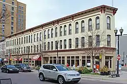 Peck Block |
December 7, 2000 (#00001483) |
34-50 Monroe Center NW. 42°57′51″N 85°40′07″W |
Grand Rapids | |
| 41 | Abram W. Pike House | 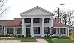 Abram W. Pike House |
July 8, 1970 (#70000276) |
230 Fulton St., E. 42°57′42″N 85°39′47″W |
Grand Rapids | |
| 42 | Porter Hollow Embankment and Culvert | 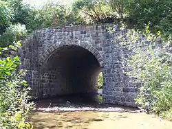 Porter Hollow Embankment and Culvert |
September 24, 2001 (#01001018) |
White Pine Trail at Stegman Creek, west of Summit Ave. 43°09′57″N 85°34′01″W |
Algoma Township | |
| 43 | Rood Building | 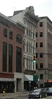 Rood Building |
March 4, 1988 (#88000142) |
139 Pearl Street[6] 42°57′59″N 85°40′20″W |
Grand Rapids | |
| 44 | Saint Joseph Seminary |  Saint Joseph Seminary |
September 16, 2019 (#100004384) |
600 Burton St. SE 42°55′39″N 85°39′05″W |
Grand Rapids | |
| 45 | Sixth Street Bridge† | 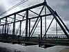 Sixth Street Bridge† |
August 13, 1976 (#76001030) |
Spans Grand River between Newberry and 6th St. 42°58′36″N 85°40′27″W |
Grand Rapids | |
| 46 | St. Cecilia Society Building |  St. Cecilia Society Building |
December 9, 1971 (#71000401) |
24-30 Ransom Ave., NE. 42°57′49″N 85°39′53″W |
Grand Rapids | |
| 47 | Third Reformed Church |  Third Reformed Church |
April 22, 1982 (#82002845) |
1009 Hermitage St., SE. 42°57′40″N 85°38′39″W |
Grand Rapids | |
| 48 | Thornapple River Drive Bridge |  Thornapple River Drive Bridge |
April 18, 1990 (#90000570) |
Thornapple River Dr. over Thornapple River 42°56′23″N 85°29′29″W |
Cascade Township | |
| 49 | Turner House† |  Turner House† |
July 8, 1970 (#70000277) |
731 Front St., NW. 42°58′35″N 85°40′35″W |
Grand Rapids | |
| 50 | U.S. Post Office | 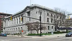 U.S. Post Office |
July 10, 1974 (#74000990) |
17 Pearl St. NW 42°58′00″N 85°40′06″W |
Grand Rapids | |
| 51 | Villa Maria† | 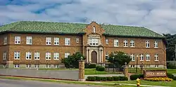 Villa Maria† |
March 27, 1987 (#86003373) |
1315 Walker NW. 42°59′01″N 85°42′02″W |
Grand Rapids | |
| 52 | Whitney Tavern Stand |  Whitney Tavern Stand |
February 1, 2007 (#06001326) |
5283 Whitneyville Ave. 42°52′08″N 85°27′34″W |
Cascade Township | |
| 53 | Willard Building | Willard Building |
January 14, 2013 (#12001172) |
150 E. Fulton St. 42°57′47″N 85°39′52″W |
Grand Rapids | Built in 1930. Home of E. A. Rood & Company, a china and glassware specialty store for many years. |
Former listing
| [2] | Name on the Register | Image | Date listed | Date removed | Location | City or town | Summary |
|---|---|---|---|---|---|---|---|
| 1 | Grand Rapids City Hall |  Grand Rapids City Hall |
Unknown (#69000375) | 1970 | 35 Lyon St., NW 42°58′02″N 85°40′10″W |
Grand Rapids | Demolished in December 1969. |
See also
| Wikimedia Commons has media related to National Register of Historic Places in Kent County, Michigan. |
References
- "National Register of Historic Places: Weekly List Actions". National Park Service, United States Department of the Interior. Retrieved on January 29, 2021.
- Numbers represent an alphabetical ordering by significant words. Various colorings, defined here, differentiate National Historic Landmarks and historic districts from other NRHP buildings, structures, sites or objects.
- "National Register Information System". National Register of Historic Places. National Park Service. April 24, 2008.
- The eight-digit number below each date is the number assigned to each location in the National Register Information System database, which can be viewed by clicking the number.
- Location is given by NPS on their website, maps show it in "Indian Mound Park"; the NRIS lists the property as "Address Restricted"
- Staff. "Rood Building". State Historic Preservation Office. Michigan State Housing Development Authority. Archived from the original on July 7, 2013. Retrieved May 12, 2013. the NRIS lists the property as "Address Restricted"
| Lists by county |
|  |
|---|---|---|
| Other lists |
| |
| Topics | |
|---|---|
| Lists by state |
|
| Lists by insular areas | |
| Lists by associated state | |
| Other areas | |
| Related | |
| |
This article is issued from Wikipedia. The text is licensed under Creative Commons - Attribution - Sharealike. Additional terms may apply for the media files.