Lower Tenthill, Queensland
Lower Tenthill is a locality in the Lockyer Valley Region, Queensland, Australia.[2] In the 2016 census, Lower Tenthill had a population of 252 people.[1]
| Lower Tenthill Queensland | |||||||||||||||
|---|---|---|---|---|---|---|---|---|---|---|---|---|---|---|---|
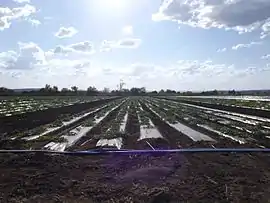
 Crops along Gatton Clifton Road, 2014 | |||||||||||||||
 Lower Tenthill | |||||||||||||||
| Coordinates | 27.6038°S 152.2386°E | ||||||||||||||
| Population | 252 (2016 census)[1] | ||||||||||||||
| • Density | 9.66/km2 (25.01/sq mi) | ||||||||||||||
| Postcode(s) | 4343 | ||||||||||||||
| Area | 26.1 km2 (10.1 sq mi) | ||||||||||||||
| Time zone | AEST (UTC+10:00) | ||||||||||||||
| LGA(s) | Lockyer Valley Region | ||||||||||||||
| State electorate(s) | Lockyer | ||||||||||||||
| Federal Division(s) | Wright | ||||||||||||||
| |||||||||||||||
Geography
Agriculture has developed along Tenthill Creek which also forms part of both the south-western and north-eastern boundary of Lower Tenthill. Lower Tenthill Weir on Tenthill Creek, has a storage capacity of 70 ML and is used for the purpose of recharging groundwater supplies.[3] The northern boundary follows Lockyer Creek. Two other creeks cross the area - Ma Ma Creek and Deep Creek. The locality is within the North East Coast drainage basin.[4]
The Gatton Clifton Road (State Route 80) passes through from north-east to west.
History
The name Tenthill is comes from the name of a pastoral property established by 1845 by Phillip Friell.[5]
Tent Hill State School opened in 1873.[6] It was renamed Tent Hill Lower State School in 1876. However it was unofficially known as Lower Tent Hill State School.[7]
At the 2011 census the locality recorded a population of 333.[8]
Education
Tent Hill Lower State School is a government primary (Prep-6) school for boys and girls at 90 Lower Tenthill Road (27.5915°S 152.2361°E).[9][10] In 2017, the school had an enrolment of 66 students with 6 teachers (5 full-time equivalent) and 5 non-teaching staff (2 full-time equivalent).[11]
References
- Australian Bureau of Statistics (27 June 2017). "Lower Tenthill (SSC)". 2016 Census QuickStats. Retrieved 20 October 2018.

- "Lower Tenthill – locality in Lockyer Valley Region (entry 44975)". Queensland Place Names. Queensland Government. Retrieved 11 June 2019.
- "Strategic Asset Management Plan" (PDF). Seqwater. 18 May 2009. p. 26. Archived (PDF) from the original on 30 March 2014. Retrieved 15 October 2014.
- "Queensland Globe". State of Queensland. Retrieved 23 July 2019.
- "Tenthill – unbounded locality in the Lockyer Valley Region (entry 33720)". Queensland Place Names. Queensland Government. Retrieved 23 July 2019.
- "Tent Hill Lower State School". Department of Education, Training and Employment. Archived from the original on 22 October 2014. Retrieved 15 October 2014.
- Queensland Family History Society (2010), Queensland schools past and present (Version 1.01 ed.), Queensland Family History Society, ISBN 978-1-921171-26-0
- Australian Bureau of Statistics (31 October 2012). "Lower Tenthill (State Suburb)". 2011 Census QuickStats. Retrieved 15 October 2014.

- "State and non-state school details". Queensland Government. 9 July 2018. Archived from the original on 21 November 2018. Retrieved 21 November 2018.
- "Tent Hill Lower State School". Archived from the original on 26 March 2012. Retrieved 21 November 2018.
- "ACARA School Profile 2017". Archived from the original on 22 November 2018. Retrieved 22 November 2018.