List of works by Francisco Salamone
Francisco Salamone (1897–1959) was an Argentine architect known for designing, in just four years, more than 60 monumental buildings in Buenos Aires Province. He began his work in the city of Villa María, Córdoba doing paving works, a slaughterhouse and the Centenario Square. After several problems and accusations of corruption in the municipality he moved to the province of Buenos Aires.[1] There, Salamone met the provincial governor, the conservative Manuel Fresco of the National Democratic Party.[2] He entrusted Salamone with the task of building different public buildings in the humid pampas, giving him full powers for his projects, encouraging the growth of small towns and cities.[3]

The majority of his work consisted mainly of three types of constructions: municipalities, cemeteries portals and slaughterhouses. He also made squares, porticos, sidewalks, lights, urban furniture and furniture of the municipal palaces. During this period he only built 2 private homes.
When the administration of Governor Fresco ended in 1940, Salamone moved with his family to Buenos Aires City. In 1943 he had to go into exile in Uruguay after being accused of corruption in a paving work in San Miguel de Tucumán. After the charges were withdrawn, he returned to Argentina where he directed multiple urban paving works and only projected 2 buildings of rationalist style and a private house.[4]
Buildings
| Work | Image | City | Departamento/ Partido[n 1] |
Province | Address Coordinates |
Construction | Notes | Ref. |
|---|---|---|---|---|---|---|---|---|
| Adolfo Alsina City Hall |  |
Carhué | Adolfo Alsina | Buenos Aires | Carlos Pellegrini and Rivadavia 37.18033°S 62.76124°W |
1937–3 December 1938 | [5] [6] | |
| Villa Epecuén Slaughterhouse | 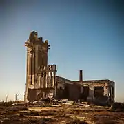 |
Villa Epecuén | Adolfo Alsina | Buenos Aires | 37.14527°S 62.78562°W | 1937–3 December 1938 | [5] [6] | |
| Adolfo Gonzales Chaves City Hall |  |
Adolfo Gonzales Chaves | Adolfo Gonzales Chaves | Buenos Aires | Mitre and J. Elicagaray 38.03259°S 60.09843°W |
1939 | [7] | |
| Municipal Market |  |
Adolfo Gonzales Chaves | Adolfo Gonzales Chaves | Buenos Aires | Sarmiento 158 38.03281°S 60.09718°W |
1937–1939 | Currently Gerogina Valdez de Lafargue Cultural Center. | [7] |
| Adolfo Gonzales Chaves Slaughterhouse | — | Adolfo Gonzales Chaves | Adolfo Gonzales Chaves | Buenos Aires | 38.04315°S 60.07993°W | 1938 | [8] | |
| Alberti City Hall |  |
Alberti | Alberti | Buenos Aires | 9 de Julio and Leandro N. Alem 35.03129°S 60.28133°W |
1937–1938 | [9] | |
| Social Club | — | Alberti | Alberti | Buenos Aires | Leandro N. Alem 151–199 35.03197°S 60.28086°W |
1937 | Remodeling of the old municipality to Social Club. Then became the Rural Normal School and now it is the Secondary School Nº2 Pablo A. Pizzurno. | [9] [10] |
| Carlos Calegari House | — | Alberti | Alberti | Buenos Aires | Sarmiento 112 35.03271°S 60.27651°W |
1937 | [10] | |
| Cemetery Dome | — | Alberti | Alberti | Buenos Aires | Poeta Barbieri and Ceferino Ferreyra Basso 35.04263°S 60.29815°W |
[9] | ||
| Car Impound Lot | — | Alberti | Alberti | Buenos Aires | 1937 | [10] | ||
| Coronel Mom Municipal Delegation | — | Coronel Mom | Alberti | Buenos Aires | 1937 | [10] | ||
| Azul Slaughterhouse |  |
Azul | Azul | Buenos Aires | 36.80794°S 59.82488°W | 1938 | [11] | |
| Azul Cemetery |  |
Azul | Azul | Buenos Aires | Sarmiento and Necochea 36.77376°S 59.85133°W |
1938 | [11] | |
| Daneri House | — | Azul | Azul | Buenos Aires | Colón and Belgrano 36.77618°S 59.86284°W |
1938 | [12] | |
| Cacharí Municipal Delegation |  |
Cacharí | Azul | Buenos Aires | Belgrano 1663 36.37694°S 59.50504°W |
1937 | [8] | |
| Cacharí Slaughterhouse |  |
Cacharí | Azul | Buenos Aires | 36.36654°S 59.49838°W | 1937 | [8] | |
| Chillar Municipal Delegation |  |
Chillar | Azul | Buenos Aires | García 66 37.31349°S 59.98486°W |
1937 | [8] | |
| Chillar Slaughterhouse | 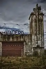 |
Chillar | Azul | Buenos Aires | 37.30815°S 59.99878°W | 1937 | [8] | |
| Car Impound Lot | — | Balcarce | Balcarce | Buenos Aires | 1936 | [10] | ||
| Balcarce Slaughterhouse | 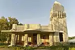 |
Balcarce | Balcarce | Buenos Aires | 37.83187°S 58.27327°W | 1937 | Currently Salamone Cultural Center. | [13] |
| Balcarce Cemetery | 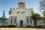 |
Balcarce | Balcarce | Buenos Aires | 37.87213°S 58.24599°W | 1936 | [13] | |
| Rural Normal School |  |
Balcarce | Balcarce | Buenos Aires | 37.84758°S 58.25458°W | 1938 | Currently Secondary School Nº1 Antonio González Balcarce. | [13] |
| Los Pinos Municipal Delegation |  |
Los Pinos | Balcarce | Buenos Aires | 37.94308°S 58.32493°W | [13] | ||
| San Agustín Municipal Delegation |  |
San Agustín | Balcarce | Buenos Aires | 38.01063°S 58.35607°W | 1936–1937 | [13] | |
| Chascomús City Hall |  |
Chascomús | Chascomús | Buenos Aires | Cramer 270 35.57841°S 58.01389°W |
1940 | [14] | |
| Coronel Pringles City Hall | .JPG.webp) |
Coronel Pringles | Coronel Pringles | Buenos Aires | 25 de Mayo and Colón 37.98523°S 61.34973°W |
1937 | [15] | |
| Coronel Pringles Slaughterhouse | .JPG.webp) |
Coronel Pringles | Coronel Pringles | Buenos Aires | José Hernández 701 37.99553°S 61.34568°W |
1937 | [15] | |
| Dr. Manuel B. Cabrera Municipal Hospital | — | Coronel Pringles | Coronel Pringles | Buenos Aires | 25 de Mayo and Bahía Blanca 37.97659°S 61.36158°W |
1937 | Extension. | [8] |
| Escobar Municipal Delegation | — | Belén de Escobar | Escobar | Buenos Aires | Juan Manuel Estrada and Asborno 34.34585°S 58.79536°W |
1938 | Currently Escobar City Hall. Only the ground floor was built. | [8] |
| Emilio Canzani House | — | Mar del Plata | General Pueyrredón | Buenos Aires | Buenos Aires 2715 38.01015°S 57.54867°W |
1954 | [16] | |
| Guaminí City Hall |  |
Guaminí | Guaminí | Buenos Aires | Manuel Ochoa and Villegas 37.01091°S 62.42223°W |
1937 | [17] | |
| Guaminí Slaughterhouse |  |
Guaminí | Guaminí | Buenos Aires | 37.01874°S 62.41199°W | 1937 | [17] | |
| Bonifacio Municipal Delegation | 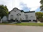 |
Bonifacio | Guaminí | Buenos Aires | 36.80738°S 62.2466°W | 1937 | [18] | |
| Casbas Municipal Delegation |  |
Casbas | Guaminí | Buenos Aires | 36.75716°S 62.50382°W | 1937 | [18] | |
| Garré Municipal Delegation |  |
Garré | Guaminí | Buenos Aires | Arturo Illia and Juan Domingo Perón 36.56138°S 62.60016°W |
1937 | [18] | |
| Laprida City Hall |  |
Laprida | Laprida | Buenos Aires | San Martín 1160 37.54475°S 60.8005°W |
1937 | [19] | |
| Laprida Cemetery | 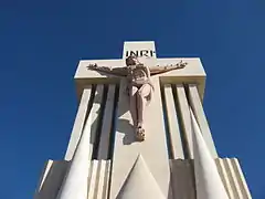 |
Laprida | Laprida | Buenos Aires | 37.56314°S 60.83068°W | 1937 | [19] | |
| Laprida Slaughterhouse |  |
Laprida | Laprida | Buenos Aires | 37.58114°S 60.84702°W | 1937 | [19] | |
| Municipal Car Impound Lot | — | Laprida | Laprida | Buenos Aires | Rivadavia 1359 37.54721°S 60.80039°W |
1936 | [19] | |
| Municipal Ranch | — | Laprida | Laprida | Buenos Aires | 37.57549°S 60.84904°W | 1938 | [20] [21] | |
| San Jorge Municipal Delegation | — | San Jorge | Laprida | Buenos Aires | 37.22949°S 60.96189°W | 1937 | [18] | |
| Leandro N. Alem City Hall |  |
Vedia | Leandro N. Alem | Buenos Aires | Rivadavia and Estrada 34.49801°S 61.5432°W |
Finished in 1938 | [22] | |
| Vedia Slaughterhouse | — | Vedia | Leandro N. Alem | Buenos Aires | 34.49891°S 61.55911°W | 1937 | [22] | |
| Alem Slaughterhouse | — | Alem | Leandro N. Alem | Buenos Aires | 34.52585°S 61.39869°W | 1937 | [22] | |
| Alem Municipal Delegation | — | Alem | Leandro N. Alem | Buenos Aires | Roldán and Layera 34.51962°S 61.39038°W |
1937 | Currently a first aid room. | [22] |
| Alberdi Slaughterhouse | — | Alberdi | Leandro N. Alem | Buenos Aires | 34.44866°S 61.82997°W | 1937 | [22] | |
| Alberdi Municipal Delegation | — | Alberdi | Leandro N. Alem | Buenos Aires | 34.43888°S 61.81153°W | 1937 | [22] | |
| El Dorado Municipal Delegation | — | El Dorado | Leandro N. Alem | Buenos Aires | 34.65241°S 61.5833°W | 1937 | [22] | |
| Pellegrini City Hall |  |
Pellegrini | Pellegrini | Buenos Aires | Alsina 250 36.26784°S 63.16448°W |
1937 | [23] | |
| Pellegrini Slaughterhouse | 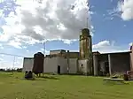 |
Pellegrini | Pellegrini | Buenos Aires | 36.25544°S 63.17379°W | 1937 | [23] | |
| Pellegrini Athletic Club | — | Pellegrini | Pellegrini | Buenos Aires | 1938 | [12] | ||
| Pilar Cemetery |  |
Pilar | Pilar | Buenos Aires | Lorenzo López 1202 34.45959°S 58.92246°W |
1938 | The great cross in the portal of the cemetery built by Salamone was demolished in 1947. | [18] |
| Rauch City Hall | 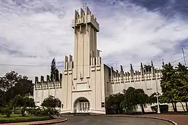 |
Rauch | Rauch | Buenos Aires | Rivadavia 750 36.77519°S 59.08619°W |
1937 | [24] | |
| Eustoquio Diaz Velez Municipal Hospital | — | Rauch | Rauch | Buenos Aires | Alberti 450 36.7809°S 59.08601°W |
1936 | Extension. | [10] |
| Miranda Municipal Delegation |  |
Miranda | Rauch | Buenos Aires | 36.53597°S 59.13425°W | 1938 | [24] | |
| Cuartel VII Municipal Delegation | — | Cuartel VII | Rauch | Buenos Aires | 1936 | [18] | ||
| Salliqueló Slaughterhouse |  |
Salliqueló | Salliqueló | Buenos Aires | Dr. Juan Moreda and Uruguay 36.75392°S 62.95089°W |
1937–1938 | [25] | |
| Salliqueló Cemetery |  |
Salliqueló | Salliqueló | Buenos Aires | 36.76632°S 62.96278°W | 1937–1938 | [25] | |
| Tornquist City Hall |  |
Tornquist | Tornquist | Buenos Aires | Sarmiento 53 38.10054°S 62.2215°W |
1937 | [26] | |
| Tornquist Slaughterhouse | — | Tornquist | Tornquist | Buenos Aires | 38.09978°S 62.25072°W | 1937 | Extension. | [18] |
| Saldungaray Municipal Delegation |  |
Saldungaray | Tornquist | Buenos Aires | La Plata and Pavón 38.20456°S 61.77002°W |
1937–1938 | [27] | |
| Saldungaray Cemetery | 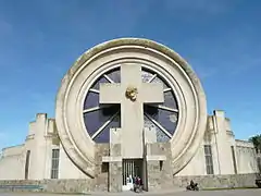 |
Saldungaray | Tornquist | Buenos Aires | Corrales and Rincón 38.20148°S 61.7591°W |
1937 | [27] | |
| Saldungaray Slaughterhouse |  |
Saldungaray | Tornquist | Buenos Aires | 38.1853°S 61.77483°W | 1937 | [27] | |
| Municipal Market |  |
Saldungaray | Tornquist | Buenos Aires | Belgrano and Donado 38.20669°S 61.77323°W |
1937 | [27] | |
| Tres Picos Municipal Delegation | — | Tres Picos | Tornquist | Buenos Aires | 38.28776°S 62.21075°W | 1937 | [10] | |
| Tres Lomas Municipal Delegation |  |
Tres Lomas | Tres Lomas | Buenos Aires | Rivadavia 149 36.45946°S 62.86174°W |
1937 | Currently Tres Lomas City Hall. | [28] |
| Tres Lomas Slaughterhouse |  |
Tres Lomas | Tres Lomas | Buenos Aires | 36.45034°S 62.85073°W | 1937–1938 | [28] | |
| Michael Ham School | — | Vicente López[n 2] | Buenos Aires | 34.53018°S 58.47356°W | 1951 | Extension. | [4] | |
| Apartment Building | — | Vicente López[n 2] | Buenos Aires | Zufriategui 637 34.53439°S 58.46645°W |
1950 | [4] | ||
| Apartment Building |  |
Buenos Aires City | —[n 3] | Ayacucho and Alvear 34.58747°S 58.38917°W |
1950 | [4] | ||
| Las Varillas City Hall |  |
Las Varillas | San Justo | Córdoba | España and M. A. Luque 31.86969°S 62.71943°W |
May 1935–22 March 1936 | [30] | |
| Villa María Slaughterhouse |  |
Villa María | General San Martín | Córdoba | Paso de los Libres and Marcelo T. de Alvear 32.42474°S 63.22311°W |
1934–February 1936 | [31] | |
| Spain House | — | Villa María | General San Martín | Córdoba | Bartolomé Mitre 82 32.41372°S 63.24566°W |
1935 | Extension. | [32] |
| Alta Gracia Slaughterhouse | — | Alta Gracia | Santa María | Córdoba | 31.66964°S 64.43042°W | Currently Padre Domingo Viera Agrotechnical Institute. | [33] [34] | |
Squares and Street Furniture
| Work | Image | City | Departamento/ Partido[n 1] |
Province | Address Coordinates |
Construction | Notes | Ref. |
|---|---|---|---|---|---|---|---|---|
| Cemetery Cross |  |
Carhué | Adolfo Alsina | Buenos Aires | 37.16828°S 62.77341°W | 1938 | Sculptor Santiago Chièrico. Replaced the cross currently in Arano. | [5] [35] |
| Cross at estancia Las Calaveras | — | Arano | Adolfo Alsina | Buenos Aires | 1937 | Originally in Carhué. Moved to estancia Las Calaveras after collapsing in storm shortly after being placed. | [35] | |
| General San Martín Municipal Park Portal | — | Alberti | Alberti | Buenos Aires | Gral. San Martín and Vaccarezza 35.02699°S 60.28256°W |
1937 | [9] | |
| General José Arias Square |  |
Alberti | Alberti | Buenos Aires | 35.03157°S 60.28024°W | 1937 | [9] | |
| Cross |  |
Azul | Azul | Buenos Aires | Piazza and National Route 3 36.79242°S 59.83987°W |
[36] | ||
| San Martín Square |  |
Azul | Azul | Buenos Aires | 36.77749°S 59.86346°W | 1937 | [11] | |
| Domingo Faustino Sarmiento Municipal Park Portal |  |
Azul | Azul | Buenos Aires | Guaminí and Pellegrini 36.78292°S 59.87097°W |
1937 | [11] | |
| Libertad Square |  |
Balcarce | Balcarce | Buenos Aires | 37.84646°S 58.25548°W | 1936 | The base for Monument to the Republic built by Salamone was demolished in 1945. A door was rescued and is installed in the Municipal Historical Museum. | [13] |
| Libres del Sur Municipal Park | — | Chascomús | Chascomús | Buenos Aires | 35.58027°S 58.01780°W | 1938 | [37] | |
| Juan Pascual Pringles Square | 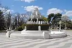 |
Coronel Pringles | Coronel Pringles | Buenos Aires | 37.98499°S 61.35003°W | 1937–1939 | [15] | |
| 25 de Mayo Boulevard | .JPG.webp) |
Coronel Pringles | Coronel Pringles | Buenos Aires | 37.98300°S 61.35247°W | 1937 | [10] | |
| Cemetery Cross | 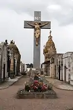 |
Coronel Pringles | Coronel Pringles | Buenos Aires | 37.9761°S 61.32943°W | [15] | ||
| Alsina Square | 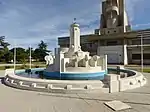 |
Guaminí | Guaminí | Buenos Aires | 37.01109°S 62.42202°W | 1937 | [17] | |
| Cross | 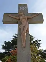 |
Guaminí | Guaminí | Buenos Aires | Hipólito Irigoyen and G. Pereyra 37.01665°S 62.4135°W |
[17] | ||
| Pedro Pereyra Square |  |
Laprida | Laprida | Buenos Aires | 37.54423°S 37.54423°W | 1936–1937 | [19] | |
| Rivadavia Square | — | Vedia | Leandro N. Alem | Buenos Aires | 34.49792°S 61.54228°W | 1937 | [22] | |
| General José de San Martín Square | 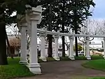 |
Pellegrini | Pellegrini | Buenos Aires | 36.26799°S 63.16435°W | 1937 | [23] | |
| San Martín Square | — | Pilar | Pilar | Buenos Aires | 34.45873°S 58.91392°W | 1938 | [37] | |
| Rauch City Hall Square |  |
Rauch | Rauch | Buenos Aires | 36.77506°S 59.08639°W | [24] | ||
| Cemetery Cross | — | Arroyo Corto | Saavedra | Buenos Aires | 37.50678°S 62.32111°W | [38] | ||
| 9 de Julio Boulevard | — | Salliqueló | Salliqueló | Buenos Aires | 36.75083°S 62.95959°W | 1938 | Demolished. | [12] |
| Ernesto Tornquist Square |  |
Tornquist | Tornquist | Buenos Aires | 38.10065°S 62.22303°W | 1937 | Originally designed by Carlos Thays. | [26] |
| Cemetery Cross |  |
Tornquist | Tornquist | Buenos Aires | 38.08971°S 62.21824°W | 1938 | [26] | |
| Independencia Square |  |
Saldungaray | Tornquist | Buenos Aires | 38.20524°S 61.76958°W | 1937 | [27] | |
| Leandro N. Alem Square |  |
Tres Lomas | Tres Lomas | Buenos Aires | 36.45912°S 62.8625°W | 1938 | [28] | |
| Centenario Square |  |
Villa María | General San Martín | Córdoba | 32.41036°S 63.24334°W | 1934–12 October 1935 | [31] | |
| Independencia Square | — | Villa María | General San Martín | Córdoba | 32.41500°S 63.24353°W | 1934 | Landscaping. | [31] |
| San Martín Square | — | Villa María | General San Martín | Córdoba | 32.41352°S 63.24834°W | 1934 | Landscaping. | [31] |
| España Boulevard |  |
Villa María | General San Martín | Córdoba | 32.40485°S 63.24204°W | 1934 | Demolished. | [31] |
Attributed Works
For the following works it can not be fully confirmed the authorship of Salamone.
| Work | Image | City | Departamento | Province | Address Coordinates |
Year | Notes | Ref. |
|---|---|---|---|---|---|---|---|---|
| Mansion | — | Córdoba | Capital | Córdoba | Av. Argentina 640 31.42960°S 64.18474°W |
1921 | Possible house in the current address of Hipólito Yrigoyen 638 attributed to Ubaldo Emiliani. Salamone possibly participated in the beginning of construction or was later remodeled by Emiliani in Liberty style. | [39] |
| General Belgrano Municipal Park Portal |  |
Venado Tuerto | General López | Santa Fe | Jujuy and Caseros 33.73995°S 61.95877°W |
Finished in February 1941 | Equal to the General San Martín Municipal Park Portal in Alberti, Buenos Aires. | [40] |
| Juan de Garay Municipal Park Portal |  |
Santa Fe | La Capital | Santa Fe | Juan Perón and Salvador Caputo 31.63691°S 60.71865°W |
Demolished in 1987. | [40] | |
| El Dominador Neighborhood | — | Valle Hermoso | Punilla | Córdoba | 31.10158°S 64.48882°W | 1925 | Oral source. | [41] |
| El Rincón Neighborhood | — | Valle Hermoso | Punilla | Córdoba | 1928 | Oral source. | [41] | |
| Cinema |  |
Valle Hermoso | Punilla | Córdoba | Castellana 315 31.12420°S 64.48907°W |
1928 | Oral source. | [41] |
Unbuilt Works
| Work | City | Departamento/ Partido[n 1] |
Province | Address | Year | Notes | Ref. |
|---|---|---|---|---|---|---|---|
| Policemen and Firemen Pantheon | Buenos Aires City | —[n 3] | La Chacarita Cemetery | 1919 | Preliminary draft for contest. | [42] | |
| Palace of the 14 Provinces | Buenos Aires City | —[n 3] | Preliminary draft. | [43] | |||
| Dr. Ricardo Villela's Apartment Building | Córdoba | Capital | Córdoba | Deán Funes 168/174 | 1921 | Possibly not built, demolished, remodeled or simply unidentifiable. | [39] |
| Dr. Allende's Palace | Córdoba | Capital | Córdoba | Alvear 160 | 1921 | Possibly not built, demolished, remodeled or simply unidentifiable. | [39] |
| Mrs. Garzón Palacio's Palace | Córdoba | Capital | Córdoba | Possibly not built, demolished, remodeled or simply unidentifiable. | [39] | ||
| Business | Córdoba | Capital | Córdoba | 25 de Mayo and Alvear | 1922 | Possibly not built, demolished, remodeled or simply unidentifiable. | [39] |
| Gran Hotel Victoria | Córdoba | Capital | Córdoba | 1922 | Possibly not built, demolished, remodeled or simply unidentifiable. | [39] | |
| Teacher Pantheon | Córdoba | Capital | Córdoba | San Jerónimo Cemetery | 1922 | Preliminary draft. | [39] |
| National University of Cordoba | Córdoba | Capital | Córdoba | Vélez Sársfield and Duarte Quirós | 1922 | Preliminary draft for contest. Extension. | [39] |
| South Markert | Córdoba | Capital | Córdoba | 1925 | Preliminary draft for contest. First prize. | [39] | |
| Villa María City Hall | Villa María | General San Martín | Córdoba | 1933 | Draft. | [31] | |
| Public assistance | Villa María | General San Martín | Córdoba | Lisandro de la Torre and Catamarca | 1934 | Preliminary draft. | [31] |
| Independencia Square | Villa María | General San Martín | Córdoba | 1935 | Preliminary draft. | [32] | |
| San Martín Square | Villa María | General San Martín | Córdoba | 1935 | Preliminary draft. | [32] | |
| Ramos Otero Municipal Delegation | Ramos Otero | Balcarce | Buenos Aires | 1936 | Draft. | [32] | |
| Napaleofú Municipal Delegation | Napaleofú | Balcarce | Buenos Aires | 1936 | Draft. | [32] | |
| Rivera Municipal Delegation | Rivera | Adolfo Alsina | Buenos Aires | 1937 | Draft. | [12] | |
| San Miguel Arcángel Municipal Delegation | San Miguel Arcángel | Adolfo Alsina | Buenos Aires | 1937 | Draft. | [12] | |
| Azul City Hall | Azul | Azul | Buenos Aires | 1937 | Preliminary draft. | [12] | |
| Tigre Cemetery | Tigre | Tigre | Buenos Aires | 1938 | Draft. | [37] | |
| Market | Tigre | Tigre | Buenos Aires | 1938 | Draft. | [37] | |
| San Martín Square | Tigre | Tigre | Buenos Aires | 1938 | Draft. | [37] | |
| Rivadavia Square | Tigre | Tigre | Buenos Aires | 1938 | Draft. | [37] | |
| Boulevard | Tigre | Tigre | Buenos Aires | Rocha Street | 1938 | Draft. | [37] |
| Small Square | Tigre | Tigre | Buenos Aires | 1938 | Draft. | [37] | |
| Lobería City Hall | Lobería | Lobería | Buenos Aires | 1938 | Draft. | [37] | |
| Lobería Slaughterhouse | Lobería | Lobería | Buenos Aires | 1938 | Draft. | [37] | |
| Lobería Cemetery | Lobería | Lobería | Buenos Aires | 1938 | Draft. | [37] | |
| Mitre Square | Lobería | Lobería | Buenos Aires | 1938 | Draft. | [37] | |
| Ramblas | Lobería | Lobería | Buenos Aires | 1938 | Draft. | [37] | |
| Hospital | Lobería | Lobería | Buenos Aires | 1938 | Draft. | [37] | |
| Quequén Municipal Delegation | Quequén | Necochea | Buenos Aires | 1938 | Draft. | [37] | |
| Quequén Slaughterhouse | Quequén | Necochea | Buenos Aires | 1938 | Draft. | [37] | |
| Chascomús Cemetery | Chascomús | Chascomús | Buenos Aires | 1938 | Preliminary draft. | [37] | |
| Lezama Municipal Delegation | Lezama | Lezama | Buenos Aires | 1938 | Preliminary draft. | [37] | |
| Lezama Cemetery | Lezama | Lezama | Buenos Aires | 1938 | Preliminary draft. | [37] | |
| Tres Arroyos Slaughterhouse | Tres Arroyos | Tres Arroyos | Buenos Aires | 1938 | Draft. | [37] | |
| Daireaux City Hall | Daireaux | Daireaux | Buenos Aires | 1938 | Preliminary draft. | [37] | |
| Daireaux Slaughterhouse | Daireaux | Daireaux | Buenos Aires | 1938 | Preliminary draft. | [37] | |
| Hospital | Daireaux | Daireaux | Buenos Aires | 1938 | Preliminary draft. | [37] | |
| Salazar Municipal Delegation | Salazar | Daireaux | Buenos Aires | 1938 | Preliminary draft. | [37] | |
| José de San Martín Monument | Mar del Plata | General Pueyrredón | Buenos Aires | 1953 | Project for the centenary of the death of José de San Martín. | [16] | |
| Carmen de Patagones Cemetery | Carmen de Patagones | Patagones | Buenos Aires | 1938 | Preliminary draft. | [37] | |
| Municipal Park | Carmen de Patagones | Patagones | Buenos Aires | 1938 | Preliminary draft. | [37] | |
| Hotel | Corrientes | Capital | Corrientes | Punta Vidal | Preliminary draft. | [43] | |
Misattributed Works
| Work | City | Partido | Province | Notes | Ref. |
|---|---|---|---|---|---|
| Mar Chiquita City Hall | Coronel Vidal | Mar Chiquita | Buenos Aires | Work by Ingeniero Civil Francisco Marseillán SRL. | [44] [45] |
| Puan City Hall | Puan | Puan | Buenos Aires | Work by Ingeniero Civil Francisco Marseillán SRL. | [44] [46] |
| Pirovano Municipal Delegation | Pirovano | Bolívar | Buenos Aires | Work by Ingeniero Civil Francisco Marseillán SRL. | [44] [46] |
| Urdampilleta Municipal Delegation | Urdampilleta | Bolívar | Buenos Aires | Work by Ingeniero Civil Francisco Marseillán SRL. | [44] [46] |
| Italians' Clock | Chascomús | Chascomús | Buenos Aires | Work by Telésforo Sallaberry. | [47] |
References
Notes
- In Argentina the territorial divisions of second order are called Partidos in the Buenos Aires and Departamentos in the other provinces.
- The town of Vicente López covers the whole Partido of the same name.[29]
- The City of Buenos Aires is autonomous and does not belong to any province.
Citations
- Longoni & Molteni 2014, p. 22–29.
- Longoni & Molteni 2014, p. 28–30.
- Longoni & Molteni 2014, p. 42–45.
- Longoni & Molteni 2014, p. 37–41.
- Novacovsky & París Benito 2011, p. 198–200.
- "Fresco en Carhué". La Nueva Provincia (in Spanish). 15 December 2005. Retrieved 25 March 2019.
- Novacovsky & París Benito 2011, p. 232–235.
- Novacovsky & París Benito 2011, p. 188.
- Novacovsky & París Benito 2011, p. 191–193.
- Longoni & Molteni 2014, p. 113.
- Novacovsky & París Benito 2011, p. 201–208.
- Longoni & Molteni 2014, p. 114.
- Novacovsky & París Benito 2011, p. 209–217.
- Novacovsky & París Benito 2011, p. 229–231.
- Novacovsky & París Benito 2011, p. 218–228.
- Longoni & Molteni 2014, p. 40–42.
- Novacovsky & París Benito 2011, p. 236–241.
- Novacovsky & París Benito 2011, p. 189.
- Novacovsky & París Benito 2011, p. 242–247.
- Invasión Salamone (5 September 2014). "Un tesoro desde Laprida". Facebook (in Spanish). Retrieved 25 March 2019.
- "CHACRA MUNICIPAL EN LAPRIDA OBRA DEL ARQUITECTO SALAMONE". historiasconpueblos.blogspot.com.ar (in Spanish). 17 April 2017. Retrieved 25 March 2019.
- Novacovsky & París Benito 2011, p. 194–197.
- Novacovsky & París Benito 2011, p. 248–252.
- Novacovsky & París Benito 2011, p. 253–257.
- Novacovsky & París Benito 2011, p. 258–262.
- Novacovsky & París Benito 2011, p. 263–264.
- Novacovsky & París Benito 2011, p. 265–272.
- Novacovsky & París Benito 2011, p. 273–275.
- "Vicente López". Municipalidad de Vicente López (in Spanish). Retrieved 25 March 2019.
- Longoni & Molteni 2014, p. 28.
- Longoni & Molteni 2014, p. 23–27.
- Longoni & Molteni 2014, p. 112.
- Longoni 2001, p. 19.
- "El matadero de Alta Gracia es ahora escuela agrotécnica". La Voz del Interior (in Spanish). Great Córdoba. 18 March 2008. Retrieved 25 March 2019.
- "El Cristo de Salamone que nadie recuerda". La Nueva Provincia (in Spanish). 26 August 2018. Retrieved 25 March 2019.
- Longoni & Molteni 2014, p. 96.
- Longoni & Molteni 2014, p. 115.
- "Declarando bien historico y artistico la cruz del cementerio de Arroyo Corto" (PDF). Honorable Concejo Deliberante de Saavedra (in Spanish). 14 September 2016. Retrieved 25 March 2019.
- Longoni & Molteni 2014, p. 16–18.
- Longoni & Molteni 2014, p. 34, 36–37.
- Longoni & Molteni 2014, p. 20.
- Longoni & Molteni 2014, p. 13.
- Longoni & Molteni 2014, p. 37.
- Minervino 2012.
- Longoni, René (17 May 2005). "Los "otros Salamone"". Clarín (in Spanish). Archived from the original on 12 October 2017. Retrieved 25 March 2019.
- Llinás 2012, p. 134.
- Serviddio 2017, p. 49.
Bibliography
- Llinás, Mariano (2012). Historias extraordinarias (in Spanish). Penguin Random House Grupo Editorial Argentina. ISBN 978-987-658-158-5. Retrieved 25 March 2019.
- Longoni, René (October 2001). "El exilio de "Metrópolis"" (PDF). Revista Ramona (in Spanish). No. 17. Buenos Aires City: Fundación Start. ISSN 1666-1826. Retrieved 25 March 2019.
- Longoni, René; Molteni, Juan Carlos (2014). Maestros de la Arquitectura Argentina: Francisco Salamone (in Spanish). Ciudad Autónoma de Buenos Aires: Arte Gráfico Editorial Argentino. ISBN 978-987-07-2855-9.
- Minervino, Mario (October 2012). "Francisco Marseilán y Guillermo Martín. Los otros proyectistas de la llanura bonaerense". Obras y Protagonistas (in Spanish). No. 209. Retrieved 25 March 2019.
- Novacovsky, Alejandro; París Benito, Felicidad (2011). Francisco Salamone en la provincia de Buenos Aires. Obra y patrimonio 1936–1940 (in Spanish). Mar del Plata: Gráfica Altamirano. ISBN 978-987-544-414-0.
- Serviddio, Damián (November 2017). "Escapada a Chascomús: Fin de semana frente a la laguna". Locally (in Spanish). No. 107. Nordelta: Mundial Impresos. Retrieved 25 March 2019.