List of rivers of Texas
The list of rivers of Texas is a list of all named waterways, including rivers and streams that partially pass through or are entirely located within the U.S. state of Texas. Across the state, there are 3,700 named streams and 15 major rivers accounting for over 191,000 mi (307,000 km) of waterways.[1][2] All of the state's waterways drain towards the Mississippi River, the Texas Gulf Coast, or the Rio Grande, with mouths located in seven major estuaries.[1]
Major waterways
- Angelina River
- Blanco River
- Bosque River
- Brazos River
- Colorado River
- Concho River
- Canadian River
- Guadalupe River
- James River
- Lampasas River
- Lavaca River
- Leon River
- Little River
- Llano River
- Navidad River
- Neches River
- Nolan River
- Nueces River
- Paluxy River
- Pease River
- Pedernales River
- Prairie Dog Town Fork Red River
- Red River
- Rio Grande
- Sabine River
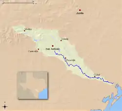
- San Antonio River
- San Bernard River
- San Gabriel River
- San Jacinto River
- San Marcos River
- San Saba River
- Sulphur River
- Trinity River
- Wichita River
- White River
Seasonal and restrictive waterways
- Aransas River
- Armand Bayou
- Arroyo Colorado
- Attoyac Bayou
- Austin Bayou
- Barton Creek
- Bastrop Bayou
- Bedias Creek
- Beech Creek
- Big Cow Creek
- Big Cypress Bayou
- Big Cypress Creek
- Big Mineral Creek
- Big Pine Creek
- Big Sandy Creek
- Bois D'Arc Creek
- Buffalo Bayou
- Caney Creek (Red River tributary)
- Catfish Creek
- Cedar Bayou
- Chacon Creek
- Cibolo Creek
- Clear Creek
- Coffee Mill Creek
- Coleto Creek
- Comal River
- Dead Negro Draw
- Denton Creek
- Dickinson Bayou
- Double Bayou, East Fork
- Garcitas Creek
- Highland Bayou
- Hurst Creek
- Keechi Creek
- Lake Charlotte Creek (Lake Pass)
- Little Cypress Bayou
- Navasota River
- Onion Creek
- Oso Creek
- Oyster Bayou
- Oyster Creek
- Palo Pinto Creek
- Pecan Bayou
- Pine Island Bayou
- Rainwater Creek
- Rincon Bayou
- Sabinal River
- Salado Creek
- Sanders Creek
- Spring Creek
- Taylor Bayou
- Turkey Creek
- Village Creek
- Walnut Branch
- Zacate Creek
Waterways by drainage basin
This list is arranged by drainage basin, with tributaries indented under each larger stream's name listed in order from mouth to source.
Mississippi River

- Mississippi River (LA, AR)
- Red River
- Cross Bayou
- Twelvemile Bayou (LA)
- Sulphur River
- White Oak Creek
- North Sulphur River
- South Sulphur River
- Pecan Bayou
- Big Pine Creek
- Sanders Creek
- Bois D'Arc Creek
- Caney Creek (Red River tributary)
- Washita River
- Big Mineral Creek
- Little Wichita River
- Wichita River
- Holliday Creek
- Beaver Creek
- North Wichita River
- Middle Fork Wichita River
- South Wichita River
- Pease River
- Wanderers Creek
- Groesbeck Creek
- North Fork Red River
- Salt Fork Red River
- Prairie Dog Town Fork Red River
- Cross Bayou
- Arkansas River (AR, OK)
- Red River
Gulf of Mexico Coastal

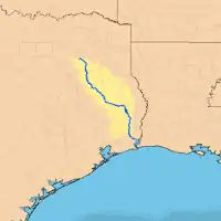
- Sabine River
- Neches River
- Taylor Bayou
- Oyster Bayou
- Double Bayou
- Double Bayou, East Fork
- West Fork Double Bayou
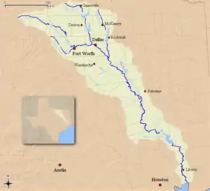
- Trinity River
- Lake Charlotte Creek (Lake Pass)
- Bedias Creek
- Keechi Creek
- Tehuacana Creek
- Richland Creek
- Cedar Creek
- Red Oak Creek
- East Fork Trinity River
- White Rock Creek
- Turtle Creek
- Elm Fork Trinity River
- West Fork Trinity River
- Johnson Creek
- Clear Fork Trinity River
- Big Sandy Creek
- Cedar Bayou
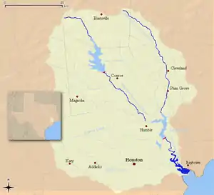
- San Jacinto River
- Clear Creek
- Dickinson Bayou
- Highland Bayou
- Chocolate Bayou
- Bastrop Bayou
- Oyster Creek

- Brazos River
- Mill Creek
- Navasota River
- Yegua Creek
- Nolan River
- Little Brazos River
- Little River
- Bosque River
- North Bosque River
- East Bosque River
- South Bosque River
- Middle Bosque River
- North Bosque River
- Aquilla Creek
- Paluxy River
- Palo Pinto Creek
- Clear Fork Brazos River
- Elm Creek
- Millers Creek
- Double Mountain Fork Brazos River
- Salt Fork Brazos River
- San Bernard River
- Caney Creek (Matagorda Bay)
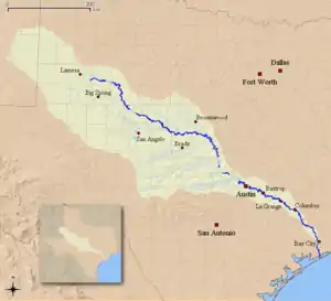
- Colorado River
- Cummins Creek
- Bull Creek
- Onion Creek
- Barton Creek
- Pedernales River
- Llano River
- Gentry Creek
- North Llano River
- South Llano River
- San Saba River
- Pecan Bayou
- Home Creek
- Concho River
- Kickapoo Creek
- North Concho River
- South Concho River
- Spring Creek (Tom Green County, Texas)
- Middle Concho River
- Beals Creek
- Tres Palacios Creek
- Garancahua Creek
- Lavaca River
- Garcitas Creek


Rio Grande

10 longest rivers
Of the following 10 rivers, all empty into the Gulf of Mexico. Four of the rivers are tributaries: The Pecos flows into the Rio Grande, the Red into the Mississippi River, and the Sabine and Neches flow into Sabine Lake which is connected to the Gulf of Mexico by Sabine Pass. The Canadian is a tributary of a tributary and flows into the Arkansas River which is itself a tributary of the Mississippi.
- Rio Grande – 1,896 miles (3,051 km), 1,250 miles (2,010 km) of which are in Texas (although technically on the border between Texas and Mexico)
- Red River – 1,360 miles (2,190 km) of which 680 miles (1,090 km) are in Texas
- Brazos River – 1,280 miles (2,060 km) of which 840 miles (1,350 km) are in Texas, making it the longest section of river in Texas
- Pecos River – 926 miles (1,490 km) most of which is in New Mexico
- Colorado River – 862 miles (1,387 km) almost entirely in Texas of which 600 miles (970 km) are not dry
- Canadian River – 760 miles (1,220 km) of which 200 miles (320 km) are in Texas
- Trinity River – 423 miles (681 km) entirely in Texas
- Sabine River – 360 miles (580 km) of which 360 miles (580 km) are in Texas
- Neches River – 416 miles (669 km) entirely in Texas
- Nueces River – 315 miles (507 km) entirely in Texas
The Trinity River is the longest river with its entire drainage basin in Texas. The Colorado is the longest river with both its source based on river name and its mouth in the state. The actual longest source of the Colorado is in New Mexico.
Shortest river
The Comal River is the shortest river in the state of Texas and the fifth-shortest river in the United States. Located entirely within the city limits of New Braunfels in Central Texas, its spring-fed waters run a distance of 2.5 miles (4 kilometers).
See also
| Wikimedia Commons has media related to Rivers of Texas. |
References
- "Texas River Guide". Texas Parks and Wildlife Department. Retrieved 12 February 2013.
- "Outline Maps of the Major Rivers of Texas". EnchantedLearning.com. Retrieved 12 February 2013.
- "An Analysis of Texas Waterways". Retrieved 2006-05-04.
- USGS Geographic Names Information Service
- USGS Hydrologic Unit Map - State of Texas (1974)
- "River Basin Map of Texas". Bureau of Economic Geology, University of Texas at Austin. 1996. Archived from the original (JPEG) on 2012-04-10. Retrieved 2006-07-22.
