List of parishes in the Roman Catholic Archdiocese of Washington
The following is a list of parishes in the Roman Catholic Archdiocese of Washington.
Montgomery County
Parishes of the archdiocese located in Montgomery County, Maryland.
Upper Montgomery East Deanery
| Parish | Location | Founded | Map Coordinates | |
|---|---|---|---|---|
 |
Resurrection | Burtonsville | 1981 | 39.097186°N 76.943586°W |
.JPG.webp) |
St. Francis of Assisi | Derwood | 1972 | 39.141552°N 77.135429°W |
 |
St. Andrew Kim | Olney | 1974 | 39.145254°N 77.050578°W |
 |
St. Peter | 1953 | 39.148525°N 77.062166°W | |
.JPG.webp) |
Shrine of St. Jude | Rockville | 1956 | 39.065139°N 77.096883°W |
_01.JPG.webp) |
St. Mary | 1813 | 39.081600°N 77.144562°W | |
| Our Lady of China (Pastoral Mission) (Chinese Community) |
1983 | |||
 |
St. Patrick | 1966 | 39.108494°N 77.082249°W | |
 |
Our Lady of Grace | Silver Spring | 1983 | 39.112216°N 77.067743°W |
 |
Saint Andrew the Apostle | 1959 | 39.047105°N 77.031283°W | |
 |
St. Catherine Labouré | Wheaton | 1951 | 39.048318°N 77.068650°W |
Upper Montgomery West Deanery
| Parish | Location | Founded | Map Coordinates | |
|---|---|---|---|---|
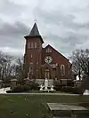 |
St. Mary | Barnesville | 1807 | 39.221058°N 77.380628°W |
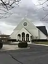 |
St. Paul | Damascus | 1957 | 39.283404°N 77.193002°W |
.JPG.webp) |
Our Lady of the Visitation | Darnestown | 1991 | 39.102787°N 77.294836°W |
.JPG.webp) |
St. John Neumann | Gaithersburg | 1978 | 39.193992°N 77.186107°W |
.JPG.webp) |
St. Martin of Tours | 1920 | 39.138421°N 77.194362°W | |
.JPG.webp) |
St. Rose of Lima | 1972 | 39.150227°N 77.241612°W | |
.jpg.webp) |
Mother Seton | Germantown | 1974 | 39.182952°N 77.273180°W |
.JPG.webp) |
Our Lady of the Presentation | Poolesville | 1992 | 39.135328°N 77.404768°W |
Middle Montgomery County Deanery
| Parish | Location | Founded | Map Coordinates | |
|---|---|---|---|---|
 |
German Pastoral Mission (Connelly School of the Holy Child) |
Bethesda | 1992 | 39.000220°N 77.187652°W |
 |
Little Flower | 1948 | 38.961689°N 77.112265°W | |
 |
Our Lady of Lourdes | 1926 | 38.985317°N 77.091673°W | |
.JPG.webp) |
St. Bartholomew | 1960 | 38.983959°N 77.140594°W | |
 |
St. Jane Frances de Chantal | 1950 | 39.013253°N 77.116526°W | |
.JPG.webp) |
Holy Cross | Garrett Park | 1960 | 39.033501°N 77.098091°W |
.JPG.webp) |
Holy Redeemer | Kensington | 1948 | 39.013813°N 77.084784°W |
_01.JPG.webp) |
Our Lady of Mercy | Potomac | 1959 | 39.009332°N 77.173272°W |
.JPG.webp) |
St. Elizabeth | Rockville | 1964 | 39.054421°N 77.136734°W |
.JPG.webp) |
St. Raphael | 1966 | 39.061712°N 77.175873°W |
Lower Montgomery County Deanery
| Parish | Location | Founded | Map Coordinates | |
|---|---|---|---|---|
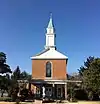 |
Christ the King | Silver Spring | 1961 | 38.994582°N 77.048585°W |
 |
Our Lady, Queen of Poland and St. Maximilian Kolbe |
1983 | 39.016046°N 77.051503°W | |
 |
Our Lady of Vietnam | 1990 | 39.049785°N 76.994408°W | |
 |
St. Bernadette | 1948 | 39.020178°N 77.008787°W | |
 |
St. Camillus | 1951 | 39.009519°N 76.981753°W | |
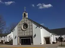 |
St. John the Baptist | 1960 | 39.058381°N 76.995516°W | |
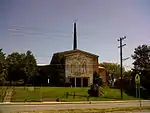 |
St. John the Evangelist | 1774 | 39.022459°N 77.044459°W | |
 |
St. Michael the Archangel | 1930 | 38.996929°N 77.022876°W | |
 |
Our Lady of Sorrows | Takoma Park | 1932 | 38.977637°N 76.991178°W |
Prince George’s County
Parishes of the archdiocese located in Prince George's County, Maryland.
Upper Prince George’s County Deanery
| Parish | Location | Founded | Map Coordinates | |
|---|---|---|---|---|
 |
St. Joseph | Beltsville | 1956 | 39.036149°N 76.920937°W |
 |
Ascension | Bowie | 1893 | 39.006268°N 76.787877°W |
 |
Sacred Heart | 1965 | 38.983402°N 76.721473°W | |
 |
St. Edward the Confessor | 1972 | 38.914939°N 76.723368°W | |
 |
St. Pius X | 1962 | 38.976187°N 76.750171°W | |
 |
St. Hugh of Grenoble | Greenbelt | 1947 | 39.004941°N 76.879514°W |
 |
St. Matthias the Apostle | Lanham | 1961 | 38.964347°N 76.840831°W |
 |
St. Mary of the Mills | Laurel | 1843 | 39.108006°N 76.855919°W |
| St. Nicholas | 1967 | 39.072289°N 76.858635°W |
Middle Prince George’s County Deanery
| Parish | Location | Founded | Map Coordinates | |
|---|---|---|---|---|
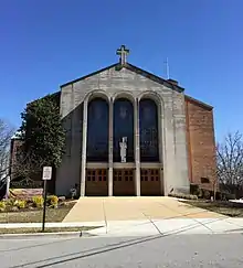 |
St. Ambrose | Cheverly | 1949 | 38.928985°N 76.908225°W |
.JPG.webp) |
St. John Baptist de La Salle | Chillum | 1951 | 38.960338°N 76.987249°W |
.JPG.webp) |
Holy Redeemer | College Park | 1912 | 38.994727°N 76.928379°W |
 |
St. Jerome | Hyattsville | 1886 | 38.953365°N 76.942763°W |
.JPG.webp) |
St. Mark the Evangelist | 1958 | 38.982305°N 76.954433°W | |
 |
St. Mary | Landover Hills | 1960 | 38.947532°N 76.888307°W |
 |
St. Joseph | Largo | 1922 | 38.918075°N 76.843723°W |
.JPG.webp) |
St. James | Mt. Rainier | 1946 | 38.937986°N 76.958319°W |
 |
St. Margaret of Scotland | Seat Pleasant | 1908 | 38.882736°N 76.896769°W |
 |
St. Bernard of Clairvaux | Riverdale Park | 1948 | 38.957414°N 76.915518°W |
| Our Lady of Fatima (Portuguese Community) |
1999 |
Lower Prince George’s County Deanery
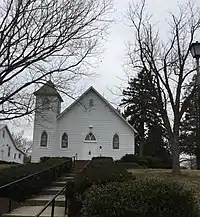
Front view of Old Most Holy Rosary Church, Rosaryville, MD 38.756985°N 76.811449°W
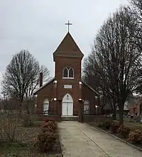
Front view of Old St Mary Church, Piscataway, MD 38.704375°N 76.967066°W
| Parish | Location | Founded | Map Coordinates | |
|---|---|---|---|---|
 |
St. Philip the Apostle | Camp Springs | 1957 | 38.822040°N 76.912950°W |
 |
St. John the Evangelist | Clinton | 1875 | 38.767344°N 76.898138°W |
 |
St. Mary, Piscataway | 1830 | 38.704982°N 76.967892°W | |
 |
Holy Spirit | Forestville | 1966 | 38.867129°N 76.863518°W |
 |
Mount Calvary | 1942 | 38.852397°N 76.890598°W | |
 |
Holy Family | Hillcrest Heights | 1952 | 38.835862°N 76.965253°W |
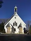 |
Holy Family | Mitchellville | 1938 | 38.922774°N 76.796798°W |
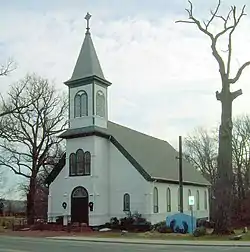 |
St. Ignatius | Oxon Hill | 1849 | 38.804485°N 76.966669°W |
 |
St. Columba | 1960 | 38.783699°N 76.991085°W | |
| Most Holy Rosary | Rosaryville | 1966 | 38.749159°N 76.804868°W | |
 |
St. Bernardine of Siena | Suitland | 1966 | 38.857797°N 76.920259°W |
 |
St. Mary of the Assumption | Upper Marlboro | 1824 | 38.818677°N 76.748152°W |
Southern Maryland
Parishes of the archdiocese located in Calvert County, Charles County, and St. Mary's County of Southern Maryland.
Calvert County Deanery
| Parish | Location | Founded | Map Coordinates | |
|---|---|---|---|---|
 |
Jesus the Divine Word | Huntingtown | 1994 | 38.610723°N 76.594148°W |
 |
St. Anthony | North Beach | 1962 | 38.703254°N 76.533658°W |
 |
Jesus the Good Shepherd | Owings | 1985 | 38.709016°N 76.638141°W |
 |
St. John Vianney | Prince Frederick | 1965 | 38.537595°N 76.580676°W |
 |
Our Lady Star of the Sea | Solomons | 1888 | 38.324649°N 76.458659°W |
Charles County Deanery
| Parish | Location | Founded | Map Coordinates | |
|---|---|---|---|---|
 |
St. Dominic | Aquasco | 1974 | 38.581861°N 76.723854°W |
 |
St. Michael | Baden | 1957 | 38.649774°N 76.770322°W |
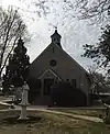 |
St. Francis de Sales | Benedict | 1903 | 38.514441°N 76.679040°W |
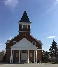 |
St. Mary | Bryantown | 1793 | 38.539452°N 76.837188°W |
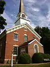 |
St. Ignatius | Chapel Point | 1641 (c.) | 38.465522°N 77.023855°W |
 |
St. Ignatius of Loyola | Hilltop | 1851 | 38.483943°N 77.140641°W |
 |
St. Mary, Star of the Sea | Indian Head | 1901 | 38.596054°N 77.167594°W |
 |
Holy Ghost | Issue | 1904 | 38.299068°N 76.880452°W |
 |
Sacred Heart | La Plata | 1755 | 38.526222°N 76.978855°W |
 |
St. Catherine of Alexandria | McConchie | 1911 | 38.502587°N 77.058458°W |
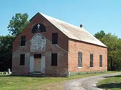 |
St. Mary | Newport | 1674 | 38.433720°N 76.909659°W |
 |
St. Joseph | Pomfret | 1763 | 38.586694°N 77.024245°W |
| Our Lady Help of Christians | Waldorf | 1980 | 38.602674°N 76.898308°W | |
 |
St. Peter | 1700 | 38.620057°N 76.861267°W |
St. Mary’s County Deanery
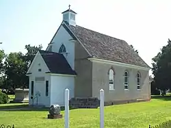
Historic St. Ignatius, located in St. Inigoes, St. Mary's County, Maryland, was the First Catholic parish in English speaking North America.
38.150327°N 76.423943°W
38.150327°N 76.423943°W
| Parish | Location | Founded | Map Coordinates | |
|---|---|---|---|---|
 |
Holy Angels | Avenue | 1906 | 38.254756°N 76.768398°W |
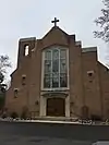 |
Sacred Heart | Bushwood | 1755 | 38.302415°N 76.792218°W |
 |
Our Lady of the Wayside | Chaptico | 1938 | 38.367196°N 76.777396°W |
 |
Holy Face | Great Mills | 1879 | 38.239203°N 76.509159°W |
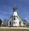 |
St. John Francis Regis | Hollywood | 1690 | 38.332558°N 76.559112°W |
 |
St. Aloysius | Leonardtown | 1710 | 38.294658°N 76.635027°W |
 |
Immaculate Heart of Mary | Lexington Park | 1947 | 38.280683°N 76.472482°W |
 |
Immaculate Conception | Mechanicsville | 1876 | 38.442831°N 76.748233°W |
 |
Our Lady’s Church at Medley’s Neck | Medley’s Neck | 1776 | 38.261122°N 76.620520°W |
 |
St. Joseph | Morganza | 1700 | 38.375978°N 76.696992°W |
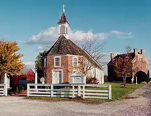 |
St. Francis Xavier | Newtowne | 1640 | 38.255698°N 76.700042°W |
 |
St. Michael | Ridge | 1890 | 38.121551°N 76.367045°W |
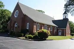 |
St. Peter Claver | St. Inigoes | 1952 | 38.131517°N 76.381721°W |
 |
St. Cecilia | St. Mary’s City | 1975 | 38.191053°N 76.416890°W |
 |
St. George | Valley Lee | 1851 | 38.194954°N 76.503304°W |
Washington, D.C.
Parishes of the archdiocese located in Washington, D.C..
Northwest-East Deanery
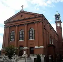
St. Aloysius was a parish church from 1859 until 2012 when it was merged with Holy Redeemer parish. 38.901559°N 77.009452°W
| Parish | Founded | Map Coordinates | |
|---|---|---|---|
 |
Holy Redeemer | 1922 | 38.905339°N 77.014175°W |
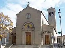 |
Holy Rosary | 1913 | 38.897583°N 77.015036°W |
 |
Immaculate Conception | 1864 | 38.907398°N 77.022583°W |
 |
Nativity | 1901 | 38.963225°N 77.029088°W |
 |
St. Augustine | 1865 | 38.918341°N 77.034254°W |
 |
St. Gabriel | 1920 | 38.943728°N 77.020003°W |
 |
St. Martin of Tours | 1801 | 38.915779°N 77.009330°W |
 |
St. Mary, Mother of God | 1845 | 38.899362°N 77.018749°W |
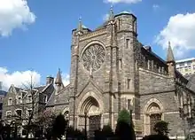 |
St. Patrick | 1794 | 38.897921°N 77.025811°W |
Northwest-West Deanery
| Parish | Founded | Map Coordinates | |
|---|---|---|---|
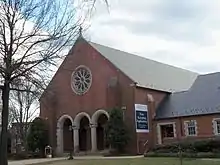 |
Annunciation | 1948 | 38.930191°N 77.075766°W |
 |
Blessed Sacrament | 1911 | 38.968386°N 77.075413°W |
 |
Cathedral of St. Matthew | 1840 | 38.906224°N 77.040129°W |
 |
Epiphany | 1925 | 38.907579°N 77.056438°W |
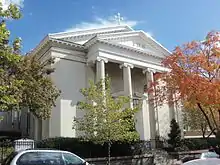 |
Holy Trinity | 1791 | 38.907175°N 77.070122°W |
 |
Our Lady, Queen of the Americas | 1985 | 38.915845°N 77.049173°W |
 |
Our Lady of Victory | 1910 | 38.916283°N 77.094899°W |
| St. Blaise (Pastoral Mission) (Croation Community) |
|||
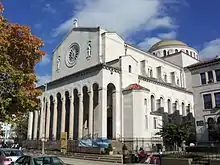 |
Sacred Heart | 1911 | 38.931175°N 77.035910°W |
 |
St. Ann | 1869 | 38.946567°N 77.079283°W |
 |
St. Louis de France | 1978 | 38.956201°N 77.081804°W |
 |
St. Stephen, Martyr | 1867 | 38.903307°N 77.053050°W |
 |
St. Thomas the Apostle | 1913 | 38.925986°N 77.055046°W |
Northeast Deanery
| Parish | Founded | Map Coordinates | |
|---|---|---|---|
 |
Holy Comforter-St. Cyprian | 1893 | 38.889558°N 76.986046°W |
 |
Holy Name | 1892 | 38.901905°N 76.991706°W |
 |
St. Anthony of Padua | 1892 | 38.932290°N 76.991200°W |
 |
St. Benedict the Moor | 1946 | 38.893865°N 76.975304°W |
 |
St. Dominic | 1852 | 38.882954°N 77.020264°W |
 |
St. Francis de Sales | 1722 | 38.929141°N 76.975546°W |
 |
St. Joseph's on Capitol Hill | 1868 | 38.893812°N 77.003339°W |
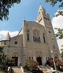 |
St. Peter's on Capitol Hill | 1820 | 38.885825°N 77.003760°W |
 |
St. Vincent de Paul | 1903 | 38.876692°N 77.008835°W |
| Kidane-Mehret Ge’ez Rite Catholic Church (Ethiopian Community) |
Southeast Deanery
| Parish | Founded | Map Coordinates | |
|---|---|---|---|
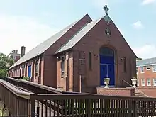 |
Assumption | 1916 | 38.841103°N 77.004015°W |
 |
Incarnation | 1925 | 38.901564°N 76.920739°W |
 |
Our Lady, Queen of Peace | 1948 | 38.883020°N 76.947909°W |
 |
Our Lady of Perpetual Help | 1920 | 38.857396°N 76.982325°W |
 |
St. Francis Xavier | 1924 | 38.872409°N 76.967353°W |
 |
St. Luke | 1957 | 38.889378°N 76.930805°W |
 |
St. Teresa of Avila | 1879 | 38.865570°N 76.987743°W |
 |
St. Thomas More | 1952 | 38.825445°N 77.000027°W |
External link
- Complete Directory of the Archdiocese of Washington
This article is issued from Wikipedia. The text is licensed under Creative Commons - Attribution - Sharealike. Additional terms may apply for the media files.
