List of Ultras of the Himalayas
This is a list of all the Ultra prominent peaks (with topographic prominence greater than 1,500 metres) in the Himalayas. Listed separately, to the west and north-west are the Karakoram and Hindu Kush Ultras, and while to the north-east and east are the ultras of Tibet.
9 of the 10 Himalayan 8,000m peaks are ultras (the exception is Lhotse), and there are a further 28 peaks over 7000m.
Punjab - Between Indus and Sutlej Rivers
| No | Peak | Country | Elevation (m) | Prominence (m) | Col (m) |
|---|---|---|---|---|---|
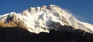
| 1 | Nanga Parbat | 8,125 | 4,608 | 3517 | |
| 2 | Nun | 7,135 | 2,404 | 4731 | |
| 3 | Shikar Beh | 6,200 | 2,223 | 3977 | |
| 4 | Parbati Parbat | 6,633 | 2,093 | 4540 | |
| 5 | Reo Purgyil | 6,816 | 1,978 | 4838 | |
| 6 | Sunset Peak | 4,745 | 1,942 | 2803 | |
| 7 | Miranjani | 2,981 | 1,911 | 1070 | |
| 8 | Gya | 6,794 | 1,910 | 4884 | |
| 9 | Dofana | 5,940 | 1,875 | 4065 | |
| 10 | Point 5608 | 5,608 | 1,850 | 3758 | |
| 11 | Manirang | 6,593 | 1,727 | 4866 | |
| 12 | Point 5800 | 5,800 | 1,682 | 4118 | |
| 13 | Point 6086 | 6,086 | 1,618 | 4468 | |
| 14 | Bharanzar | 6,574 | 1,606 | 4968 | |
| 15 | Mulkila | 6,517 | 1,586 | 4931 | |
| 16 | Kolahoi | 5,425 | 1,585 | 3840 | |
| 17 | Point 5971 | 5,971 | 1,566 | 4405 | |
| 18 | Junkor | 5,373 | 1,563 | 3810 | |
| 19 | Doda | 6,573 | 1,504 | 5069 | |
Garwhal - Sutlej to Kali Rivers
| No | Peak | Country | Elevation (m) | Prominence (m) | Col (m) |
|---|---|---|---|---|---|
| 1 | Nanda Devi | 7,816 | 3,139 | 4677 | |
| 2 | Kamet | 7,756 | 2,825 | 4931 | |
| 3 | Rangrik Rang | 6,684 | 1,674 | 5010 | |
| 4 | Haathi Parvat | 6,727 | 1,673 | 5054 | |
| 5 | Trisul | 7,120 | 1,616 | 5504 | |
| 6 | Panchchuli | 6,904 | 1,614 | 5290 | |
| 7 | Chaukhamba | 7,138 | 1,594 | 5544 | |
| 8 | Nanda Kot | 6,861 | 1,592 | 5269 | |
Western Nepal: Sharda River to Kali Gandaki River
| No | Peak | Country | Elevation (m) | Prominence (m) | Col (m) |
|---|---|---|---|---|---|
| 1 | Dhaulagiri | 8,167 | 3,357 | 4810 | |
| 2 | Gurla Mandhata | 7,694 | 2,788 | 4906 | |
| 3 | Dhaulagiri II | 7,752 | 2,397 | 5355 | |
| 4 | Api | 7,132 | 2,040 | 5092 | |
| 5 | Kanjiroba | 6,883 | 1,870 | 5013 | |
| 6 | Saipal | 7,031 | 1,824 | 5207 | |
| 7 | Kubi Gangri | 6,859 | 1,699 | 5160 | |
| 8 | Deora | 4,390 | 1,678 | 2712 | |
| 9 | Changla | 6,721 | 1,657 | 5064 | |
| 10 | Bhalu Lek | 5,425 | 1,643 | 3782 | |
| 11 | Jethi Bahurani | 6,850 | 1,558 | 5292 |
The Kali Gandaki River is normally considered to mark the divide between the Western and Eastern Himalayas.
Central Nepal: Kali Gandaki River to Arun River
| No | Peak | Country | Elevation (m) | Prominence (m) | Col (m) |
|---|---|---|---|---|---|
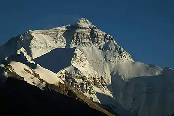
| 1 | Mount Everest | 8,848 | 8,848 | 0 | |
| 2 | Manaslu | 8,163 | 3,092 | 5071 | |
| 3 | Annapurna I | 8,091 | 2,984 | 5107 | |
| 4 | Shishapangma | 8,027 | 2,897 | 5130 | |
| 5 | Annapurna II | 7,937 | 2,437 | 5500 | |
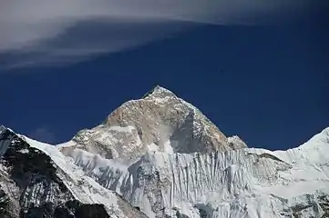
| 6 | Makalu | 8,485 | 2,378 | 6107 | |
| 7 | Yangra | 7,422 | 2,352 | 5070 | |
| 8 | Cho Oyu | 8,188 | 2,340 | 5848 | |
| 9 | Chamar | 7,165 | 2,061 | 5104 | |
| 10 | Labuche Kang | 7,367 | 1,957 | 5410 | |
| 11 | Nemjung | 7,140 | 1,920 | 5220 | |
| 12 | Tsanglha Ri (Zang La) | 6,495 | 1,712 | 4783 | |
| 13 | Himalchuli | 7,893 | 1,633 | 6260 | |
| 14 | Pangpoche | 6,620 | 1,622 | 4998 | |
| 15 | Gauri Sankar | 7,146 | 1,600 | 5546 | |
| 16 | Melungtse | {{ CHN}} | 7,181 | 1,551 | 5630 |
| 17 | Langtang Lirung | 7,234 | 1,534 | 5700 | |
Arun River to Bhutan border
| No | Peak | Country | Elevation (m) | Prominence (m) | Col (m) |
|---|---|---|---|---|---|
| 1 | Kangchenjunga | 8,586 | 3,922 | 4664 | |
| 2 | Pauhunri | 7,128 | 2,035 | 5093 | |
| 3 | Nyonno Ri | 6,724 | 1,805 | 4919 | |
| 4 | Pandim | 6,691 | 1,762 | 4929 | |
| 5 | Chomo Yummo | 6,829 | 1,559 | 5270 | |
Bhutan to the Brahmaputra (Assam Himalaya)
| No | Peak | Country | Elevation (m) | Prominence (m) | Col (m) |
|---|---|---|---|---|---|
| 1 | Namcha Barwa | 7,782 | 4,106 | 3676 | |
| 2 | Gangkhar Puensum | 7,570 | 2,995 | 4575 | |
| 3 | Kangto | 7,060 | 2,195 | 4865 | |
| 4 | Noijin Kangsang | 7,191 | 2,145 | 5046 | |
| 5 | Chomolhari | 7,326 | 2,077 | 5249 | |
| 6 | Yarla Shampo | 6,636 | 1,805 | 4831 | |
| 7 | Tongshanjiabu | 7,207 | 1,757 | 5450 | |
| 8 | Nyegyi Kansang | 7,047 | 1,752 | 5295 | |
| 9 | Point 5980 | 5,980 | 1,747 | 4233 | |
| 10 | Tarlha Ri | 6,777 | 1,697 | 5080 | |
| 11 | HP Dafla Range | 3,776 | 1,684 | 2092 | |
| 12 | Point 5641 | 5,641 | 1,681 | 3960 | |
| 13 | Kula Kangri | 7,553 | 1,669 | 5884 | |
| 14 | Tarka La | 4,735 | 1,624 | 3111 | |
| 15 | Kazi Razi | 6,505 | 1,561 | 4944 | |
| 16 | Point 6215 | 6,215 | 1,521 | 4694 | |
| 16 | Point 5840 | 5840 | 1,511 | 4329 | |
Sources
This article is issued from Wikipedia. The text is licensed under Creative Commons - Attribution - Sharealike. Additional terms may apply for the media files.


