List of Archaeological Protected Monuments in Ampara District
This is a list of Archaeological Protected Monuments in Ampara District, Sri Lanka.[1]
| Monument | Image | Location | Grama Niladhari Division |
Divisional Secretary's Division |
Registered | Description | Refs |
|---|---|---|---|---|---|---|---|
| A. C. camp village ruins | A. C. camp village | Kotawehera | Ampara | 10 October 2014 | Rocks with paintings of Pre historic era, cave inscriptions and drip ledged caves in the forest of A. C. camp (latitude 07º 14' 59.8 N and longitude 081º 37' 35E) | [2] | |
| Abayasinghepura ruins | Abayasinghepura | No. PP 03 Panama | Lahugala | 10 October 2014 | The cave and surrounding area with archaeological evidences at Abayasinghepura (on the road leads to fisheries village and lagoon) (latitude 06º 76653' N and longitude 081º 81470'E) | [3] | |
| Akkara 100 yaya ruins | Karangawa | No. W/89/J, Karangawa | Ampara | 10 October 2014 | Rock plain on which the pieces of terracotta are scattered and the surrounding area in the area called Akkara 100 yaya West (latitude 07º 18' 24.1 N and longitude 081º 39' 36.3E) | [2] | |
| Akuloba ruins | Akuloba | Borapola | Mahaoya | 10 October 2014 | Other archaeological remains with hillock of ancient Dagoba, ruins of buildings with stone pillars at the area surrounding Akuloba Paddy fields of (Latitude 07º 50116' N and longitude 081º 38752' E) | [4] | |
| Akuloba ruins | Akuloba | Borapola | Maha Oya | 26 December 2014 | Site of the ruins of buildings (Latitude 07º 52´ 30.7´´ N and longitude 081º 39´ 29.9´´ E) | [5] | |
| Alankulama ruins | Alankulama | No. 17 Addalachchenei | Addalachchenai | 10 October 2014 |
|
[6] | |
| Aligala | No. W/89/B, Samapura | Ampara | 10 October 2014 | Rock plain with archaeological evidences including the rock inscription, flight of steps, ruins of buildings, chronicles situated towards West from Japan Sama Chaitya at the place called Aligala in the area of Hardy Technical College (latitude 07º 17' 09.9 N and longitude 081º 38' 58.0E) | [2] | ||
| Aligambe ruins | Aligambe | Aligambe | Alayadiwembu | 10 October 2014 |
|
[7] | |
| Alioluwa Wewa ruins | Colony No. B 07 | No. W/86/H, Ambamalthalawa | Ampara | 26 December 2014 | Site of the construction of ancient buildings with stone pillars at Catchment area of Alioluwa lake (Latitude 07º 14´ 54.2´´ N and longitude 81º 34´ 12.9´´ E) | [8] | |
| Aloka Raja Maha Vihara | Ekgaloya | No. W/24/B, Ekgaloya | Damana | 26 December 2014 | All places of ruins of ancient Arama complex including ancient Chaithya and ruins of buildings (Latitude 07º 18´ 43.8´´ N and longitude 81º 64´ 50.3´´ E) | [9] | |
| Anaulundal Wayal ruins | Anaulundal | No. AP/20A/4 Aalimnahar | Akkaraipattu | 10 October 2014 | Rock with the remains of ancient building and chisel holing at the place called “Anaulundal Wayal” (latitude 07º 71' 94 N and longitude 081º 76' 11.2E) | [6] | |
| Andirayan cemetery | Walathapitiya | No. 89B, Walathapitiya 011 | Samanthurai | 10 October 2014 | Place with the remains of ancient settlement (Pieces of pottery scattered in the area) at the place called Andirayan cemetery (latitude 07º 18' 02.5 N and longitude 081º 43' 18E) | [10] | |
| Aralupitiya ancient bridge | No. 140, Kehelulla | Padiyathalawa | 10 October 2014 | (latitude 07º 19' 372 N and longitude 081º 13' 554 E) | [11] | ||
| Aranthalawa ruins | Aranthalawa | Aranthalawa | Mahaoya | 10 October 2014 | Aranthalawa hillock of ruins with the hillock of ancient Chaitya and other archeological remains at the place of (Latitude 07º 60659' N and longitude 081º 42708' E) | [4] | |
| Ariyakara Vihara | Peranigama | Thottama W/25 | Damana | 10 October 2014 | A rock called “Vehera Pudamaya” with other archaeological evidences including inscriptions at Ariyakara Vihara premises, ruins of buildings, flight of steps, illustrations of animals and other sketches | [12] | |
| Aththaikandam ruins | Kambiluwil 02 | Thirukkovil | 26 December 2014 | Hillock of ancient Stupa, ruins of buildings at surrounding area and rock plane with archeological ruins belonging to the village (latitude 07º 08´ 17´´ N and longitude 81º 48´ 46´´ E) | [13] | ||
| Athurugiri Purana Raja Maha Vihara | Kudaharasgala | Kudaharasgala | Mahaoya | 10 October 2014 | Places with ruins of buildings and other archaeological remains (Latitude 07º 48533' N and longitude 081º 33737' E) | [4] | |
| Balagala Wewa | Bandaraduwa | No. W/104B/2, Bandaraduwa | Uhana | 10 October 2014 | [14] | ||
| Bandaraduwa Megalithic cemeteries | No. W/104B/2, Bandaraduwa | Uhana | 26 December 2014 | (Latitude 071º 25´ 26.7´´ N and longitude 081º 34´ 32.2´´ E) | [5] | ||
| Berawaniwela archaeological site | Berawaniwela | No. PP 02 Panama South | Lahugala | 10 October 2014 | Site with archaeological ruins (latitude 06º 75356' N and longitude 081º 77824' E) | [15] | |
| Buddhangala Forest Hermitage | 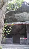 | Ampara | [16] | ||||
| Buddhist colony ruins | Buddhist colony | No. 1 Dighavapi | Addalachchenai | 10 October 2014 | Drip ledged cave complex with cave inscriptions and cave inscriptions | [6] | |
| Bulathwaththayaya ruins | Kahatagasyaya | No. W/100/A/180, kahatagasyaya | Uhana | 10 October 2014 | Small rock with rock inscription and hillock of Dagoba at the place called Bulathwaththayaya (latitude 07º 19' 05 N and longitude 081º 34' 08E) | [14] | |
| Colony No. B 07 ruins | Colony No. B 07 | No. W/86/H, Ambamalthalawa | Ampara | 26 December 2014 | Rock plane with plight of steps in the paddy field (Latitude 07º 15´ 06.8´´ N and longitude 81º 34´ 15.5´´ E) | [8] | |
| Darampanawa archaeological site | Darampanawa | No. P 26 Hijranagar | Pothuvil | 10 October 2014 | Darampanawa archaeological site with pre historic art, cave inscriptions and all the drip edged caves, ruins of buildings, hillock covering chaitya, ponds and other archaeological evidence (latitude 06º 56' 10 N and longitude 081º 47' 09 E) | [7] | |
| Dewala Elakandiya Archaeological ruins | Pollebedda | Maha Oya | 23 January 2009 | The ancient ruins situated at Dewala Elakandiya ruins | [17] | ||
| Dewale kele ruins | Ellegoda | Kudaharasgala | Mahaoya | 10 October 2014 | Complex of ruins with all the places containing ancient buildings at the place called Dewalekele | [4] | |
| Dighavapi | 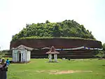 | Dighavapi | Addalachchenai | 18 April 1947 | The Stupa | [18][19] | |
| Dighavapi | Dighavapi | Addalachchenai | 31 December 1999 | Ancient caves with drip ledges and inscriptions, brick rampart, stone steps, stone pillars, carved holes on rock, workshops using stone posts and complete land with other ruins | [20] | ||
| Dighavapi village ruins | village No. 234 | No. 2 Dighavapi | Addalachchenai | 10 October 2014 | Rocks with drip ledged cave and Brahmi inscriptions and rocks with archaeological evidences including chisel holing situated in the paddy filed No. 234 | [6] | |
| Dissa wewa bund ruins | Mahawela | No. W/100/1, Lathugala | Uhana | 10 October 2014 | The rock plain with the bund of ancient Dissa wewa, evidences of ruined buildings connected to the lake and other archaeological evidences (latitude 07º 22' 06N and longitude 081º 33' 59E) | [14] | |
| Dissa wewa Spill | Panagolla | No. W/100/A/180, Kahatagasyaya | Uhana | 10 October 2014 | Spill with laid stone slabs and the bund of ancient lake called Dissa wewa (Latitude 07º 19' 54 N and longitude 081º 34' 32E) | [14] | |
| Diviyagala Raja Maha Vihara | No. W/27/D, Diviyagala | Damana | 26 December 2014 | Arama complex including ancient Chaithya all caves with inscriptions and drip ledges, rock inscriptions and ruins of buildings (Latitude 07º 22´ 798´´ N and longitude 81º 62´ 68.4´´ E) | [9] | ||
| Divulana mountain range ruins | Bandaraduwa | No. W/104B/2, Bandaraduwa | Uhana | 10 October 2014 | Ruins at Divulana mountain range with drip ledged caves with inscriptions | [14] | |
| Divulana Wewa ruins | Rajagalatenna | No. W/104/4025, Rajagalatenna South | Uhana | 10 October 2014 | Ancient Bisokotuwa, sluice, ancient bund of the lake and anicut in the middle of Divulana lake (latitude 07º 28' 05 N and longitude 081º 35' 47E) | [14] | |
| Dungalayaya ruins | Polwaga Colony | No. W/86/F, Polwaga Colony | Ampara | 26 December 2014 | Site of ruins with ancient stone pillars in the area called Dungalayaya, 117 (Latitude 07º 14´ 31.5´´ N and longitude 81º 35´ 22.6´´ E) | [8] | |
| Ekgal oya Reservoir ruins | Ekgal oya | No. W/24/B Ekgal oya | Damana | 10 October 2014 | Sites of the ruins of buildings with stone pillars in the middle of Ekgal oya tank (latitude 07º 15801' N and longitude 081º 61287' E) | [12] | |
| Elakatuwa Welyaya ruins | 9th Mile post | Perani Lahugala | Lahugala | 10 October 2014 | Site of ruins with ancient stone pillars and buildings located in the place (latitude 06º 87221' N and longitude 081º 70638' E) | [3] | |
| Eragama Wewa | Rahumanth Nagar, Kuduvil, Manikkamadu, Ameer Alipuram | No. 5-2-34005 Eragama 07, No. 5- 2-34-035 Eragama 01, No. 5-2-34-055 Eragama 04 and No. 5-2-34-025 Eragama 025 | Eragama | 10 October 2014 | The old sluice and the bund | [21] | |
| Eragama Wewa ruins | Eragama 01 | No. 5-2-34-035, Eragama 01 | Eragama | 26 December 2014 | Rock plane with archeological evidences (Olinda poru, crucible) and the place nearby where pieces of ancient pottery are scattered near Eragama lake (Latitude 07º 14´ 419.1´´ N and longitude 81º 43´ 056´´ E) | [13] | |
| Eththama ruins | Eththama | No. P/10, Eththama | Pothuvil | 26 December 2014 | Place with ancient stone pillars at the place where houses are situated in Eththama village (Latitude 06º 53´ 17´´ N and longitude 81º 49´ 33´´ E) | [13] | |
| Galahitiyagoda ruins | Galahitiyagoda | No. W/88A/170, Galahitiyagoda | Uhana | 26 December 2014 | Small rock plane with Chronicles at the area called 40 Idama (Latitude 07º 21´ 52´´ N and longitude 081º 36´ 23´´ E) | [5] | |
| Galapitagala ruins | Galapitagala | No. W/104/C, Galapitagala | Uhana | 26 December 2014 | Small rock with plight of steps near the road of paddy field No. 32/109 (Latitude 07º 27´ 34´´ N and longitude 081º 39´ 17´´ E) | [5] | |
| Galdebokkawa reserve ruins | Galdebokkawa | Kanchirankuda | Thirukkovil | 10 October 2014 | Rock plain with pre historic evidences in Galdebokkawa reserve | [22] | |
| Galkanda cave | Galkanda | Galkanda | Damana | 10 October 2014 | Cave inscriptions and drip ledged Galkanda cave (latitude 07º 15564' N and longitude 081º 05926' E) | [12] | |
| Galmaduwa Raja Maha Vihara, Ampara | 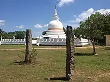 | Grama No. 05, Galmaduwa | No. W/27/H, Galmaduwa | Damana | 26 December 2014 | All archeological evidences including stone pillars and places of ancient buildings (Latitude 07º 26´ 23.5´´ N and longitude 81º 68´ 93.2´´ E) | [9] |
| Gamwela ruins | Gamwela | No. 141/C, Hagamwela | Padiyathalawa | 10 October 2014 | Rock with archaeological evidences in the land called Mungalawa (latitude 07º 26' 42.6 N and longitude 081º 13' 25.2 E) | [11] | |
| Gamawela ruins | Gamawela | No. 141/C, Hagamwela | Padiyathalawa | 26 December 2014 | The rocks with archeological evidences in the land called Gamawelawaththa (Latitude 07º26´ 24.7´´ N and longitude 81º 13´ 18.5´´ E) | [13] | |
| Girikumbala Raja Maha Vihara | No. WA104/020, Bakkiella | Uhana | 26 December 2014 | Bases of pillars Postholes, place with ruins of buildings where pieces of ancient bricks and tiles are scattered and inscription at the premises (Latitude 07º 18´ 21.2´´ N and longitude 081º 35´ 50.1´´ E) | [8] | ||
| Gonagala ruins | Gonagala | No. W/104C/2105, Gonagala | Uhana | 26 December 2014 | Site with chronicles on the rock plane in Paddy land No. 31/65 (Latitude 07º 25´ 55´´ N and longitude 081º 39´ 33´´ E) | [5] | |
| Gonagolla Vihara | 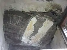 | Kothmale colony | No. W/104A/01/050, Kothmale | Uhana | 10 October 2014 | Rock with the paintings of Adiwasi people (Indigenous) and Anuradhapura era, all drip ledged caves, hillock of Dagoba buildings with stone pillars, places of ruins, rock inscriptions and flights of steps and buildings, and the rock with two ponds and base stones situated in Gonagolla cave temple (Punchi Seegiriya) | [10][23] |
| Gonanpanna ruins | Lathugala | No. W/100/1, Lathugala | Uhana | 10 October 2014 | Site of ruins of buildings and stone pillars and foundation at the area called Gonanpanna (latitude 07º 23' 51 N and longitude 081º 31' 22E) | [14] | |
| Gorikana stone quarry | 136 A 1 Borapola | Maha Oya | 23 January 2009 | The stone quarry situated on the Gorikana Mount slope | [17] | ||
| Grama 09 Keenawaththa ruins | 35A land | No. W/27/E, Keenawaththa | Damana | 26 December 2014 | Cave complex with drip ledges and inscriptions (Latitude 07º 22´ 98.2´´ N and longitude 81º 65´ 430´´ E) | [9] | |
| Hagamwela ruins | Hagamwela | No. 141/C, Hagamwela | Padiyathalawa | 10 October 2014 | Archaeological evidences found in Kokagala mountain range (latitude 07º 25' 028 N and longitude 081º 12' 910 E) | [11] | |
| Hagirigolla Kotawehera ruins | Grama 09 Keenawaththa | No. W/27/E, Keenawaththa | Damana | 26 December 2014 | Rock plane with ancient Chaithya and evidences of buildings in the middle of paddy field (Latitude 07º 24´ 250´´ N and longitude 81º 63´ 63.8´´ E) | [9] | |
| Harasgala Gallen Vihara | Harasgala | Kekirihena | Mahaoya | 10 October 2014 | All drip ledged caves at the premises (Latitude 07º 46573' N and longitude 081º 32880' E) | [4] | |
| Heda Oya stone anicut | 14 Kanuwegama | No. PP 12 Hulannuge West | Lahugala | 10 October 2014 | (latitude 06º 89074' N and longitude 081º 64542' E) | [7] | |
| Heda Oya ruins | Hulannuge | No. PP 12 | Lahugala | 10 October 2014 | Site of ruins with stone pillars near “Heda Oya” (latitude 06º 89073' N and longitude 081º 64594' E) | [3] | |
| Heda oya yaya ruins | Nugewewa | Hulannuge Kandahindagama | Lahugala | 10 October 2014 | The site with hillocks covered by stone pillars and stone plates situated in the area (latitude 06º 89592' N and longitude 081º 64335' E) | [7] | |
| Heethawanniya rock Archaeological ruins | 136 A 1 Borapola | Maha Oya | 23 January 2009 | The drip ledged rock caves with inscriptions situated on the Heethawanniya Mount slope | [17] | ||
| Hennanigala Raja Maha Vihara | Hennanigala | Dehiattakandiya | 23 February 2007 | Ancient Bodhigaraya, image house, pond with naga symbol, ancient rampart, Dathumandira, Poyage, Dagoba and the cave | [24] | ||
| Himidurawa ruins | Himidurawa | No. WA88-C270, Himidurawa | Uhana | 26 December 2014 | Site of the ruins of buildings with stone pillars (Latitude 07º 18´ 26.3´´ N and longitude 81º 37´ 52´´ E) | [8] | |
| Hinguremada Raja Maha Vihara | Hinguremada | Pollebedda | Mahaoya | 10 October 2014 | Hillock of ancient and all places containing ruins of buildings at the premises | [4] | |
| Horabokka ruins | No. 141/C, Hagamwela | Padiyathalawa | 10 October 2014 | Complex of ruins including all the caves with Brahmi inscription and drip ledges in the mountain range called Kokagalakanda (Horabokka) (latitude 07º 27' 24.8 N and longitude 081º 12' 28.4 E) | [11] | ||
| Hulannuge ruins | Hulannuge | No. PP/12, Hulannuge | Lahugala | 26 December 2014 | Hillock of ancient Dagoba and place of ruins with stone pillars at the place called 14th mile post belonging to Hulannuge village (Latitude 06º 91´ 566´´ N and longitude 81º 65´ 134´´ E) | [13] | |
| Hulannuge ruins | Hulannuge | No. PP 12 Hulannuge | Lahugala | 10 October 2014 | The site with drip edged caves, ancient brick mound, stairways carved in the natural rock and other archaeological evidences (latitude 06º 89494' N and longitude 081º 65807' E) | [7] | |
| Ibbige Ela | Wilathalawa | No. 144/A1, Iddapola | Mahaoya | 10 October 2014 | Place containing scattered slag within paddy land near Ibbige Ela (Latitude 07º 50540' N and longitude 081º 27970' E) | [4] | |
| Ilukpitiya cave | Ilukpitiya | W/27/A Peranigama, Hingurana | Damana | 10 October 2014 | (latitude 07º 21455' N and longitude 081º 66710' E) | [12] | |
| Ilukpitiya Purana Vihara | Peranigama | No. W/27/A, Peranigama | Damana | 26 December 2014 | All places with archaeological evidences including ancient Chaithya, cave complex with drip ledges and inscriptions and ruins of buildings (Latitude 07º 21´ 210´´ N and longitude 81º 66´ 47.8´´ E) | [9] | |
| Iluksena ruins | Iluksena (East) | No. 5-2-34-015 Eragama 02 | Eragama | 10 October 2014 | Rock with drip ledged cave (latitude 7º 13' 005 N and longitude 081º 44' 065 E) | [21] | |
| Isanganichmai ruins | Isanganichmai | No. AP/20A/3, Isanganichmai | Akkaraipattu | 26 December 2014 | Rock plane, where chisel holings and pices of ancient bricks and pottery and other archeological evidences are scattered, in the middle of paddy field (Latitude 071º 258´´ N and longitude 81º 47´ 55´´ E) | [9] | |
| Isanganichmai ruins | No. AP/20A/3, Isanganichmai | Akkaraipattu | 26 December 2014 | Rock plane with hillock of ancient Chaithya, places of the ruins of buildings and where ancient tiles, bricks etcare scattered, in the middle of paddy field belonging to Isanganichmai village (Latitude 07º 13´ 06´´ N and longitude 81º 47´ 46´´ E) | [8] | ||
| Kachchena Rahumanthi ruins | Kachchena Rahumanthi | No. 5-2-34-005 Eragama 07 | Eragama | 10 October 2014 | Natural rock boulder with stairways, base pockets, and natural rock plain with the signs of a drain and the rock plain with ruins of a Dagoba (Stupa) on the West and rock boulder where stairway is designed on the South (latitude 7º 13' 58 N and longitude 081º 45' 39 E) | [22] | |
| Kahatagasyaya ruins | Kahatagasyaya | No. W/100/A/180, Kahatagasyaya | Uhana | 10 October 2014 | Small rock plain with flight of steps, chisel holing and crucible (latitude 07º 20' 24 N and longitude 081º 34' 10E) | [14] | |
| Kambetta ruins | Kambetta | No. 02, Kambatta | Thirukkovil | 10 October 2014 | 03 rock boulders with archaeological evidence situated in the middle of the paddy field (latitude 07º 08' 21 N and longitude 081º 48' 07 E) | [11] | |
| Kanchikudiaru ruins | Kanchikudiaru | Kanchikudiaru | Thirukkovil | 10 October 2014 |
|
[22] | |
| Kandahindagama ruins | Kandahindagama | No. PP 12 Hulannuge West | Lahugala | 10 October 2014 | Buddhist Monastery complex with hillock covering chaitya, teras walls, brick mounds, rock cut line in the natural rock and stairways in 16th Milepost (latitude 06º 90573' N and longitude 081º 64342' E) | [7] | |
| Kandurugoda Archaeological Site | Kandurugoda | No. W/86C/005, Dambethalawa | Ampara | 10 October 2014 | The archaeological site with ancient chaitya, shrine, ruins of other buildings (latitude 07º 17' 33 N and longitude 081º 32' 45E) | [2] | |
| Karabana ruins | Wadinagala | Damana | 26 December 2014 | Archeological sites, where slags and pices of ancient pottery are scattered, belonging to Karabana village (Latitude 071º 05´ 38´´ N and longitude 81º 57´ 78.4´´ E) | [9] | ||
| Karabana ruins | Wadinagala | Damana | 26 December 2014 | Places of buildings with ancient stone pillars belonging to Karabana village (Latitude 71º 0884´´ N and longitude 81º 57´ 35.2´´ E) | [9] | ||
| Karandikulam Archaeological ruins | Karandikulam | Addalachchenai | 31 December 1999 | All rocks, carved stairway, ancient stone corry and ruins of buildings | [20] | ||
| Karankowa ruins | Karankowa (Kotawehera) | Pansalgoda | Lahugala | 10 October 2014 | Archaeological site with Chaithya mounds and ruins of buildings at Karankowa (latitude 06º 85258' N and longitude 081º 75067' E) | [3] | |
| Kethsirigama ruins | Kethsirigama | W/24 Kethsirigama | Damana | 10 October 2014 | Drip ledged cave at Kethsirigama with stone inscriptions (latitude 07º 17198' N and longitude 081º 58847' E) | [12] | |
| Kethsirigama ruins | Kethsirigama | W/26 Kethsirigama | Damana | 10 October 2014 | Site of the ruins of buildings with stone pillars in the middle of the paddy field (latitude 07º 17343' N and longitude 081º 57956' E) | [12] | |
| Kochchikachena Wellapatitamale ruins | Alankulama | No. 17 Addalachchenei | Addalachchenai | 10 October 2014 | Rock with rock inscriptions, flight of steps, base pockets, sediments of stone tools and remains of ancient pottery at the place called “Kochchikachena Wellapatitamale” | [6] | |
| Kohombana ruins | Kohombana | No. W/102/01, Walagampura | Uhana | 26 December 2014 | Site with ruins of buildings (Latitude 07º 23´ 18´´ N and longitude 081º 37´ 02´´ E) | [5] | |
| Kokkulama ruins | Kokkulama | No. 11C, Sagama | Thirukkovil | 10 October 2014 | Old settlement site with ancient pieces of pottery and stone archaeological evidences situated in Kokkulama reserve (latitude 07º 05' 22 N and longitude 081º 44' 58 E) | [11] | |
| Konduwattuwana Wewa ruins | 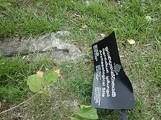 | Govikandawura | No. W/86/K 060 Kotawehera | Ampara | 10 October 2014 | Place with the ruins of ancient buildings at the area called Konduwatuwan (latitude 07º 16' 38.3 N and longitude 081º 38' 03.4E) | [2] |
| Kollegama Raja Maha Vihara (Holike) | No. 138, Holike | Padiyathalawa | 26 December 2014 | The place with ruins of buildings and other archeological relics at Ancient Temple premises (latitude 07º 22´ 098´´ N and longitude 81º 15´ 66.7´´ E) | [13] | ||
| Kolongemmegoda ruins | Wilathalawa | No. 144/A1, Iddapola | Mahaoya | 10 October 2014 | Kolongemmegoda rock plain with hillock of ancient Dagoba, ruins of buildings with stone pillars, ponds and sediments of stone tools of pre historic era (Latitude 07º 55420' N and longitude 081º 27977' E) | [4] | |
| Korai stone bridge | Vinayagapuram | Vinayagapuram 3 | Thirukkovil | 10 October 2014 | Stone bridge in the middle of Korai lagoon | [22] | |
| Kossagalakanda ruins | Rajagalatenna | No. W/104/A005, Walagampura | Uhana | 10 October 2014 | Kossagalakanda with drip ledged caves containing cave inscriptions and other marks in Kossagala village (latitude 07º 23' 58 N and longitude 081º 34' 59E) | [14] | |
| Kossapola cave complex | Kossapola | No. W/86/E, Wavinna South | Ampara | 10 October 2014 | Drip ledged cave complex (latitude 07º 14' 32.5 N and longitude 081º 35' 22.6E) | [2] | |
| Kotawehera forest ruins | Kotaweheragama | No. W/86/k 060, Kotawehera | Ampara | 10 October 2014 | The place with the ruins of ancient buildings and other archaeological evidences in Kotawehera forest (latitude 07º 16' 06.6 N and longitude 081º 37' 58.5E) | [2] | |
| Kotawehera Purana Raja Maha Vihara | Ganangolla | No. W/86/K, Kotawehera | Ampara | 26 December 2014 | Hillock of Chaithya, hillock of ruins and other archaeological evidences (Latitude 07º 15´ 29.7´´ N and longitude 81º 37´ 51.5´´ E) | [8] | |
| Kotawehera ruins | Kotawehera | Kotawehera | Ampara | 10 October 2014 |
|
[2] | |
| Kotigala rock Archaeological ruins | 136 A 1 Borapola | Maha Oya | 24 July 2009 | The drip-ledged cave and Brahmi letters and the drip-ledged cave at the Venue called Digavapya, Kotigala | [25] | ||
| Kotigala ruins | Pennanweli | No. SP 84C-005-07 Eragama | Eragama | 10 October 2014 |
30 E)
|
[21] | |
| Kotte Vihara | Thambiluvil 2 | Thambiluwil 2 | Thirukkovil | 10 October 2014 | Hillock covering Chaitya and Rock plain with evidences of stairway and building ruins | [22] | |
| Kudakalli ruins | Kudakalli | No. P 18 Sinnaulla | Pothuvil | 10 October 2014 | Rock boulder called Kudakalli with ancient buildings and stairways situated near Kudakalli lagoon (latitude 06º 49' 11 N and longitude 081º 49' 22.3 E) | [7] | |
| Kudumbigala | 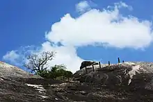 | Kunukola | No. PP 02 Panama South | Lahugala | 10 October 2014 | Place with all archaeological evidences including all drip ledged caves with inscriptions, with ancient buildings, hillocks covering Stupas and flight of steps (latitude 06º 67263' N and longitude 081º 74664' E) | [15][26] |
| Kuduvil ruins | Kuduvil | No. SP 84C-005-07 Eragama | Eragama | 10 October 2014 | Rock boulder with stairway Kethukawata and Terracotta remains in the area (latitude 7º 16' 07 N and longitude 081º 4' 39 E) | [22] | |
| Kuduvil ruins | Kuduvil | No. SP84C-005-07, Eragama (Irakkamam) | Eragama | 26 December 2014 | Two rocks with relics of Teracotta items and the place where iron has been produced, pieces of ancient pottery in Kuduwil village (Latitude 07º 16´ 10´´ N and longitude 81º 44´ 42´´ E) | [13] | |
| Kuduvil ruins | Kuduvil | No. 5-2-34-005-07, Eragama | Eragama | 26 December 2014 | Rock plane with ancient signs (signs of a mortar) and rock plane with evidences of ancient buildings belonging to Kuduwil village (Latitude 07º 16´ 09´´ N and longitude 81º 49´ 20´´ E) | [13] | |
| Kukul Kotuwa | Ashroff village | Oluvil | Addalachchenai | 10 October 2014 | Two rock plains with the ruins of ancient buildings | [6] | |
| Kukuluwa Raja Maha Vihara | Mahanagapura-Ihalagam | Thottama W/25 | Damana | 10 October 2014 | Archaeological evidences including ancient chaithya, ruins of buildings with stone pillars, ponds at the premises (latitude 07º 13884' N and longitude 081º 70325' E) | [12] | |
| Kunukola Lagoon ruins | Kunukolakanda | No. PP 02 Panama North | Lahugala | 10 October 2014 | Rock with evidences of the construction of ancient buildings, stone pillars, ponds and other archaeological evidences (latitude 06º 70694' N and longitude 081º 79292' E) | [15] | |
| Kurunduvinna Archaeological ruins | Kurunduvinna | Pollebedda | Maha Oya | 23 January 2009 | The ancient steps carved on the natural rock situated in the Village of Kurunduwinna | [17] | |
| Lahugala Kiri Vehera | 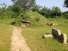 | Lahugala | Perani Lahugala PP 10 | Lahugala | 10 October 2014 | Ancient Chaithya and ruins of Vihara complex in the territory | [3] |
| Lahugala Kota Vehera | 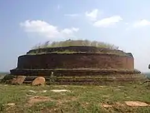 | Pansalgoda | Lahugala | 10 October 2014 | Buddhist Monastery complex with archaeological evidences including ancient Dagaba, building sites with stone pillars, flight of steps carved on natural rock plain, drip ledged caves located in the place (latitude 06º 87831' N and longitude 081º 75269' E) | [3] | |
| Lathugala ruins | Lathugala | No. W/100/1, Lathugala | Uhana | 10 October 2014 | Site of ruins of buildings and stone pillars (latitude 07º 23' 14 N and longitude 081º 33' 01E) | [14] | |
| Lunubokka (Nagiri) Aranya Senasana | Marava | No. 139B, Komana | Padiyathalawa | 10 October 2014 | All the caves with inscriptions, drip ledges and other archaeological remains (latitude 07º 21' 363 N and longitude 081º 19' 750 E) | [11] | |
| Madana Perani Wehera | Kahatagasyaya | No. W/100/A/180, Kahatagasyaya | Uhana | 10 October 2014 | Hillock of ancient Dagoba, place with ruins of buildings and stone pillars and other archaeological evidences in the surrounding area (Latitude 07º 18' 35 N and longitude 081º 33' 36E) | [14] | |
| Magul Maha Viharaya | 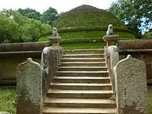 | Lahugala | Lahugala | 26 March 1954 | [27] | ||
| Mahanaga Nevi Camp ruins | Shasthrawela | Panama Shasthrawela | Lahugala | 10 October 2014 | Ruins of Buddhist monastery complex with all archaeological evidences with rock inscriptions, hillocks covering Dagabas, stone pillars and drains situated within the Mahanaga Nevi Camp (latitude 07º 17976' N and longitude 081º 5639.8' E) | [15] | |
| Mahathalawa ruins | Mahathalawa | Unuwathurabubula | Maha Oya | 26 December 2014 |
|
[28] | |
| Maha Wewa sliuce | 9th Mile post village | Perani Lahugala | Lahugala | 10 October 2014 | Ancient sluice of the tank called “Mahawewa” (latitude 06º 86940'N and longitude 081º 74312' E) | [3] | |
| Malayadikanda ruins | Madawalalanda | No. W/24/A Madawalalanda | Damana | 10 October 2014 | Drip ledged cave with inscriptions at “Malayadikanda” alias “Aranyakanda” (latitude 07º 19879' N and longitude 081º 68158' E) | [12] | |
| Malwaththa ruins | Chadayamthalawa | Malwaththa 03 | Samanthurai | 10 October 2014 | Rock plain with chisel holing and scattered ancient bricks in the premises belonging to Government Seed Farm Malwaththa (latitude 07º 21' 58 N and longitude 081º 43' 59E) | [10] | |
| Manankulama lake ruins | Manankulama | Sagama | Thirukkovil | 10 October 2014 |
|
[22] | |
| Manankulama ruins | Manankulama | Sagama | Thirukkovil | 10 October 2014 | Rock plain with archaeological evidence (with chisel holing) situated in the North of the Sagama Primary College | [22] | |
| Mandiyawalikulam ruins | Thandiadi | Thandiadi | Thirukkovil | 10 October 2014 | Ruins with stone pillars | [22] | |
| Manikkamadu Kanda ruins | Manikkamadu | No. 5-2-34-005-07 Eragama | Eragama | 10 October 2014 | Manikkamadu Kanda with drip ledged caves with Brahmi inscriptions belonging to Manikkamadu village (hill on the north from Eragama Lake) (latitude 7º 15' 17 N and longitude 081º 43' 18 E) | [21] | |
| Manikkamadu ruins | Manikkamadu | No. 5-2-34-005-07 Eragama | Eragama | 10 October 2014 | Manikkamadu Dagoba mound and rock boulders with stairways (latitude 7º 15' 36 N and longitude 081º 43' 16 E) | [21] | |
| Mattayagala forest ruins | Madawalalanda | No. W/24/A Madawalalanda | Damana | 10 October 2014 | Rock with drip ledged caves with inscriptions and ruins of buildings and archaeological evidences scattered in the surrounding area in Mattayagala forest reservation (latitude 07º 19619' N and longitude 081º 6724.9' E) | [12] | |
| Meerahala Purana Vihara | Meerahala | W/25/B Bakmitiyawa | Damana | 10 October 2014 | Ancient Chaithya at Meerahala ancient vihara premises and other archaeological evidences (latitude 07º 38350' N and longitude 081º 65840' E) | [12] | |
| Meewagala ruins | Wilathalawa | No. 144/A, Iddapola | Mahaoya | 10 October 2014 | Meewagala rock plain with hillock of Chaitya, cave with drip ledges and cave inscriptions and chronicles (Latitude 07º 51232' N and longitude 081º 28889' E) | [4] | |
| Mekiniyangala ruins | 9th Mile post | Perani Lahugala | Lahugala | 10 October 2014 | Buddhist monastery complex with ancient Dagaba, drip ledged caves, ponds and rampart walls located in the site (latitude 06º 87868' N and longitude 081º 71190' E) | [3] | |
| Methodist Church, Kalmunai | Kalmunai | No. 01 B, Kalmunei | Kalmunai | 26 December 2014 | [28] | ||
| Meulugala Aranya Senasana | Kirihandigala | No. 138/B, Kolamanthalawa | Padiyathalawa | 10 October 2014 | Drip ledged rock caves (latitude 07º 21' 414 N and longitude 081º 17' 066 E) | [11] | |
| Mihindu Aranya Senasanaya | Kethsirigama | No. W/26/A, Kethsirigama | Damana | 26 December 2014 | Arama complex with ruins of ancient buildings, plight of steps, Chaithya at the premises (Latitude 71º 66´ 85´´ N and longitude 81º 58´ 195´´ E) | [9] | |
| Mottayagala ruins | Panankadu | Panankadu No. AV13 | Alayadiwembu | 10 October 2014 |
|
[21] | |
| Mudalaik Kalmadu ruins | Sembukkulam village at 5th mile post | No. AP/20A/4 Aalimnahar | Akkaraipattu | 10 October 2014 | Rock with chisel holing and scattered pottery pieces and bricks in the middle of paddy field called “Mudalaik Kalmadu” (latitude 07º 21' 08.2 N and longitude 081º 79' 55.3E) | [6] | |
| Mudalaik Kalmel Kanda ruins | Aalimnahar | No. AP/20A/4 Aalimnahar | Akkaraipattu | 10 October 2014 | Rock with hillocks of Buddhist chaithyas, flight of steps ruins of buildings, chisel holing with drains at the place called “Mudalaik Kalmel Kanda” (latitude 07º 20' 58.1 N and longitude 081º 79' 01.8E) | [6] | |
| Muhandiram Archaeological ruins | Mollikulam | Addalachchenai | 31 December 1999 | Ancient caves with drip ledge at Muhandiram rock | [20] | ||
| Muhudu Maha Viharaya | 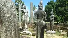 | Pothuvil | Pothuvil | [29] | |||
| Muwangala Raja Maha Vihara | 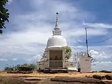 | No. W/27/13, Muwangala | Damana | 26 December 2014 | Rock with the drip ledged cave, rock inscriptions, ruins of buildings, plight of steps and other archaeological evidences at the premises (Latitude 07º 35´ 002´´ N and longitude 81º 76´ 20.6´´ E) | [9] | |
| Muwangala ruins | Muwangala | No. W/27/B Muwangala | Damana | 10 October 2014 | Sites with ruins of buildings with ancient stone pillars and other archaeological evidences in the part “Grama 02” (latitude 07º 26221' N and longitude 081º 66587' E) | [12] | |
| Namal Oya Wewa ruins | Namaloya | No. W/86C/005, Dambethalawa | Ampara | 10 October 2014 | Ancient constructions in the middle of Namal Oya lake | [2] | |
| Navagiriyawa ruins | Navagiriyawa | No. W/104/60, Navagiriyawa | Uhana | 26 December 2014 | Site of ruins of buildings with stone pillars (Latitude 07º 26´ 42´´ N and longitude 081º 37´ 070´´ E) | [5] | |
| Nawagiri Aru Wewa ruins | Bandaraduwa | No. W/104B/2, Bandaraduwa | Uhana | 10 October 2014 | Two rocks with the hillock of stupa, buildings with stone pillars, foundations of buildings, chisel holing | [10] | |
| Nawainna Purana Vihara | No. 141/B, Unapana | Padiyathalawa | 26 December 2014 | The two places with ruins of buildings and other archaeological evidences at Ancient Temple premises (latitude 07º 26´ 152´´ N and longitude 81º 14´ 104´´ E) | [13] | ||
| Neelagiriseya | 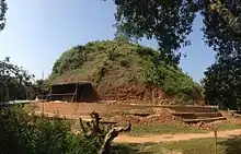 | Perani Lahugala PP 10 | Lahugala | 10 October 2014 | Neelagiri dagaba and the adjoining premises with buildings with stone pillars in inscriptions and sites with archaeological ruins, cave complex with cave inscriptions and pre historical arts | [3] | |
| Nella Archaeological Site | Nella | No. W/100/A/180, Kahatagasyaya | Uhana | 10 October 2014 | The site with other archaeological remains including ancient Chaitya, places with ruins of buildings and stone pillars, drip ledged caves, inscription | [4] | |
| Nidangala | Pollebedda | No. 136B | Maha Oya | 26 December 2014 | Rock called Nidangala with two rock inscriptions, plight of steps, chronicles and square type marks (Latitude 07º 47´ 94.1´´ N and longitude 081º 38´ 530´´ E) | [5] | |
| Nidangala rock ruins | Pannalagama | No. W/25/A Pannalagama | Damana | 10 October 2014 | The rock called “Nidangala” (Dewalagala) with the ruins of buildings with stone pillars, flight of steps and rock inscriptions (latitude 07º 14752' N and longitude 081º 67728' E) | [12] | |
| Niyuguna Kanda ruins | Helagampura (Malayadigama) | No. 5-2- 34-050-04 Eragama 05 | Eragama | 10 October 2014 | The hill called Niyuguna Kanda with Caves with rock inscriptions and drip ledges, boukder inscriptions, hillock covering chaitya, stairways and mound ruins | [21] | |
| Niyuguna Raja Maha Vihara | No. 5-2-34-0501, Eragama 05 | Eragama | 26 December 2014 | Hillock of Dagoba, rock inscription, ruins of buildings, plight of steps, places with evidences of Pre-historic era and the mountain range with ruins of buildings, drip ledged caves, siripathul gal situated in the south of the Vihara (Latitude 07º 13´ 40´´ N and longitude 81º 43´ 14´´ E) | [13] | ||
| Niyuguna Raja Maha Vihara | Niyuguna | No. 5-2-34-0501 Eragama | Eragama | 10 October 2014 | Drip ledged cave located at the west of the Vihara (latitude 7º 13' 43 N and longitude 081º 42' 00 E) | [21] | |
| Norochcholei Arabi Charat ruins | Norochcholei | No. AP/20A/4 Aalimnahar | Akkaraipattu | 10 October 2014 | Natural rock plain on which drains have been built in the area called “Norochcholei Arabi Charat” (latitude 07º 12' 54 N and longitude 081º 44' 47E) | [6] | |
| Okanda Devalaya | 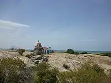 | Okanda | No. PP 02 Panama South | Lahugala | 10 October 2014 | Rock with archaeological evidences at Okanda Dewalaya premises (latitude 06º 65089' N and longitude 081º 72000' E) | [15] |
| Orukulam Archaeological ruins | Karandikulam | Addalachchenai | 31 December 1999 | Carved stairway of two rocks and carved elephant figures at Orukulam paddy field | [20] | ||
| Othgamuwa archaeological site | Hulannuge | No. PP 12 Hulannuge West | Lahugala | 10 October 2014 | Othgamuwa archaeological site with ancient chaitya, ruins of buildings with stone pillars, inscriptions, drip ledged caves and other archaeological evidences. (latitude 06º 88582' N and longitude 081º 64853' E) | [7] | |
| Ovagiriya | 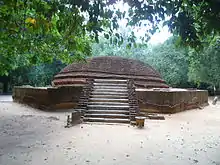 | Polwatta, Ampara | Ancient stupa and other ruins | ||||
| Padagoda Raja Maha Vihara | Pahalanda | No. W/28/A, Pahalanda | Damana | 26 December 2014 |
|
[9] | |
| Padavikanda Vihara | Marava | No. 139B, Komana | Padiyathalawa | 10 October 2014 | Natural rock plane with Hillock of ruins and inscriptions, drain system and pothole carved with a fish at the place (latitude 07º 20' 335 N and longitude 081º 20' 038 E) | [11] | |
| Padiyadora Raja Maha Vihara | 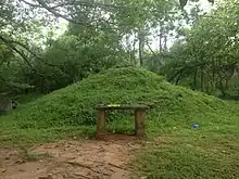 | Padiyathalawa | No. 140/D, Thalapita Oya Left | Padiyathalawa | 10 October 2014 | The ancient stupa, ruins of buildings, pond, wall and other archaeological evidences (latitude 70º 23' 981 N and longitude 081º 14' 900 E) | [11] |
| Palaweli Archaeological Site | Palaweli | No. 89B, Walathapitiya 01 | Samanthurai | 10 October 2014 | The archaeological site with other archaeological evidences including the ruins of a Bodhighara of an ancient Chaitya, building sites, inscriptions, flight of steps (latitude 07º 18' 34.3 N and longitude 081º 43' 09.1E) | [10] | |
| Palaweli Shivan Kovil | Palaweli | No. 89B, Walathapitiya 01 | Samanthurai | 26 December 2014 | Rock plane with other archeological evidences including ancient letters and signs in front of the premises of Shivan Kovil (Latitude 07º 18´ 27.6´´ N and longitude 81º 43´ 05.1´´ E) | [8] | |
| Pallekadu Archaeological ruins | Oluvil | Addalachchenai | 31 December 1999 | Ruins of ancient dagoba, ancient stone wall and ruins of ancient buildings at Pallekadu jungle | [20] | ||
| Panagolla old quarry | Kahatagasyaya | No. W/100A/180, Kahatagasyaya | Uhana | 26 December 2014 | Small rock with the marks of old quarry (Latitude 07º 19´ 49´´ N and longitude 081º 34´ 26´´ E) | [5] | |
| Panama Wewa ruins | Weweyaya | Panama South | Lahugala | 10 October 2014 | Premises of building with ancient stone pillars in catchment area (latitude 06º 77495' N and longitude 081º 77955' E) | [15] | |
| Panankadu ruins | Panankadu | Panankadu No. AV13 | Alayadiwembu | 10 October 2014 | The rock boulder called Mottayagala with old hillock covering chaitya, flight of steps, illustration of meditating Buddha, ruins of buildings, signs of hand railings, ponds, places with chisel holing, drip ledged caves and boulder places with the signs of chisel holing (latitude 07º 08' 40 N and longitude 081º 48' 17 E) | [21] | |
| Pannalgama ruins | Pannalgama | Kumana | Damana | 10 October 2014 | The site with the ruins of buildings with stone pillars and other archaeological evidences (latitude 07º 10730' N and longitude 081º 68184' E) | [12] | |
| Pannathgoda Purana Vihara | Pallamoya | No. W/26/B, Pallamoya | Damana | 26 December 2014 | All ruins of Arama complex with ancient Chaithya, rock inscription, plight of steps (Latitude 071º 46´ 59´´ N and longitude 81º 55´ 235´´ E) | [9] | |
| Pansalgala ruins | Himindurawa | No. W/08J/270, Himindurawa | Uhana | 10 October 2014 |
|
[10] | |
| Pansalgala ruins | Samodayagama | No. W/86/J065, Paragahakele East | Ampara | 10 October 2014 |
|
[2] | |
| Pansalgala ruins | Welekahagolla part B | No. W/88/A/1-185, Welikahagolla | Uhana | 10 October 2014 | Rock plain with the hillock of Chaitya, pillar bases, flight of steps and chronicles | [4] | |
| Pansalyaya ruins | No. 11C, Sagama | Thirukkovil | 10 October 2014 | Drip ledged cave, ruined buildings and other archaeological evidences found in the land (latitude 07º 06' 12 N and longitude 081º 45' 45 E) | [11] | ||
| Paragahakele forest ruins | Paragahakele | Paragahakele East | Ampara | 10 October 2014 | Drip ledged cave in the forest called Paragahakele | [2] | |
| Parana Govipola Aththani inscription | Parana Govipola | Pansalgoda | Lahugala | 10 October 2014 | Aththani inscription located close to the Parana Govipola of Lahugala - Magul Maha Viharaya road (latitude 06º 86641' N and longitude 081º 73266' E) | [3] | |
| Parana Govipola Ethgala | Parana Govipola | Pansalgoda | Lahugala | 10 October 2014 | Ancient construction covered by a stone rampart wall called Ethgala (latitude 06º 86154' N and longitude 081º 73591' E) | [3] | |
| Parana Govipola ruins | Parana Govipola | Pansalgoda | Lahugala | 10 October 2014 | Site of buildings with ancient stone pillars (latitude 06º 86308' N and longitude 081º 73647' E) | [3] | |
| Patarkulam rock ruins | Oluvil | Oluvil | Addalachchenai | 10 October 2014 | “Patarkulam” rock with drip ledged cave with stone inscriptions, sites of ruins of buildings with chisel holing and other archaeological evidences and the rock with drip ledged cave with stone inscriptions | [6] | |
| Paththam village ruins | 10 colaniya (Paththam village) | No. AP/20A/4 Aalimnahar | Akkaraipattu | 10 October 2014 | Rock plain with drains and other archaeological graffiti situated in the middle of paddy field at 10 colaniya (latitude 07º 12' 39 N and longitude 081º 44' 22E) | [6] | |
| Perawelpitiya archaeological site | Lathugala | No. W/100/1, Lathugala | Uhana | 10 October 2014 | Perawelpitiya site of ruins where ruins of buildings are found with hillock of Dagoba and stone pillars (latitude 07º 23' 22 N and longitude 081º 32' 37E) | [14] | |
| Perawelthalawa ruins | Perawelthalawa | Unuwathura Bubula | Maha Oya | 26 December 2014 | Site of the ruins of buildings (Latitude 07º 37´ 79´´ N and longitude 081º 35´ 44.8´´ E) | [5] | |
| Piyangala Forest Hermitage | 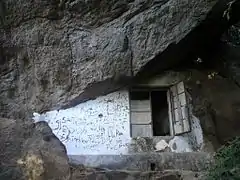 | Piyangala | No. 104/5W, Piyangala | Uhana | 26 December 2014 | Site of the ruins of buildings with stone pillars (Latitude 07º 30´ 16´´ N and longitude 081º 37´ 40´´ E) | [5] |
| Piyangala frescoes cave | Piyangala | No. W/104/5W, Piyangala | Uhana | 10 October 2014 | Piyangala cave with paintings of Adiwasi People (Indigenous) (latitude 07º 30' 44 N and longitude 081º 37' 12E) | [14] | |
| Pokkanagala ruins | No. 11C, Sagama | Thirukkovil | 10 October 2014 | Buddhist Monastery complex with hillocks of Chaitya, ruins of buildings and drip ledged caves in Pokkanagala reserve. (latitude 07º 07' 52 N and longitude 081º 45' 10 E) | [30] | ||
| Pokunugala Raja Maha Vihara | Ambalanoya | Ambalanoya W/24/D | Damana | 10 October 2014 | All archaeological evidences including ancient chaithya, stone pillars and hillocks, ponds at the premises (latitude 07º 17894' N and longitude 081º 69590' E) | [12] | |
| Pollebedda drainage system ruins | Pollebedda | Maha Oya | 23 January 2009 | The drainage system made of rock | [17] | ||
| Pothana Welyaya ruins | Sagama | No. 11C, Sagama | Thirukkovil | 10 October 2014 | Hillock covering a Chaitya and site with archaeological evidence in the land called Pothana Welyaya. (latitude 07º 07' 45 N and longitude 081º 45' 17 E) | [30] | |
| Radella ruins | Radella | No. PP 04 Panama North | Lahugala | 10 October 2014 |
|
[15] | |
| Radella Wewa | Radella | No. PP 04 Panama North | Lahugala | 10 October 2014 | Radella tank with ancient sluice, tank bunt and break water (latitude 06º 82562' N and longitude 081º 75996' E) | [15] | |
| Rahuman Nagar ruins | Rahumanthi Nagar | No. 5-2-34-005 Eragama 07 | Eragama | 10 October 2014 | Rock boulder with ancient stairway and other archaeological evidences at the place called Rahuman Nagar | [22] | |
| Rajagama 08 ruins | Rajagama 08 | No. W/944/1-135, Rajagama South | Uhana | 26 December 2014 | Hillock of Dagoba in 95/1, land (Latitude 07º 24´ 45.3´´ N and longitude 081º 41´ 45.4´´ E) | [5] | |
| Rajagalatenna | 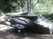 | Rajagalatenna | Uhana | [31] | |||
| Rajagalatenna ruins | Rajagalatenna | No. W/104/4025, Rajagalatenna South | Uhana | 10 October 2014 | Rock plain with buildings, flight of steps, chronicles and chisel holing at the cachment area of Divulana lake (latitude 07º 27' 56 N and longitude 081º 35' 35E) | [14] | |
| Rajagalatenna ruins | Rajagalathenna 80 Bunteka | No. W/104/3, Rajagalathenna North | Uhana | 26 December 2014 |
|
[5] | |
| Rajagiri Purana Vihara | Mahakandiya | No. WA100, Mahakandiya | Uhana | 26 December 2014 | Rock with hillock of ancient Dagoba, ruins of buildings with stone pillars, places with chisel holing and other archaeological evidences | [8] | |
| Rambakan Oya Dam ruins | 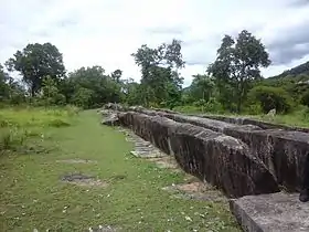 | Pollebedda | Maha Oya | 23 January 2009 | The ancient Tank bund of Rambukken Oya (Watawala Kandiya) | [17] | |
| Rupaskulama lake reserve ruins | Rupaskulama | Kanchirankuda | Thirukkovil | 10 October 2014 |
|
[30] | |
| Rupaskulama lake reserve ruins | Kanchikudiaru | Thirukkovil | 10 October 2014 |
|
[22] | ||
| Rupaskulama ruins | Rupaskulama | Kanchirankuda | Thirukkovil | 10 October 2014 | Site with drip ledged caves with Brahmi inscriptions and stone pillars on the East of the Rupaskulam lake towards the road to lake. (latitude 07º 04' 39 N and longitude 081º 46' 53 E) | [30] | |
| Rupaskulama Wewa and bund | Rupaskulama | Kanchirankuda | Thirukkovil | 10 October 2014 | (latitude 07º 05' 10 N and longitude 081º 46' 53 E) | [30] | |
| Ruwanmaluwa Aranya Senasanaya | Pannalagama | W/25/A Pannalagama | Damana | 10 October 2014 | Other archaeological evidence including drip ledged caves with inscriptions and stone pillars (latitude 07º 09380' N and longitude 081º 6459' E) | [12] | |
| Sadhdhathissa Maha Vidyala ruins | Sadhdhathissapura | No. W/86/A, Jayawardhanapura | Ampara | 10 October 2014 | Rock plain with drip ledged cave, flight of steps and other Graffiti, construction site with stone pillars at the premises of Sadhdhathissa Maha Vidyala (latitude 07º 13' 28.5 N and longitude 081º 34' 22.1E) | [2] | |
| Sagama Seya | Urakawattei | No. 11/C, Sagama | Thirukkovil | 10 October 2014 | (latitude 07º 08' 24 N and longitude 081º 49' 24 E) | [11] | |
| Sagama ruins | No. 11C, Sagama | Thirukkovil | 10 October 2014 | The site of archaeological ruins with evidences of ancient settlements in the land near Kalipotaru canal (latitude 07º 07' 59 N and longitude 081º 48' 00 E) | [11] | ||
| Sagama ruins | Sagama | Thirukkovil | 10 October 2014 | Drip ledged cave situated in the road leads towards Sagama Wewa | [22] | ||
| Sagama Wewa ruins | Sagama | No. 11C, Sagama | Thirukkovil | 10 October 2014 | Sluice of Sagama lake and nearby stone pillars and other archaeological ruins. (latitude 07º 07' 38 N and longitude 081º 48' 56 E) | [30] | |
| Sagama Wewa reservation ruins | Manankulama | Sagama | Thirukkovil | 10 October 2014 | Rock plain with archaeological evidence and signs situated near Rajawewa | [30] | |
| Samanabedda cave temple |  | Ampara | |||||
| Samangala Forest Hermitage | 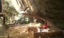 | Samangala | No. W/104B/2, Bandaraduwa | Uhana | 10 October 2014 | Samangala mountain range with drip ledged cave complex containing inscriptions | [14][32] |
| Samapura Pilleyar Kovil | Samapura | No. W/89/B, Samapura | Ampara | 10 October 2014 | Rock plain with chronicles at the premises of Pilleyar Kovil (latitude 07º 17' 16.5 N and longitude 081º 39' 53.6E) | [2] | |
| Sambunagar ruins | Sambunagar | No. 05 Addalachchenei | Addalachchenai | 10 October 2014 | Hillock covering ancient Chaithya | [6] | |
| Sangaman Kanda Kattuchena reserve ruins | Kandiadi | Thirukkovil | 10 October 2014 | Ruins of a Buddhist Vihara complex and archaeological site with pre historic evidence | [22] | ||
| Sangaman Kanda ruins | Sangaman Kanda | Sangaman Kanda | Thirukkovil | 10 October 2014 | Rock plain with ruins of buildings near Sangaman Kanda Kattupillayar Kovil | [22] | |
| Sangaman Kanda ruins | Sangaman Kanda | No. P22 Sangaman Kanda | Pothuvil | 10 October 2014 | The rock boulder called Sangaman Kanda with hillock covering chaitya, ruins of buildings, pre historic cave art, cave inscriptions and complex of drip ledged caves and other archaeological evidences (latitude 07º 01' 04.8 N and longitude 081º 50' 53.3 E) | [7] | |
| Sapanagar ruins | Sapanagar | No. 5-2-34-015 Eragama 02 | Eragama | 10 October 2014 | Rock plain with rock inscription, place containing ruins of Dagoba and Kethukawata at 8th Mile Post (latitude 07º 12' 49 N and longitude 081º 44' 32 E) | [21] | |
| Saranagama ruins | Saranagama | No. 140/D, Saranagama | Padiyathalawa | 10 October 2014 | Premises with slag. (Premises adjoining Thalapitaoya from Demodara College) situated within latitude 07º 25' 004 N and longitude 081º 15' 945 E | [11] | |
| Sehunapura ruins | Sehunapura | No. SP 84C-005-07 Eragama | Eragama | 10 October 2014 | Two rock boulders with Kethukawata and other archaeological evidences and the land where ancient pieces of pottery are scattered belonging to Sehunapura village (from the east of Eragama lake) (latitude 7º 14' 45 N and longitude 081º 44' 50 E) | [21] | |
| Sellak Oya ruins | Meegahapallama | Dewalahinda W/26/E | Damana | 10 October 2014 | The site of ruins with hillocks covering Chaithyas, building site with stone pillars, flight of steps in the place called “Sellak Oya” (latitude 07º 17976' N and longitude 081º 56398' E) | [15] | |
| Sengamuwa army camp ruins | Sengamuwa | Pansalgoda | Lahugala | 10 October 2014 | Site of ruins with stone pillars and buildings, located at the premises of Sengamuwa Army Camp (latitude 06º 88438' N and longitude 081º 76309' E) | [3] | |
| Sengamuwa ruins | Sengamuwa | Victor estate 02 P 17 | Pothuvil | 10 October 2014 | Rock plain with stairways, signs of chisel holing and other archaeological evidences (latitude 6º 53' 37 N and longitude 81º 46 00' E) | [7] | |
| Serankada Purana Vihara | No. 137/A, Serankada | Padiyathalawa | 26 December 2014 | The two places with ruins of buildings and other archaeological evidences at Ancient Temple premises (latitude 07º 27´ 165´´ N and longitude 81º 16´ 660´´ E) | [13] | ||
| Shasthrawela Vihara | Shasthrawela | No. PP 06 Panama North | Lahugala | 10 October 2014 | Small rock (crocodile rock) with drip ledged caves, flight of steps, ruins of an ancient stupa at coastal belt situated towards east from Shasthrawela Vihara premises (latitude 06º 80998' N and longitude 081º 82424' E) | [15] | |
| Sir Swami Vipulananda house | Karthivu | Karthivu 01 | Karativu | 26 December 2014 | [8] | ||
| Somawathi Abhayapura Idama ruins | Abhayapura | No. W/88C/01/275, Abhayapura | Uhana | 10 October 2014 | Rock with the hillock of ancient Dagoba at the place | [10] | |
| Sri Chandimarama Purana Vihara | Serupitiya | No. 142, Serupitiya | Dehiattakandiya | 26 December 2014 | Other archaeological relics including ancient shrine with stone statue of Buddha and stone pillars at the premises | [28] | |
| Sri Dharmendrarama Raja Maha Vihara | 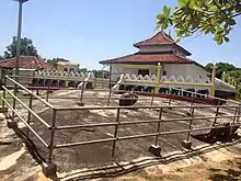 | Mayadunne | No. W/04A/055, Mayadunne | Uhana | 10 October 2014 | Rock inscription, places with ruins of buildings and other archaeological evidences in vihara premises. (latitude 07º 25' 32.1 N and longitude 081º 37' 58.3E) | [10] |
| Sri Sumanarama Vihara, Weheragama | Weheragama | No. W/94A/3-115, Weheragama West | Uhana | 26 December 2014 | Natural rock plane with archeological evidences including ruins of buildings, drains, chisel holing, small stone ponds at the premises | [8] | |
| Sri Suvusudhdharmara Vihara, Moragahapallama | Moragahapallama | Damana | 26 December 2014 | Drip ledged cave (Latitude 07º 20´ 85.4´´ N and longitude 81º 60´ 62.9´´ E) | [9] | ||
| Sthree Gala | Panama South | Lahugala | 10 October 2014 | Rock called “Sthree Gala” with drip ledged caves, ponds, flight of steps, buildings and other archaeological evidences scattered in the surrounding area | [15] | ||
| Sudagala pond | Wattamadu | No. 11C, Sagama | Thirukkovil | 10 October 2014 | The pond situated on the rock called Sudugala (latitude 07º 07' 13 N and longitude 081º 46' 06 E) | [11] | |
| Sudharshanarama Vihara | Colony 33 village | No. W/08J/270, Navagiriyawa | Uhana | 10 October 2014 | Rock with archaeological evidences such as stone pillars, stone tablets, stone, flower stones and treasure stones at the premises | [10] | |
| Tempitiya Wewa | Tempitiya | Tempitiya | Mahaoya | 10 October 2014 | Tempitiya Lake with the ancient bund of the lake, Bisokotuwa and sluice | [4] | |
| Thalapitaoya ruins | Thalapitaoya South | No. 140/B, Thalapitaoya south | Padiyathalawa | 26 December 2014 | The place with ruins of buildings with stone pillars and rock plane with Brahmi inscriptions in the village (latitude 07º 23´ 811´´ N and longitude 81º 15´ 867´´ E) | [13] | |
| Thangavelavipuram reserve ruins | Thangavelavipuram | Thirukkovil | 10 October 2014 | Site with ruins of Buddhist Monastery complex with rock inscription | [22] | ||
| Thangavelawipuram ruins | Thangavelawipuram | Thangavelavipuram | Thirukkovil | 10 October 2014 | Rock plain with archaeological evidences | [22] | |
| Tharulengala Aranya Senasana | Hulannuge | No. PP 11 Hulannuge | Lahugala | 10 October 2014 | Karandahela amountain range with cave inscriptions of Tharulengala Aranya Senasana, cave complex with ancient art and drip ledged caves, building site with stone pillars, inscriptions, hillock covering dagoba and stairways and other archaeological evidences (latitude 06º 92763' N and longitude 081º 65491' E) | [7] | |
| Third mile post ruins |  | Victor Estate 02-P-17 | Pothuvil | 10 October 2014 | A Monastery complex with ruins of an old dagoba and remaining of buildings situated at third mile post (latitude 06º 52' 56 N and longitude 081º 47' 36 E) | [7] | |
| Thiruwaliwarpuram ruins | Thiruwaliwarpuram | No. 89, Thiruwaliwarpuram Malwaththa 01 | Samanthurai | 26 December 2014 |
|
[8] | |
| Thissa Purana Raja Maha Vihara | Rathupas Uhana | Unuwathura Bubula | Mahaoya | 10 October 2014 | Rock plain with other archaeological remains and flight of steps including hillock of ancient Chaitya, all places with the ruins of buildings at the premises (Latitude 07º 57573' N and longitude 081º 35059' E) | [4] | |
| Thiththawel Mandiya Welyaya ruins | Lahugala PP 10 | Lahugala | 10 October 2014 | The site containing ruins of buildings with stone pillars and other archaeological remains (latitude 06º 86725' N and longitude 081º 70942' E) | [3] | ||
| Thonikal Kandam ruins | Thonikal Kandam | No. 11C, Sagama | Thirukkovil | 10 October 2014 | Buddhist Monastery complex with hillock covering of stupa, drip ledged caves, rock inscriptions and ruins of buildings (latitude 07º 07' 49 N and longitude 081º 46' 33 E) | [11] | |
| Udayagiri Raja Maha Vihara | 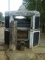 | Udagirigama | No. W/88B, Udagirigama Eas | Uhana | 26 December 2014 | Site with the evidences of buildings with stone pillars, all archaeological relics such as Stupa chatra, Balustardes, Moonstone and flower altar at the premises | [5] |
| Udayapura Piller Inscription and other ruins | Mihindupura | No. W/89/N, Mihindupura | Ampara | 10 October 2014 | Udayapura Piller inscription with archaeological evidences in the surrounding area, rocks (with Chisel holing) and place where pieces of ancient pottery are scattered at the place called Pansalwatta (latitude 07º 17' 35.8 N and longitude 081º 42' 04.5E) | [2] | |
| Uraniya ruins | Uraniya | No. P/25, Kanakarakiramam | Pothuvil | 26 December 2014 | Brick wall and archaeological evidences found in nearby area in the land called Suddage waththa (Latitude 06º 53´ 59´´ N and longitude 81º 50´ 34´´ E) | [13] | |
| Uththara Jayamaha Vihara | 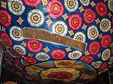 | Hingurana | No. W/27/F, Karalewa | Damana | 26 December 2014 | Caves with drip ledges and inscriptions (Latitude 07º 22´ 14.5´´ N and longitude 81º 67´ 93.3´´ E) | [9] |
| Uthurupaw archaeological site | Bokkebedda | No. W/102/1085, Walagampura | Uhana | 10 October 2014 | Madankanda mountain range with drip ledged cave complex with inscriptions and the hillock of ancient stupa at the foot of the mountain range at the archaeological site | [14] | |
| Veddagala Archaeological ruins | Mollikulam | Addalachchenai | 31 December 1999 | Ancient caves with drip ledge and other ruins of ancient buildings at Veddagala rock | [20] | ||
| Veeradi Amuna | Neinakadu | Addalachchenai | 31 December 1999 | Old Bund called Veeraadi Amuna crossed the Gal Oya | [20] | ||
| Veheragala archaeological ruins | Veheragala, Maha Oya | Maha Oya | 6 July 2007 | Ancient Bodhigaraya, image house, pond with naga symbol, ancient rampart, Dathumandira, Poyage, Dagoba and the cave | [33] | ||
| Veheragala archaeological site | Dighavapi | Addalachchenai | 31 December 1999 | Stone inscription and other ruins in veheragala rock | [20] | ||
| Veheragala caves | Dighavapi colony | No. 1 Dighavapi | Addalachchenai | 10 October 2014 | Drip ledged cave complex with Brahmi inscriptions extended from the area near Sinhala College up to archaeological site “Veheragala” | [6] | |
| Veheragala ruins | Buddhist colony | No. 1 Dighavapi | Addalachchenai | 10 October 2014 | Rock with rock inscriptions, ruins of buildings and flight of steps and the pond with stone rampart wall at the base of the said rock at the place called “Veheragala” | [6] | |
| Veheragala ruins | Aligambe | Aligambe | Alayadiwembu | 10 October 2014 | The rock plain called Veheragala with hillock covering old Chaitya, ruins of buildings, stairways, rock inscription, pond and other scattered archaeological evidences (latitude 07º 64090' N and longitude 081º 76' 565' E) | [7] | |
| Veheragala ruins | colony No. 19A | W/25/C Weheragala | Damana | 10 October 2014 | Rock with archaeological ruins (latitude 07º 14166' N and longitude 081º 77674' E) | [12] | |
| Veheragoda ruins | Thalapita Oya South | No. 140/B, Thalapita Oya South | Padiyathalawa | 10 October 2014 | Ruins with the Hillock of stupa and pillars at the place (latitude 07º 23' 315 N and longitude 081º 15' 913 E) | [11] | |
| Vehera godella ruins | Samapura | No. W/89/B, Samapura | Ampara | 10 October 2014 | Place with hillock with ancient stupa and Stone pillars at the place called Vehera godella (latitude 07º 17' 07.8 N and longitude 081º 39' 56.7E) | [2] | |
| Veherakema Buddhist Religious Center | Kunukola | Panama South | Lahugala | 10 October 2014 | Rock with archaeological ruins including hillocks covering ancient chaithyas, ruins of buildings, ponds, flight of steps, inscriptions (latitude 06º 70028' N and longitude 081º 77635' E) | [15] | |
| Viharagala ruins | Kannakiramam | Kannkiramam No. 01 AV 20 | Alayadiwembu | 10 October 2014 | The rock plain called Viharagala with hillock covering dagoba, stairways, water canals and other scattered archaeological evidence (latitude 07 17702' N and longitude 081º 80 766' E) | [7] | |
| Wadinagala forest reservation ruins | 15th mile post village | Wadinagala | Damana | 10 October 2014 | Ruins of buildings with stone pillars within forest reservation (latitude 07º 10557' N and longitude 081º 55160' E) | [12] | |
| Wahava ruins | Wahava | No. 139, Dorakumbura | Padiyathalawa | 10 October 2014 | Hillock of ancient stupa, ruins of buildings and other archaeological remains (latitude 07º 21' 609 N and longitude 081º 18' 419 E) | [11] | |
| Walathapitiya ruins | No. 89B, Walathapitiya 01 | Samanthurai | 26 December 2014 | Rock plane with grinding places and other archaeological evidences in the paddy field, Pudukkadu (Latitude 07º 18´ 50.0´´ N and longitude 81º 43´ 48.9´´ E) | [8] | ||
| Walathapitiya Wewa road ruins | No. 89B, Walathapitiya 01 | Samanthurai | 26 December 2014 | Rock plane with sign of quarry at Walathapitiya lake road (Latitude 07º 18´ 42.6´´ N and longitude 081º 43´ 17.7´´ E) | [8] | ||
| Walathapitiya Wewa ruins | Wilwewa | No. 89B, Walathapitiya 011 | Samanthurai | 10 October 2014 | The premises with stone pillars, relics of ancient bricks and pieces of tiles (premises bounded North-east by outer canal of Walathapitiya lake, South and West by paddy field, North-west by the bund of the lake) situated towards South-east from the spill of Walathapitiya lake (latitude 07º 19' 23.5 N and longitude 081º 43' 30.9E) | [10] | |
| Wandagama ruins | Wandagama-Gamagoda | No. PP 02 Panama South | Lahugala | 10 October 2014 | Site with archaeological ruins at “Wandagama” with ancient buildings (latitude 06º 74860' N and longitude 081º 77828' E) | [15] | |
| Waralanda road ruins | Lahugala | Perani Lahugala PP 10 | Lahugala | 10 October 2014 | The site of ruins with stone pillars and other archaeological remains, at Waralanda road (latitude 06º 87330' N and longitude 081º 72224' E) | [3] | |
| Waralanda ruins | Waralanda | Waralanda | Lahugala | 26 December 2014 | Place of ruins with ancient stone pillars in a land near the causeway on Lahugala-Kiriwehera road belonging to Waralanda village (Latitude 06º 87´ 208´´ N and longitude 81º 72´ 11.9´´ E) | [13] | |
| Wattamadu ruins | Wattamadu | No. 11C, Sagama | Thirukkovil | 10 October 2014 | Building complex with ruins with places consists of ruined buildings, stupas and stone remains at the place called Wattamadu (latitude 07º 06' 29 N and longitude 081º 45' 45 E) | [11] | |
| Wavinna Gewal Hatha ruins | Wavinna Gewal Hatha | No. W/86/E, Wavinna | Ampara | 26 December 2014 | Rock plane with rock inscription and evidences of the construction of ancient buildings (Latitude 07º 14´ 089´´ N and longitude 81º 14´ 58.5´´ E) | [8] | |
| Weeragoda Purana Gale Vihara | Weeragoda | No. W/93C/420, Weeragoda North | Uhana | 10 October 2014 | Site of buildings with the hillock of ancient Dagoba and stone pillars, moonstone and balustrades (Korawakgala) at the surrounding | [10] | |
| Weeragoda Purana Gale Vihara | Weeragoda | No. W/93C/4-220, Weeragoda North | Uhana | 26 December 2014 | Rock plane with hillock of Chaithya, ruins of a shrine and base pockets of pillars at the premises (Latitude 07º22´ 48.7´´ N and longitude 081º 41´ 29.9´´ E) | [5] | |
| Weheragala Aranya Senasanaya | Weheragala | Unuwathura Bubula | Mahaoya | 10 October 2014 | Weheragalakanda with all other archaeological remains including cave inscriptions and all drip ledged caves, rock inscriptions, hillock of Dagoba, flight of steps and chronicles at the premises (Latitude 07º 77790' N and longitude 081º 35448' E) | [4] | |
| Weheragala rock ruins | Bandaraduwa | No. W/104B/2, Bandaraduwa | Uhana | 10 October 2014 | Weheragala rock plain with archaeological evidences including hillock of Dagaba, rock inscriptions and, flight of steps | [14] | |
| Weheragoda ruins | Kudalakatuwa | Tempitiya | Mahaoya | 10 October 2014 | Weheragoda site of ruins with four hillocks of ancient Chaityas, places containing buildings with stone pillars and other archaeological remains (Latitude 07º 60088' N and longitude 081º 41850' E) | [4] | |
| Wehera Goddella ruins | Weeranthalawa | Unuwathura Bubula | Mahaoya | 10 October 2014 | Hillock of ancient Chitya, places with the ruins of buildings and other archaeological remains (Latitude 07º 39026' N and longitude 081º 79298' E) | [4] | |
| Wembeadikulam ruins | Wembeadikulam | No. 11C, Sagama | Thirukkovil | 10 October 2014 |
|
[11] | |
| Weppeadikulam ruins | Weppeadikulam | No. 11C, Sagama | Thirukkovil | 10 October 2014 |
|
[30] | |
| Werankotagoda Agrarian Services office ruins | Werankotagoda | No. W/104A/005, Mayadunna | Uhana | 26 December 2014 | Site with other archaeological evidences including the building with laid down stone tablets and the wall around the building situated towards south from Agrarian Services office (Latitude 07º 25´ 12´´ N and longitude 081º 37´ 16´´ E) | [5] | |
| Wiranathalawa ruins | Wiranathalawa | Unuwathurabubula | Maha Oya | 26 December 2014 |
|
[28] | |
| Wewe Vehera | Mangalagama | Panama South | Lahugala | 10 October 2014 | The monastery Complex, where the ruins of ancient buildings hillocks covering Chaithyas, inscriptions, caves, ponds and archaeological evidences are scattered, at the place called “Wewevehera” (latitude 06º 74409' N and longitude 081º 77817' E) | [15] | |
| Yalpotha Wewa ruins | Bogahalanda | Pansalgoda PP 07 | Lahugala | 10 October 2014 | Rock plain with ancient chisel holing located towards North West to the Yalpotha tank (06º 86944' N and 081º 73777' E) | [3] | |
| Yalpotha Wewa sluice | Bogahalanda | Pansalgoda | Lahugala | 10 October 2014 | Ancient sluice and break water of Yalpotha tank (latitude 06º 86940' N and longitude 081º 74312' E) | [3] | |
| Yannai Paambulakanda ruins | Aalimnahar | No. AP/20A/4 Aalimnahar | Akkaraipattu | 10 October 2014 | The site with caves built on the rock at the place called “Yannai Paambulakanda” (latitude 071º 94' 93 N and longitude 081º 78' 21.4E) | [6] | |
Notes
- "Protercted Monument List 2012-12-12 (In Sinhala)" (PDF). Department of Archaeology. 12 December 2012. Retrieved 29 March 2016.
- Gazette 1884 & 10 October 2014, p. 921.
- Gazette 1884 & 10 October 2014, p. 917.
- Gazette 1884 & 10 October 2014, p. 924.
- Gazette 1895 & 26 December 2014, p. 1150.
- Gazette 1884 & 10 October 2014, p. 920.
- Gazette 1884 & 10 October 2014, p. 916.
- Gazette 1895 & 26 December 2014, p. 1149.
- Gazette 1895 & 26 December 2014, p. 1148.
- Gazette 1884 & 10 October 2014, p. 922.
- Gazette 1884 & 10 October 2014, p. 912.
- Gazette 1884 & 10 October 2014, p. 919.
- Gazette 1895 & 26 December 2014, p. 1147.
- Gazette 1884 & 10 October 2014, p. 923.
- Gazette 1884 & 10 October 2014, p. 918.
- "Buddangala". Department of Archaeology. Retrieved 1 March 2016.
- Gazette 1586 & 23 January 2009, p. 108.
- "Gazette". The Gazette of the Democratic Socialist Republic of Sri Lanka. 9692. 18 April 1947.
- Deegawapi Chaithiya i and its vicinity declared a sacred premise Archived 2012-03-03 at the Wayback Machine
- "Gazette". The Gazette of the Democratic Socialist Republic of Sri Lanka. 2106. 31 December 1999.
- Gazette 1884 & 10 October 2014, p. 915.
- Gazette 1884 & 10 October 2014, p. 914.
- "Gonagolla". Department of Archaeology. Retrieved 1 March 2016.
- Gazette 1486 & 23 February 2007, p. 9.
- Gazette 1612 & 24 July 2009, p. 1025.
- "Kudumbigala". Department of Archaeology. Retrieved 1 March 2016.
- "Gazette". The Gazette of the Democratic Socialist Republic of Sri Lanka. 10657. 26 March 1954.
- Gazette 1895 & 26 December 2014, p. 1151.
- "Muhudu Maha Viharaya". Department of Archaeology. Retrieved 1 March 2016.
- Gazette 1884 & 10 October 2014, p. 913.
- "Rajagala". Department of Archaeology. Retrieved 1 March 2016.
- "Samangala". Department of Archaeology. Retrieved 1 March 2016.
- Gazette 1505 & 6 July 2007, p. 11.
References
- "PART I : SECTION (I) — GENERAL Government Notifications" (PDF). The Gazette of the Democratic Socialist Republic of Sri Lanka. 1486. 23 February 2007. Archived from the original (PDF) on 24 April 2012.
- "PART I : SECTION (I) — GENERAL Government Notifications" (PDF). The Gazette of the Democratic Socialist Republic of Sri Lanka. 1505. 6 July 2007.
- "PART I : SECTION (I) — GENERAL Government Notifications" (PDF). The Gazette of the Democratic Socialist Republic of Sri Lanka. 1586. 23 January 2009.
- "PART I : SECTION (I) — GENERAL Government Notifications" (PDF). The Gazette of the Democratic Socialist Republic of Sri Lanka. 1612. 24 July 2009.
- "PART I : SECTION (I) — GENERAL Government Notifications" (PDF). The Gazette of the Democratic Socialist Republic of Sri Lanka. 1884. 10 October 2014.
- "PART I : SECTION (I) — GENERAL Government Notifications" (PDF). The Gazette of the Democratic Socialist Republic of Sri Lanka. 1895. 26 December 2014.
This article is issued from Wikipedia. The text is licensed under Creative Commons - Attribution - Sharealike. Additional terms may apply for the media files.