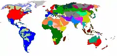
Linguistic map
A linguistic map is a thematic map showing the geographic distribution of the speakers of a language, or isoglosses of a dialect continuum of the same language. A collection of such maps is a linguistic atlas.


The earliest such atlas was the Sprachatlas des Deutschen Reiches of Georg Wenker and Ferdinand Wrede, published beginning in 1888, followed by the Atlas Linguistique de la France, of Jules Gilliéron between 1902 and 1910, and the AIS - Sprach- und Sachatlas Italiens und der Südschweiz of Karl Jaberg and Jakob Jud, published 1928–1940. The first linguistic atlas of the US was published by Hans Kurath.[1] The Linguistic Atlas of England was the result of the Survey of English Dialects, led by Harold Orton and Eugen Dieth.
The first computerised linguistic atlas was the Atlas Linguarum Europae.
See also
| Wikimedia Commons has media related to Linguistic maps. |
- A Linguistic Atlas of Early Middle English
- Atlas
- Language geography
- List of languages
References
- Chambers, J.K.; Trudgill, Peter (1998). Dialectology (2nd ed.). Cambridge University Press. pp. 15–18. ISBN 978-0-521-59646-6.
External links
General:
- 80+ language maps by LangMap
- Linguistic mapping project by the LINGUIST List
- Linguistic maps from Muturzikin.com
- Linguistic atlas of the world
- Bibliography of linguistic atlases (by Joachim Grzega)
- List of US-American Linguistic Atlas Projects
German:
- Digital Wenker-Atlas
- REDE SprachGIS, an interface to several German dialect atlases, including Wenker's (overview)
- Atlas der deutschen Alltagssprache (University of Liege, University of Salzburg)
French:
- Atlas Linguistique de la France at Universitäts- und Landesbibliothek Tirol
Italian: