Lak Si District
Lak Si (Thai: หลักสี่, pronounced [làk sìː]) is one of the 50 districts (khet) of Bangkok, Thailand. It is bounded by (from the north clockwise): Don Mueang, Bang Khen and Chatuchak of Bangkok; Mueang Nonthaburi District and Pak Kret District of Nonthaburi Province.
Lak Si
หลักสี่ | |
|---|---|
Khet | |
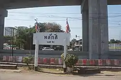
 Sign of Lak Si Station | |
 Khet location in Bangkok | |
| Coordinates: 13°53′15″N 100°34′44″E | |
| Country | Thailand |
| Province | Bangkok |
| Seat | Thung Song Hong |
| Khwaeng | 2 |
| Khet established | 21 November 1997 |
| Area | |
| • Total | 22.841 km2 (8.819 sq mi) |
| Population (2017) | |
| • Total | 104,701[1] |
| • Density | 4,583.90/km2 (11,872.2/sq mi) |
| Time zone | UTC+7 (ICT) |
| Postal code | 10210 |
| Geocode | 1041 |
History
The name Lak Si means 'fourth milestone'. The community here was called Lak Si because it is at the fourth milestone of Khlong Prem Prachakon (คลองเปรมประชากร) (canal) dug during King Chulalongkorn's reign linking Bangkok to Bang Pa-in. Lak Si became a district on 21 November 1997, separating from Don Mueang District.
Administration
The district is divided into two sub-districts (khwaeng).
| 1. | Thung Song Hong | ทุ่งสองห้อง | |
| 2. | Talat Bang Khen | ตลาดบางเขน |
References
- "Population and House Report for Year 2017 (see page 2 for data of this district)". Department of Provincial Administration, Ministry of Internal Affairs. Retrieved 1 April 2018. (Search page)
This article is issued from Wikipedia. The text is licensed under Creative Commons - Attribution - Sharealike. Additional terms may apply for the media files.
.svg.png.webp)