Kharua Rajapur
Kharua Rajapur is a village in Kalupur gram panchayat in Bangaon CD Block in Bangaon subdivision of North 24 Parganas district in the Indian state of West Bengal.
Kharua Rajapur | |
|---|---|
Village | |
 | |
| Nickname(s): Rajapur | |
 Kharua Rajapur Location in West Bengal, India  Kharua Rajapur Kharua Rajapur (India) | |
| Coordinates: 22.99479°N 88.753568°E | |
| Country | India |
| State | West Bengal |
| Division | Presidency division |
| District | North 24 Parganas district |
| Government Gram Panchayet | |
| • Panchayet Pradhan | Hema Biswas (TMC) |
| Area | |
| • Village | 2.33 km2 (0.90 sq mi) |
| • Rural | 233 ha (576 acres) |
| Dimensions | |
| • Length | 2.5 km (1.6 mi) |
| • Width | 1.3 km (0.8 mi) |
| Elevation | 9 m (30 ft) |
| Population (2011) | |
| • Village | 1,591 |
| • Density | 680/km2 (1,800/sq mi) |
| Time zone | UTC+5.30 (IST) |
| ISO 3166 code | IN-WB |
Geography
Kharua Rajapur is 15 kilometres (9.3 mi) from subdivision headquarters Bangaon and 52 kilometres (32 mi) from district headquarters Barasat. The nearest railway station is Chandpara railway station at Chandpara.[1]

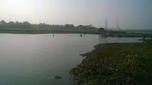
Choita river at Kharua Rajapur
Choita river flows past Kharua Rajapur.[2]
Demographics
In the 2011 census Kharua Rajapur had a population of 1591, of which 813 were males and 778 were females. Children age 0-6 number 151. The literacy rate is 89.93.[3]
Education

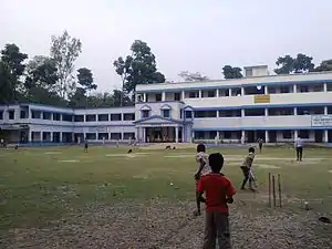
Maine building of Kharua Rajapur High School
One higher secondary school and two primary schools operate in Kharua Rajapur:
- G.R.F.P Primary School
- S.S.K.M Primary School
References
- "Kharua Rajapur pin code".
- "বিষমুক্ত জল দেবে কে,প্রশ্ন মানুষের". আনন্দবাজার প্রত্রিকা. Retrieved 8 April 2016.
- "Kharua Rajapur Population -North Twenty Four Parganas,West Bengal,India".
- "Kharua Rajapur High School-North Twenty Four Parganas,West Bengal".
This article is issued from Wikipedia. The text is licensed under Creative Commons - Attribution - Sharealike. Additional terms may apply for the media files.