Kamatchipuram
Kamatchipuram is a small village in Tamil Nadu, India and falls under village panchayat administrative unit of Chinnamanur block in Uthamapalayam taluk, Theni district.[1][2]
Kamatchipuram | |
|---|---|
Village | |
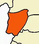
 Kamatchipuram Location in Tamil Nadu, India | |
| Coordinates: 9°51′54″N 77°27′14″E | |
| Country | |
| State | Tamil Nadu |
| District | Theni |
| Area | |
| • Total | 7.182 km2 (2.773 sq mi) |
| Population (2011) | |
| • Total | 3,253 |
| • Density | 450/km2 (1,200/sq mi) |
| Languages | |
| • Official | Tamil |
| Time zone | UTC+5:30 (IST) |
| PIN | 626520 |
| Telephone code | 04546 |
| Vehicle registration | TN- |
| Coastline | 0 kilometres (0 mi) |
| Nearest city | Madurai |
| Lok Sabha constituency | Theni constituency |
| Climate | Windy (Köppen) |
| Sex ratio | .946 ♂/♀ |
Geography
The nearby villages are Seepalakkottai, Veppampatti, Poomalaikkundu, Azhakapuri, Kallapatti, Erakkottaipatti.
Demography
There are many communities such as Nadar, Adi Dravida, Arundhathiyar, Chettiyar, Asari etc.
Educational institutions
- Pachayappa Hindu nadar primary school.[3]
- Patchayappa Hindu Nadar Higher Secondary School.
- Mariyappa Memorial Matriculation School.
- Kamarajar nursery & primary school.
Economy
Its economy depends mostly on agriculture, business and trading. Once upon a time it was very famous for cotton trading.
Agriculture:
- As its lands are known for chilli cultivation most people from the nearby surrounding villages come purchase them in bulk during harvest season.
- Onion and other food crops are cultivated.
- Banana plantation is one of the major plantations in this village.
- Tobacco cultivation.
Business:
Its business depends on near by villages, Compared to other nearby villages it has a good infrastructure and hospitality.
References
- http://www.tnrd.gov.in/databases/Villages.pdf
- "Archived copy". Archived from the original on 10 April 2009. Retrieved 22 August 2009.CS1 maint: archived copy as title (link)
- http://www.worldcolleges.info/schooluser/schoolshow.php?category=HigherSecondary&startdistrict=1980
This article is issued from Wikipedia. The text is licensed under Creative Commons - Attribution - Sharealike. Additional terms may apply for the media files.
