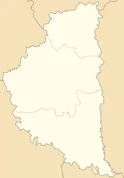
Kalne, Zboriv Raion
Kalne (Ukrainian: Кальне́) is a village (selo) located in the Zboriv Raion (district), Ternopil Oblast (province of Western Ukraine).
The area of the village is 6,295 km2 and it has a population of 537 people. [1] Local government is administered by Kalnenska village council, which consists of two villages: Kalne and Zhabynia. [2]
Kal'ne
Кальне | |
|---|---|
Village | |
 Kal'ne | |
| Coordinates: 49°37′49″N 24°58′37″E | |
| Country | |
| Province | |
| District | Zboriv Raion |
| Established | 1492 |
| Area | |
| • Total | 2.400 km2 (0.927 sq mi) |
| Elevation | 299 m (981 ft) |
| Population | |
| • Total | 537 |
| • Density | 220/km2 (580/sq mi) |
| Time zone | UTC+2 (EET) |
| • Summer (DST) | UTC+3 (EEST) |
| Postal code | 47270 |
| Area code | +380 3540 |
| Website | село Кальне/райцентр Зборів (in Ukrainian) |
Geography
The village is located on the banks of the river Zvarych (basin of the Dniester) at an altitude of 299 metres (980 ft) above sea level.
It is situated 53 kilometres (33 mi) from the regional center Ternopil, 16 kilometres (9.9 mi) from the district center Zboriv and 4 kilometres (2.5 mi) from an urban-type settlement Pomoryany.
History and Attractions
The first written mention of the village dates back to year 1492. In 1811 in the village been constructed a wooden church. It is a Church of the Resurrection (1811). [3] [4]
The priest Luka Demchuk (1873 -1929) [5] [6] has been headed the parish of the village Kal'ne from 1909 to 1929. He has been grandfather of the UGCC of Cardinal Lubomyr Husar.
References
- Село Кальне (Тернопільська обл., Зборівський р-н): карта вулиць, фото (in Ukrainian)
- Кальненська сільська рада (in Ukrainian)
- Церква Воскресіння Христового (с.Кальне, Тернопільська обл.): карта, фото (in Ukrainian)
- Кальне, Церква Воскресіння Господнього 1811 (in Ukrainian)
- Демчук, родовід (in Ukrainian)
- (in Ukrainian)
Literature
- "Kalne 2.) ". Geographical Dictionary of the Kingdom of Poland (in Polish). 3. Warszawa: Kasa im. Józefa Mianowskiego. 1882. p. 703.
— S. 703.