Howell, Michigan
Howell is a city in the U.S. state of Michigan. It is the largest city and county seat of Livingston County.[6] As of the 2010 census, the city had a population of 9,489. The city is mostly surrounded by Howell Township, but the two are administered autonomously. Howell is part of the South Lyon–Howell–Brighton Urban Area, which is an extension of the larger Detroit–Warren–Dearborn (Metro Detroit) Metropolitan Statistical Area.
Howell, Michigan | |
|---|---|
| City of Howell | |
 Facing east along Grand River Avenue (BL I-96) | |
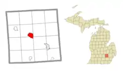
 Location within Livingston County | |
 Howell Location within the state of Michigan | |
| Coordinates: 42°36′35″N 83°55′58″W | |
| Country | United States |
| State | Michigan |
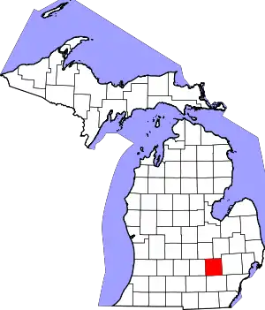
| County | Livingston |
| Platted | 1835 |
| Incorporated | 1863 |
| Area | |
| • City | 5.19 sq mi (13.45 km2) |
| • Land | 4.99 sq mi (12.93 km2) |
| • Water | 0.20 sq mi (0.53 km2) |
| Elevation | 935 ft (285 m) |
| Population | |
| • City | 9,489 |
| • Estimate (2019)[3] | 9,604 |
| • Density | 1,924.65/sq mi (743.04/km2) |
| • Metro | 4,296,250 (Metro Detroit) |
| Time zone | UTC-5 (Eastern (EST)) |
| • Summer (DST) | UTC-4 (EDT) |
| ZIP code(s) | 48843, 48844 |
| Area code(s) | 517 |
| FIPS code | 26-39540[4] |
| GNIS feature ID | 0628717[5] |
| Website | www |
History
January 1836 saw the establishment of the first post office. Flavius J. B. Crane was postmaster and the post office was in the Eagle Tavern. In March of this same year, there was a mail route started between Howell and the village of Kensington, and west to Grand Rapids.
The City of Howell is the county seat of Livingston County. On 24 March 1836, the legislature passed an act organizing Livingston County and Howell was slated to become the county seat. This claim was vigorously opposed by a group from Brighton and was not wholly relinquished by them until the county buildings were erected 12 years later. Howell at once assumed the dignity of the county seat.
The town was originally called Livingston Center and was established as a village by an act of Legislature on 14 March 1863, consisting of sections 35 and 36, and the south half of sections 25 and 26 of Howell Township.[7]
The Howell Home Rule City Charter was initially adopted in 1955.[8]
Geography
According to the United States Census Bureau, the city has an area of 4.95 square miles (12.82 km2), of which 4.75 square miles (12.30 km2) is land and 0.20 square miles (0.52 km2) is water.[9]
Demographics
| Historical population | |||
|---|---|---|---|
| Census | Pop. | %± | |
| 1850 | 473 | — | |
| 1860 | 754 | 59.4% | |
| 1880 | 2,071 | — | |
| 1890 | 2,387 | 15.3% | |
| 1900 | 2,518 | 5.5% | |
| 1910 | 2,338 | −7.1% | |
| 1920 | 2,951 | 26.2% | |
| 1930 | 3,615 | 22.5% | |
| 1940 | 3,748 | 3.7% | |
| 1950 | 4,353 | 16.1% | |
| 1960 | 4,861 | 11.7% | |
| 1970 | 5,224 | 7.5% | |
| 1980 | 6,976 | 33.5% | |
| 1990 | 8,184 | 17.3% | |
| 2000 | 9,232 | 12.8% | |
| 2010 | 9,489 | 2.8% | |
| 2019 (est.) | 9,604 | [3] | 1.2% |
| U.S. Decennial Census[10] | |||
As of 2000, the city's median household income was $43,958 and the median family income was $57,149. Males had a median income of $44,980 versus $27,956 for females. The city's per capita income was $22,254. About 4.6% of families and 6.6% of the population were below the poverty line, including 7.2% of those under the age of 18 and 7.9% of those 65 and older.
2010 census
As of the census[2] of 2010, the city had 9,489 people, 4,028 households, and 2,237 families. The population density was 1,997.7 inhabitants per square mile (771.3/km2). There were 4,551 housing units at an average density of 958.1 per square mile (369.9/km2). The city's racial makeup was 94.8% White, 0.4% African American, 0.7% Native American, 1.1% Asian, 0.3% Pacific Islander, 1.3% from other races, and 1.3% from two or more races. Hispanic or Latino people of any race were 3.5% of the population.
There were 4,028 households, of which 30.4% had children under the age of 18 living with them, 36.8% were married couples living together, 13.6% had a female householder with no husband present, 5.1% had a male householder with no wife present, and 44.5% were non-families. 36.6% of all households were made up of individuals, and 12% had someone living alone who was 65 years of age or older. The average household size was 2.25 and the average family size was 2.97.
The median age in the city was 35.2 years. 23.2% of the city's population was under age 18; 10.1% was between the age 18 and 24; 29.8% was from age 25 to 44; 23.6% was from age 45 to 64; and 13.5% was age 65 or older. The city's gender makeup was 48.2% male and 51.8% female.[11]
Historic reputation
For many decades, Howell had the reputation of being associated with the Ku Klux Klan due to White Supremacist leader and Michigan Grand Dragon Robert E. Miles, who held KKK gatherings on his farm 12 miles north of the city in Cohoctah Township with a Howell mailing address.[12] Miles died in 1992, but the gatherings, including the burning of crosses, continued.[13] The reputation persisted into the 2000s, with events such as a public auction of KKK items scheduled for Martin Luther King Jr.'s birthday in January 2005,[14] the 2010 suspension of a teacher who removed students for wearing a Confederate flag and making antigay slurs,[15] and students' racist tweets toward a racially mixed team in 2014.[16]
The Livingston Diversity Council, founded in response to a 1988 cross-burning on the lawn of a black family,[17] promotes diversity and inclusion in the county.[18] While they are numerous in Metro Detroit, Howell is not listed as an active home to any hate group by the Southern Poverty Law Center.[19]
Education

Elementary schools
- Three Fires Elementary School (Timberwolves)
- Northwest Elementary School (Eagles)
- Southwest Elementary School (Coyotes)
- Southeast Elementary School (Super Stars) (closed 2017)
- Challenger Elementary School (Champions)
- Voyager Elementary School (Vikings)
- Hutchings Elementary School (Huskies)
- St. Joseph Catholic Elementary School
Middle schools
- Parker Middle School (Patriots)
- Highlander Way Middle School (Hawks)
High schools
- Howell High School (grades 10-12) (Highlanders)
- Howell High School Freshman Campus (grade 9) (Highlanders)
- Kensington Woods High School (Bears)
Higher Education institutions
- Cleary University (Cougars)
- Lansing Community College
Other Schools
Innovation Academy (Ravens)
Libraries
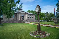
- The Carnegie District Library[20]
Climate
This climatic region is typified by large seasonal temperature differences, with warm to hot (and often humid) summers and cold (sometimes severely cold) winters. According to the Köppen Climate Classification system, Howell has a humid continental climate, abbreviated "Dfb" on climate maps.[21]
Notable people
- Bones – rapper and singer
- Donald Burgett – World War II veteran and author
- Timothy Busfield – actor and director
- Melissa Gilbert – actress and author
- T.J. Hensick – hockey player for St. Louis Blues
- Andy Hilbert – hockey player for New York Islanders
- William Mather Lewis – president of George Washington University, mayor of Lake Forest, Illinois
- Robert E. Miles - pastor of the Mountain Church of Jesus Christ the Savior
- Mike Rogers – United States Congressman
- Mark Schauer – former United States Congressman and Michigan gubernatorial candidate in 2014
- Bert Tooley – shortstop for the Brooklyn Dodgers, 1911–1912
References
- "2019 U.S. Gazetteer Files". United States Census Bureau. Retrieved July 25, 2020.
- "U.S. Census website". United States Census Bureau. Retrieved 2012-11-25.
- "Population and Housing Unit Estimates". United States Census Bureau. May 24, 2020. Retrieved May 27, 2020.
- "U.S. Census website". United States Census Bureau. Retrieved 2008-01-31.
- "US Board on Geographic Names". United States Geological Survey. 2007-10-25. Retrieved 2008-01-31.
- "Find a County". National Association of Counties. Archived from the original on 2011-05-31. Retrieved 2011-06-07.
- City of Howell: History of Howell, accessed 31 December 2020.
- Howell City Charter index page, accessed 31 December 2020.
- "US Gazetteer files 2010". United States Census Bureau. Archived from the original on 2012-01-25. Retrieved 2012-11-25.
- "Census of Population and Housing". Census.gov. Retrieved June 4, 2015.
- "Howell (city) QuickFacts from the US Census Bureau". Archived from the original on 2012-12-04.
- "A tale of two towns: Newest racial incident has Howell facing its past". MLive.com. Retrieved 2016-01-05.
- Walker, Sam. "Michigan Town Battles Image of Racism". Christian Science Monitor. ISSN 0882-7729. Retrieved 2016-01-05.
- Peters, Jeremy W. (2005-05-23). "Auctioning Memories in a Town Haunted by the Klan". The New York Times. ISSN 0362-4331. Retrieved 2016-01-05.
- "Michigan teacher suspended over anti-gay punishment - USATODAY.com". usatoday30.usatoday.com. Retrieved 2016-01-05.
- "Shocking racist tweets follow high school basketball win by all-white team". MLive.com. Retrieved 2016-01-05.
- "Livingston Diversity Council". www.livingstondiversity.org. Retrieved 2016-01-06.
- "Livingston Diversity Council". www.livingstondiversity.org. Retrieved 2016-01-06.
- Brush, Mark. "Report: 35 "Hate Groups" in Michigan". michiganradio.org. Retrieved 3 May 2017.
- "Welcome - Howell Carnegie District Library". www.howelllibrary.org. Retrieved 3 May 2017.
- "Howell, Michigan Kppen Climate Classification (Weatherbase)". Weatherbase.
