Havana, Oregon
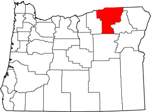
Havana is an unincorporated community[1] in Umatilla County, Oregon, United States, 9 miles (14 km) northeast of Pendleton on Wildhorse Creek. This former Union Pacific Railroad station[2] is near the junction of Oregon Route 335, known as the Havana–Helix Highway, with Oregon Route 11, about 9 miles south of Helix. Its elevation is 1312 ft (400 m) above sea level.[1]
Havana, Oregon | |
|---|---|
 Havana, Oregon Location within the state of Oregon | |
| Coordinates: 45°43′29″N 118°39′25″W | |
| Country | United States |
| State | Oregon |
| County | Umatilla |
| Elevation | 1,312 ft (400 m) |
| Time zone | UTC-8 (Pacific (PST)) |
| • Summer (DST) | UTC-7 (PDT) |
| Area code(s) | 458 and 541 |
| GNIS feature ID | 1136364[1] |
| Coordinates and elevation from Geographic Names Information System[1] | |
References
- "Havana". Geographic Names Information System. United States Geological Survey. November 28, 1980. Retrieved September 9, 2016.
- "The Idea of National Highways". Motoring Magazine and Motoring Life. Oct–Dec 1913. Retrieved December 21, 2009.
External links
- 1950s images of the McCormmach Ranch in the Havana area from Oregon State University Extension Service, Umatilla County
This article is issued from Wikipedia. The text is licensed under Creative Commons - Attribution - Sharealike. Additional terms may apply for the media files.
