Graskop
Graskop is a small town in Mpumalanga province, South Africa. It was set up in the 1880s as a gold mining camp but it now serves as a tourist destination and the timber industry. The name is Afrikaans for grassy hillock. “God’s Window”, a scenic view from the escarpment of the Lowveld below, is located outside the town.
Graskop | |
|---|---|
 Shops along the main street of Graskop | |
 Graskop  Graskop | |
| Coordinates: 24°55′54″S 30°50′30″E | |
| Country | South Africa |
| Province | Mpumalanga |
| District | Ehlanzeni |
| Municipality | Thaba Chweu |
| Area | |
| • Total | 35.01 km2 (13.52 sq mi) |
| Elevation | 1,436 m (4,711 ft) |
| Population (2011)[1] | |
| • Total | 3,996 |
| • Density | 110/km2 (300/sq mi) |
| Racial makeup (2011) | |
| • Black African | 61.2% |
| • Coloured | 13.0% |
| • Indian/Asian | 0.9% |
| • White | 22.9% |
| • Other | 2.0% |
| First languages (2011) | |
| • Afrikaans | 29.4% |
| • Northern Sotho | 22.0% |
| • Sotho | 14.8% |
| • English | 10.9% |
| • Other | 22.8% |
| Time zone | UTC+2 (SAST) |
| Postal code (street) | 1270 |
| PO box | 1270 |
| Area code | 013 |
Graskop is 14 km south-east of Pilgrim's Rest and 28 km north of Sabie. It was laid out between 1880 and 1890 on a farm belonging to Abel Erasmus, Native Commissioner of the Transvaal Republic. Named after a grassy hillock (Afrikaans gras, ‘grass’, kop, ‘hillock’). Originally it was a mining camp. It is the best place to view the "Edge of the Lowveld", with a sudden drop of 700 metres.[2]
 Potholes at Bourke's Luck near Graskop.
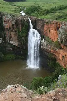
 The Berlin Falls near Graskop.
 "The Pinnacle" near Graskop.
 "God's Window" near Graskop.
References
- "Main Place Graskop". Census 2011.
- "Dictionary of Southern African Place Names (Public Domain)". Human Science Research Council. p. 187.
External links
 Graskop travel guide from Wikivoyage
This article is issued from Wikipedia. The text is licensed under Creative Commons - Attribution - Sharealike. Additional terms may apply for the media files.
.svg.png.webp)