Grade II listed buildings in Liverpool-L6

Liverpool is a city and port in Merseyside, England, which contains many listed buildings. A listed building is a structure designated by English Heritage of being of architectural and/or of historical importance and, as such, is included in the National Heritage List for England. There are three grades of listing, according to the degree of importance of the structure. Grade I includes those buildings that are of "exceptional interest, sometimes considered to be internationally important"; the buildings in Grade II* are "particularly important buildings of more than special interest"; and those in Grade II are "nationally important and of special interest". Very few buildings are included in Grade I — only 2.5% of the total. Grade II* buildings represent 5.5% of the total, while the great majority, 92%, are included in Grade II.[1]

Listed Buildings in Liverpool
Listed buildings in Liverpool
Grade I listed buildings
Grade II* listed buildings
Grade II listed buildings:

Liverpool contains more than 1,550 listed buildings, of which 28 are in Grade I, 109 in Grade II*, and the rest in Grade II.[lower-alpha 1] This list contains the Grade II listed buildings in the L6 postal district of Liverpool. The postal district contains the suburb of Fairfield, and part of Everton, once a separate village, later absorbed by the expansion of Liverpool to become another suburb. The district is mainly residential, and most of the listed buildings are houses, or associated structures. Also listed are a hospital and its associated buildings, a waterworks, a former chapel, a bandstand, a war memorial, a drinking fountain, and a pillar box.

Grade II listed buildings from other areas in the city can be found through the box on the right, along with the lists of the Grade I and Grade II* buildings in the city.

Buildings

Name Location Photograph Built Notes
Office Block, Ogden Imperial Tobacco Ltd.
Boundary Lane
53.41819°N 2.95358°W / 53.41819; -2.95358 (Office Block, Ogden Imperial Tobacco Ltd.)
1899 Office block of Ogden Ltd (later Ogden-Imperial Tobacco Ltd.) tobacco manufacturers, 1899, probably by Henry Hartley, eclectic Queen Anne style in pressed red brick with sandstone dressings and clock tower to centre.[2]
9 and 10 Brougham Terrace
53.41435°N 2.96053°W / 53.41435; -2.96053 (9 and 10 Brougham Terrace)
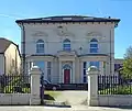
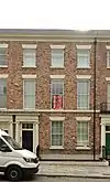
1830 The remaining part of a terrace of houses, used as a mosque between 1889 and 1908, then converted into offices. It is built in brick, partly stuccoed, with stone dressings, and a slate roof. The terrace has three storeys, and is in four bays. The windows are sashes. At the top is a shallow parapet.[3][4]
47 and 49 Everton Road
53.41580°N 2.96462°W / 53.41580; -2.96462 (47 and 49 Everton Road)
1830s Two brick houses with stone dressings and slate roofs. They have three storeys and basements, and each house is in three bays. At the top of the building is a frieze and a cornice. The windows are sashes with wedge lintels. The doorways are round-headed and the doorcases are flanked by Doric fluted columns.[5]
51 Everton Road
53.41591°N 2.96479°W / 53.41591; -2.96479 (51 Everton Road)
1830s A brick house with stone dressings and a slate roof. It has three storeys and a basement, and a three-bay front. At the top of the building is a cornice. The windows are sashes with wedge lintels. The doorway is round-headed and the doorcase is flanked by Doric fluted columns.[6]
53 Everton Road
53.41600°N 2.96491°W / 53.41600; -2.96491 (53 Everton Road)
1830s A brick house with stone dressings and a slate roof. It has three storeys and a basement, and a three-bay front. At the top of the building is a cornice. The windows are sashes with wedge lintels. The doorway is round-headed and the doorcase is flanked by Doric fluted columns.[7]
55 Everton Road
53.41608°N 2.96502°W / 53.41608; -2.96502 (55 Everton Road)
1830s A brick house with stone dressings and a slate roof. It has three storeys and a basement, and a three-bay front. At the top of the building is a cornice. The windows are sashes with wedge lintels. The doorway is round-headed and the doorcase is flanked by Doric fluted columns.[8]
57, 59 and 61 Everton Road
53.41612°N 2.96508°W / 53.41612; -2.96508 (57, 59 and 61 Everton Road)
1830s Originally three houses, later converted into one. It is built in brick with stone dressings and a slate roof. The house has three storeys and a basement, and a nine-bay front. The central three bays break forward, and contain a carriage entrance. At the top of the building is a cornice. The windows are sashes.[9]
63 Everton Road
53.41676°N 2.96543°W / 53.41676; -2.96543 (63 Everton Road)
1830s A brick house with stone dressings and a slate roof. It has three storeys and a basement, and a three-bay front. At the top of the building is a cornice. The windows are sashes with wedge lintels. The doorway is round-headed and the doorcase is in Doric style.[10]
65 Everton Road
53.41653°N 2.96554°W / 53.41653; -2.96554 (65 Everton Road)
1830s A brick house with stone dressings and a slate roof. It has three storeys and a basement, and a three-bay front. At the top of the building is a cornice. The windows are sashes with wedge lintels. The doorway is round-headed and the doorcase is in Doric style.[11]|
Bandstand Fairfield Crescent
53.41520°N 2.93692°W / 53.41520; -2.93692 (Bandstand, Newsham Park)
1880s The bandstand is at the west end of Newsham Park. It has an octagonal brick base with stone pilasters. Iron columns support a felted roof.[12]
Reservoir retaining wall Hodson Place
53.41943°N 2.96404°W / 53.41943; -2.96404 (Reservoir retaining wall)
1854 A stone retaining wall of a reservoir. It runs for 692 metres (2,270 ft) along Hodson Place, and has a round turret at the east end and an octagonal turret at the west end. The wall then runs south for 53.5 metres (176 ft).[13]
4 Laurel Road
53.4130°N 2.9381°W / 53.4130; -2.9381 (4 Laurel Road)
1860s A stuccoed house with a slate roof. It has two storeys, and is in three bays. In the ground floor are canted bay windows containing casements. The windows in the upper floor have architraves, friezes, and cornices, the central window has a segmental pediment.[14]
6 Laurel Road
53.4127°N 2.9380°W / 53.4127; -2.9380 (6 Laurel Road)
1860s A stuccoed house with a hipped slate roof. It has two storeys, and is in three bays. In the ground floor are canted bay windows with entablatures and a parapet. In the upper floor the windows have archivolts, keystones, and pediments. All the windows are casements.[15]
South building,
Water Works
Margaret Street
53.4191°N 2.9630°W / 53.4191; -2.9630 (South building, Water Works)
1857 A stone building in two storeys. On the front are two bays, with one bay on the sides. There is a single storey adjoining block with three bays.[16]
Water tower and building Margaret Street
53.4195°N 2.9632°W / 53.4195; -2.9632 (Water tower and building)
1857 This consists of a circular three-stage water tower with an iron water tank, a square tower to the south, and further to the south is a two-storey block in four bays. The whole structure is built in stone.[17]
Judge's House Newsham Drive
53.4207°N 2.9443°W / 53.4207; -2.9443 (Judge's House)
Late 18th century Initially known as Newsham House, it was converted in 1866–67 to act as Judges' Lodgings. It is built in brick on a stone base, with stone dressings and a hipped slate roof. The house has three storeys with a basement, and a five-bay front. The middle three bays break forward under a pediment. The porch contains pairs of Corinthian columns, and the windows are sashes with wedge lintels. On the left of the house is an extension containing a circular library.[18][19]
Stable and coach house,
Judge's House
Newsham Drive
53.42058°N 2.94475°W / 53.42058; -2.94475 (Stable and coach house, Judge's House)
Late 18th century A building in brick with stone dressings and a slate roof. It has two storeys, and a front of eight bays. The central two bays break forward under a pediment. On the ground floor are carriage openings, inserted garage doors, and sash windows. The upper floor contains square and round glazed pitch holes.[18][20]
Newsham Park Hospital Orphan Drive
53.4212°N 2.9349°W / 53.4212; -2.9349 (Newsham Park Hospital)
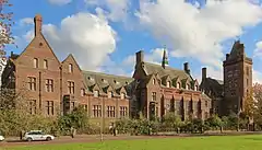
1871–75 Originally the Royal Seamen's Orphan Institution, later a hospital. It was designed by Alfred Waterhouse and is built in brick with stone dressings and a slate roof. It is in two and three storeys, and has two ranges. The west range is symmetrical with 19 bays; the south range is smaller, and is architecturally simpler. At the corner of the ranges is a tower with an octagonal stair turret. Other features include oriel windows and a flèche.[21][22]
Lodge to north of Newsham Park Hospital Orphan Drive
53.4224°N 2.9357°W / 53.4224; -2.9357 (Lodge to north of Newsham Park Hospital)
1871–75 The building was designed by Alfred Waterhouse. It is built in brick with stone dressings and has a slate roof. The building is in two storeys. It has a projecting bays under a gable and contains three-light mullioned windows.[21][23]
Building to south of Newsham Park Hospital Orphan Drive
53.4209°N 2.9337°W / 53.4209; -2.9337 (Building to south of Newsham Park Hospital)
1871–75 The building was designed by Alfred Waterhouse and is attached to the hospital by a corridor. It is built in brick with stone dressings and has a slate roof. The building is in three storeys and an attic, and has a front of four bays with dormers.[21][24]
The Hollies 1 Prospect Vale
53.4138°N 2.9375°W / 53.4138; -2.9375 (The Hollies)
c. 1840 A stuccoed house with a slate roof, in two storeys. It has three bays on each side. The windows in the upper floor are sashed; in the ground floor some are blind; others are casements. The doorway has an architrave with a frieze and a cornice.[25]
Particular Baptist Chapel Shaw Street
53.41246°N 2.96766°W / 53.41246; -2.96766 (Particular Baptist Chapel)
1847 The chapel was converted into flats in 2004. It is built in brick with sandstone dressings and a slate roof. Its front has three bays, and along the sides are five bays. It has an Ionic porch with angle pilasters, at the top of which is an entablature and a pediment.[26][27]
War Memorial, Whitley Gardens Shaw Street
53.41477°N 2.96881°W / 53.41477; -2.96881 (War Memorial, Whitley Gardens)
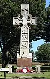
1863 A memorial to members of the 8th (The King's) Regiment who died in the Indian Mutiny in 1857–58. Originally in Portsmouth, it was moved to Chelsea in 1877, and to Liverpool in 1911. It consists of a Celtic cross on a sandstone base. Around the base of the cross are reliefs, and on the base is an inscription.[28][29]
41–49 Shaw Street
53.41398°N 2.96894°W / 53.41398; -2.96894 (41–49 Shaw Street)
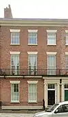
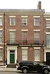
1830s A terrace of five brick houses with stone dressings and a slate roof. They have three storeys, basements and attics. Each house has a three-bay front. At the top of the building is a frieze and a cornice. The windows are sashes with wedge lintels. The doorways have Ionic surrounds. On the first floors are balconies.[30][31]
51 Shaw Street
53.41420°N 2.96915°W / 53.41420; -2.96915 (51 Shaw Street)
1830s A brick house with stone dressings and a slate roof. It has three storeys and a basement, with a three-bay front. At the top of the building is a frieze and a cornice. The windows have wedge lintels. The windows in the first floor are sashes, with casements in the top floor. The door has an Ionic surround.[30][32]
53 Shaw Street
53.41436°N 2.96923°W / 53.41436; -2.96923 (53 Shaw Street)
1830s A brick house with stone dressings and a slate roof. It has three storeys and a basement, with a three-bay front. At the top of the building is a frieze and a cornice. The windows are sashes with wedge lintels. The door has an Ionic surround.[30][33]
55 Shaw Street
53.41440°N 2.96926°W / 53.41440; -2.96926 (55 Shaw Street)
1830s A brick house with stone dressings and a slate roof. It has three storeys and a basement, with a three-bay front. At the top of the building is a frieze and a cornice. The windows are sashes with wedge lintels. The door has an Ionic surround.[30][34]
57 Shaw Street
53.41449°N 2.96931°W / 53.41449; -2.96931 (57 Shaw Street)
1830s A brick house with stone dressings and a slate roof. It has three storeys and a basement, with a three-bay front. At the top of the building is a frieze and a cornice. The windows are sashes with wedge lintels. The door has an Ionic surround.[30][35]
59 and 61 Shaw Street
53.41458°N 2.96936°W / 53.41458; -2.96936 (59 and 61 Shaw Street)
1830s Two brick houses with stone dressings and slate roofs. At the top of the building is a frieze and a cornice. The windows are a mix of sashes and casements, with wedge lintels. The doors have an Ionic surround.[30][36]
63, 65 and 67 Shaw Street
53.41471°N 2.96941°W / 53.41471; -2.96941 (63, 65 and 67 Shaw Street)
1830s Three brick houses with stone dressings and slate roofs. At the top of the building is a frieze and a cornice. The windows are sashes with wedge lintels. The doors have an Ionic surround.[30][37]
69 and 71 Shaw Street
53.41488°N 2.96950°W / 53.41488; -2.96950 (69 and 71 Shaw Street)
1830s Two brick houses with stone dressings and slate roofs. They have three storeys and a basement, and each house is in three bays. At the top of the building is a frieze and a cornice. The windows are sashes with wedge lintels. The doors have Ionic surrounds.[30][38]
105 and 107 Shaw Street
53.41646°N 2.97032°W / 53.41646; -2.97032 (105 and 107 Shaw Street)
1830s Two brick houses with stone dressings and slate roofs, now derelict. They have three storeys and basements, and each house is in five bays. At the top of the building is a frieze and a cornice. The windows have wedge lintels, and the doors have Ionic surrounds.[30][39]
115, 117 and 119 Shaw Street
53.41697°N 2.97056°W / 53.41697; -2.97056 (115, 117 and 119 Shaw Street)
1830s Three brick houses with stone dressings and slate roofs. They have three storeys and basements, and each house is in five bays. At the top of the building is a frieze and a cornice. The windows have wedge lintels, and the doors have Ionic surrounds.[30][40]
63 Walton Road
53.43227°N 2.97398°W / 53.43227; -2.97398 (63 Walton Road)
1830s A brick house with stone dressings and a slate roof. It has three storeys with a three-bay front. The third bay breaks forward under half a pediment. At the top of the building is a cornice. The windows are a mix of sashes and casements with wedge lintels. The enclosed porch has pairs of Ionic columns supporting an entablature.[41]
Bowden Drinking Fountain West Derby Road
53.41476°N 2.95996°W / 53.41476; -2.95996 (Bowden Drinking Fountain)
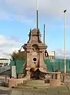
1913 The stone drinking fountain stands on a square of polished red marble. Volute brackets rise from the angles and support a square cap with obelisks. On the top is a small cupola with an obelisk finial. At the front are curving balustraded steps.[42]

See also

References

Notes

  1. These figures are taken from a search in the National Heritage List for England in May 2013, and are subject to variation as further buildings are listed, grades are revised, or buildings are delisted.

Citations

  1. Listed Buildings, Historic England, retrieved 25 March 2015
  2. Historic England, "Ogden Imperial Tobacco Ltd , Office Block, Boundary Lane (1392062)", National Heritage List for England, retrieved 24 January 2019
  3. Historic England, "9 and 10 Brougham Terrace, Liverpool (1454793)", National Heritage List for England, retrieved 19 March 2018
  4. Sardais, Louise (2003), The 'little mosque', Architectural Heritage, BBC, retrieved 4 June 2013
  5. Historic England, "47 and 49 Everton Road, Liverpool (1068230)", National Heritage List for England, retrieved 31 May 2013
  6. Historic England, "51 Everton Road, Liverpool (1356375)", National Heritage List for England, retrieved 31 May 2013
  7. Historic England, "53 Everton Road, Liverpool (1068231)", National Heritage List for England, retrieved 31 May 2013
  8. Historic England, "55 Everton Road, Liverpool (1068232)", National Heritage List for England, retrieved 31 May 2013
  9. Historic England, "57, 59 and 61 Everton Road, Liverpool (1356376)", National Heritage List for England, retrieved 31 May 2013
  10. Historic England, "63 Everton Road, Liverpool (1068233)", National Heritage List for England, retrieved 31 May 2013
  11. Historic England, "65 Everton Road, Liverpool (1356337)", National Heritage List for England, retrieved 31 May 2013
  12. Historic England, "Bandstand at west end of Newsham Park, Liverpool (1206708)", National Heritage List for England, retrieved 3 June 2013
  13. Historic England, "Retaining wall to covered reservoir at water works, Liverpool (1075183)", National Heritage List for England, retrieved 3 June 2013
  14. Historic England, "4 Laurel Road, Liverpool (1084205)", National Heritage List for England, retrieved 3 June 2013
  15. Historic England, "6 Laurel Road, Liverpool (1346275)", National Heritage List for England, retrieved 4 June 2013
  16. Historic England, "South building of water works, Liverpool (1208230)", National Heritage List for England, retrieved 3 June 2013
  17. Historic England, "Water tower and north building of water works, Liverpool (1070630)", National Heritage List for England, retrieved 3 June 2013
  18. Pollard & Pevsner (2006), p. 426
  19. Historic England, "Judge's House, Liverpool (1070619)", National Heritage List for England, retrieved 3 June 2013
  20. Historic England, "Stable & coach house to Judge's House, Liverpool (1293121)", National Heritage List for England, retrieved 4 June 2013
  21. Pollard & Pevsner (2006), p. 425
  22. Historic England, "Park Hospital, Liverpool (1363057)", National Heritage List for England, retrieved 4 June 2013
  23. Historic England, "Lodge to north of Newsham Park Hospital, Liverpool (1208680)", National Heritage List for England, retrieved 3 June 2013
  24. Historic England, "Building to south of Newsham Park Hospital, Liverpool (1072982)", National Heritage List for England, retrieved 3 June 2013
  25. Historic England, "The Hollies, 1 Prospect Vale, Liverpool (1209011)", National Heritage List for England, retrieved 3 June 2013
  26. Pollard & Pevsner (2006), p. 420
  27. Historic England, "Particular Baptist Chapel, Shaw Street, Liverpool (1217824)", National Heritage List for England, retrieved 3 June 2013
  28. Pollard & Pevsner (2006), p. 424
  29. Historic England, "War memorial at north end of Whitley Gardens, Shaw Street, Liverpool (1217833)", National Heritage List for England, retrieved 4 June 2013
  30. Pollard & Pevsner (2006), p. 423
  31. Historic England, "41–49 Shaw Street, Liverpool (1210160)", National Heritage List for England, retrieved 3 June 2013
  32. Historic England, "51 Shaw Street, Liverpool (1360237)", National Heritage List for England, retrieved 4 June 2013
  33. Historic England, "53 Shaw Street, Liverpool (1062534)", National Heritage List for England, retrieved 31 May 2013
  34. Historic England, "55 Shaw Street, Liverpool (1210167)", National Heritage List for England, retrieved 3 June 2013
  35. Historic England, "57 Shaw Street, Liverpool (1360238)", National Heritage List for England, retrieved 3 June 2013
  36. Historic England, "59 and 61 Shaw Street, Liverpool (1292292)", National Heritage List for England, retrieved 4 June 2013
  37. Historic England, "63, 65 and 67 Shaw Street, Liverpool (1062535)", National Heritage List for England, retrieved 31 May 2013
  38. Historic England, "69 and 71 Shaw Street, Liverpool (1210175)", National Heritage List for England, retrieved 3 June 2013
  39. Historic England, "105 and 107 Shaw Street, Liverpool (1062537)", National Heritage List for England, retrieved 31 May 2013
  40. Historic England, "115, 117 and 119 Shaw Street, Liverpool (1217818)", National Heritage List for England, retrieved 3 June 2013
  41. Historic England, "63 Walton Road, Liverpool (1360214)", National Heritage List for England, retrieved 4 June 2013
  42. Historic England, "Bowden Drinking Fountain at corner of Boaler St, Liverpool (1291913)", National Heritage List for England, retrieved 4 June 2013

Sources

This article is issued from Wikipedia. The text is licensed under Creative Commons - Attribution - Sharealike. Additional terms may apply for the media files.