Garrison, Utah
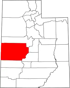
Garrison is an unincorporated community in western Millard County, Utah, United States. It is home to a Utah Department of Transportation yard and office, but other than that, offers no services.
Garrison | |
|---|---|
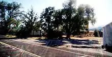
 A view of downtown and the UDOT yard, on Utah State Route 159 | |
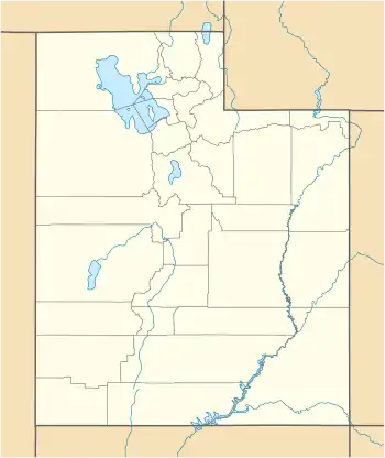
 Garrison Location within the state of Utah | |
| Coordinates: 38°56′04″N 114°01′59″W | |
| Country | United States |
| State | Utah |
| County | Millard |
| Elevation | 5,276 ft (1,608 m) |
| Time zone | UTC-7 (Mountain (MST)) |
| • Summer (DST) | UTC-6 (MDT) |
| ZIP codes | 84728 |
| Area code(s) | 435 |
| GNIS feature ID | 1428153[1] |
ZIP code
The 84728 ZIP code, which includes Garrison as the primary population center, has 158 residents spread out over 335.54 square miles. The median household income is $37,857 and 62 out of 83 housing units are occupied. Three public school run by the Millard School District serve the area covered by the ZIP code: the Garrison School (elementary), Garrison 7th & 8th, and Eskdale High School.[2]
Geography

Garrison is located in Snake Valley in the far west central area of the state just east of the Nevada state line. In fact, some of the town's farms and structures are legally in Nevada. The Great Basin National Park is in Nevada just a few miles west of the border, accessed via Baker.
History
| Historical population | |||
|---|---|---|---|
| Census | Pop. | %± | |
| 1910 | 88 | — | |
| 1920 | 109 | 23.9% | |
| 1930 | 90 | −17.4% | |
| 1940 | 60 | −33.3% | |
| 1950 | 84 | 40.0% | |
| Source: U.S. Census Bureau[3] | |||
Founded as a cattle rustling and outlaw community in the 1850s, the town of Garrison later became the center of mining interests. The name comes from the Garrison family who farmed in the area. After mining interests subsided, the Garrisons had a livestock and hay ranch. Mrs. Garrison was a schoolteacher who also handled the mail, and the town's name honors her.[4][5]
Climate
Garrison experiences a semi-arid climate with hot summers and cold winter. Due to Garrison's elevation and aridity, the Diurnal temperature variation is substantial.
| Climate data for Garrison, Utah | |||||||||||||
|---|---|---|---|---|---|---|---|---|---|---|---|---|---|
| Month | Jan | Feb | Mar | Apr | May | Jun | Jul | Aug | Sep | Oct | Nov | Dec | Year |
| Record high °F (°C) | 71 (22) |
73 (23) |
79 (26) |
86 (30) |
95 (35) |
108 (42) |
106 (41) |
104 (40) |
98 (37) |
91 (33) |
80 (27) |
72 (22) |
108 (42) |
| Average high °F (°C) | 41.4 (5.2) |
47.1 (8.4) |
54.8 (12.7) |
64.5 (18.1) |
73.4 (23.0) |
84.4 (29.1) |
92.3 (33.5) |
89.2 (31.8) |
80.0 (26.7) |
67.1 (19.5) |
53.2 (11.8) |
43.3 (6.3) |
65.9 (18.8) |
| Average low °F (°C) | 15.4 (−9.2) |
20.9 (−6.2) |
26.2 (−3.2) |
32.2 (0.1) |
39.6 (4.2) |
48.1 (8.9) |
56.6 (13.7) |
55.6 (13.1) |
45.3 (7.4) |
34.2 (1.2) |
24.6 (−4.1) |
16.8 (−8.4) |
34.6 (1.4) |
| Record low °F (°C) | −21 (−29) |
−26 (−32) |
−5 (−21) |
9 (−13) |
12 (−11) |
27 (−3) |
33 (1) |
33 (1) |
20 (−7) |
1 (−17) |
−14 (−26) |
−20 (−29) |
−26 (−32) |
| Average precipitation inches (mm) | 0.43 (11) |
0.48 (12) |
0.83 (21) |
0.72 (18) |
0.72 (18) |
0.43 (11) |
0.54 (14) |
0.72 (18) |
0.73 (19) |
0.76 (19) |
0.61 (15) |
0.42 (11) |
7.42 (188) |
| Average snowfall inches (cm) | 4.4 (11) |
4.2 (11) |
6.1 (15) |
2.9 (7.4) |
1.0 (2.5) |
0.2 (0.51) |
0 (0) |
0 (0) |
0.0 (0.0) |
1.4 (3.6) |
3.7 (9.4) |
3.1 (7.9) |
26.8 (68) |
| Source: The Western Regional Climate Center[6] | |||||||||||||
References
- U.S. Geological Survey Geographic Names Information System: Garrison, Utah
- "84728". unitedstateszipcodes.org. Retrieved 21 May 2019.
- "Census of Population and Housing". U.S. Census Bureau. Archived from the original on February 8, 2006. Retrieved November 4, 2011.
- Van Cott, John W. (1990). Utah Place Names. Salt Lake City, Utah: University of Utah Press. p. 152. ISBN 0-87480-345-4.
- Van Atta, Dale (Jan 22, 1977). "You name it - there's a town for it". The Deseret News. p. 15. Retrieved 18 October 2015.
- "Seasonal Temperature and Precipitation Information". Western Regional Climate Center. Retrieved March 29, 2013.
External links
![]() Media related to Garrison, Utah at Wikimedia Commons
Media related to Garrison, Utah at Wikimedia Commons
