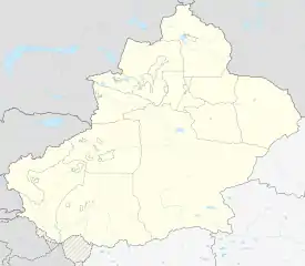
Fuyun County
Fuyun County (Chinese: 富蕴县) as the official romanized name, also transliterated from Uyghur as Koktokay County (Uighur: كوكتوقاي ناھىيىسى; Chinese: 可可托海县), is a county situated in the Xinjiang Uyghur Autonomous Region and is under the administration of the Altay Prefecture. It has an area of 32,237 km² with a population of 80,000. The seat of Fuyun County is in Ku Ertix Town (库额尔齐斯镇). The Koktokay National Geopark is in Koktokay Town (可可托海镇). The Postcode of Fuyun County is 836100.
Fuyun County
富蕴县 كوكتوقاي ناھىيىسى | |
|---|---|
.jpg.webp) | |
.png.webp) Location of Fuyun County (red) in Altay Prefecture (yellow) and Xinjiang | |
 Fuyun Location of the seat in Xinjiang | |
| Coordinates: 47°13′N 89°39′E | |
| Country | People's Republic of China |
| Region | Xinjiang |
| Prefecture | Altay |
| Township-level divisions | 3 towns 6 townships 3 ethnic townships |
| County seat | Ku Ertix (库额尔齐斯镇) |
| Area | |
| • Total | 32,237 km2 (12,447 sq mi) |
| Dimensions | |
| • Length | 413 km (257 mi) |
| • Width | 180 km (110 mi) |
| Highest elevation | 3,863 m (12,674 ft) |
| Lowest elevation | 430 m (1,410 ft) |
| Population | |
| • Total | 80,000 |
| • Density | 2.5/km2 (6.4/sq mi) |
| Time zone | UTC+8 (China Standard) |
| Postal code | 836100 |
| Fuyun County | |||||||||||
|---|---|---|---|---|---|---|---|---|---|---|---|
| Chinese name | |||||||||||
| Simplified Chinese | 富蕴县 | ||||||||||
| Traditional Chinese | 富蘊縣 | ||||||||||
| |||||||||||
| Alternative Chinese name | |||||||||||
| Simplified Chinese | 可可托海县 | ||||||||||
| Traditional Chinese | 可可託海縣 | ||||||||||
| |||||||||||
| Uyghur name | |||||||||||
| Uyghur | كوكتوقاي ناھىيىسى | ||||||||||
| |||||||||||
Administrative divisions
Town (镇)
- Kueerqisi Town (库额尔齐斯镇), Koktokay Town (可可托海镇), Shakurti Town (恰库尔图镇)
Township (乡)
- Turgun Township (吐尔洪乡), Dure Township 杜热乡, Kürti Township 库尔特乡, Karatüngke Township (喀拉通克乡), Temeki Township (铁买克乡), Kara Bulgin Township 喀拉布勒根乡
Geography
| Climate data for Fuyun County (1971−2000) | |||||||||||||
|---|---|---|---|---|---|---|---|---|---|---|---|---|---|
| Month | Jan | Feb | Mar | Apr | May | Jun | Jul | Aug | Sep | Oct | Nov | Dec | Year |
| Record high °C (°F) | 5.1 (41.2) |
7.7 (45.9) |
24.5 (76.1) |
31.0 (87.8) |
34.7 (94.5) |
39.2 (102.6) |
42.2 (108.0) |
38.7 (101.7) |
35.2 (95.4) |
28.4 (83.1) |
18.2 (64.8) |
10.0 (50.0) |
42.2 (108.0) |
| Average high °C (°F) | −12.1 (10.2) |
−7.9 (17.8) |
0.7 (33.3) |
14.9 (58.8) |
22.5 (72.5) |
27.7 (81.9) |
29.3 (84.7) |
28.2 (82.8) |
22.3 (72.1) |
13.1 (55.6) |
0.7 (33.3) |
−9.2 (15.4) |
10.9 (51.5) |
| Average low °C (°F) | −26 (−15) |
−23.8 (−10.8) |
−13.4 (7.9) |
0.8 (33.4) |
7.0 (44.6) |
12.5 (54.5) |
14.7 (58.5) |
12.3 (54.1) |
6.3 (43.3) |
−1.1 (30.0) |
−11.6 (11.1) |
−21.8 (−7.2) |
−3.7 (25.4) |
| Record low °C (°F) | −57.8 (−72.0) |
−46.5 (−51.7) |
−40.7 (−41.3) |
−17.7 (0.1) |
−5.9 (21.4) |
−0.3 (31.5) |
4.7 (40.5) |
−0.6 (30.9) |
−6.0 (21.2) |
−19.3 (−2.7) |
−41.8 (−43.2) |
−47.5 (−53.5) |
−57.8 (−72.0) |
| Average precipitation mm (inches) | 8.9 (0.35) |
6.9 (0.27) |
9.4 (0.37) |
13.6 (0.54) |
16.7 (0.66) |
19.6 (0.77) |
32.1 (1.26) |
14.5 (0.57) |
15.5 (0.61) |
15.2 (0.60) |
21.8 (0.86) |
15.3 (0.60) |
189.5 (7.46) |
| Average precipitation days (≥ 0.1 mm) | 7.1 | 6.4 | 7.4 | 6.5 | 6.5 | 6.7 | 8.2 | 6.6 | 5.9 | 6.4 | 8.7 | 8.7 | 85.1 |
| Average relative humidity (%) | 76 | 75 | 73 | 51 | 43 | 44 | 48 | 46 | 49 | 58 | 72 | 78 | 59 |
| Mean monthly sunshine hours | 168.5 | 188.3 | 241.5 | 267.5 | 315.9 | 321.8 | 320.2 | 306.8 | 265.1 | 215.1 | 154.6 | 135.7 | 2,901 |
| Percent possible sunshine | 61 | 65 | 66 | 66 | 68 | 68 | 67 | 70 | 71 | 64 | 55 | 51 | 65 |
| Source: China Meteorological Administration | |||||||||||||
This article is issued from Wikipedia. The text is licensed under Creative Commons - Attribution - Sharealike. Additional terms may apply for the media files.