Freedom Tower station
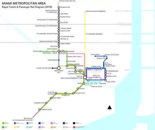
Freedom Tower is a Metromover station in Downtown, Miami, Florida, directly west of the Freedom Tower and the American Airlines Arena.
Freedom Tower | ||||||||||||
|---|---|---|---|---|---|---|---|---|---|---|---|---|
| Metromover people mover station | ||||||||||||
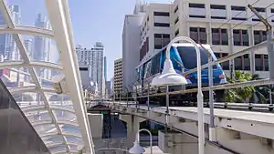
 Government Center-bound train departing the station | ||||||||||||
| Location | 600 NE Second Avenue Miami, Florida 33132 | |||||||||||
| Coordinates | 25°46′49″N 80°11′26″W | |||||||||||
| Owned by | Miami-Dade County | |||||||||||
| Platforms | 1 island platform | |||||||||||
| Tracks | 2 | |||||||||||
| Connections | ||||||||||||
| Construction | ||||||||||||
| Disabled access | Yes | |||||||||||
| History | ||||||||||||
| Opened | May 26, 1994 | |||||||||||
| Services | ||||||||||||
| ||||||||||||
The station is located at the intersection of Northeast Sixth Street and Second Avenue, opening to service May 26, 1994.
Station layout
| P Platform level |
Southbound | ← Omni Loop toward Downtown (College/Bayside) |
| Island platform, doors will open on the left | ||
| Northbound | Omni Loop toward School Board (Park West) → | |
| G | Street level | Exit/entrance and buses |
Places of interest
- Freedom Tower
- American Airlines Arena
- Miami Dade College (Wolfson Campus)
- Paramount Park Tower
- Freedom Square
External links
 Media related to Freedom Tower metro station at Wikimedia Commons
- MDT – Metromover Stations
- 6th Street entrance from Google Maps Street View
- 7th Street entrance from Google Maps Street View
This article is issued from Wikipedia. The text is licensed under Creative Commons - Attribution - Sharealike. Additional terms may apply for the media files.
