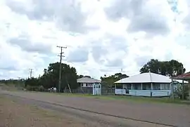
Didcot, Queensland
Didcot is a rural locality in the North Burnett Region, Queensland, Australia.[2] In the 2016 census Didcot had a population of 60 people.[1]
| Didcot Queensland | |||||||||||||||
|---|---|---|---|---|---|---|---|---|---|---|---|---|---|---|---|
 Didcot, 2008 | |||||||||||||||
 Didcot | |||||||||||||||
| Coordinates | 25.4677°S 151.8636°E | ||||||||||||||
| Population | 60 (2016 census)[1] | ||||||||||||||
| • Density | 0.48/km2 (1.23/sq mi) | ||||||||||||||
| Postcode(s) | 4621 | ||||||||||||||
| Area | 126.0 km2 (48.6 sq mi) | ||||||||||||||
| Time zone | AEST (UTC+10:00) | ||||||||||||||
| Location |
| ||||||||||||||
| LGA(s) | North Burnett Region | ||||||||||||||
| State electorate(s) | Callide | ||||||||||||||
| Federal Division(s) | Flynn | ||||||||||||||
| |||||||||||||||
Geography
The now-closed Mungar-Monto railway line passed through Didcot from west to east with two now-abandonded railway stations serving the locality:
- Didcot railway station in the west of the locality (25.4745°S 151.8682°E) [3][4]
- Chowey railway station in the east of the locality (25.4648°S 151.9372°E).[3][5]
History
Didcot Provisional School opened on 23 November 1908. On 1 January1909 it became Didcot State School. It closed in 1967.[6]
In the 2011 census, Didcot had a population of 287 people.[7]
In the 2016 census Didcot had a population of 60 people.[1]
Heritage listings
Didcot has a number of heritage-listed sites, including:
- Chowey Cemetery Road, off Gooroolba Biggenden Road: Chowey Cemetery (also known as Mount Shamrock Cemetery)[8]
- on the Mungar-Monto railway line: Deep Creek Railway Bridge[8][9]
Economy
There are a number of homesteads in the locality:[10]
- Avalon (25.4687°S 151.8334°E)
- Bibaringa (25.5004°S 151.8552°E)
- Brahman Pk (25.5687°S 151.8935°E)
- Danebo (25.5043°S 151.8739°E)
- Nora Creina (25.4624°S 151.8795°E)
- Plum Tree (25.4645°S 151.8919°E)
- Warra Creek (25.4993°S 151.8519°E)
Education
There are no schools in Didcot. The nearest primary schools are Coalstoun Lakes State School in neighbouring Coalstoun Lakes to the south and Biggenden State School in neighbouring Biggenden to the south-east. The nearest secondary schools are Biggenden State School (to Year 10) and Burnett State College (to Year 12) in Gayndah to the south-west.[11]
References
- Australian Bureau of Statistics (27 June 2017). "Didcot (SSC)". 2016 Census QuickStats. Retrieved 20 October 2018.

- "Didcot – locality in North Burnett Region (entry 45342)". Queensland Place Names. Queensland Government. Retrieved 28 December 2020.
- "Railway stations and sidings - Queensland". Queensland Open Data. Queensland Government. 2 October 2020. Archived from the original on 5 October 2020. Retrieved 5 October 2020.
- "Didcot – railway station in North Burnett Region (entry 9921)". Queensland Place Names. Queensland Government. Retrieved 28 September 2017.
- "Chowey – railway station in North Burnett Region (entry 7167)". Queensland Place Names. Queensland Government. Retrieved 28 September 2017.
- Queensland Family History Society (2010), Queensland schools past and present (Version 1.01 ed.), Queensland Family History Society, ISBN 978-1-921171-26-0
- Australian Bureau of Statistics (31 October 2012). "Didcot (SSC)". 2011 Census QuickStats. Retrieved 19 August 2016.

- "North Burnett Local Heritage Register" (PDF). North Burnett Regional Council. Archived (PDF) from the original on 16 August 2019. Retrieved 16 August 2019.
- "Deep Creek Railway Bridge, Chowey (entry 600031)". Queensland Heritage Register. Queensland Heritage Council. Retrieved 12 July 2013.
- "Homesteads - Queensland". Queensland Open Data. Queensland Government. 18 November 2020. Archived from the original on 24 November 2020. Retrieved 24 November 2020.
- "Queensland Globe". State of Queensland. Retrieved 5 February 2021.
External links
![]() Media related to Didcot, Queensland at Wikimedia Commons
Media related to Didcot, Queensland at Wikimedia Commons