Cobden, New Zealand
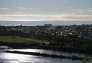
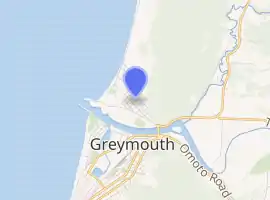
Cobden is a suburb to the north of Greymouth on the West Coast of New Zealand. The Grey River separates Cobden from the rest of Greymouth. To the north is the Rapahoe Range, also called the Twelve Apostles Range. State Highway 6 skirts the south-eastern edge of Cobden.[1][2]
Cobden | |
|---|---|
Suburb | |
 | |

| |
| Country | New Zealand |
| Local authority | Greymouth |
| Electoral ward | Central |
| Population (2018) | |
| • Total | 1,551 |
| Runanga | ||
| (Tasman Sea) |
|
|
| Blaketown | Greymouth Central |

During the period, 1853 to 1876, Cobden was administrated as part of the Nelson Province.
Demographics
| Year | Pop. | ±% p.a. |
|---|---|---|
| 2006 | 1,710 | — |
| 2013 | 1,656 | −0.46% |
| 2018 | 1,551 | −1.30% |
| Source: [3] | ||
Cobden had a population of 1,551 at the 2018 New Zealand census, a decrease of 105 people (-6.3%) since the 2013 census, and a decrease of 159 people (-9.3%) since the 2006 census. There were 666 households. There were 771 males and 783 females, giving a sex ratio of 0.98 males per female. The median age was 40.5 years (compared with 37.4 years nationally), with 300 people (19.3%) aged under 15 years, 291 (18.8%) aged 15 to 29, 720 (46.4%) aged 30 to 64, and 240 (15.5%) aged 65 or older.
Ethnicities were 89.7% European/Pākehā, 15.5% Māori, 1.9% Pacific peoples, 2.1% Asian, and 1.9% other ethnicities (totals add to more than 100% since people could identify with multiple ethnicities).
The proportion of people born overseas was 8.1%, compared with 27.1% nationally.
Although some people objected to giving their religion, 58.8% had no religion, 27.5% were Christian, 0.2% were Hindu, 0.6% were Muslim, 0.4% were Buddhist and 2.7% had other religions.
Of those at least 15 years old, 60 (4.8%) people had a bachelor or higher degree, and 453 (36.2%) people had no formal qualifications. The median income was $21,900, compared with $31,800 nationally. The employment status of those at least 15 was that 531 (42.4%) people were employed full-time, 204 (16.3%) were part-time, and 75 (6.0%) were unemployed.[3]
Education
Cobden School is a coeducational full primary (years 1–8) school with a roll of 84 students as of March 2020.[4][5]
References
- Peter Dowling (editor) (2004). Reed New Zealand Atlas. Reed Books. pp. map 69. ISBN 0-7900-0952-8.CS1 maint: extra text: authors list (link)
- Roger Smith, GeographX (2005). The Geographic Atlas of New Zealand. Robbie Burton. pp. map 148. ISBN 1-877333-20-4.
- "Statistical area 1 dataset for 2018 Census". Statistics New Zealand. March 2020. Cobden (310100). 2018 Census place summary: Cobden
- "New Zealand Schools Directory". New Zealand Ministry of Education. Retrieved 26 April 2020.
- Education Counts: Cobden School