Clévilliers
Clévilliers is a commune in the Eure-et-Loir department and Centre-Val de Loire region of north-central France. It lies 13 km north-west of Chartres and some 80 km west-south-west of Paris.
Clévilliers | |
|---|---|
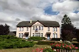
 The town hall in Clévilliers | |
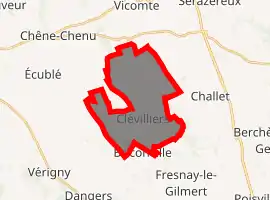
Location of Clévilliers 
| |
 Clévilliers  Clévilliers | |
| Coordinates: 48°32′36″N 1°23′19″E | |
| Country | France |
| Region | Centre-Val de Loire |
| Department | Eure-et-Loir |
| Arrondissement | Chartres |
| Canton | Chartres-1 |
| Intercommunality | CA Chartres Métropole |
| Government | |
| • Mayor (2014–2020) | Alain Bellamy |
| Area 1 | 15.78 km2 (6.09 sq mi) |
| Population (2017-01-01)[1] | 707 |
| • Density | 45/km2 (120/sq mi) |
| Time zone | UTC+01:00 (CET) |
| • Summer (DST) | UTC+02:00 (CEST) |
| INSEE/Postal code | 28102 /28300 |
| Elevation | 171–215 m (561–705 ft) (avg. 199 m or 653 ft) |
| 1 French Land Register data, which excludes lakes, ponds, glaciers > 1 km2 (0.386 sq mi or 247 acres) and river estuaries. | |
The Vacheresses stream flows through the commune, which is bordered by Tremblay-les-Villages (north), Challet (east), Berchères-Saint-Germain (south-east), Briconville (south), and Mittainvilliers-Vérigny (south-west).
The eastern border of the Parc naturel régional du Perche, an area of outstanding natural beauty, lies less than 25 km west of Clévilliers
Population
| Year | Pop. | ±% |
|---|---|---|
| 1946 | 534 | — |
| 1954 | 502 | −6.0% |
| 1962 | 454 | −9.6% |
| 1968 | 403 | −11.2% |
| 1975 | 378 | −6.2% |
| 1982 | 452 | +19.6% |
| 1990 | 549 | +21.5% |
| 1999 | 654 | +19.1% |
| 2007 | 727 | +11.2% |
| 2015 | 703 | −3.3% |
References
- "Populations légales 2017". INSEE. Retrieved 6 January 2020.
| Wikimedia Commons has media related to Clévilliers. |
This article is issued from Wikipedia. The text is licensed under Creative Commons - Attribution - Sharealike. Additional terms may apply for the media files.