Catarman, Camiguin
Catarman, officially the Municipality of Catarman, is a 5th class municipality in the province of Camiguin, Philippines. According to the 2015 census, it has a population of 16,798 people. [3]
Catarman | |
|---|---|
| Municipality of Catarman | |
 Ruin of old church, Bonbon, Catarman | |
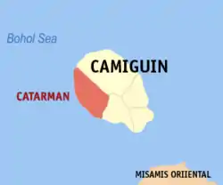 Map of Camiguin with Catarman highlighted | |
OpenStreetMap 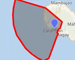
| |
.svg.png.webp) Catarman Location within the Philippines | |
| Coordinates: 9°08′N 124°41′E | |
| Country | |
| Region | Northern Mindanao (Region X) |
| Province | Camiguin |
| District | Lone District |
| Barangays | 14 (see Barangays) |
| Government | |
| • Type | Sangguniang Bayan |
| • Mayor | Kiterio Antonio Palarca II |
| • Vice Mayor | Nilo Patricio K. Amao |
| • Representative | Xavier Jesus D. Romualdo |
| • Electorate | 13,103 voters (2019) |
| Area | |
| • Total | 53.75 km2 (20.75 sq mi) |
| Elevation | 51 m (167 ft) |
| Population | |
| • Total | 16,798 |
| • Density | 310/km2 (810/sq mi) |
| • Households | 4,060 |
| Economy | |
| • Income class | 5th municipal income class |
| • Poverty incidence | 42.52% (2015)[4] |
| • Revenue | ₱59,559,204.98 (2016) |
| Time zone | UTC+8 (PST) |
| ZIP code | 9104 |
| PSGC | |
| IDD : area code | +63 (0)88 |
| Climate type | tropical rainforest climate |
| Native languages | Kinamigin Cebuano Tagalog |
Barangays
Catarman is politically subdivided into 14 barangays.
- Alga
- Bonbon
- Bura
- Catibac
- Compol
- Lawigan
- Liloan
- Looc
- Mainit
- Manduao
- Panghiawan
- Poblacion
- Santo Niño
- Tangaro
Climate
| Climate data for Catarman, Camiguin | |||||||||||||
|---|---|---|---|---|---|---|---|---|---|---|---|---|---|
| Month | Jan | Feb | Mar | Apr | May | Jun | Jul | Aug | Sep | Oct | Nov | Dec | Year |
| Average high °C (°F) | 28 (82) |
29 (84) |
30 (86) |
31 (88) |
30 (86) |
30 (86) |
30 (86) |
30 (86) |
30 (86) |
30 (86) |
29 (84) |
29 (84) |
30 (85) |
| Average low °C (°F) | 24 (75) |
24 (75) |
24 (75) |
25 (77) |
26 (79) |
26 (79) |
25 (77) |
25 (77) |
25 (77) |
25 (77) |
25 (77) |
25 (77) |
25 (77) |
| Average precipitation mm (inches) | 271 (10.7) |
217 (8.5) |
193 (7.6) |
178 (7.0) |
344 (13.5) |
423 (16.7) |
362 (14.3) |
358 (14.1) |
329 (13.0) |
320 (12.6) |
322 (12.7) |
260 (10.2) |
3,577 (140.9) |
| Average rainy days | 23.2 | 19.5 | 22.0 | 22.8 | 29.6 | 28.9 | 30.3 | 29.8 | 28.1 | 28.8 | 26.1 | 24.1 | 313.2 |
| Source: Meteoblue (modeled/calculated data, not measured locally) [5] | |||||||||||||
Demographics
| Year | Pop. | ±% p.a. |
|---|---|---|
| 1903 | 4,260 | — |
| 1918 | 7,980 | +4.27% |
| 1939 | 9,484 | +0.83% |
| 1948 | 16,845 | +6.59% |
| 1960 | 10,659 | −3.74% |
| 1970 | 11,996 | +1.19% |
| 1975 | 12,168 | +0.29% |
| 1980 | 12,422 | +0.41% |
| 1990 | 13,892 | +1.12% |
| 1995 | 14,756 | +1.14% |
| 2000 | 15,386 | +0.90% |
| 2007 | 16,060 | +0.59% |
| 2010 | 16,388 | +0.74% |
| 2015 | 16,798 | +0.47% |
| Source: Philippine Statistics Authority [3] [6] [7][8] | ||
In the 2015 census, the population of Catarman was 16,798 people, [3] with a density of 310 inhabitants per square kilometre or 800 inhabitants per square mile.
Attractions
Some of the famous tourist spot in Camiguin is the hot spring located in Mambajao, Camiguin. Cold spring located in Catarman, Camiguin and soda water in Bora, Catarman.
References
- Municipality of Catarman | (DILG)
- "Province: Camiguin". PSGC Interactive. Quezon City, Philippines: Philippine Statistics Authority. Retrieved 12 November 2016.
- Census of Population (2015). "Region X (Northern Mindanao)". Total Population by Province, City, Municipality and Barangay. PSA. Retrieved 20 June 2016.
- "PSA releases the 2015 Municipal and City Level Poverty Estimates". Quezon City, Philippines. Retrieved 12 October 2019.
- "Catarman: Average Temperatures and Rainfall". Meteoblue. Retrieved 4 March 2020.
- Census of Population and Housing (2010). "Region X (Northern Mindanao)". Total Population by Province, City, Municipality and Barangay. NSO. Retrieved 29 June 2016.
- Censuses of Population (1903–2007). "Region X (Northern Mindanao)". Table 1. Population Enumerated in Various Censuses by Province/Highly Urbanized City: 1903 to 2007. NSO.
- "Province of Camiguin". Municipality Population Data. Local Water Utilities Administration Research Division. Retrieved 17 December 2016.
External links
| Wikimedia Commons has media related to Catarman, Camiguin. |
Mambajao (capital) | |
| Municipalities | |
This article is issued from Wikipedia. The text is licensed under Creative Commons - Attribution - Sharealike. Additional terms may apply for the media files.