Busko County
Busko (Polish: powiat buski) is a unit of territorial administration and local government (powiat) in Świętokrzyskie Voivodeship, south-central Poland. It came into being on January 1, 1999, as a result of the Polish local government reforms passed in 1998. Its administrative seat and only town is Busko-Zdrój, which lies 47 kilometres (29 mi) south of the regional capital Kielce.
Busko
Busko | |
|---|---|
[City] | |
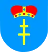
 Flag  Coat of arms | |
 Location within the voivodeship | |
| Coordinates (Busko-Zdrój): 50°28′N 20°43′E | |
| Country | |
| Voivodeship | Świętokrzyskie |
| Seat | Busko-Zdrój |
| Gminas | |
| Area | |
| • Total | 967.39 km2 (373.51 sq mi) |
| Population (2019) | |
| • Total | 67,821 |
| • Density | 70/km2 (180/sq mi) |
| • Urban | 15,832 |
| • Rural | 51,989 |
| Car plates | TBU |
| Website | http://www.powiat.busko.pl/ |
The county covers an area of 967.39 square kilometres (373.5 sq mi). As of 2019 its total population is 67,821, out of which the population of Busko-Zdrój is 15,832and the rural population is 51,989.[1]
Neighbouring counties
Busko County is bordered by Kielce County to the north, Staszów County to the east, Dąbrowa County to the south, Kazimierza County to the south-west and Pińczów County to the west.
Administrative division
The county is subdivided into eight gminas (one urban-rural and seven rural). These are listed in the following table, in descending order of population.
| Gmina | Type | Area (km²) |
Population (2019) |
Seat |
| Gmina Busko-Zdrój | urban-rural | 235.9 | 32,183 | Busko-Zdrój |
| Gmina Pacanów | rural | 123.9 | 6,242 | Pacanów |
| Gmina Stopnica | rural | 125.4 | 6,200 | Stopnica |
| Gmina Nowy Korczyn | rural | 117.3 | 5,016 | Nowy Korczyn |
| Gmina Wiślica | rural | 100.6 | 4,990 | Wiślica |
| Gmina Solec-Zdrój | rural | 84.9 | 5,054 | Solec-Zdrój |
| Gmina Gnojno | rural | 95.7 | 4,373 | Gnojno |
| Gmina Tuczępy | rural | 83.7 | 3,763 | Tuczępy |
References
- GUS. "Population. Size and structure and vital statistics in Poland by territorial divison in 2019. As of 30th June". stat.gov.pl. Retrieved 2020-09-14.
