Bedminster, Pennsylvania
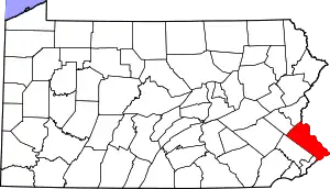
Bedminster is an unincorporated community in Bedminster Township in Bucks County, Pennsylvania, United States. Bedminster is located at the intersection of Pennsylvania Route 113 and Kellers Church Road.[2]
Bedminster, Pennsylvania | |
|---|---|
Unincorporated community | |
 Bedminster  Bedminster | |
| Coordinates: 40°25′33″N 75°10′45″W | |
| Country | United States |
| State | Pennsylvania |
| County | Bucks |
| Township | Bedminster |
| Elevation | 427 ft (130 m) |
| Time zone | UTC-5 (Eastern (EST)) |
| • Summer (DST) | UTC-4 (EDT) |
| ZIP code | 18910 |
| Area codes | 215, 267 and 445 |
| GNIS feature ID | 1169087[1] |
History
Originally known as Bedminsterville, a post office was established on 7 April 1851, Elias Ott was the first postmaster. In the days of mail coaches, Bedminster was visited three times a week from Doylestown. One of its earliest industries was chairmaking in the late 1800s by Reuben Stever. Established in 1834 by Abraham Freidlich, a major landmark in Bedminster has been the general store. Later the store was managed by the Scheetz brothers. in 1855, Levi Michley took the store followed by Peter O. Mickley who left the business in 1860 when he became township assessor. In 1860 Isaac Fluck replaced it with a new a larger store. Levi C. Hafler became proprietor becoming partners with J.H. Afflerbach until 1868 when Hafler retired. In 1870, the business was named J. H. Afflerbach & Co. when Abraham Keller entered in to partnership with Afflerbach. Afflerbach retired in 1873, then the store became Keller & Son, when Abraham partnered with his son Lewis. In 1875, the store was renamed Keller and Brother as a partnership between Lewis and Joseph M. Keller. Joseph retired in 1878. In the evening of 2 October 1886, the entire store, furniture depot and several small buildings were completely destroyed by fire. Lewis Keller rebuilt a large country store at the same location.[3]
Geography
Bedminster is located in the Deep Run watershed between the north branch and the main branch of the creek.[4]
Statistics
Bedminster was entered into the Geographic Names Information System on 2 August 1979 as identification number 1169087, its elevation is listed as 427 feet (130 m).[1]
References
- "Bedminster". Geographic Names Information System. United States Geological Survey.
- Bucks County, Pennsylvania (Map) (19th ed.). 1"=2000'. ADC Map. 2006. p. 2810. § A2. ISBN 0-87530-774-4.
- MacReynolds, George, Place Names in Bucks County, Pennsylvania, Doylestown, Bucks County Historical Society, Doylestown, PA, 1942, P18.
- https://viewer.nationalmap.gov/advanced-viewer/ The National Map, retrieved 3 December 2018
