Bahía Drake District
Bahía Drake is a district of the Osa canton, in the Puntarenas province of Costa Rica.[1][2]
Bahía Drake | |
|---|---|
Bahía Drake district | |
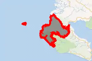
 Bahía Drake Bahía Drake district location in Costa Rica | |
| Coordinates: 8.6449811°N 83.6862375°W | |
| Country | |
| Province | Puntarenas |
| Canton | Osa |
| Creation | 3 August 2012 |
| Area | |
| • Total | 393.39 km2 (151.89 sq mi) |
| Elevation | 60 m (200 ft) |
| Time zone | UTC−06:00 |
| Postal code | 60506 |
History
Bahía Drake was created on 3 August 2012 by Acuerdo Ejecutivo N° 36-2012-MGP.[2]
Demographics
| Historical population | |||
|---|---|---|---|
| Census | Pop. | %± | |
|
Instituto Nacional de Estadística y Censos[4] |
|||
For the 2011 census, Bahía Drake had not been created, therefore census data will be available until 2021. [6]
References
- "Declara oficial para efectos administrativos, la aprobación de la División Territorial Administrativa de la República N°41548-MGP". Sistema Costarricense de Información Jurídica (in Spanish). 19 March 2019. Retrieved 26 September 2020.
- División Territorial Administrativa de la República de Costa Rica (PDF) (in Spanish). Editorial Digital de la Imprenta Nacional. 8 March 2017. ISBN 978-9977-58-477-5.
- "Área en kilómetros cuadrados, según provincia, cantón y distrito administrativo". Instituto Nacional de Estadística y Censos (in Spanish). Retrieved 26 September 2020.
- "Instituto Nacional de Estadística y Censos" (in Spanish).
- "Sistema de Consulta de a Bases de Datos Estadísticas". Centro Centroamericano de Población (in Spanish).
- "Censo. 2011. Población total por zona y sexo, según provincia, cantón y distrito". Instituto Nacional de Estadística y Censos (in Spanish). Retrieved 26 September 2020.
This article is issued from Wikipedia. The text is licensed under Creative Commons - Attribution - Sharealike. Additional terms may apply for the media files.