Alfonso Castañeda
Alfonso Castañeda, officially the Municipality of Alfonso Castañeda (Ilocano: Ili ti Alfonso Castañeda; Tagalog: Bayan ng Alfonso Castañeda), is a 1st class municipality in the province of Nueva Vizcaya, Philippines. According to the 2015 census, it has a population of 7,940 people. [3]
Alfonso Castañeda | |
|---|---|
| Municipality of Alfonso Castañeda | |
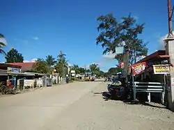
 Maharlika Highway | |
| Nickname(s): Last Frontier of Nueva Vizcaya | |
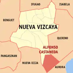
 Map of Nueva Vizcaya with Alfonso Castañeda highlighted | |
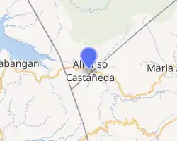
OpenStreetMap 
| |
.svg.png.webp) Alfonso Castañeda Location within the Philippines | |
| Coordinates: 15°47′38″N 121°18′00″E | |
| Country | |
| Region | Cagayan Valley (Region II) |
| Province | Nueva Vizcaya |
| District | Lone district |
| Barangays | 6 (see Barangays) |
| Government | |
| • Type | Sangguniang Bayan |
| • Mayor | Jerry P. Pasigian |
| • Vice Mayor | Wilson Capia-ao |
| • Representative | Luisa L. Cuaresma |
| • Electorate | 6,030 voters (2019) |
| Area | |
| • Total | 375.40 km2 (144.94 sq mi) |
| Elevation | 430 m (1,410 ft) |
| Population | |
| • Total | 7,940 |
| • Density | 21/km2 (55/sq mi) |
| • Households | 1,783 |
| Economy | |
| • Income class | 1st municipal income class |
| • Poverty incidence | 19.72% (2015)[4] |
| • Revenue | ₱73,077,754.85 (2016) |
| Time zone | UTC+8 (PST) |
| ZIP code | 3714 |
| PSGC | |
| IDD : area code | +63 (0)78 |
| Climate type | tropical rainforest climate |
| Native languages | Ilocano Tagalog |
History
In the 1930s, the Bugkalots inhabited Lublub, then a sitio of Barangay Marikit. In 1950, it became an independent barangay of Pantabangan, Nueva Ecija. The people of Lublub headed by Barangay Captain Alfredo L. Castillo, Sr. requested Assemblyman Carlos Padilla to convert the barangay into an independent municipality of Nueva Vizcaya. Hence, Batas Pambansa No. 27, authored and sponsored by Assemblyman Padilla, was approved and signed by President Ferdinand E. Marcos on 20 April 1979.[5] The Bill created the new town of Alfonso Castañeda, named after the first Governor of Nueva Vizcaya who belongs to a cultural minority.
Barangays
Alfonso Castañeda is politically subdivided into 6 barangays.
- Abuyo
- Galintuja
- Cauayan
- Lipuga
- Lublub (Poblacion)
- Pelaway
Demographics
| Year | Pop. | ±% p.a. |
|---|---|---|
| 1980 | 2,797 | — |
| 1990 | 3,751 | +2.98% |
| 1995 | 4,447 | +3.24% |
| 2000 | 4,808 | +1.69% |
| 2007 | 6,655 | +4.59% |
| 2010 | 7,428 | +4.08% |
| 2015 | 7,940 | +1.28% |
| Source: Philippine Statistics Authority [3] [6] [7][8] | ||
Landmarks
- Alfonso Castañeda Municipal Hall
- Alfonso Castañeda Town Plaza
- Black Nazarene Parish Church of Alfonso Castañeda
- Casecnan River
- Mount Guiwan
 Town hall
 Parish church
References
- Municipality of Alfonso Castañeda | (DILG)
- "Province: Nueva Vizcaya". PSGC Interactive. Quezon City, Philippines: Philippine Statistics Authority. Retrieved 12 November 2016.
- Census of Population (2015). "Region II (Cagayan Valley)". Total Population by Province, City, Municipality and Barangay. PSA. Retrieved 20 June 2016.
- "PSA releases the 2015 Municipal and City Level Poverty Estimates". Quezon City, Philippines. Retrieved 1 January 2020.
- "An Act Creating the Municipality of Alfonso Castañeda in the Province of Nueva Vizcaya". LawPhil.net. Retrieved 2021-01-11.
- Census of Population and Housing (2010). "Region II (Cagayan Valley)". Total Population by Province, City, Municipality and Barangay. NSO. Retrieved 29 June 2016.
- Censuses of Population (1903–2007). "Region II (Cagayan Valley)". Table 1. Population Enumerated in Various Censuses by Province/Highly Urbanized City: 1903 to 2007. NSO.
- "Province of Nueva Vizcaya". Municipality Population Data. Local Water Utilities Administration Research Division. Retrieved 17 December 2016.
External links
| Wikimedia Commons has media related to Alfonso Castañeda, Nueva Vizcaya. |
- Alfonso Castaneda Profile at PhilAtlas.com
- Official Website of Alfonso Castaneda
- Philippine Standard Geographic Code
- Philippine Census Information
- Local Governance Performance Management System