Yablonoi Mountains
The Yablonoi Mountains or Yablonovy Mountains (Russian: Яблоновый хребет, Buryat: Яабланай шэлэ нуруу, Yaablanai shele nuruu; Mongolian: Яблоны нуруу, Yablony nuruu) is a mountain range in Siberia. It is in Transbaikal (mainly in Chita Oblast) in Russia.

Geography
The range runs north-east from Mongolia, passing just to the east of Lake Baikal. The Yablonoi Mountains run for about 1600 kilometres before joining with the Stanovoi Range. The range forms the dividing line between the rivers that empty into the Arctic Ocean and those that empty into the Pacific. The range is not particularly tall or large, being long and thin. The tallest peak is Kontalaksky Golets at 1,706 metres (5,597 ft) above sea level.[1][2] It is formed with granites, crystalline slates, and sandstones. The slopes of the Yablonoviy Range are covered with larch and occasional fir and silver fir taiga. Pine forests are quite common on the southern slopes of the range. Peaks higher than 1,200 - 1,400 metres are covered with mountainous tundra vegetation.
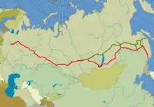
The isolated range is sparsely inhabited with most settlements engaged in mining. The area is especially rich in tin. The Trans-Siberian Railroad runs parallel to the range before going through a tunnel to bypass the heights. The Trans-Siberian Railroad passes the mountains at Chita.[3]

References
- 1:200.000, Bl. N-50-XX, 1992 edn. - Topographic map
- "Chita". visitchita.ru. Retrieved 21 August 2015.
- "Yablonovy Range". Farlex, Inc. Retrieved 30 January 2013.