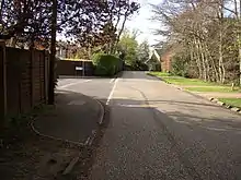
Woodham, Surrey
Woodham is a suburban village in Surrey next to New Haw and contiguous with two suburbs of Woking: Sheerwater and West Byfleet.

Amenities
Pubs
The Victoria public house is currently boarded up after its second closure in recent years.
Railway
All parts of the settlement are within 1 mile (1.6 km) north of West Byfleet or neighbouring Byfleet & New Haw stations which have South West Main Line trains (to/from London Waterloo station), a major and minor stop respectively.
Roads
The local roads form a complex grid north of Woking bypassing most residential roads, including the east-west access way of the A245 road to the south of Woodham which links Woking to the A3 at Cobham via Brooklands. Two similar roads north-south skirt to the east and west of Woodham linking Woking, and Brooklands respectively, to the M25 motorway. The grid avoids the need for dual carriageways in an area close to the eight-lane motorway which is elevated above the level of immediately surrounding streets, east of Woodham.
Schools
Woodham's schools are state-sponsored, for infants. These are a nursery and The Grange Community Infant School.
The narrowly green-buffered Row Hill part of Addlestone has the closest Primary School, Ongar Place Primary School.
Senior schools include Woking High School, The Winston Churchill School, Bishop David Brown School, Heathside School in the west of Weybridge and Salesian School in central Chertsey. Woking College and Brooklands College average closer than the senior schools, in Higher/Further Education.
The closest independent schools are Halstead Preparatory School for Girls on the opposing border of Sheerwater and St George's College, Weybridge, the senior department of which is on the opposing border of Addlestone.
Hospital
St Peter's Hospital, a large regional facility, is centred 2.5 miles (4.0 km) to the north.
Places of worship
In the Church of England Woodham is the west half of the ecclesiastical parish of New Haw. This is centred on the Church of All Saints at the west end of Woodham Lane; designed in the Old Surrey style by W F Unsworth, it has been Grade II Listed since 1984. An interesting war memorial (restored after being badly vandalised about 20 years ago and Grade II Listed in 2007) for those who died in both world wars (27 in WW1), stands near the church porch, was designed by Inigo Triggs and dedicated in 1920. A separate church hall is located beyond the car park at the rear. The parish was formed in 1902 (from what had been part of Chertsey and then its offshoot Addlestone)[1]
In the Catholic Church the parish is West Byfleet, based close the railway station at the Church of Our Lady, Help of Christians.[2][3]
In Islam the closest mosque, by a small margin, is in the Deobandi tradition, with a management mainly of British Bangladeshis, at the Surrey Muslim Centre, Albert Road, Addlestone.[4] The large Shah Jahan Mosque, Woking preaches in a range of the Sufi – Bareilvi traditions with a management formed mainly of British Pakistanis.[5]
- Former places of worship
A Baptist chapel was built in 1872, and a Wesleyan chapel in 1898.[6]
Sports Facilities
The well-established New Zealand Golf Club is situated parallel to Woodham Lane.
Landmarks
There are currently three nationally designated Listed buildings/structures in Woodham. Apart from the Church of All Saints and adjacent War Memorial already described above, there is an impressive Grade II Listed large private house named Woodhambury and Woodbrow located on the south side of Woodham Lane just east of the Martyrs Lane junction. Designed in the Vernacular style by architect W F Unsworth (1851-1912) as his own home, it was completed in 1889 but sympathetically subdivided in the 1950s.
Local authority and demography
Woodham is a ward in Runnymede Borough Council. Its population at the 2011 Census was 5304.[7]
References
- All Saints: New Haw The Church of England. Retrieved 2018-04-24
- https://www.dabnet.org/parishes/getdetail/477
- https://www.dabnet.org/Parishes/
- http://mosques.muslimsinbritain.org/maps.php#/mosque/1438
- http://mosques.muslimsinbritain.org/maps.php#/mosque/2395
- 'Parishes: Chertsey', in A History of the County of Surrey: Volume 3, ed. H E Malden (London, 1911), pp. 403–413. British History Online: http://www.british-history.ac.uk/vch/surrey/vol3/pp403-413, accessed 24 April 2018.
- "Runneymede Ward population 2011". Neighbourhood Statistics. Office for National Statistics. Retrieved 9 October 2016.
External links
![]() Media related to Woodham, Surrey at Wikimedia Commons
Media related to Woodham, Surrey at Wikimedia Commons