Wood Springs 2 Fire
The Wood Springs 2 Fire is a wildfire currently burning on the Navajo Nation, three miles east of Wood Springs in Apache County, Arizona in the United States. The result of a lightning strike, the fire was first reported on June 27, 2020. The fire has burned a total of 12,861 acres (5,205 ha) and is 98 percent contained as of July 13, 2020. Two outbuildings and five livestock pens were destroyed. One residence has been damaged. The fire currently threatens the area around Fluted Rock, Arizona.
| Wood Springs 2 Fire | |
|---|---|
 The Wood Springs 2 Fire on June 30, 2020 | |
| Location | Wood Springs, Apache County, Arizona, United States |
| Coordinates | 35.835°N 109.386°W |
| Statistics[1] | |
| Date(s) | June 27, 2020– |
| Burned area | 12,861 acres (5,205 ha) |
| Cause | Lightning strike |
| Buildings destroyed | 2 |
| Map | |
 Location in Arizona | |
Events
June
The Wood Springs 2 Fire was first reported burning 3 miles east of Wood Springs, Arizona, on the Navajo Nation, on June 27, 2020 around 2:00 PM. Fueled by piñon-juniper and pine, the fire was started by a lightning strike.[1] Fire crews made significant containment efforts, but, high winds caused the fire to grow. By the evening, the fire had burned 300 acres (121 ha). Air support was called in, using Winslow–Lindbergh Regional Airport for staging. Navajo Route 7 from Sawmill to Chinle and Wood Springs was closed, as was Navajo Route 26 from Nazlini and Sawmill.[2]
On June 29, the fire had grown to 3,000 acres (1,214 ha) and residents of Fluted Rock and Sawmill were told to be ready to evacuate if asked.[3] The fire acted "extreme" according to incident managers, with 200-foot flames forming due to 45 mile per hour wind gusts. The fire crossed Navajo Route 26 and moved northeast towards Navajo Route 7.[4]
July
By the morning of July 1, the fire had damaged an unknown number of structures. The fire kept growing with the help of dry fuels and steep topography. Air quality, due to the smoke traveling east and northeast, was impacted in Crystal, New Mexico.[5] Fort Defiance, Arizona, Sawmill, Arizona, and Navajo, New Mexico experienced poor air quality due to smoke.[6]
As of the evening of July 2, 2020, the fire has burned over 10,000 acres (4,047 ha) and was five percent contained. Crews began structure assessment, reporting that one hogan sustained minor damage and two livestock pens were destroyed.[7] On July 4, a drone was used to limit fire growth by firing ping-pong-ball-like spheres that ignite when they hit the ground, burning out potential fuels. Two more corrals and an additional building were reported as destroyed. Additionally, Navajo Nation President Jonathan Nez toured the fire by air. Nez implemented an executive order closing the area surrounding the fire from the public.[8] On July 7, the community of Sawmill was considered no longer threatened by the fire and was taken off of high alert.[1] The next day, an additional outbuilding and corral was reported as destroyed, bringing the total to two outbuildings and five corrals destroyed by the fire.[9]
As of July 13, the fire has burned 12,861 acres (5,205 ha) and is 98 percent contained.[1]
Current evacuations and closures

As of July 9, 2020, the following roads are closed except to residents:[10]
- Navajo Route 7 is from Sawmill to Three Turkey Ruin Junction
- N-26 is closed from the intersection of N-27 east to Route 7
Impact
The Wood Springs 2 Fire threatened communities in central Navajo Nation, specifically Fluted Rock, Kin Dah Lichíí, Nazlini, Sawmill, and Wood Springs.[11] Some community members were asked to evacuate. The fire also threatened sheep and horse camps, and cultural and historical sites.[5] A hogan sustained minor damage and two outbuildings and five livestock pens were destroyed.[7][8][9]
The fire caused Navajo Route 7 (from Sawmill to Chinlee and Wood Springs) and Navajo Route 26 (from Nazlini to Sawmill) to close.[1] Additionally,
Air quality was impacted in Sawmill, Flute Rock, Fort Defiance, Arizona, Navajo, New Mexico, and Window Rock, Arizona.[6][12] Smoke was visible from Highway 264, Window Rock, Ganado, Sawmill, Nazlini, Chinle and other surrounding communities.[1]
Gallery
 The fire on June 29, as seen from Window Rock
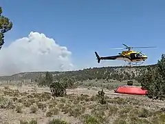
 Helicopter procuring water to fight the fire on June 29
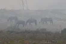
 Smoke from the Wood Springs 2 Fire in Navajo, New Mexico on June 30
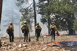
 Fire crew monitor burning operations off Route 7 on July 2
See also
References
![]() This article incorporates public domain material from websites or documents of the United States Forest Service.
This article incorporates public domain material from websites or documents of the United States Forest Service.
- "Wood Springs 2 Fire Information - InciWeb the Incident Information System". InciWeb. Retrieved 30 June 2020.
- "The Wood Springs 2 Fire Sparks And Grows Northeast Of Ganado - KAFF News". Great Circle Media. 28 June 2020. Retrieved 30 June 2020.
- "Wood Springs 2 Fire in Arizona grows to 3,000 acres, 0% contained". KRQE News 13 Albuquerque - Santa Fe. 29 June 2020. Archived from the original on 30 June 2020. Retrieved 30 June 2020.
- "Wood Springs 2 Fire Update: Tuesday, June 30, 2020 - InciWeb the Incident Information System". InciWeb. 30 June 2020. Archived from the original on 30 June 2020. Retrieved 30 June 2020.
- "Wood Springs 2 Fire Daily Update, Wednesday, July 01, 2020 - InciWeb the Incident Information System". InciWeb. Retrieved 2 July 2020.
- "Smoke Forecast Outlook Issued for NE Arizona". Wildland Fire Air Quality Response Program. USFS Wildland Fire Air Quality Response Program. 1 July 2020. Archived from the original on 2 July 2020. Retrieved 2 July 2020.
- "Wood Springs 2 Fire Update: Thursday, July 2, 2020 - InciWeb the Incident Information System". InciWeb. Retrieved 8 July 2020.
- "Wood Springs 2 Fire Update, Saturday, July 4, 2020 - InciWeb the Incident Information System". InciWeb. 4 July 2020. Retrieved 8 July 2020.
- "Wood Springs 2 Fire Daily Update, Wednesday, July 8, 2020 - InciWeb the Incident Information System". InciWeb. 8 July 2020. Retrieved 8 July 2020.
- "Wood Springs 2 Fire Daily Update, Thursday, July 9, 2020 - InciWeb the Incident Information System". InciWeb. 9 July 2020. Retrieved 14 July 2020.
- Goodman, Jessica (29 June 2020). "Navajo Nation wildfire grows more than 5800 acres, causes evacuations and road closures". AZFamily. Archived from the original on 1 July 2020. Retrieved 1 July 2020.
- "Smoke Expected Near Fluted Rock This Afternoon - InciWeb the Incident Information System". InciWeb. 30 June 2020. Retrieved 1 July 2020.
External links
| Wikimedia Commons has media related to Wood Springs 2 Fire. |