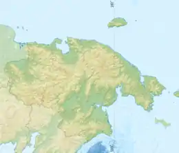
Velikaya (Chukotka)
The Velikaya (Russian: Великая,[1] also Большая Bolshaya, Онемен Onemen;[2] Chukot: Мэйнывээм, Meynyveem), is a river in Chukotka Autonomous Okrug in Russia. It is 451 kilometres (280 mi) long (556 km including its source river Kylvygeyvaam), and has a drainage basin of 31,000 square kilometres (12,000 sq mi).[3]
| Velikaya Meynyveem | |
|---|---|
.jpg.webp) | |
 Location in the Chukotka Autonomous Okrug, Russia | |
| Physical characteristics | |
| Source | |
| • location | Confluence of Kuimveyem and Kylvygeyvaam |
| • elevation | 329 metres (1,079 ft) |
| Mouth | |
• location | Onemen Bay |
• coordinates | 64.5292°N 176.1235°E |
• elevation | 0 m (0 ft) |
| Length | 451 km (280 mi) |
| Basin size | 31,000 km2 (12,000 sq mi) |
| Discharge | |
| • average | 409 m3/s (14,400 cu ft/s) |
Course
It flows north-eastwards from the confluence of the rivers Kuimveyem and Kylvygeyvaam in the Koryak Range through the southern end of the Anadyr Lowlands into Onemen Bay, part of the Anadyr River estuary of the Bering Sea at the Gulf of Anadyr. The Rarytkin Range rises along the left bank of the river in its middle and lower course.
Velikaya (Великая) translates to great in Russian, Bolshaya (Большая) translates to big in Russian.[4] The Velikaya and its tributaries belong to the Chukotka Autonomous Okrug. One of the native names of this river is Echinku, so that in some documents referring to this river in Soviet times, it was referred to as Velikaya-Echinku.[5]
There is a small populated place in the area close to its estuary also called Velikaya.
References
- Словарь названий гидрографических объектов России и других стран — членов СНГ, Federal Service for Geodesy and Cartography of Russia, 1999, p. 83
- Великая (река в Магаданской обл.), Great Soviet Encyclopedia
- Река Великая (Большая) in the State Water Register of Russia (Russian)
- "Location" (PDF). (571 KB)
- Velikaya-Echinku naming.
- "Beluga distribution".
External links
- "Bird life" (PDF). Archived from the original (PDF) on 2004-07-07. Retrieved 2004-07-07. (1.43 MB)