Thakurdwara
Thakurdwara is a city in Moradabad district in the indian state of Uttar Pradesh.
Thakurdwara | |
|---|---|
Town | |
| Nickname(s): Thakragarh | |
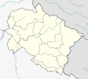
 Thakurdwara Location in Uttarakhand, India | |
| Coordinates: 29.19°N 78.86°E | |
| Country | |
| State | Uttar Pradesh |
| District | Moradabad |
| Founded by | Thakur Sahab |
| Government | |
| • Type | Indian |
| • MLA | Nawab Jaan Khan |
| Area rank | 14 |
| Elevation | 315 m (1,033 ft) |
| Population (2011)[2] | |
| • Total | 4,875 |
| Languages | |
| • Official | Khariboli, Haryanvi, Hindi, Kumaoni, Punjabi, Urdu, English |
| Time zone | UTC+5:30 (IST) |
| PIN | 244 601 |
| Telephone code | 0591 |
| Vehicle registration | UP 21,UK 06,HT 12 |
Location
Kashipur is just 15 kms. The township has been very large part of erstwhile UP and now a thriving in the north of Uttar Pradesh.
Geography
Thakurdwara is located at 29.19°N 78.86°E.[3] The city is situated on Ramnagar-Kashipur-Moradabad Road. Thakurdwara is at just 12 km distance from Kashipur, 48 km distance from its District Main City Moradabad, 218 km distance from National Capital New Delhi and 411 km distance from Awadh Capital Lucknow.
Tourism
The world famous Jim Corbett National Park is just 52 km away from it. The Ramganga Dam(Kalagarh Dam) is 46 km away.
Infrastructure and Transport
The city is nearest Railway Station is Kashipur, Uttarakhand (12 km). The nearest International Airport is Indira Gandhi International Airport, New Delhi, 218 km away. Another near Airport is 72 km away at Pantnagar. But the airport has only single flight on Fri, Sat, Sun, Wed for New Delhi operated by Alliance Air (India).
Demographics
As of 2011 India census,[2] Thakurdwara had a population of 4875. Males constitute 52% of the population and females 48%. Thakurdwara has an average literacy rate of 78%, higher than the national average of 85%: male literacy is 89%, and female literacy is 80%. In Thakurdwara, 11% of the population is under 6 years of age .
Industry
Major source of income of the Thakurdwara are through -
- Agriculture,
- Handloom.
Pasupati Acrylon Limited is spread over an area of approximately 90 acres. Pasupati Acrylon has a manufacturing capacity of 42000 MT/Annum of Acrylic fibre. Pasupati Acrylon supplies its Acrylic fiber under the brand name ‘ACRYLON'.[4]
References
- "Thakurdwara, UttarPradesh, India Map Lat Long Coordinates".
- "Census of India 2011: Data from the 2011 Census, including cities, villages and towns (Provisional)". Census Commission of India. Retrieved 4 November 2017.
- "Thakurdwara, Uttar Pradesh, India Map Lat Long Coordinates".
- "Plant, Pasupati Acrylon".