Terningen Lighthouse
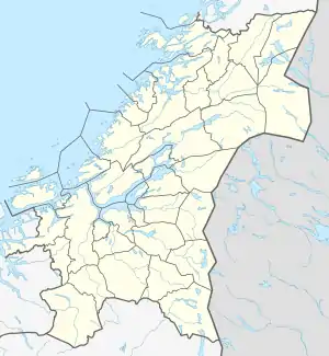
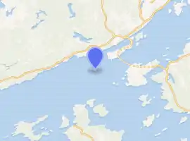
Terningen Lighthouse (Norwegian: Terningen fyr) is a lighthouse in the municipality of Hitra in Trøndelag county, Norway. The lighthouse is located in the Trondheimsleia near the mouth of the Hemnfjorden, just west of the island of Hemnskjela, and about 4 kilometres (2.5 mi) southwest of the village of Sandstad. The light marks one of the main channels that leads to the Trondheimsfjorden.[1]
.jpg.webp) View of the lighthouse | |
  | |

| |
| Location | Trøndelag, Norway |
|---|---|
| Coordinates | 63.4939°N 09.0394°E |
| Year first constructed | 1833 |
| Automated | 1991 |
| Construction | Concrete tower |
| Tower shape | Square |
| Markings / pattern | White with red roof |
| Tower height | 12 metres (39 ft) |
| Focal height | 17.8 metres (58 ft) |
| Intensity | 30,700 candelas |
| Range | Red: 13 nmi (24 km; 15 mi) Green: 12 nmi (22 km; 14 mi) |
| Characteristic | Oc WRG 6s |
| Fog signal | Horn |
| Admiralty number | L1170 |
| NGA number | 7052 |
| ARLHS number | NOR-247 |
| Norway number | 407500 |
The 12-metre (39 ft) tall lighthouse has an occulting light that flashes white, red, and green (depending on direction) once every six seconds at an elevation of 17.8 metres (58 ft) above sea level. The concrete tower is painted white and it has a red roof. The 30,700-candela light can be seen for up to 13 nautical miles (24 km; 15 mi).[1] The light is activated from July 21 until May 16 each year. The light is inactive and unnecessary during the late spring and early summer due to the midnight sun.[2][3]
References
- Kystverket (2014). Norske Fyrliste 2014 (PDF) (in Norwegian). ISBN 9788245015959.
- Wisting, Tor, ed. (2009-02-15). "Terningen fyr". Store norske leksikon (in Norwegian). Kunnskapsforlaget. Retrieved 2018-02-16.
- Rowlett, Russ (19 July 2011). "Lighthouses of Norway: Trondheim Area". University of North Carolina at Chapel Hill. Retrieved 2018-02-16.
External links
- Norsk Fyrhistorisk Forening (in Norwegian)
 Media related to Terningen fyr at Wikimedia Commons