Taferlklaussee
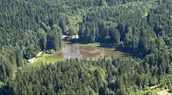
The Taferlklaussee was created in 1716 by the damming of the Aurach Creek. The lake can be reached on foot by a 3.5-hour hike from the village of Altmünster in Upper Austria.
| Taferlklaussee | |
|---|---|
 Taferklaussee Lake as seen from Aurachkar, Austria | |
 Taferlklaussee | |
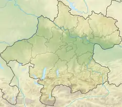
| Location | Upper Austria |
| Coordinates | 47°50′34″N 13°37′37″E |
| Type | mountain lake |
| Basin countries | Austria |
| Max. length | 170 m (560 ft) |
| Max. width | 80 m (260 ft) |
| Surface elevation | 800 m (2,600 ft) |
The lake's clear water is of drinking water quality. In winter, the lake is used for skating and curling.
This article is issued from Wikipedia. The text is licensed under Creative Commons - Attribution - Sharealike. Additional terms may apply for the media files.