Sugar Loaf Island (California)
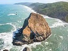
Sugar Loaf Island, also known as Sugar Loaf, Cape Rock, Sugar Loaf Island, Sugar Loaf Rock, and Sugarloaf Rock Island[1] is an island offshore Cape Mendocino in Humboldt County, California.[2][3] It is the westernmost island in California[4]


 Sugar Loaf Island | |
 Sugar Loaf Island  Sugar Loaf Island | |
| Geography | |
|---|---|
| Location | Humboldt County, California |
| Coordinates | 40°48′40.32″N 124°9′7.2″W |
| Adjacent bodies of water | Cape Mendocino |
| Administration | |
| State | |
| County | Humboldt |
| Governing body | California Department of Fish and Wildlife |
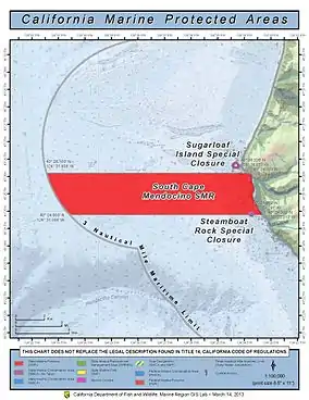
It is part of South Cape Mendocino State Marine Reserve, a large protected marine reserve centered on Cape Mendocino fully protected by the California Department of Fish and Wildlife. The area is one of the most undeveloped sections of the California coast, and its waters are home to important bird and mammal species.[5] Within the South Cape Mendocino State Marine Reserve, the take of all living marine resources is prohibited.[6] Sugarloaf Island is covered by the Cape Mendocino, California U.S. Topographic Map quadrant.[1]
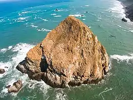
The island is named because it is shaped like a sugarloaf which was refined sugar in the form of a rounded cone, the most common way of distributing sugar until the late 19th century.
The area provides essential habitat and breeding grounds to the Steller sea lion and its rocky outcroppings also provide resting places for California sea lions.[7] South Cape Mendocino also provides key breeding grounds for the Western gull, double-crested cormorant, Brandt's cormorant, pelagic cormorant, black oystercatcher, pigeon guillemot and tufted puffin.[7]
While it is sometimes confused with "Sugarloaf Rock," the latter is found in the Farallon Islands offshore San Francisco, several hundred miles distant.
| Wikimedia Commons has media related to Sugar Loaf Island (Humboldt County, California). |
References
- "Sugarloaf Island". AnyPlace America. Retrieved 28 May 2020.
- "Sugar Loaf Island". Geographic Names Information System. United States Geological Survey. Retrieved 23 May 2020.
- Turner, Dennis W.; Turner, Gloria H. (2010). Place Names of Humboldt County, California (2nd ed.). Orangevale, CA: Dennis W. & Gloria H. Turner. p. 67. ISBN 978-0-9629617-2-4.
- Bob Lorentzen; Richard Nichols (1998). Hiking the California Coastal Trail: Oregon to Monterey. Bored Feet Publications. ISBN 978-0-939431-18-2.
- California Department of Fish and Wildlife. "Sugarloaf Island Special Closure: Northern California Marine Protected Areas (MPSs), Implemented December 2012". Retrieved 23 May 2020.
- "North Coast Marine Protected Areas". California Department of Fish and Game. Retrieved 19 November 2012.
- "Final Environmental Impact Statement. Chapter 4: Biological Resources". California Department of Fish and Game. p. 62. Retrieved 19 November 2012.