South East Bight
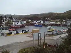
South East Bight (SEB) is a community located on the western shores of Placentia Bay on the Burin Peninsula of Newfoundland and Labrador. The community is not connected by road and is only accessible by ferry from Petite Forte. Many people from the community travel to Monkstown in the winter by snowmobile, but is very uncommon to try to get there in the summer, because of marsh, bogs, ponds and hills. To get to South East Bight one must travel towards Marystown on the Burin Peninsula, turn off the highway at Boat Harbour, travel to Petite Forte and then take a half-hour ferry ride to South East Bight.[1][2]
South East Bight | |
|---|---|
Town | |
 | |
 | |
 South East Bight Location of South East Bight in Newfoundland | |
| Coordinates: 47°23′0″N 54°35′0″W | |
| Country | Canada |
| Province | |
| Population (2018) | |
| • Total | 72 |
| Time zone | UTC-3:30 (Newfoundland Time) |
| • Summer (DST) | UTC-2:30 (Newfoundland Daylight) |
| Area code(s) | 709 |
| Highways | |
While there are a few vehicles on South East Bight, ATVs are the main form of transportation.
History
South East Bight was originally settled by the Handlins in 1835. By 1836 the population had risen to about 30 people, all of Roman Catholic religion. A census taken in 1871 showed that the main families were Dunphy, Hayne, Hefferon, Hunt, Pitman, Reddy, Ward, and Wight.
The community name came from the direction one takes to reach the community, and bight refers to a wide inlet in the coast. The first settlers of South East Bight came in the early 1850s from England and Ireland. These settlers were people involved in the fishery. In the late 19th century South East Bight was a very busy place, with a commercial farm, a slate quarry and a couple of lobster factories. Fishing was the main occupation and remains so today. In the 19th century the population was about 30 families and by the 1930s it dropped to about five families then grew to about 30 families again in the 1950s. When resettlement occurred in the 1960s many people left the community but nine families came in from surrounding places like Darby's Harbour, Clattice Harbour, and Channels Harbour. Many of these families still live in the community and return to these resettled communities to visit their cabins. The community is fully Roman Catholic religion and every family is supported by the fishery. Family names that remain today are Lake, Ward, Whyte, Hefferan, Jones, Murphy, Brewer and Hepditch.
South East Bight once had a small slate mine operating but the venture was not feasible and was quickly closed down. Years ago the men traveled to the lumber woods and to mines in places like St. Lawrence, to work in the fall to get extra money to supplement the fishing income.
Population
In the 1921 Newfoundland Census the population of South East Bight was 126 persons in 35 households.[3] By 1945 it had decreased to 51.[4] In the 1950s and 1960s it again started to grow until resettlement, when it plummeted to only two families, the Wards and the Whites. In the next few years families like the Lakes, Murphys and Powers moved in from Darby's Harbour, Murphys Cove and Clattice Harbour, and young people began to marry and settle there. Surnames like Brewer, Hefferan, Jones and Hepditch returned to restore the community.
Other Facts

- Registered midwives of earlier times were Mary Dunphy and Mary Ward.[5]
- The first mobile phone was installed in 1942, the first modern phone in 1980.
- School and church burned down on March 24, 1954.
- New church built in 1986.
- Government wharf built in 1981.
- Electrical power was provided by diesel generators starting December 20, 1974. The community was connected to the provincial power grid in 1998.
- Breakwaters tore down and new road constructed in 1993.
- There are 40 households, 10 summer homes and a teacher's residence.
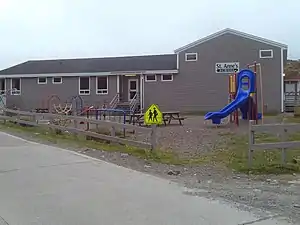
- St. Anne's School has 2 teachers and 13 students from Kindergarten to Level 1.
- Students beyond Level 1 must leave the community to go to school else where.
- The community offers 2 convenience stores, Post Office, Volunteer Fire Department, Roman Catholic Church and a Doctors Clinic.
- There are 3 cemeteries.
- The oldest standing house was owned by Edward Ward, the house is over 100 years old.
- You can walk to nearby resettled communities of Little Paradise & Great Paradise via trails in the community.
References
- Gale, Paula (November 25, 2017). "Faces and Places: A peek inside the isolated outport of South East Bight". cbc.ca. CBC News. Retrieved October 2, 2020.
- "South East Bight – Petite Forte ferry schedule". Transportation and Infrastructure. Government of Newfoundland and Labrador. Retrieved 2 October 2020.
- "Newfoundland 1921 Census - Placentia and St. Mary's District". ngb.chebucto.org. Newfoundland Grand banks. Retrieved 2 October 2020.
- "1945 Census". NL Genweb. Retrieved 6 October 2020.
- "South East Bight - History". stannes.k12.nf.ca. St. Anne's School. Retrieved 2 October 2020.
| Wikimedia Commons has media related to South East Bight, Newfoundland and Labrador. |