Sierra del Ocejón
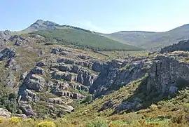
The Sierra del Ocejón or Sierra del Robledal is a mountain range located in the central part of the Iberian Peninsula.
| Sierra del Ocejón | |
|---|---|
 Panorama | |
| Highest point | |
| Elevation | 2,046 m (6,713 ft) |
| Coordinates | 41°06′17″N 3°15′20″W |
| Geography | |
| Location | Iberian Peninsula, Spain |
| Parent range | Sistema Central |
Geography

The range belongs to the Sistema Central. Its northern limit is considered the Río Sonsaz while Tamajón's territory is its southern border; from West to East the mountain range stretches from the valley of the Arroyo de la Matilla to the Río Sorbe.
Its highest point is the Ocejón, at 2068 metres.[1] The northern part of the zone is scarcely inhabited and most of the population lives in the South of the range.
Main peaks
- Pico Ocejón (2.048 msnm),
- Campo (1.919 msnm),
- Campachuelo (1.889 msnm),
- Cerrito Collado (1.738 msnm),
- Peña del Reloj (1.506 msnm),
- Cabeza de Ranas (1.492 msnm).
Concerned municipalities
Culture and economy
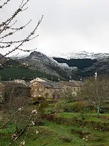
The villages of the sierra are well known for their typical sheep breeds.[2] Sierra del Ocejón area is also considered one of the places in Spain where the Arquitectura negra, a traditional building technique based on a wide use of slate, is very well preserved.[3]
Bibliography
- DÍAZ MARTÍNEZ, Miguel Ángel y LÓPEZ BALLESTEROS, José Alberto (2003). La sierra de Ayllón (in Spanish). Madrid: Ediciones El Senderista. ISBN 84-95368-22-6.CS1 maint: multiple names: authors list (link)
- PLIEGO VEGA, Domingo (1998). Los dosmiles de la sierra de Ayllón (in Spanish). Madrid: Desnivel ediciones. ISBN 84-89969-03-5.
See also
References
- "Principales cumbres montañosas de la provincia de Guadalajara". www.ign.es (in Spanish). Instituto Geográfico Nacional. Retrieved 2016-03-01.
- Pedro Vacas Moreno; Mercedes Vacas Gómez (2011). Pastores Y Cabreros (in Spanish). Musivisual. p. 128. ISBN 9788492798438.
- Javier Leralta (2008). Apodos reales: historia y leyenda de los motes regios (in Spanish). Silex Ediciones. p. 467. ISBN 9788477372110.