Si Somdet District
Si Somdet (Thai: ศรีสมเด็จ, pronounced [sǐː sǒm.dèt]) is a district (amphoe) in Roi Et Province, Thailand.
Si Somdet
ศรีสมเด็จ | |
|---|---|
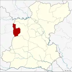
 District location in Roi Et Province | |
| Coordinates: 15°59′14″N 103°30′39″E | |
| Country | Thailand |
| Province | Roi Et |
| Seat | Si Somdet |
| Area | |
| • Total | 217.43 km2 (83.95 sq mi) |
| Population (2005) | |
| • Total | 37,161 |
| • Density | 170.9/km2 (443/sq mi) |
| Time zone | UTC+7 (ICT) |
| Postal code | 45000 |
| Geocode | 4516 |
Geography
Neighboring districts are (from the north clockwise): Mueang Roi Et and Chaturaphak Phiman of Roi Et Province; Wapi Pathum, Kae Dam, and Mueang Maha Sarakham of Maha Sarakham Province.
History
The district was created on 1 April 1987, when the five tambons, Pho Thong, Si Somdet, Mueang Plueai, Nong Yai, and Suan Chik were split off from Mueang Roi Et District.[1] It was upgraded to a full district on 4 July 1994.[2]
Administration
The district is divided into eight sub-districts (tambons), which are further subdivided into 82 villages (mubans). There are no municipal (thesaban) areas; there are eight tambon administrative organizations (TAO).
| No. | Name | Thai name | Villages | Pop. | |
|---|---|---|---|---|---|
| 1. | Pho Thong | โพธิ์ทอง | 7 | 2,877 | |
| 2. | Si Somdet | ศรีสมเด็จ | 13 | 6,079 | |
| 3. | Mueang Plueai | เมืองเปลือย | 8 | 3,075 | |
| 4. | Nong Yai | หนองใหญ่ | 10 | 3,883 | |
| 5. | Suan Chik | สวนจิก | 14 | 5,447 | |
| 6. | Phosai | โพธิ์สัย | 10 | 8,043 | |
| 7. | Nong Waeng Khuang | หนองแวงควง | 12 | 4,926 | |
| 8. | Ban Bak | บ้านบาก | 8 | 2,831 |
References
- ประกาศกระทรวงมหาดไทย เรื่อง แบ่งเขตท้องที่อำเภอเมืองร้อยเอ็ด จังหวัดร้อยเอ็ด ตั้งเป็นกิ่งอำเภอศรีสมเด็จ (PDF). Royal Gazette (in Thai). 104 (67 ง): 2483. April 9, 1987.
- พระราชกฤษฎีกาตั้งอำเภอเปือยน้อย ... และอำเภอศรีวิไล พ.ศ. ๒๕๓๗ (PDF). Royal Gazette (in Thai). 111 (21 ก): 32–35. June 3, 1994.
External links
- amphoe.com (in Thai)
This article is issued from Wikipedia. The text is licensed under Creative Commons - Attribution - Sharealike. Additional terms may apply for the media files.