Seeb
Al-Seeb, As Seeb or As Sib (Arabic: السيب) is a coastal fishing city, located several kilometres northwest of Muscat, in northeastern Oman. As of the 2003 census, it had a population of 221,115.[1]
Seeb
السيب As Seeb As Sib | |
|---|---|
City | |
.jpg.webp) Mosque in Seeb | |
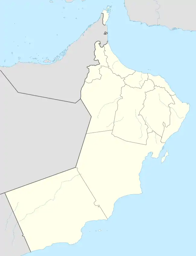
 Seeb Location in Oman | |
| Coordinates: 23°40′49″N 58°10′57″E | |
| Country | |
| Region | Muscat |
| Population (2016)[1] | |
| • Total | 361,911 |
| Time zone | UTC+4 (+4) |


Landmarks include the Naseem Garden, the Royal Stables and Equestrian Centre, Royal Guard of Oman Technical College, the Bait al Baraka palace, Muscat International Airport (formerly known as Seeb International Airport) and Markaz al Bahja.[2]
History
The “Fort of Sibo” was located in Seeb (As Seeb or As Sib), a few kilometers northwest of Muscat, capital of the Sultanate of Oman.
It complemented the defense of Muscat Square, which was one of its first and most important defenses.[3] It was part of a serial of fortified cities that the Portugal had to control the access to the Persian Gulf and the Gulf of Oman, like Khor Fakan, Muscat, Sohar, Seeb, Qurayyat and Muttrah. It is demolished, at its former place today stands the Muscat International Airport.
The Seeb is famous for being the location in which the Treaty of Seeb agreement took place between the Imamate of Oman and the Sultanate of Muscat on 25 September 1920. This treaty divided Oman into two distinct regions, the interior and the coast, which were separated historically by the Al Hajar Mountains.[4][5]
Intelligence gathering
In June 2014 The Register disclosed that Seeb is the location of a "beyond top secret" GCHQ internet monitoring site.[6]
Sports
Al-Seeb Club and Al-Shabab are located in Seeb.
Climate
Seeb has a hot desert climate (Köppen climate classification BWh) with very hot summers and warm winters. Precipitation is low, and falls mainly in the months from December to April.
| Climate data for Seeb | |||||||||||||
|---|---|---|---|---|---|---|---|---|---|---|---|---|---|
| Month | Jan | Feb | Mar | Apr | May | Jun | Jul | Aug | Sep | Oct | Nov | Dec | Year |
| Record high °C (°F) | 34.2 (93.6) |
37.0 (98.6) |
41.4 (106.5) |
44.0 (111.2) |
47.0 (116.6) |
48.3 (118.9) |
49.2 (120.6) |
46.8 (116.2) |
43.6 (110.5) |
42.0 (107.6) |
37.8 (100.0) |
33.0 (91.4) |
49.2 (120.6) |
| Average high °C (°F) | 25.5 (77.9) |
26.1 (79.0) |
29.8 (85.6) |
34.7 (94.5) |
39.5 (103.1) |
40.4 (104.7) |
38.6 (101.5) |
36.2 (97.2) |
36.3 (97.3) |
35.0 (95.0) |
30.5 (86.9) |
27.1 (80.8) |
33.3 (92.0) |
| Daily mean °C (°F) | 21.3 (70.3) |
21.9 (71.4) |
25.2 (77.4) |
29.8 (85.6) |
34.2 (93.6) |
35.2 (95.4) |
34.3 (93.7) |
32.0 (89.6) |
31.4 (88.5) |
29.7 (85.5) |
25.7 (78.3) |
22.6 (72.7) |
28.6 (83.5) |
| Average low °C (°F) | 17.3 (63.1) |
17.6 (63.7) |
20.7 (69.3) |
24.7 (76.5) |
29.1 (84.4) |
30.6 (87.1) |
30.4 (86.7) |
28.4 (83.1) |
27.5 (81.5) |
24.9 (76.8) |
20.9 (69.6) |
18.5 (65.3) |
24.2 (75.6) |
| Record low °C (°F) | 11.5 (52.7) |
12.5 (54.5) |
14.4 (57.9) |
17.5 (63.5) |
19.6 (67.3) |
24.5 (76.1) |
25.0 (77.0) |
23.3 (73.9) |
23.0 (73.4) |
17.5 (63.5) |
14.3 (57.7) |
14.4 (57.9) |
11.5 (52.7) |
| Average precipitation mm (inches) | 12.8 (0.50) |
24.5 (0.96) |
15.9 (0.63) |
17.1 (0.67) |
7.0 (0.28) |
0.9 (0.04) |
0.2 (0.01) |
0.8 (0.03) |
0.0 (0.0) |
1.0 (0.04) |
6.8 (0.27) |
13.3 (0.52) |
100.3 (3.95) |
| Average relative humidity (%) | 63 | 64 | 58 | 45 | 42 | 49 | 60 | 67 | 63 | 55 | 60 | 65 | 58 |
| Mean monthly sunshine hours | 268.6 | 244.8 | 278.3 | 292.5 | 347.4 | 325.7 | 277.7 | 278.6 | 303.9 | 316.9 | 291.9 | 267.0 | 3,493.3 |
| Source: NOAA (1979–1990)[7] | |||||||||||||
References
- "Oman: Governorates, Major Cities & Villages". CityPopulation.de. Retrieved 26 April 2013.
- Darke, Diana; Shields, Sandra (1 December 2006). Oman: The Bradt Travel Guide. Bradt Travel Guides. p. 113. ISBN 978-1-84162-168-5. Retrieved 27 February 2011.
- "Fortalezas.org".
- Dr Francis Owtram. "A Close Relationship: Britain and Oman Since 1750". QDL.
- "BBC Middle East: Oman profile - Timeline (25 April 2018)". BBC News.
- Duncan Campbell (3 June 2014). "Revealed: GCHQ's beyond top secret middle eastern internet spy base". The Register.
- "Seeb Climate Normals 1979-1990". National Oceanic and Atmospheric Administration. Retrieved January 15, 2013.
