Schliersee (lake)
Schliersee is a natural lake in Upper Bavaria in the Bavarian Alps. It is located next to the small town of Schliersee in the Miesbach district.
| Schliersee | |
|---|---|
 As seen from Mount Jägerkamp | |
 Schliersee | |
| Location | Upper Bavaria |
| Coordinates | 47°43′19″N 11°51′45″E |
| Primary outflows | Schlierach |
| Basin countries | Germany |
| Max. length | 2.3 km (1.4 mi) |
| Max. width | 1.3 km (0.81 mi) |
| Surface area | 2.241 km2 (0.865 sq mi) |
| Average depth | 20 m (66 ft) |
| Max. depth | 40 m (130 ft) |
| Surface elevation | 777 m (2,549 ft) |
| Islands | 1 (Wörth island) |
| Settlements | Schliersee |

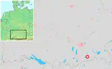
Location within Germany and Bavaria
The lake has a surface of 2.241 square kilometres (0.865 sq mi) at an elevation of 777 metres (2,549 ft) AMSL, expanding 2.3 kilometres (1.4 mi) by 1.3 kilometres (0.81 mi) maximum. The average depth is 20 metres (66 ft) The maximum depth is 40 metres (130 ft). The only island is Wörth island, located almost in the middle of the lake.
The lake is named for the monastery Kloster Schliersee ("Sliersee"), established in 779 at Kirchbichl nearby Westenhofen.
See also
- List of lakes in Bavaria
External links
- Nixdorf, B.; et al. (2004), "Schliersee", Dokumentation von Zustand und Entwicklung der wichtigsten Seen Deutschlands (in German), Berlin: Umweltbundesamt, p. 63
This article is issued from Wikipedia. The text is licensed under Creative Commons - Attribution - Sharealike. Additional terms may apply for the media files.