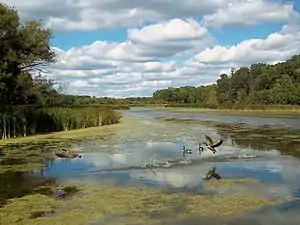
Salt Creek (Des Plaines River tributary)
Salt Creek is a 43.4-mile-long (69.8 km)[1] stream in northeastern Illinois.[2] It is an important tributary of the Des Plaines River, part of the Illinois River and ultimately the Mississippi River watersheds. It rises in northwest Cook County at Wilke Marsh in Palatine and flows in a meandering course generally southward through DuPage County, returning to central Cook County and emptying into the Des Plaines River in Riverside, Illinois. Most of the creek's watershed is urbanized, densely populated and flood-prone.

| Salt Creek | |
|---|---|
 Creek showing York Road/Fullersburg Bridge and Graue Mill | |
| Physical characteristics | |
| Source | |
| • location | Hoffman Estates, Illinois |
| • coordinates | 42°05′58″N 88°06′41″W |
| Mouth | |
• location | Confluence with the Des Plaines River, Lyons, Illinois |
• coordinates | 41°49′06″N 87°49′57″W |
• elevation | 607 ft (185 m) |
| Length | 43 mi (69 km) |
| Basin features | |
| Progression | Salt Creek → Des Plaines → Illinois → Mississippi → Gulf of Mexico |
| GNIS ID | 422069 |
Flood control dams were constructed along the creek in 1978 within the Ned Brown Forest Preserve near Elk Grove Village, Illinois, creating the 590-acre (2.4 km2) Busse Lake. A diversion tunnel was constructed approximately 1.6 miles (2.6 km) north of the confluence with the Des Plaines River, at a point where the two streams are separated by only 1,600 feet (490 m).
Tributary streams include Addison Creek. The Graue Mill historic gristmill stands on the bank of the creek in Oak Brook.
It was originally known to European settlers as the Little Des Plaines River but was given the name Salt Creek in the mid-nineteenth century after a large wagonload of salt spilled in the waterway. Some of the species of fish in the creek include carp, smallmouth bass, northern pike, bluegill/sunfish minnow/shad, and bullhead catfish.[3]
See also
- List of Illinois rivers
- Forest Preserve District of DuPage County
References
- U.S. Geological Survey. National Hydrography Dataset high-resolution flowline data. The National Map, accessed May 13, 2011
- U.S. Geological Survey Geographic Names Information System: Salt Creek
- http://www.encyclopedia.chicagohistory.org/pages/1111.html
External links
| Wikimedia Commons has media related to Salt Creek (Des Plaines River tributary). |