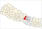
Rigaun
Rigaun or Ree gaun is a village development committee in Dhading District in the Bagmati Zone of central Nepal. At the time of the 1991 Nepal census it had a population of 5218 and had 875 houses in it. Ree Gaun is located in the Northern part of Dhading. It consists of wards no 1 & 2 of Gangajamuna Rural Municipality, State 3, Dhading Nepal. There are 90% people of the Tamang ethnic group, and some are Gurung, Kami (BK), Damai. The main occupation of this area is agriculture.[1]
Ree gaun
रिगाउँ ( Nepali Language) | |
|---|---|
 Ree gaun Location in Nepal | |
| Coordinates: 28.11°N 84.97°E | |
| Country | |
| Zone | Bagmati Zone |
| District | Dhading District |
| Province | Province No. 3 |
| Rural Municipality | Gangajamuna |
| Government | |
| • Asst. Secy. GRM | Enjeela Tamang |
| • ward no 1 Secy. | Bahadur Tamang |
| • Ward no.2 Secy. | Phaising Tamang |
| Population (1991) | |
| • Total | 5,218 |
| • Religions | Christian Bon and Buddhist |
| Time zone | UTC+5:45 (Nepal Time) |
Village's name list in Ree
- Tawal Village & Tawal Bensi
- Dhuseni Village
- Latab Village
- Kutal Village
- Saleri & Teshyapho Village
- Shyaktali Village
- Gangmrang Village
- Ree gaun . Choke Village
- Epi Village Village
- Richet Village
- Tajimrang Village
- Kichet, Annar Cheprang, & Karang Village
Ward no.1
The ward no.1 is combined with 4 local wards.
- Ree gaun
- Choke Village
- Epi Village Village
- Richet Village
- Tajimrang Village
- Kichet Village
- Annar Cheprang
- Karang Village
Ward no.2
There are more than six local villages has been combined in ward no.2 after the new local governance of GRM.
- Latab Village
- Dhuseni Village
- Tawal Village & Tawal Bensi
- Kutal Village
- Saleri & Teshyapho Village
- Shyaktali Village
- Gangmrang Village
Tourist destination
- Longarchet Valley: a place where earthquake victims lived for two years as temporary place.
- Shyanchet Dada
- Pasangchowk
- Palang-Naang
Economy
The main occupation of Ree Gaun is farming. The recent local business here is knitting baskets, selling local products like baskets and meats.
Administration
Ree Gaun VDC consists of two wards.
- Ward 1 – Office: Tajimrang
- Ward 2 – Office: Tawal Mele Dada
Earthquake 2015
In Ree Gaun the earthquake of 2015 killed more than 78 people, and 99% of houses and buildings were completely destroyed.
Rivers
The main river of the Ree is Kutal-Chhumrung Khola which comes from Ganesh Himal and passes through Ringne and Lapang and meets Kutal-Chhumrung Khola separates the Ree and Dark, Jharlang. There are 5 small rivers, the main being Kutal-Chhumrung Khola, Chimchok Khola, Kalshyong Khola, Saleri Khola. Besides these, there are over 10 smaller rivers, springs and seasonal streams.
References
- "Nepal Census 2001". Nepal's Village Development Committees. Digital Himalaya. Archived from the original on October 12, 2008. Retrieved 2008-08-24.
- The Map of Potential Vegetation of Nepal - a forestry/agroecological/biodiversity classification system (PDF), Forest & Landscape Development and Environment Series 2-2005 and CFC-TIS Document Series No.110., 2005, ISBN 87-7903-210-9.
External links
- Ree VDC WEBSITE
- Local Governance Gangajamuna Rural Municipality
- जिल्ला समन्वय समितिको कार्यालय, धादिङ, नेपाल
- Nepal Information Technology Center (NP)
- LOCAL GOVERNANCE AND COMMUNITY DEVELOPMENT PROGRAMME (LGCDP)
- Nepal Law Commission
- Ministry of Finance Nepal
- राष्ट्रिय योजना आयोग
- Earthquake documentary video of Tawal
- Documentary Video of Longarchet Earthquake Victims Ree Dhading, Nepal
