Richmond County, New South Wales

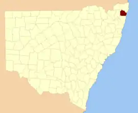
Richmond County is one of the 141 Cadastral divisions of New South Wales. It lies south of the Richmond River and includes South Casino.

Richmond
New South Wales
Location in New South Wales
Lands administrative divisions around Richmond:
Buller Rous Pacific Ocean
Drake Richmond Pacific Ocean
Drake Clarence Pacific Ocean

Richmond County was named in honour of Charles Gordon Lennox, Fifth Duke of Richmond (1791- 1860).[1]

Parishes within this county

A full list of parishes found within this county; their current LGA and mapping coordinates to the approximate centre of each location is as follows:

ParishLGACoordinates
BarrawangaRichmond Valley Council29°09′54″S 153°06′04″E
BundockRichmond Valley Council28°50′54″S 152°56′04″E
BungawalbinRichmond Valley Council29°04′54″S 153°17′04″E
BusbyRichmond Valley Council28°59′54″S 152°48′04″E
CamiraClarence Valley Council29°15′54″S 152°56′04″E
CoombellRichmond Valley Council28°59′54″S 152°58′04″E
DarkeRichmond Valley Council29°07′54″S 153°05′04″E
DobieClarence Valley Council29°10′54″S 152°49′04″E
DonaldsonRichmond Valley Council29°07′54″S 153°14′04″E
DoubledukeRichmond Valley Council29°10′54″S 153°16′04″E
East CasinoRichmond Valley Council28°53′54″S 153°07′04″E
EllangowanRichmond Valley Council29°00′54″S 153°08′04″E
EskRichmond Valley Council29°13′54″S 153°21′04″E
EvansRichmond Valley Council29°09′54″S 153°22′04″E
GibberageeRichmond Valley Council29°14′54″S 153°09′04″E
HogarthRichmond Valley Council29°01′54″S 152°53′04″E
MarshClarence Valley Council29°15′54″S 152°51′04″E
MongogarieRichmond Valley Council28°56′54″S 152°50′04″E
MyallRichmond Valley Council29°17′54″S 153°01′04″E
MyrtleClarence Valley Council29°07′54″S 152°59′04″E
NandabahRichmond Valley Council29°03′54″S 152°58′04″E
PowerpaClarence Valley Council29°12′54″S 152°56′04″E
RichmondRichmond Valley Council28°58′54″S 153°04′04″E
RileyRichmond Valley Council29°01′54″S 153°28′04″E
ShannonRichmond Valley Council28°53′54″S 152°54′04″E
South BallinaBallina Shire28°55′54″S 153°31′04″E
South CasinoRichmond Valley Council28°53′54″S 153°03′04″E
South CodringtonRichmond Valley Council28°56′54″S 153°15′04″E
TabbimobleRichmond Valley Council29°15′54″S 153°16′04″E
TathamRichmond Valley Council28°56′54″S 153°11′04″E
West CorakiRichmond Valley Council29°01′54″S 153°14′04″E
WhiporieRichmond Valley Council29°14′54″S 153°03′04″E
WooroowoolganRichmond Valley Council28°52′54″S 153°00′04″E
WoramRichmond Valley Council28°55′54″S 153°08′04″E
WyandahClarence Valley Council29°07′54″S 152°50′04″E
WyonRichmond Valley Council29°04′54″S 152°46′04″E

References

  1. "Richmond". Geographical Names Register (GNR) of NSW. Geographical Names Board of New South Wales. Retrieved 4 August 2013.
This article is issued from Wikipedia. The text is licensed under Creative Commons - Attribution - Sharealike. Additional terms may apply for the media files.